Fascinating podcast to listen to on your way home about how a bunch of squares put Circleville into a corner. The story of a town plan based on a grid of concentric circles, courtesy of 99% Invisible.
“Chunyun, also referred to as the Spring Festival travel season or the Chunyun period, is a period of travel in China with extremely high traffic load around the time of the Chinese New Year.”
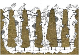
This is the website for the artist who illustrated Calvino’s Invisible Cities, Karina Puente. She has images of 15 of Calvino’s cities, and they are definitely worth looking at in more detail.
Puente’s description of her work: “They are not only drawn – I use different types of paper and draw on each one before cutting them out with exact knives. All the drawings are composed of layers of paper which are cut out and glued.”
Cartography and mapping, as science or as a discipline in the scientific context, have not escaped postmodern criticism. This is known as the contemporary critique of cartography. Nikolas Huffman has, from the standpoint of map design in postmodernism, analysed maps and mapping within the postmodernistic framework. He addresses the postmodern critique by outlining four different definitions of postmodernism and its relation to contemporary cartographic critiques. These categories are: mapping and postmodern style; cartography and postmodern social theory; capitalism and the economy of mapping; and cartography and poststructuralism (for more details see Huffman 1996).
Huffman mentions some postmodernists in cartography such as Denis Wood, J.B. Harley, Richard Helgerson, Barbara Belyea, and Robert Rundstrom. These authors question the apolitical and scientific status of cartography.
These critiques have disputed the way that language and the production of meaning have been theorized in cartography research on maps and mapping, and introduced new ways of understanding how we interact and communicate with and through maps. […] They have also pointed towards a broader sociology of mapping in which maps and mapping can be understood as artefacts within our social and material culture, and have demanded that greater attention be paid to issues of representation, politics, and social action (emphases added, Huffman 1996: 35–36).
The above statement points out new tendencies in contemporary cartography which fall within the postmodern context. These new ways of understanding maps are referred to as being an alternative to the scientific-empirical approach in cartography during modernity. Thus the map is an artefact (material or ideal) within the social and cultural context in which it is created and used, and is no longer a device with an objective, neutral, and value-free character. In other words, all these new visions in cartography and mapping are framed within the new postpositivistic epistemology of sciences.
Projection Mapping creates an experience through creativity and technical excellence needed to realize the many wild and wonderful uses of projection mapped content. (Urban Projections)
Solstice: Public Art Installation 2011 in the Illuminate Yaletown Festival. Bringing sunny skies down to the ground level into the dreary winter months.
Modern cartography covers a wide and complex range of subjects. Maps may portray political boundaries or oceanic depth, the geological structure of the earth’s surface or the density and distribution of its population; they may be used to represent, in graphic form, inventories of the world’s natural and industrial resources or of educational facilities. Military requirements, it is true, still retain a high priority in map making. However, it is equally true that the services provided by cartography are being increasingly utilized for peaceful purposes. This fact is perhaps the dominant feature of the development of car- tography during the last hundred years. The progress of the Science of Cartography is of equal concern to all nations…. (United Nations 1949: Introduction). Continue reading modern cartography→

 Follow