Project summary
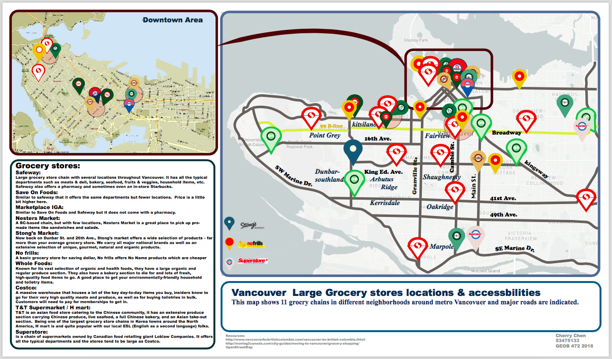
The topic I chose for this project is a useful and life-related one that associated with our everyday life. The project is a map presenting grocery stores in city of Vancouver and walkability within their own neighbourhoods. I personally love grocery shopping, because it is a big part of my life. As a student with little income, it is unlikely for me to eat outside everyday, and plus cooking at home is more healthy too! So cooking at home becomes really important. Grocery stores are places where we buy our foods, drinks, and daily essentials. While we are buying or renting a place to live, a grocery store nearby is always an asset.
A closer look at the main map
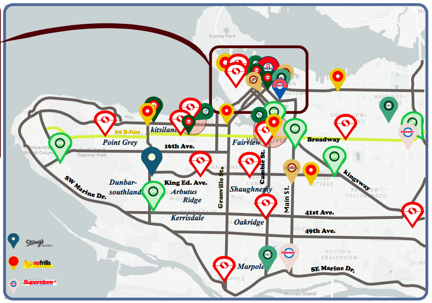
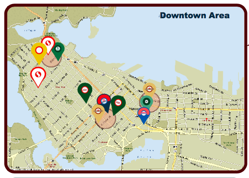
To do this project, I use Adobe Illustrator to make the map showing different grocery stores around Vancouver. For this project, I picked 11 different big grocery chains including B.C. based or national based grocery stores. In the map, there are a lot of grocery stores all together at downtown area with makes that part of map a little bit messy, so I decided to put an insect map to focus on downtown area. As we can see in the map, there are circles in different neighbourhoods and those circles are the 10 minutes walk circles that indicated the area that can be reached by foot within 10 min. I actually went walk couple times and measured the distances as I can get some exercises done while doing grocery shopping. In the map there are some lines of roads that are in different colours and those lines represent different major transit. The blue one is the Canada line with serves throughout the metro Vancouver and the yellow one is the 99 B-line that serves between UBC and Commercial/Broadway Skytrain station.
A closer look at the Inset map of downtown
I used OpenStreetMap as my foundation base map and started my outline base on it. I decided to show some major roads only to avoid some possible confusion and at the same time try to keep the map clean and well to look at. Just for the sake of easy understanding. After finished the base layer I looked up different grocery stores with their store locations and made little marks on the map so I know where should I put the pins on. For the pin designs, I chose the colours that similar to the logos of different grocery stores, in that way, map readers can determine which pin indicates which store easily by at their first glance.
Closer view at the description box
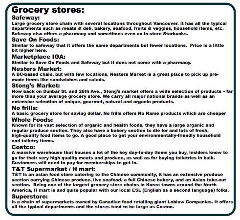
For the project, there are also some limitations that need more works done. As a sustainable city, there are so many local grocery shops, farmers’ markets in Vancouver. Many of them I have not yet been to and that is why I only chose some big grocery chains to work on. Also these big grocery stores are more known to the public so when they see the map that will soon get the idea of what the map is showing. This map is a project that related to people and community, which is useful to everyone no matter what gender, what age, or what social standing as long as we are all part of this big community.