The Agricultural Land Reserve in Comox Valley
The Agricultural Land Reserve (ALR) has been seen as one of the best example of agricultural land preservation and it’s also responsible for regional food security in the province. The ALR is a provincial land use zone designated for agriculture use for around 4.6% of the land base in British Columbia, Canada. In the ALRs, farming is encouraged and other non-agricultural uses are prohibited.(Provincial Agricultural Land Commission) The ALR comprises just 5% of BC’s total land base and is the area with the greatest agricultural capacity. To protect these valuable resource, all the landowners should know what activities may or may not be permitted.(Provincial Agricultural Land Commission)
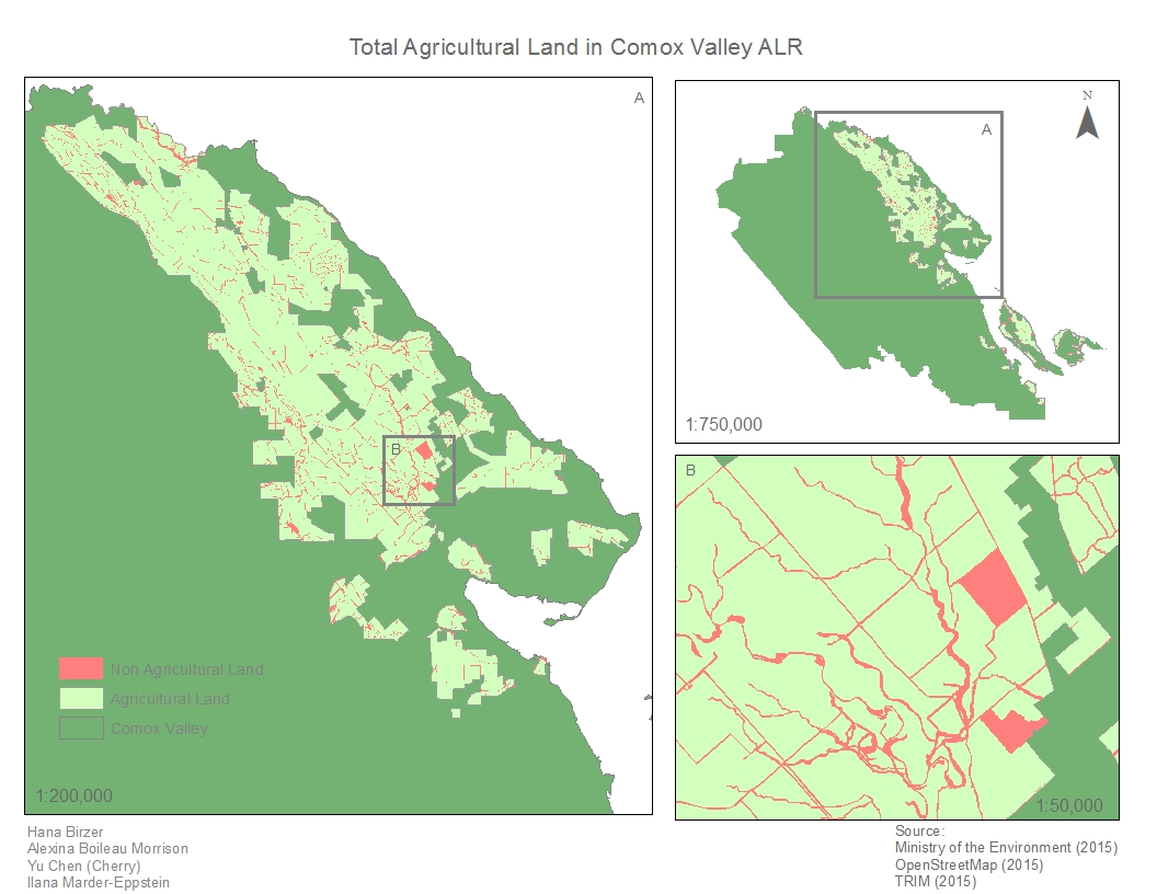
For this project, we are going to study the ALR in Comox Valley region that is located on the east side of the Vancouver Island. Our goal is to find out the usable ALR in our assigned region after a series of bio-geographical and social analysis.
click to enlarge
Our final maps show the total usable land within the ALR in Comox Valley.
This is a group project that we have 4 people in each group to finish the project and that means there are lots of things we need to think about before we start it over. The most important thing from the beginning is project management. We need to discuss the different sectors of the project and organize the meeting time as every member in the group has different schedule, and we have to finish the project in a certain time which could make the project harder. To do the project, my team members and I has set up a drive space (Google Drive) so that we can still work together even though we are all in different places which helped us a lot in the aspects of spatial and temporal. We started from drive and used e-mails to get connect with each other, and we organized the work log so that every member was assigned different questions.
In this project, every member gets their assigned maps and related questions that they should response for. We worked individually at the beginning and then combined all the maps and answers together and finally we edited together. I made 2 maps individually and 2 maps with my group members as well as the flowchart. Here, I would like to thank my team as they all played very important rules in different parts throughout the project. Everyone worked very hard and did put the effort into it.
By doing the project, we learned what the ALR is and the importance of it as the ALR is seen a pillar of our food production. We used a series of GIS tools to make the maps as well as to calculate the question and by using these tools, we are more familiar with the ArcMap. The most challenged part was probably the project management as we needed to really communicate with each other and to do the teamwork. Then we needed to find out the data and to make sure these data are the ones we need. there was also other challenge that we worked individually at the beginning, how could we share our data and information with each other, but finally we overcame the problem as we created a drive and stored everything to the drive and we spent a long time in the lab.
To conclude, this was an interesting project that we actually learned things and it was not only about the technics, but also how to work as a team and the most important is that we applied what we have learned to our daily lives.
Reference:
Provincial Agricultural Land Commission. (2015) Living in the ALR . Retrieved from
http://www.alc.gov.bc.ca/alc/content/alr-maps/living-in-the-alr