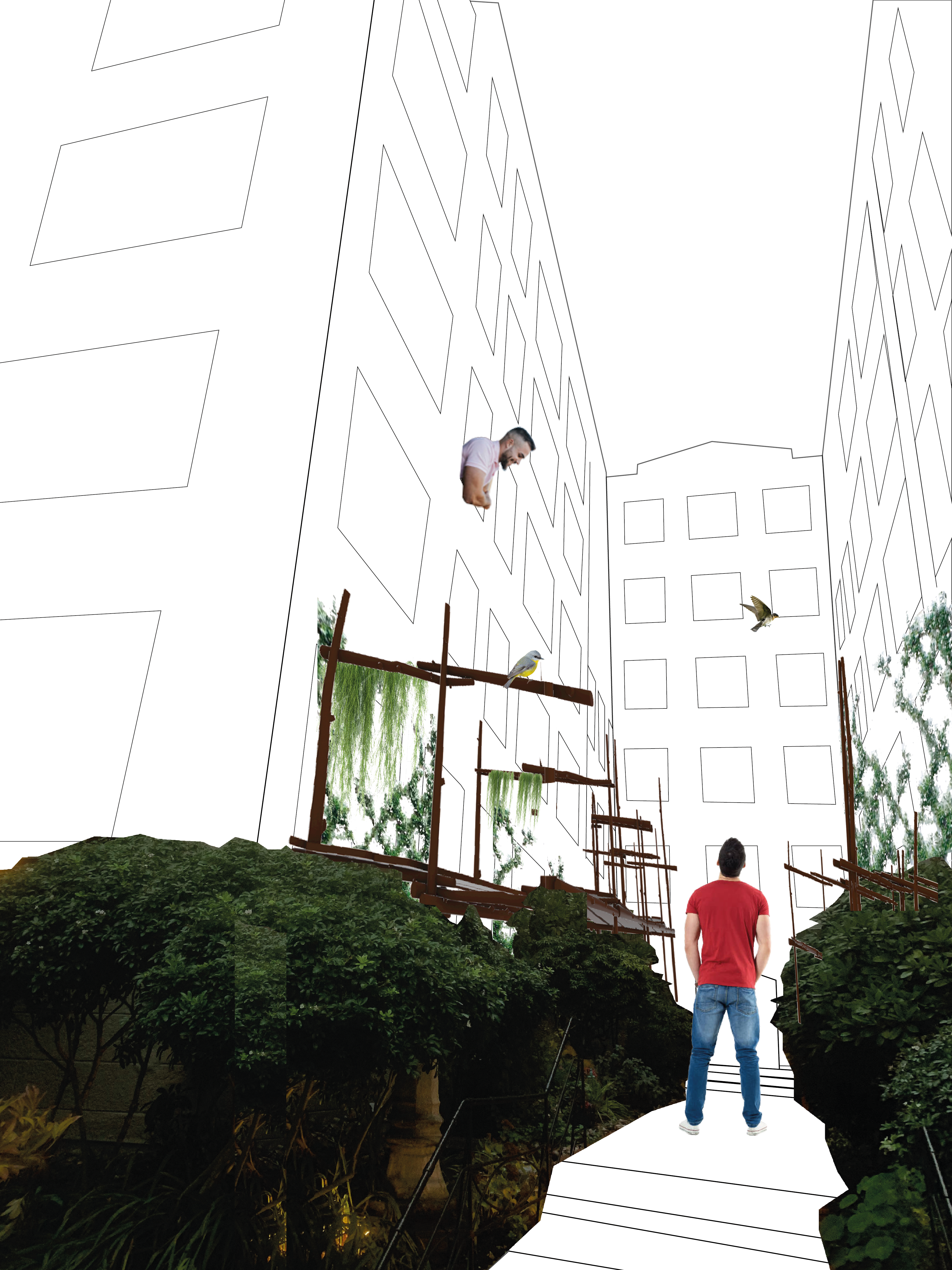
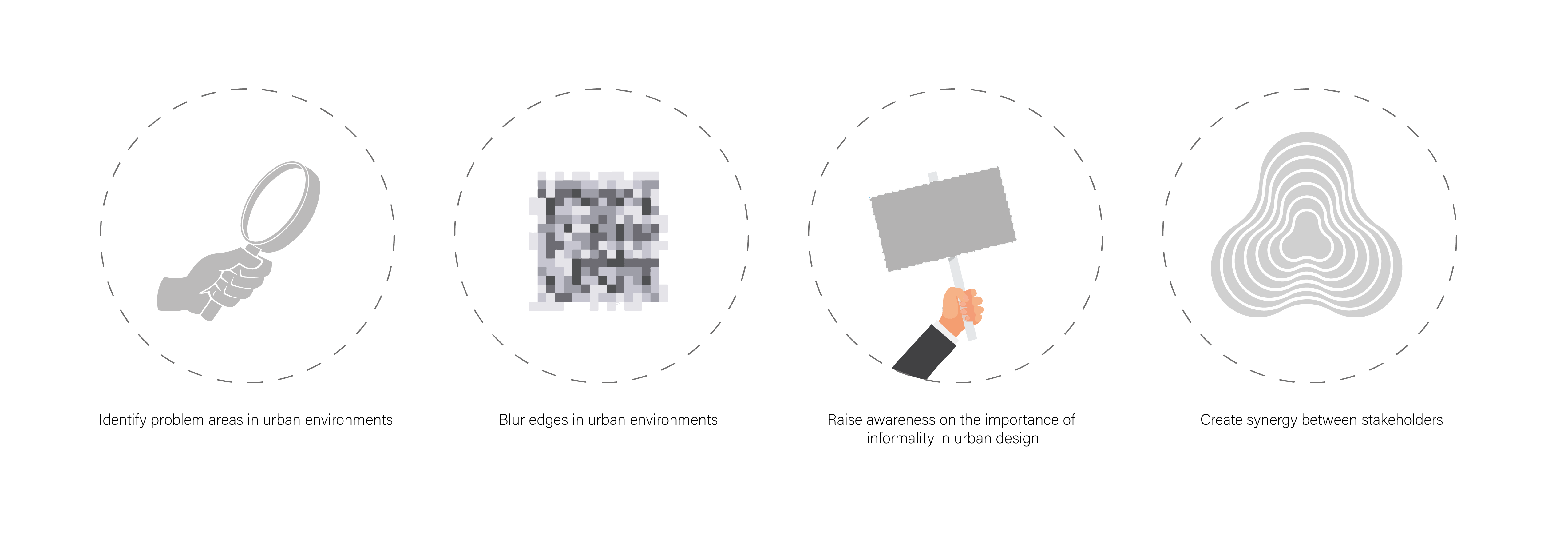
The urban environment often fails to consider relationships between informal stakeholders in the environment. This submission made an analysis of how the urban environment has characterised relationships between living things at different scales, particularly regarding edge conditions between the different actors, based on personal observations of several sites surrounding lost lagoon. We grouped urban stakeholders at different scales and examined the points on interaction between them, observing how the infrastructure aided/disrupted these interactions. One running thread we observed throughout our visual analysis of the built environment was that the harsh transition between elements and edges causes social hostility within the built environment between humans and other actors. One flaw of the urban environment is that it focuses more on formal built infrastructure and not on the informal elements. Another flaw is the solely human-centric approach to design, which is inherently negligent of other organisms and their patterns of engagement with the environment. In this submission, we propose a framework for analysis of the effectiveness of different urban edge conditions in facilitating streamlined social interaction and cohabitation between humans, pets, wild animals, and plants. Having qualified the levels of effectiveness, we then propose ways to boost the synergy between this chosen set of actors, in any given urban condition: by blurring the margins and magnifying fluidity in the built environment.
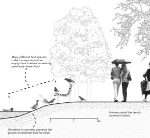
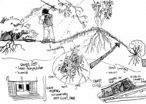
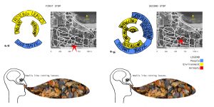
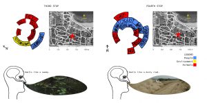
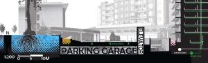
Edge relationships along lost lagoon

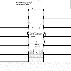
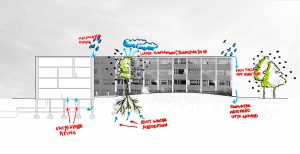
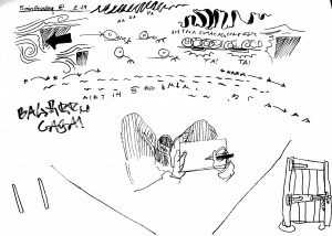
Edge conditions section(broken up for visibility)

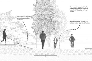
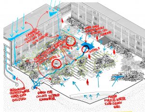
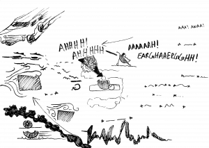
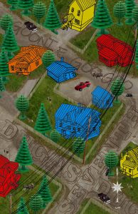
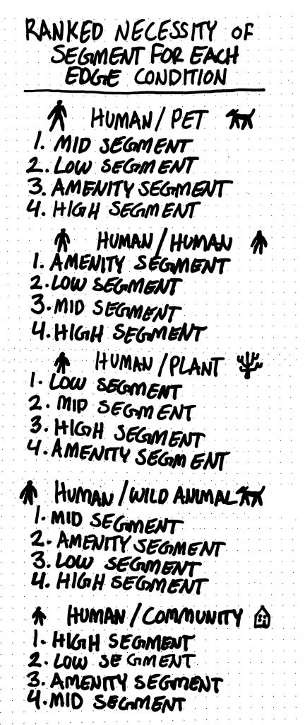
Segment options
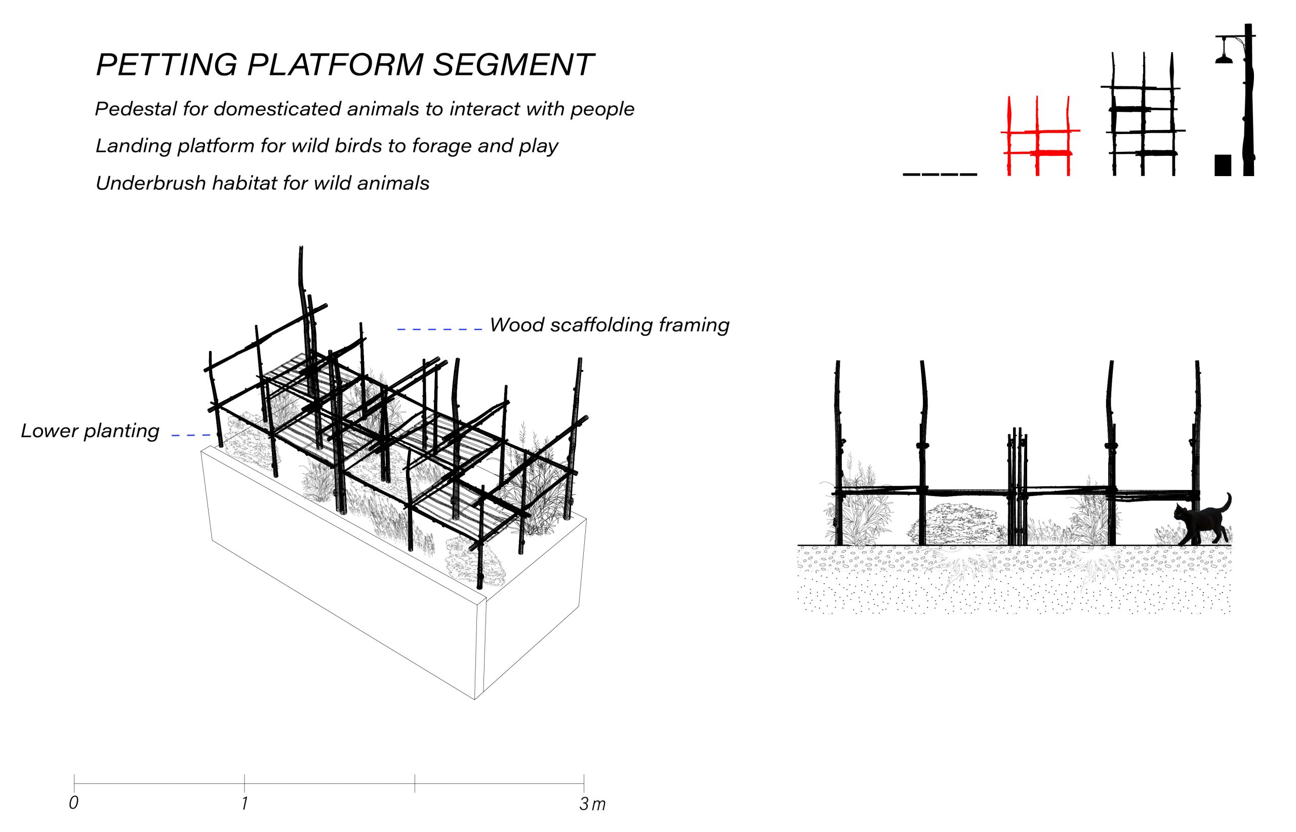


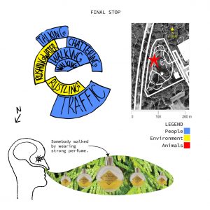
The breakdown of segments

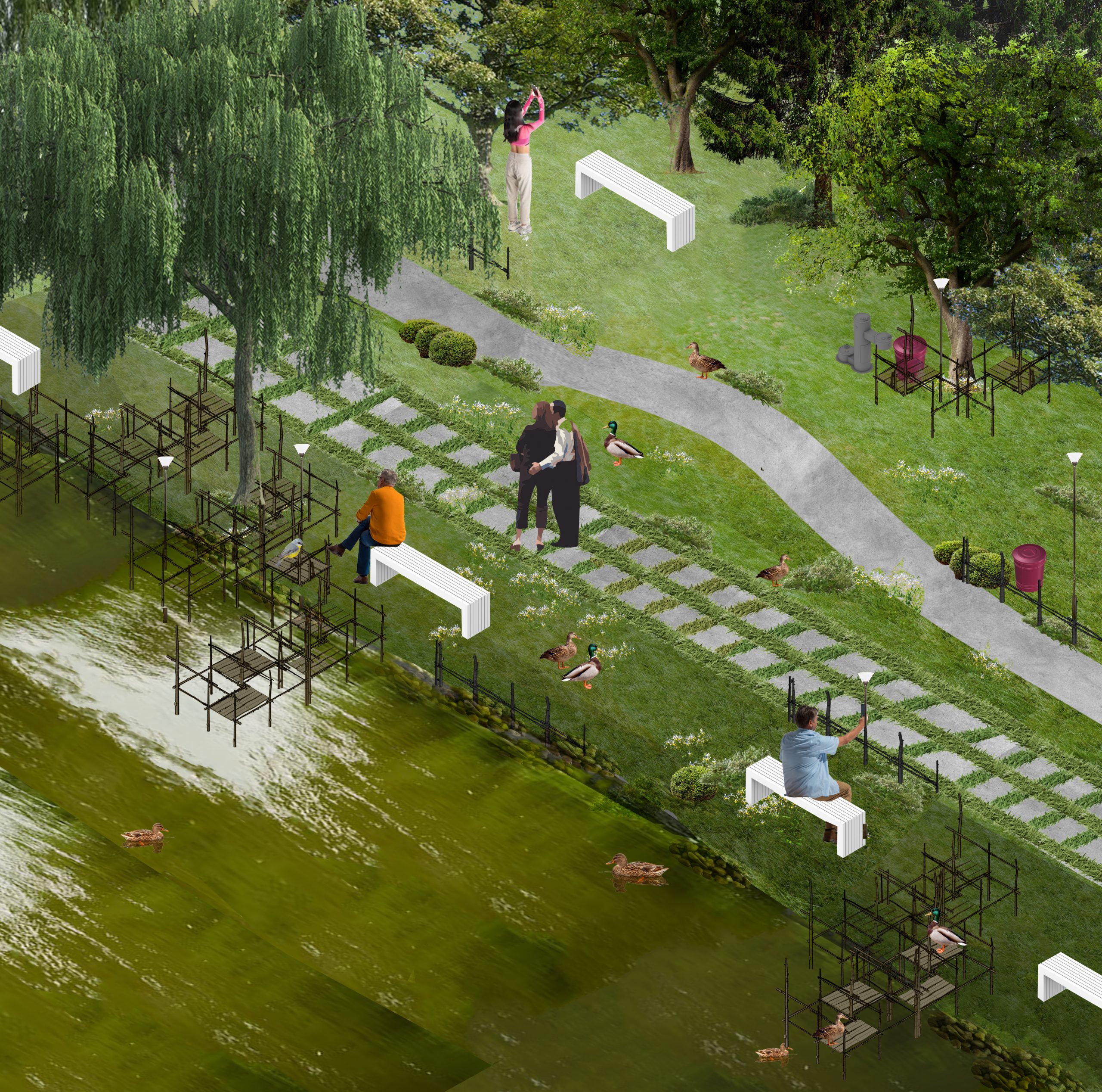
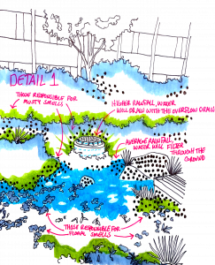
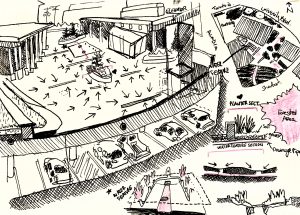
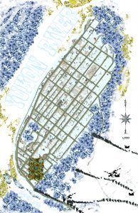
What it could look like