Category: 01
Assignment 01 – Felix Jager
Assignment 1 – Kaitlin Manuelpillai
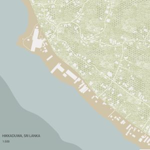
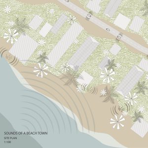
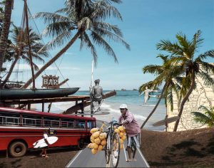
This assignment focuses on Hikkaduwa, a beach town in my home country Sri Lanka. The small town is full of vibrant people, environments, music and ruled by the power of the ocean that surrounds it. Days here are spent swimming in the water, surfing, drinking coconuts and exploring the local environment. Focusing on the element of sound in my site plan – the loud, calming sounds of waves crashing on the beach are constant, while the cacophony from ongoing traffic of tuk-tuks and buses pose an interesting juxtaposition from the tranquil ocean.
blogs.ubc.ca/…les/2023/09/site-plan-1.pdf
Adam Larsen – Assignment 01: Home Ground
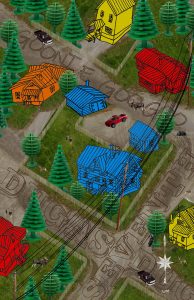
This site plan is set on the corner of Dugas and Seventh in my home town of Dawson City, Yukon Territory. It felt important to reference my childhood spent here, so the houses are playfully hand drawn (my own in blue), the trees are LEGO toys, and the cars are Hot Wheels. Dawson was a secluded place where we depended on meat we hunted for, and shared with our neighbors. Dotted throughout the plan are deer, moose, and some black bears.

My neighborhood plan is intended to showcase more characteristics of Dawson such as dirt roads, spaced apart houses, and autumnal bright yellow birch trees that are characteristic of the Yukon.
The final city plan of Dawson focuses more on it’s history. In the bottom right are rows of people who flocked to the city in the late 19th century for the famous Klondike Gold Rush. Part of the trek to get to Dawson was through the Chilkoot Pass, a mountain passage that colonists reached by the coast of Alaska. Portions of the trail were so treacherous, that many horses died on the journey.
Mary Anne William – Assignment 1

Assignment 01- Ewuraba Essel-Appiah


Assignment 01 – Hedric Bernardino
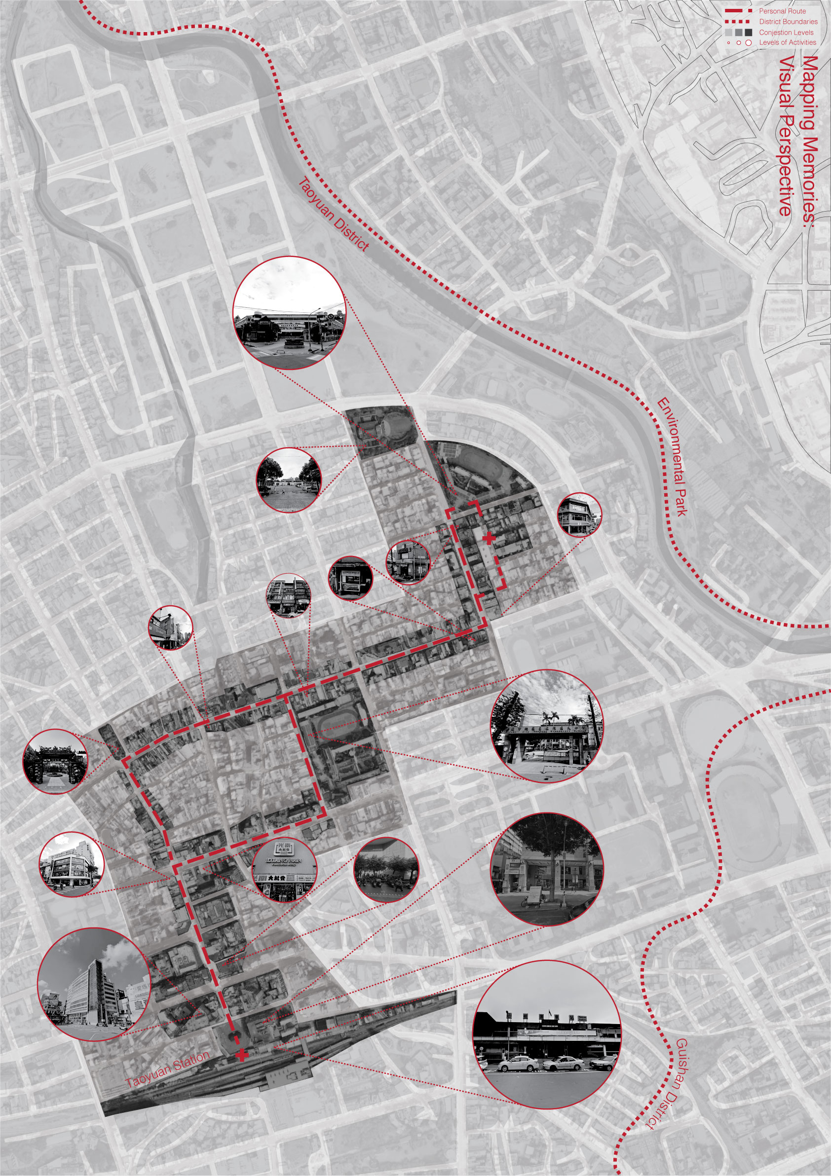
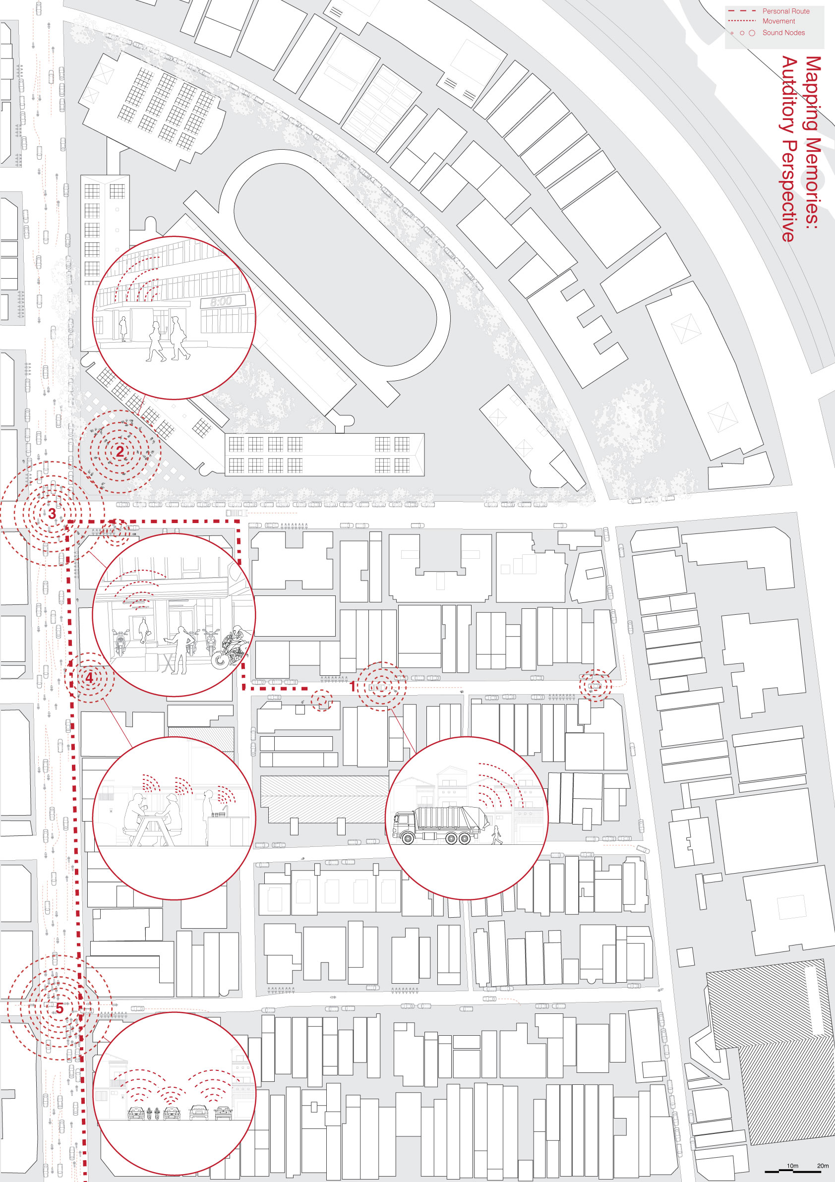
DES 430 Assignment 1 – Kai Chi

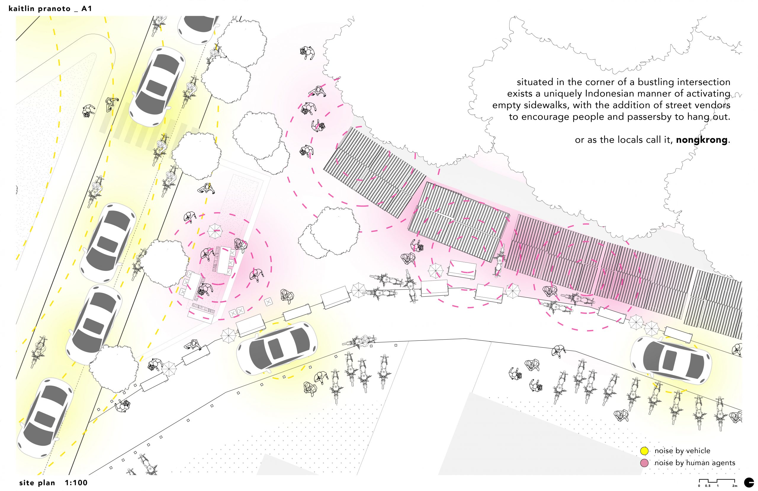
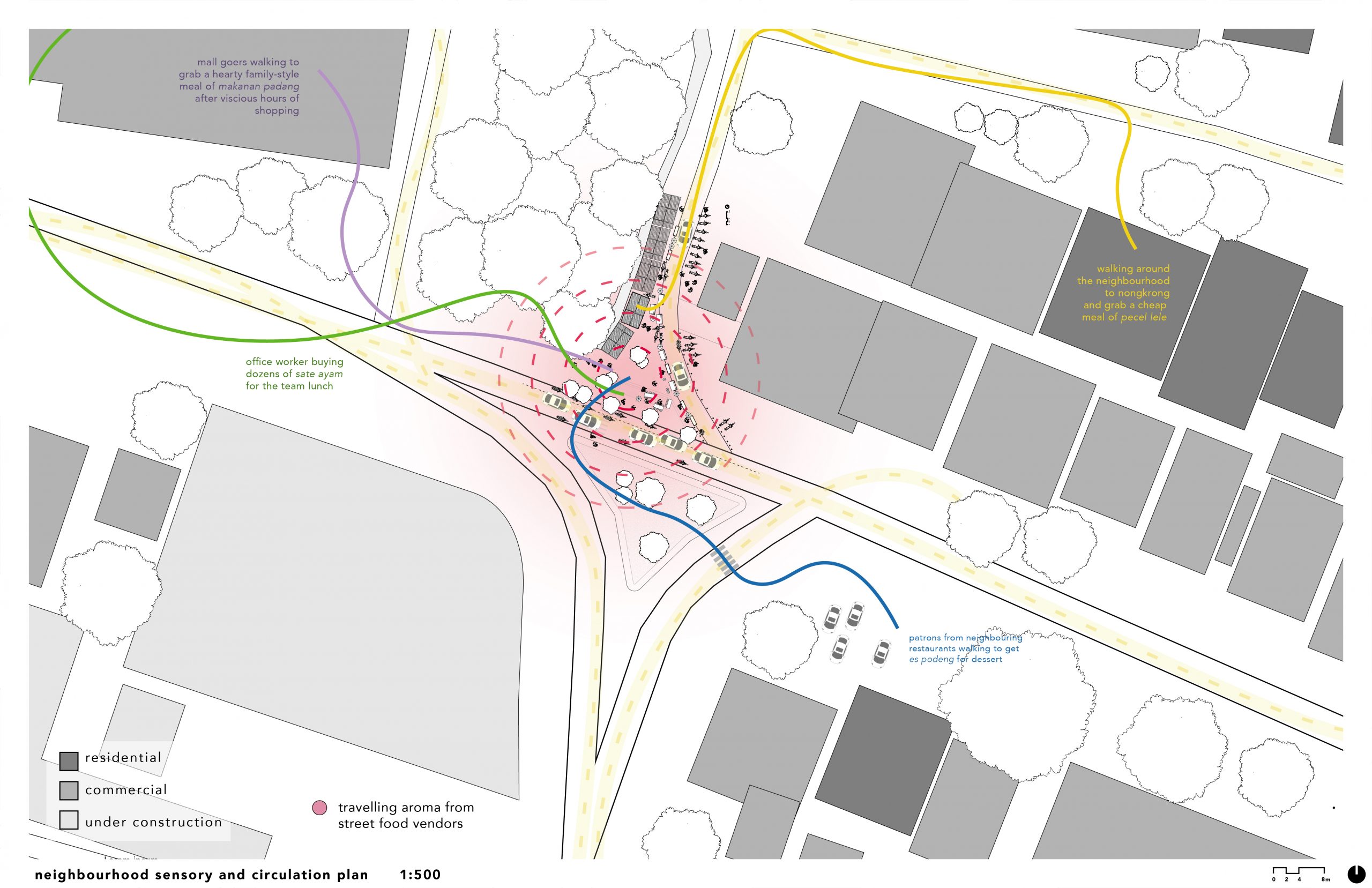
Kaitlin Pranoto – Assignment 1

A1 – Arevik Petrosyan
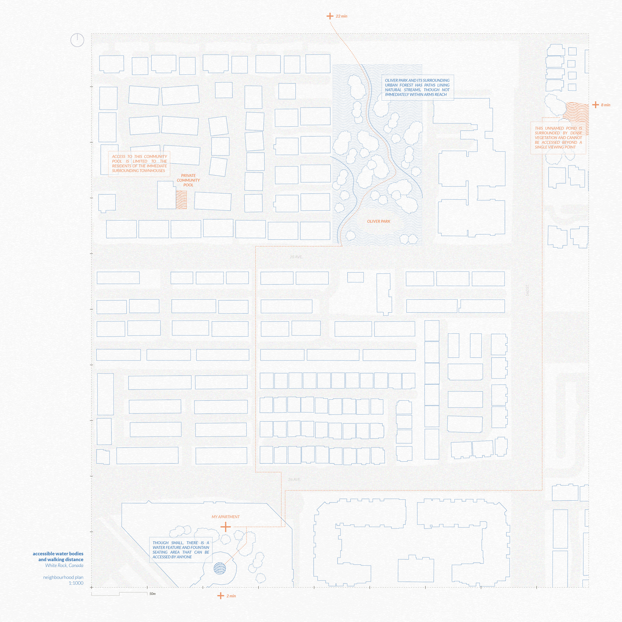
I looked at an intersection that is located adjacent to an elementary school near the house I grew up in. The neighborhood, like many in Calgary, is not very walkable. On weekdays before school, and after students are dismissed, there is a lot of congestion on this specific intersection and it doesn’t seem like the safest situation to have kids running around in every day.
Excluding the highway, the map below shows the approximate area that can be reached within a 15 minute walk of that intersection, which includes four schools located on the perimeter of a loop created by the two larger roads in the neighborhood. This area includes a handful of bus stops, a gas station, a church, and a lot of single family homes. During the morning school rush the two main roads become incredibly congested and it is nearly impossible to leave this area.

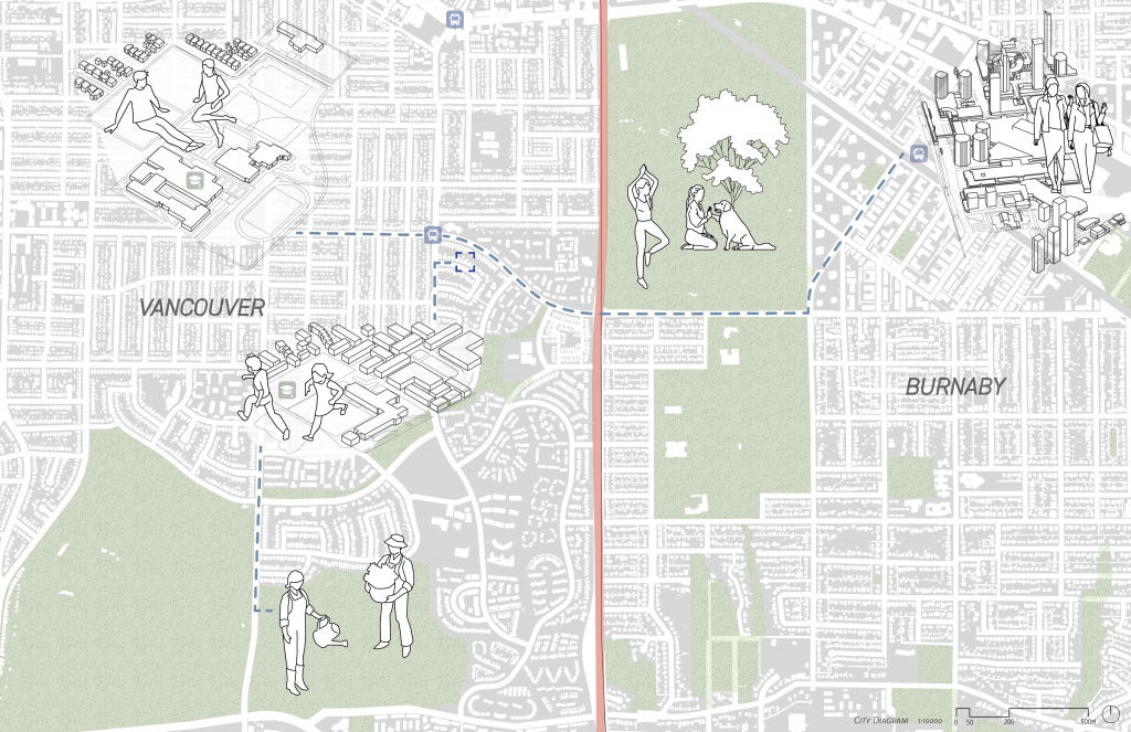
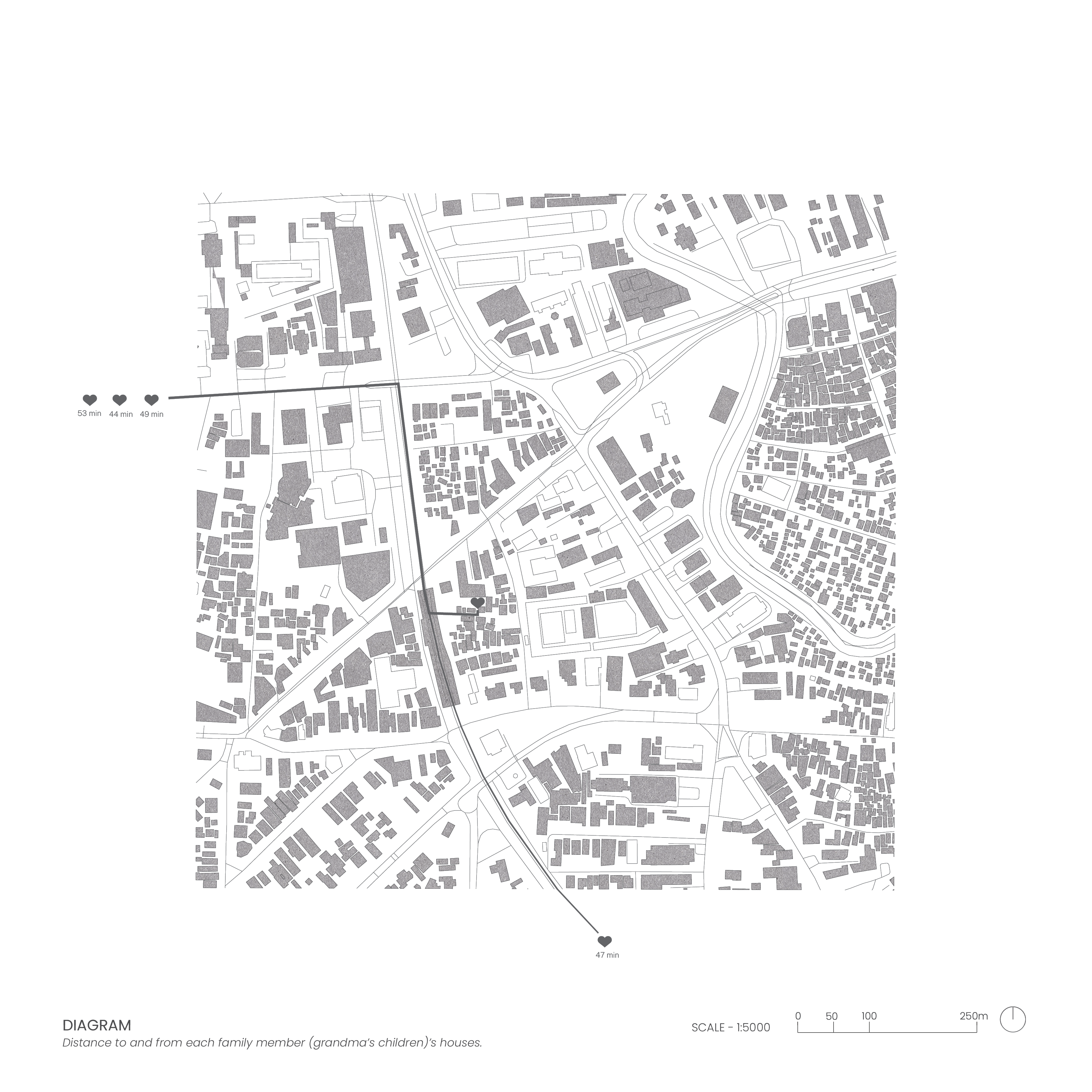
This is a mental map of Calgary and its surroundings. Anything directly adjacent to the train tracks can be reached by the LRT line I live near. I grew up in the “Deep Suburbs” in the South West, and don’t really drive on my own, so my knowledge of what exists in this city is limited to what can be reached by transit in an hour (1h 30 max). As a primarily transit commuter, more than half of this city is entirely unfamiliar to me despite living here for my entire life.
Assignment 01 – Alyssa Cheung

ASSIGNMENT 01: Lisa Besnier
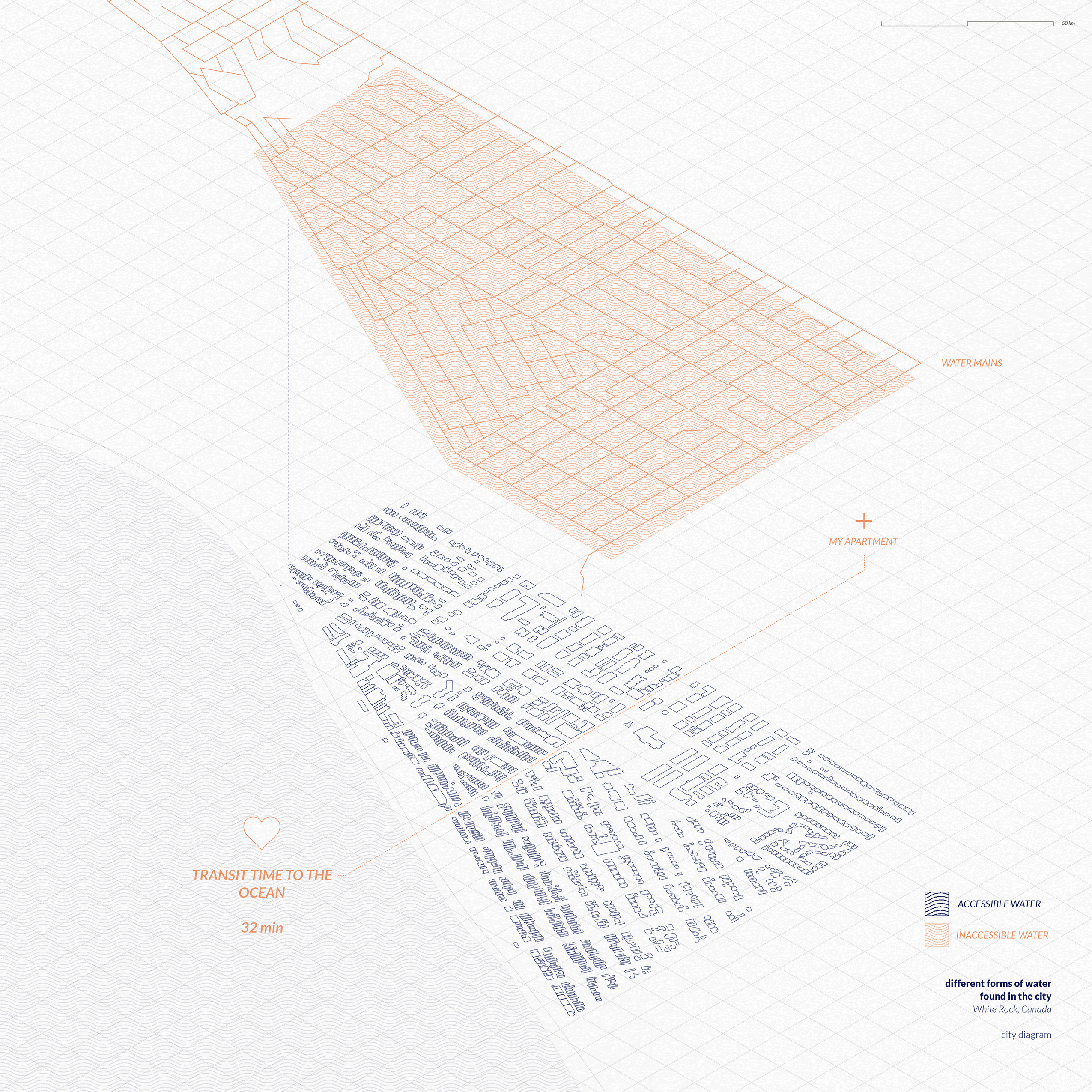
My explorations of home focused on my family’s house in Phoenix, Arizona, USA. Water plays an important part of environmental experiences in the desert city, but is also in short supply, with access increasingly falling along class boundaries. Growing up in a middle-class suburb, I routinely experienced the pleasures and excesses of non-necessary water usage.

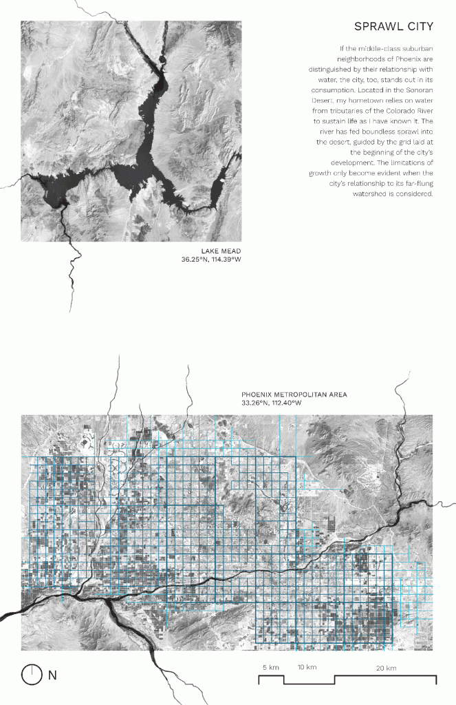
Note: the city diagram should appear as a GIF; troubleshooting to come!
A1 – Alena Bergeron

Assignment 1- Mary Xinyue Zhu
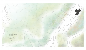
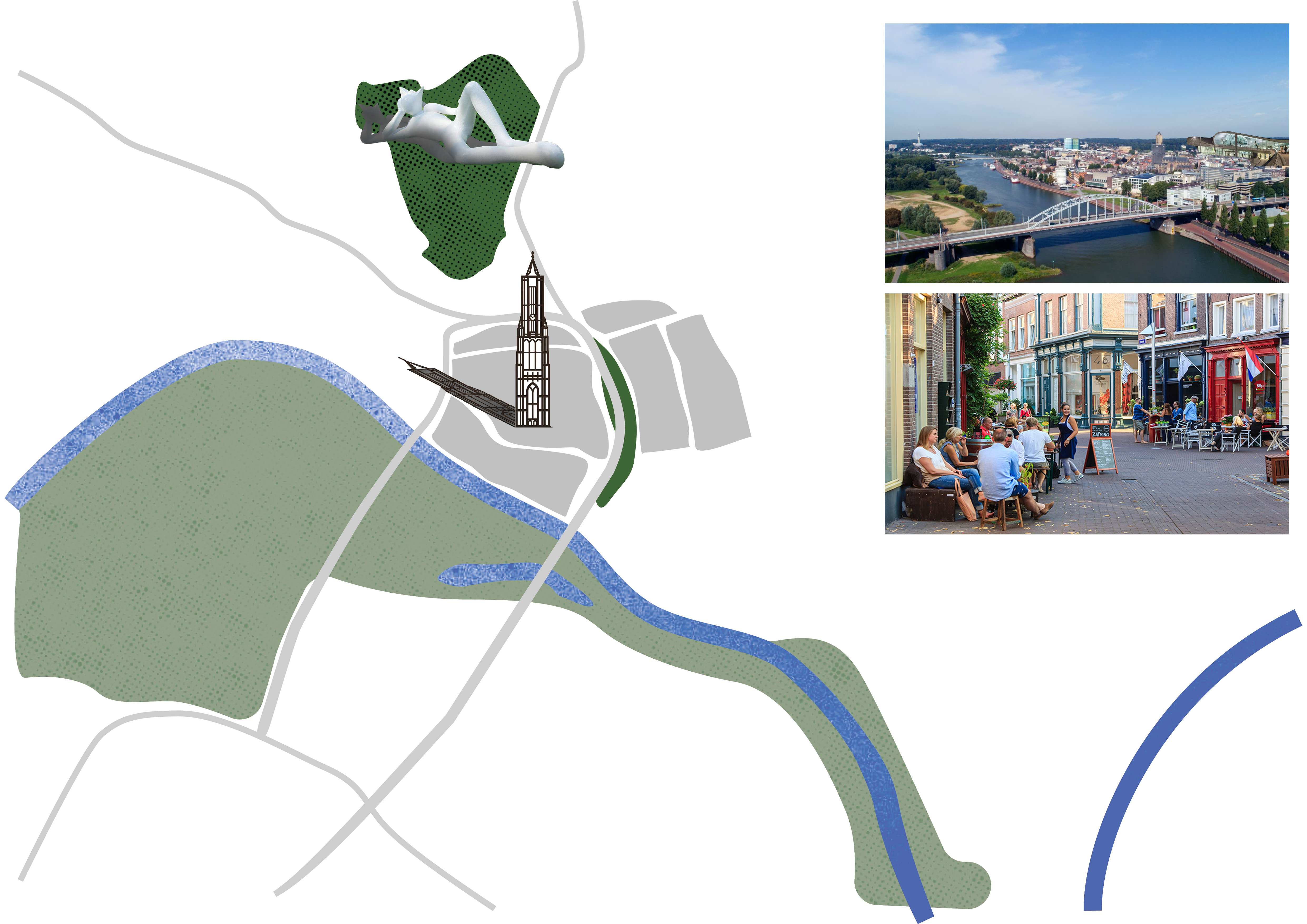
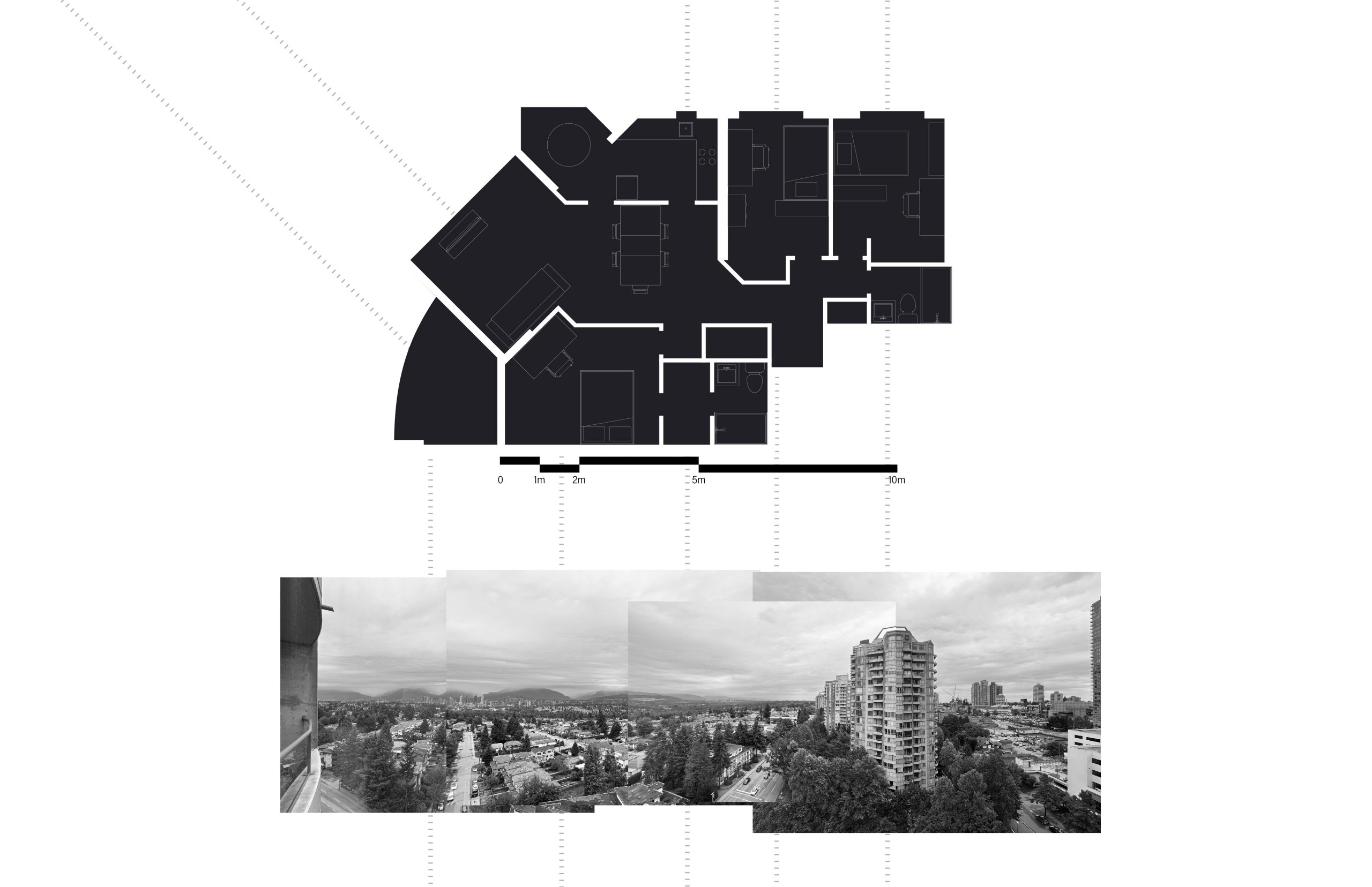
 Neighbourhood Plan 1:500
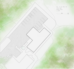
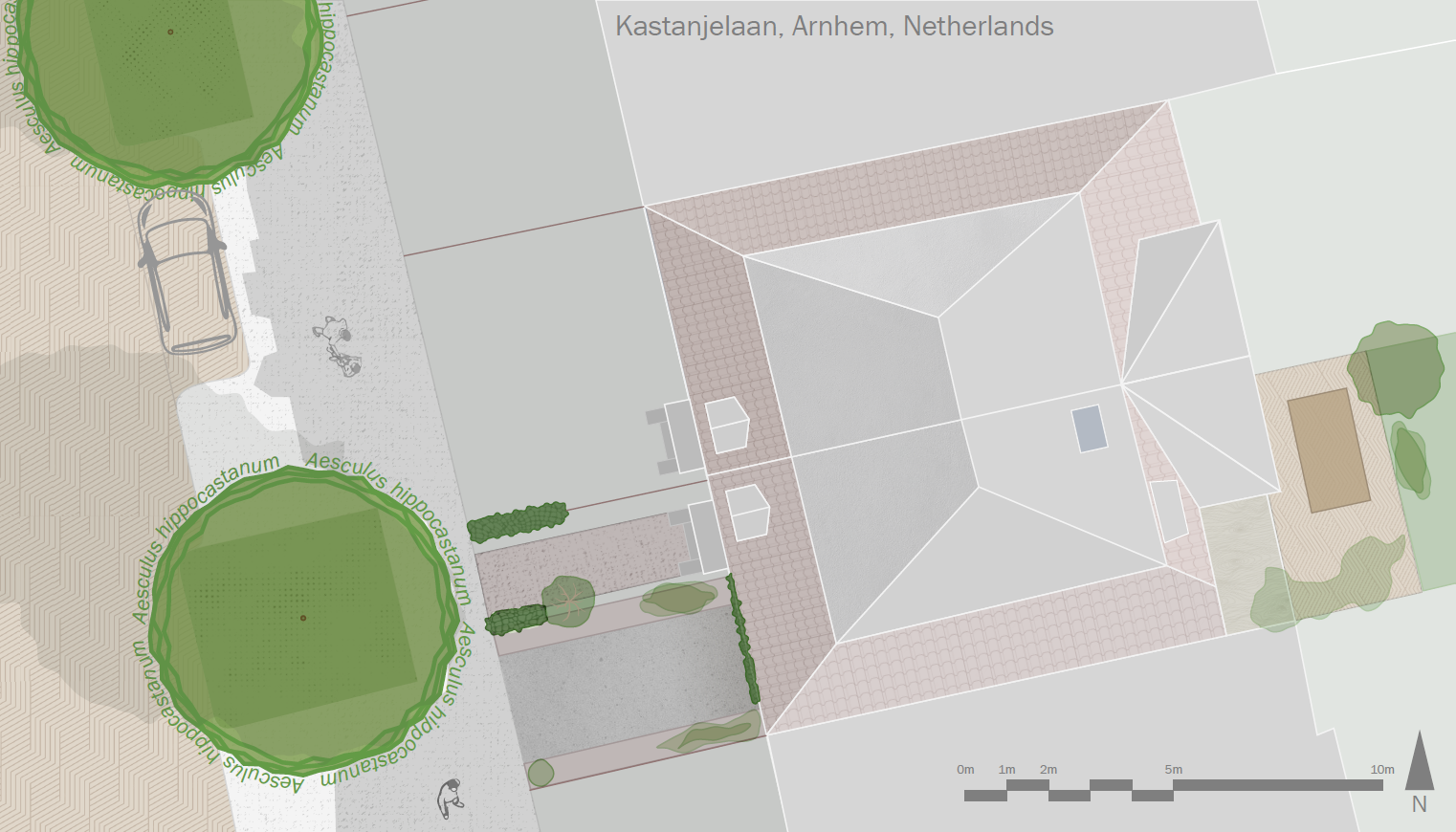
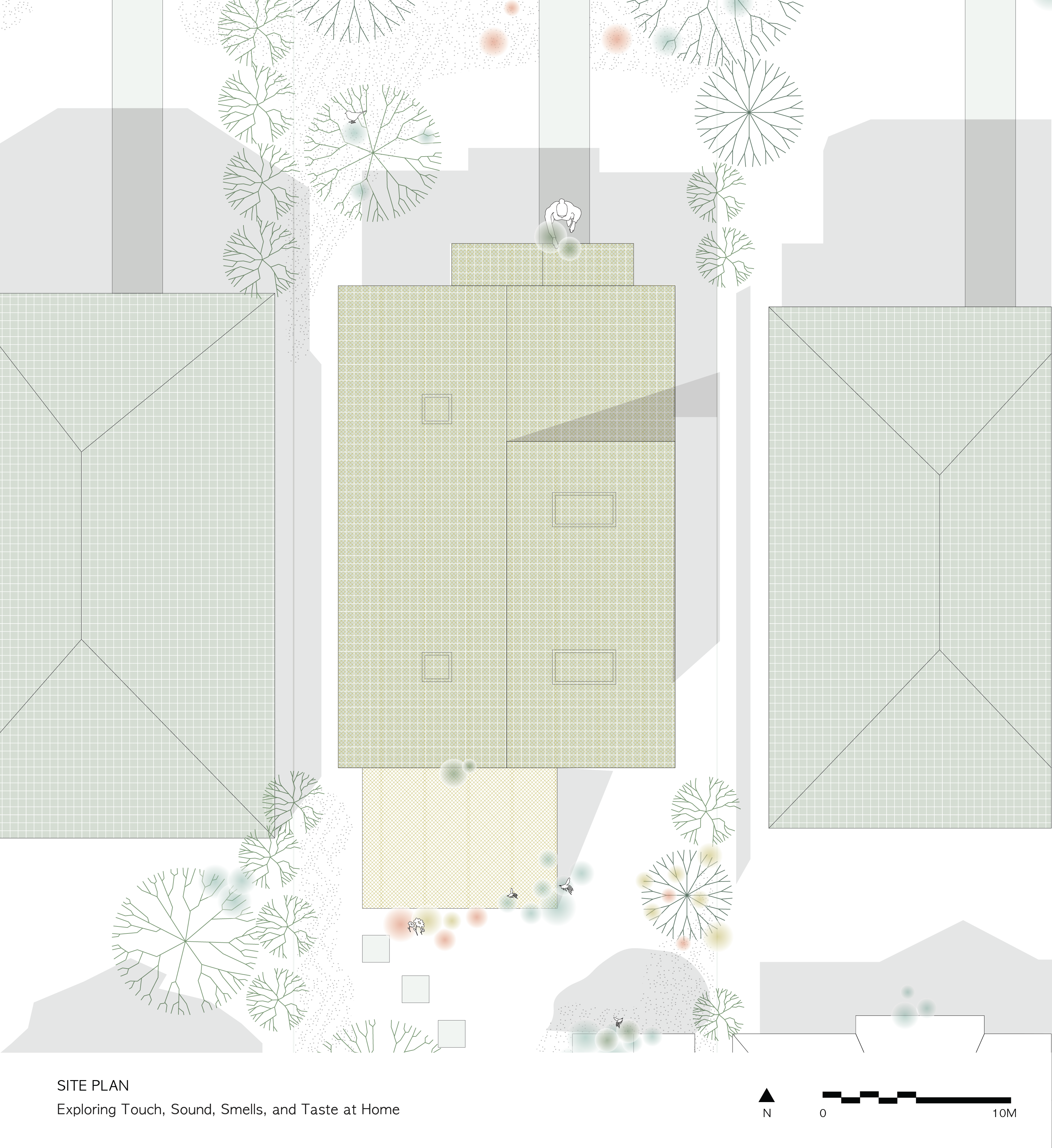
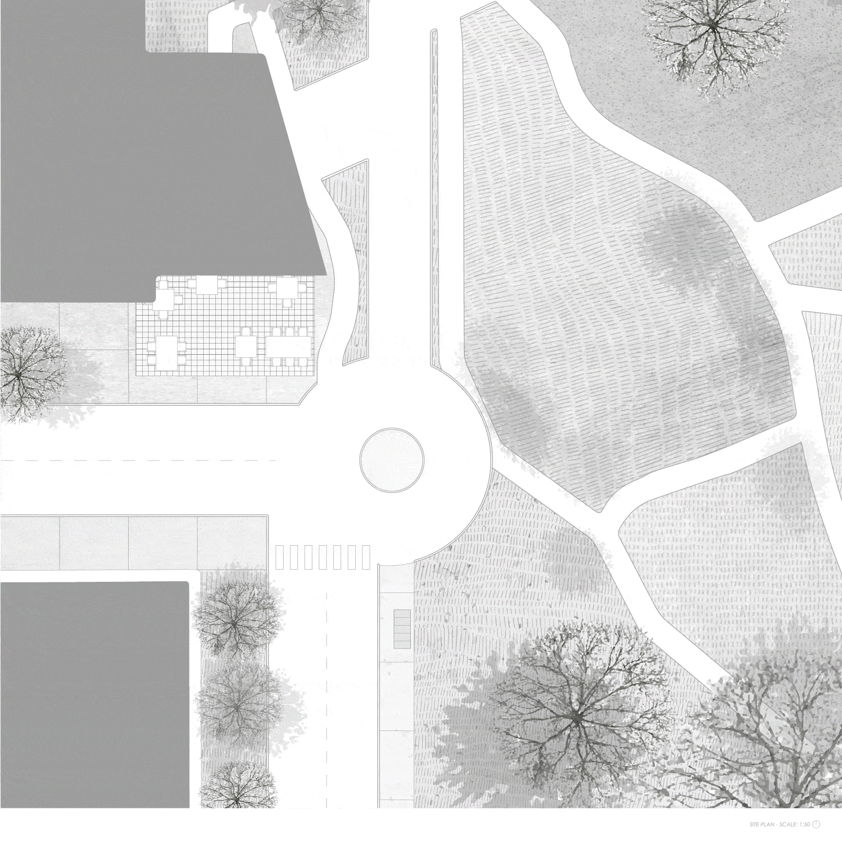
 Site Plan 1:100
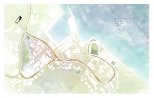
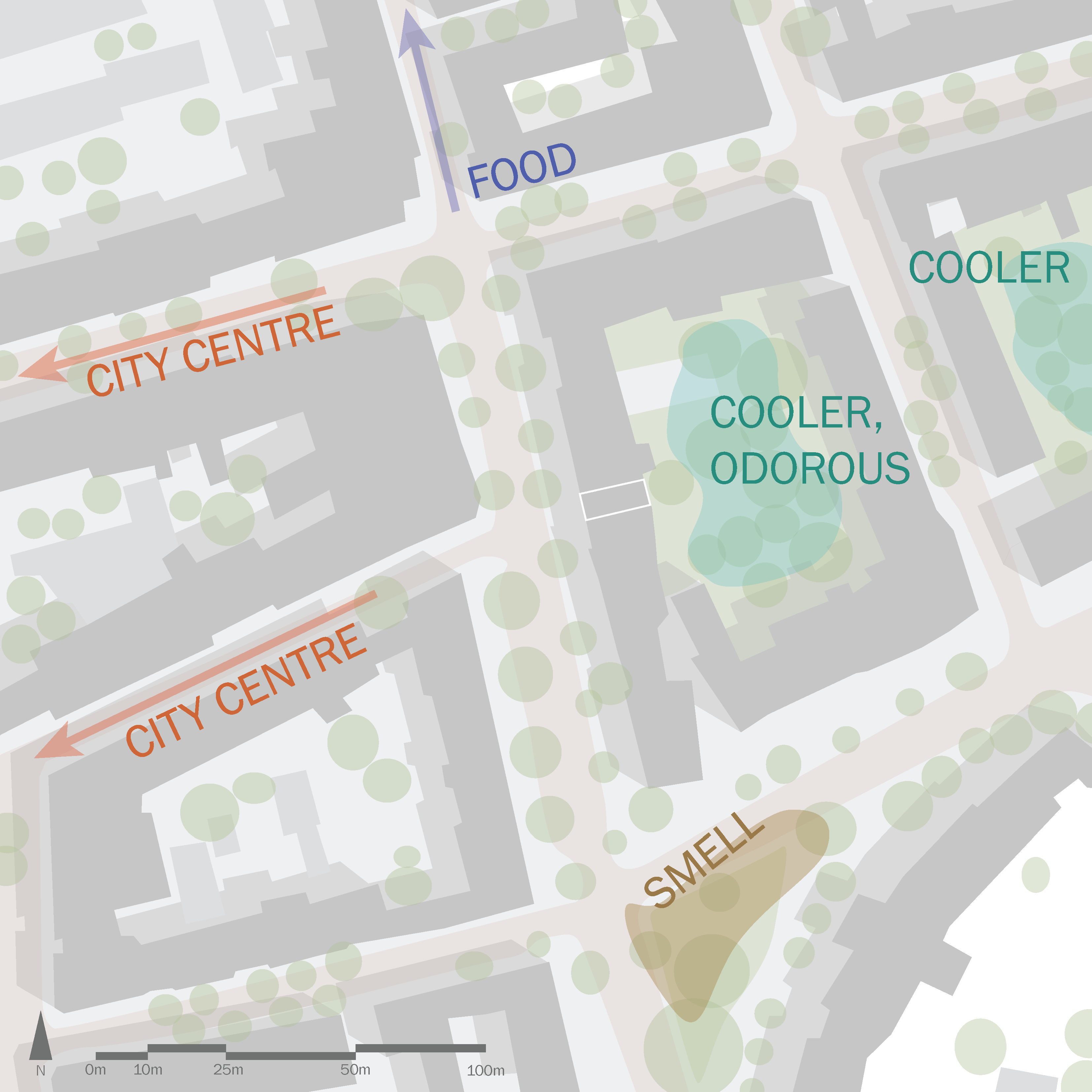
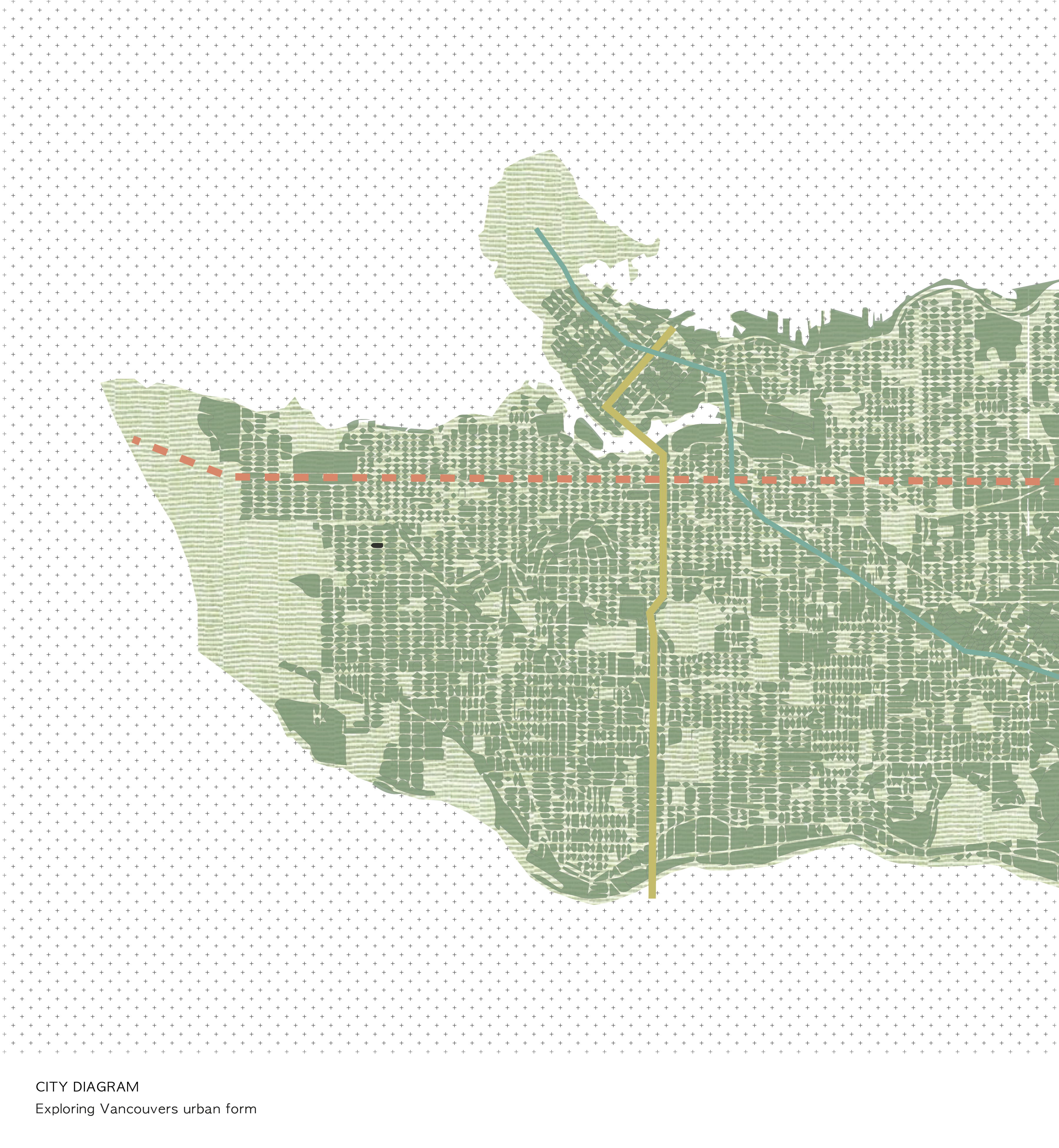
 City Diagram: 1: 2000.
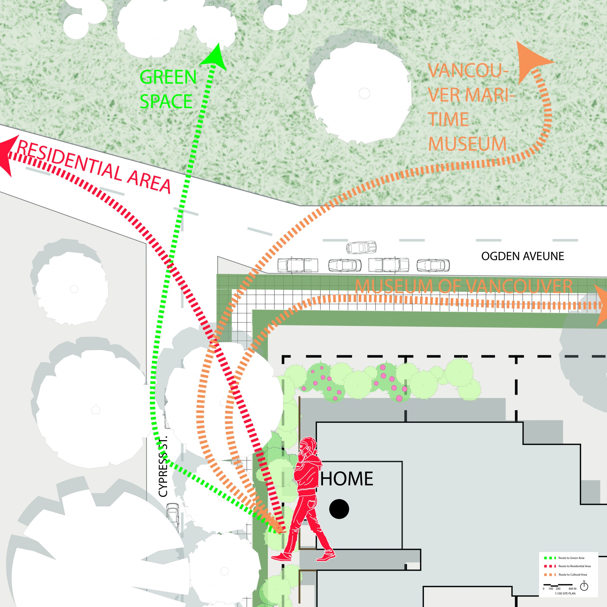
The site is located in residential area, and is encircled by Green space, then beaches, and finally the ocean. The colored lines have showed the routes and various zoning around the site, including residential area, cultural museums (Vancouver Maritime Museum, Museum of Vancouver), green spaces, and beaches. The circular distribution of geographical typology has fulfilled people’s experience when they are walking to the beach. I have searched about the walking experience from home to the shoreline.
ASSIGNMENT 1 – FABIEN KWAN

Assignment 1 – Talia Neufeld
A1 | H. Brogan Gealey


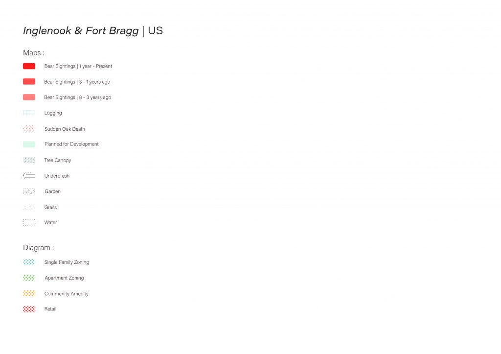
Assignment 1 – Nishi Praveen Kumar
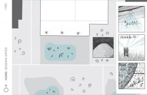
A conceptual mental map of my residence, this visual representation captures the essence of the house without adhering strictly to its precise dimensions. Within this map, the fusion of elements such as movement, aromas, sounds, and the unique utilization of each space converges harmoniously, offering a sensory journey through its interior.

This map artfully illustrates the intricate interplay between my residence and its surroundings, primarily the street it’s nestled on. It transcends traditional cartography by seamlessly weaving sensory dimensions into its depiction—capturing not just the visual landscape but also the auditory and olfactory experiences that harmonize within this environment.
Moreover, this dynamic portrayal incorporates the fluidity of movement, with pedestrian and vehicular rhythms elegantly superimposed onto the canvas. Gone are the rigid confines of property lines, as this map transcends conventional boundaries to emphasize the interconnectedness of the entire community. Indeed, it is a map that fosters a profound sense of belonging and shared space—a true testament to its community-centric approach.
This map unveils the structured urban programming that characterizes the area. Sensory experiences are meticulously superimposed onto the space, yet they seamlessly meld into the environment, making it challenging to isolate any specific sensation at a given moment within a particular locale. As an emblem of interconnectedness, property lines dissolve in this urban landscape, underscoring the city’s role as a cohesive community system.

Assignment 1 – Miucci Yung


Assignment 1 – Mia Torrence
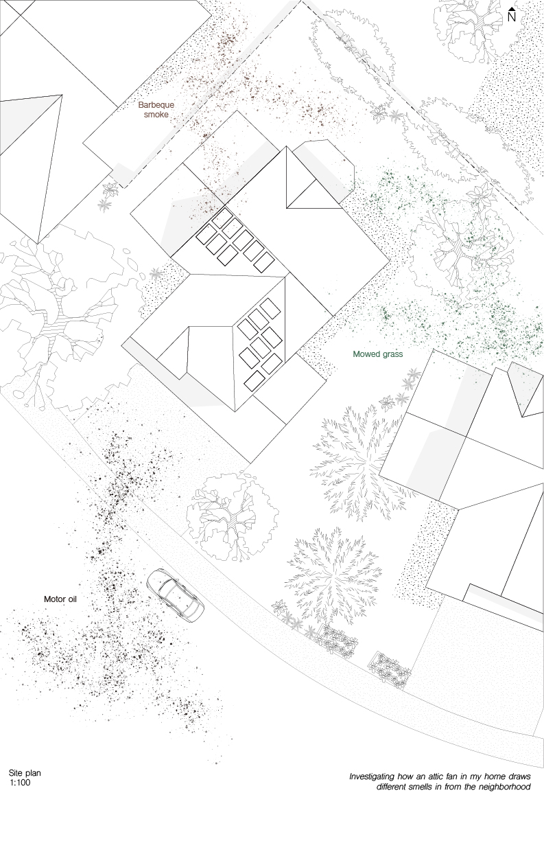
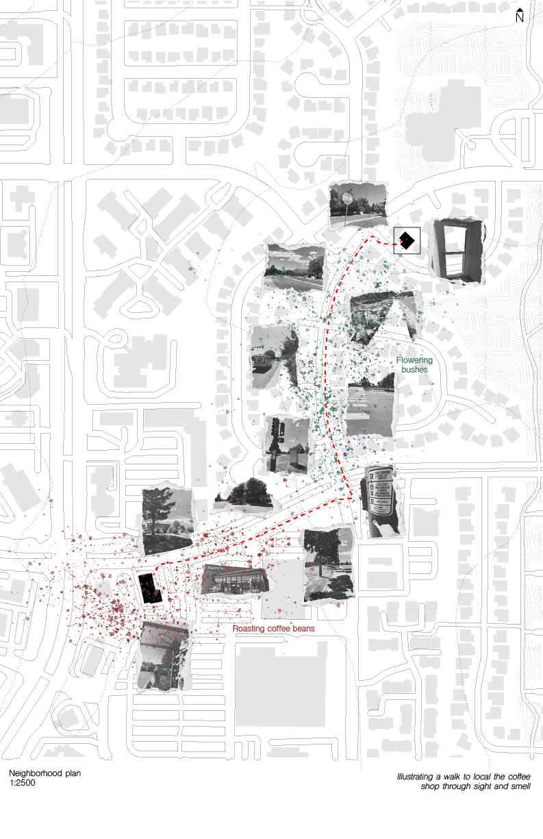
 Smelling Smoke
Mapping the smell of smoke, among other smells, in Louisville Colorado
A01 Jessica Lin

01 | ANNIKA SUNDE


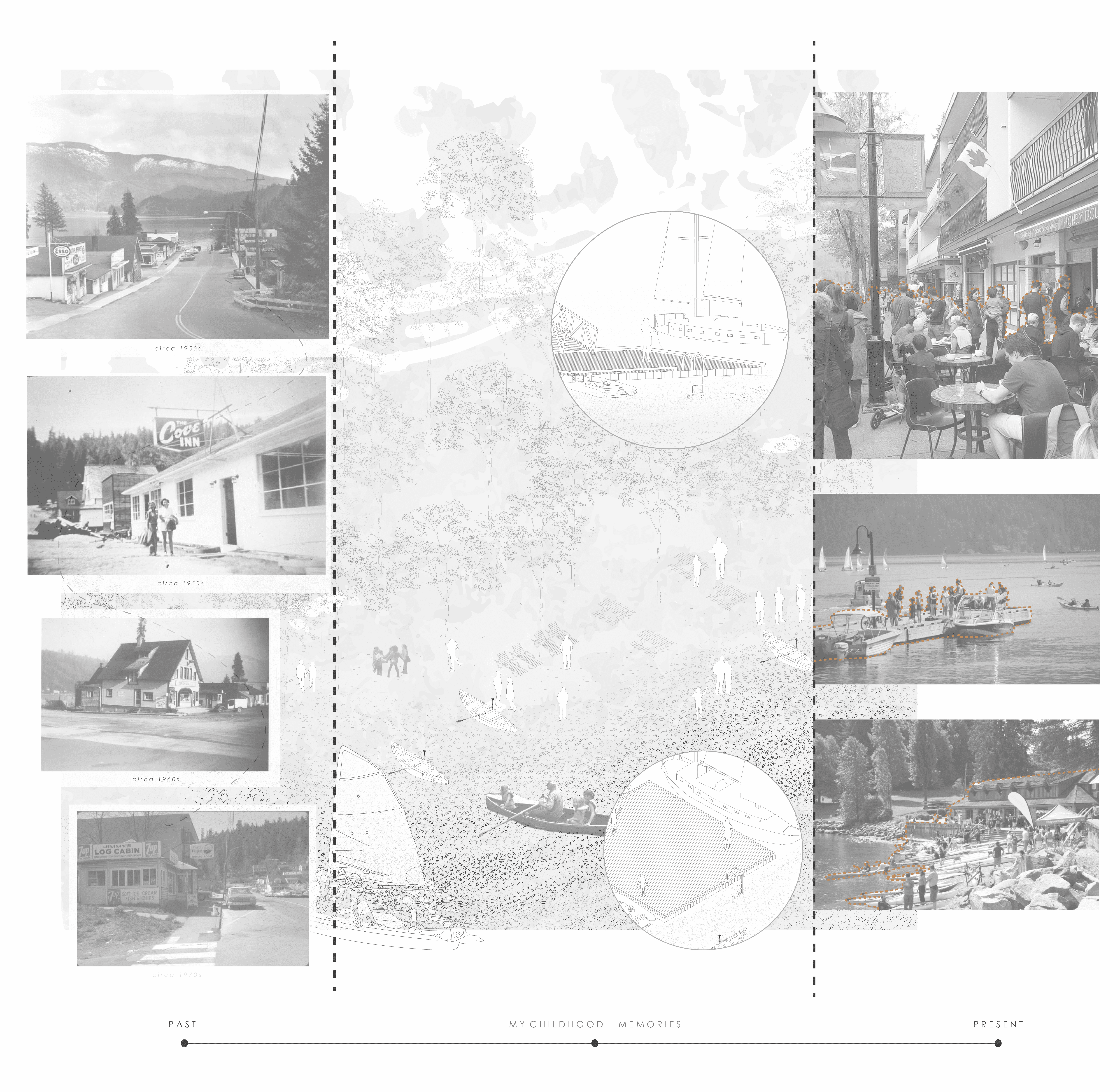
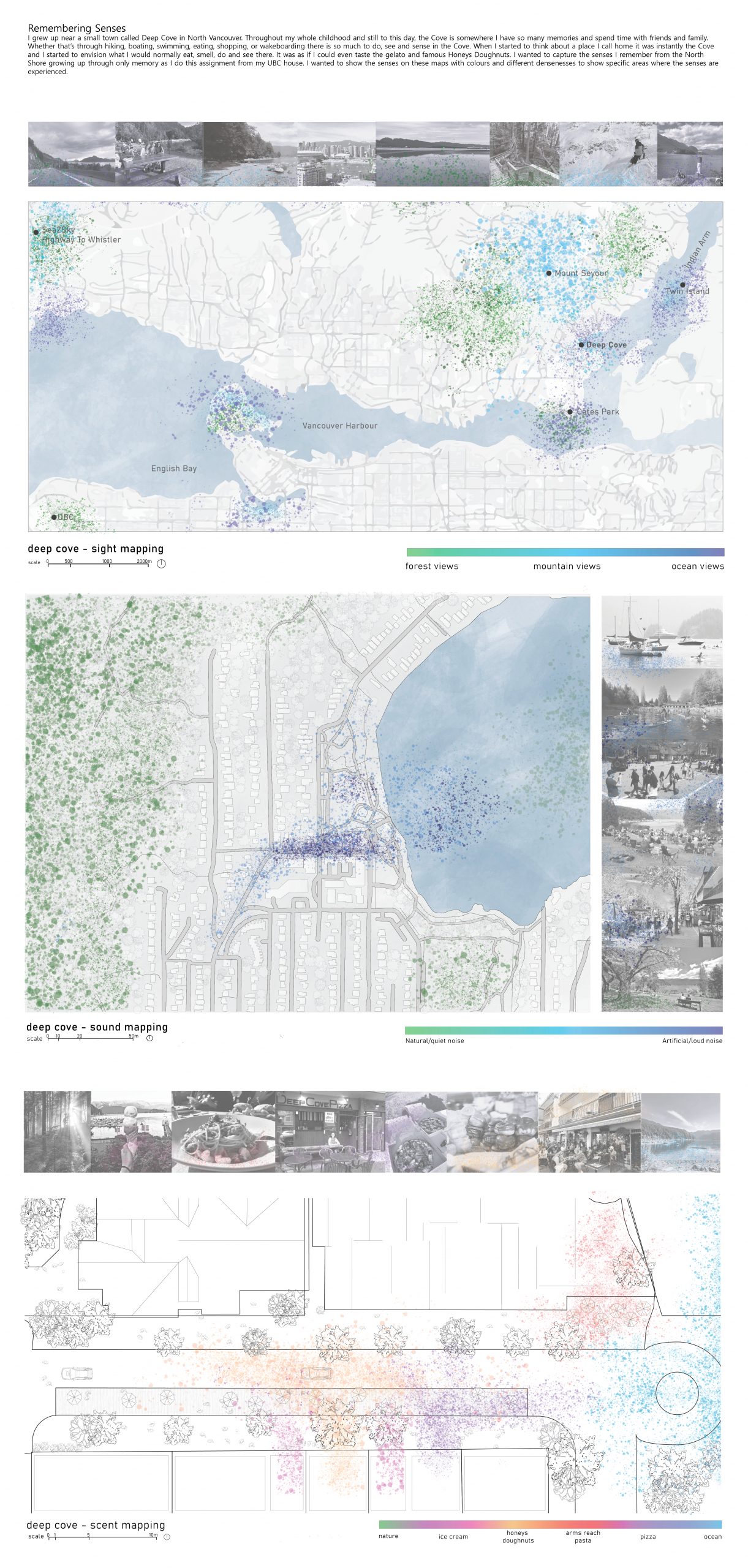
I observed my neighbourhood, Deep Cove, a small seaside village on the far easternmost outskirts of North Vancouver. The region has evolved throughout the years, from a quaint town my parents knew and loved, the community I grew up in and have created lasting memories, to the community it is today, affected by tourism and constant congestion.
Assignment 1 – Anastasia Simonovich


McNeil Fiesta | Assignment 01


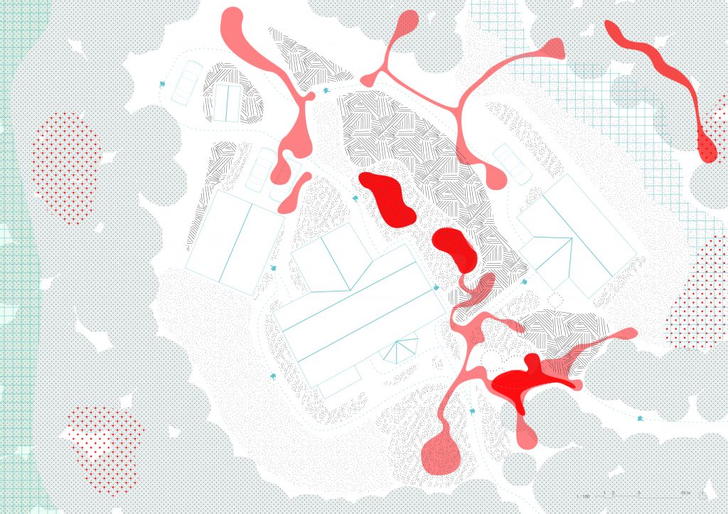
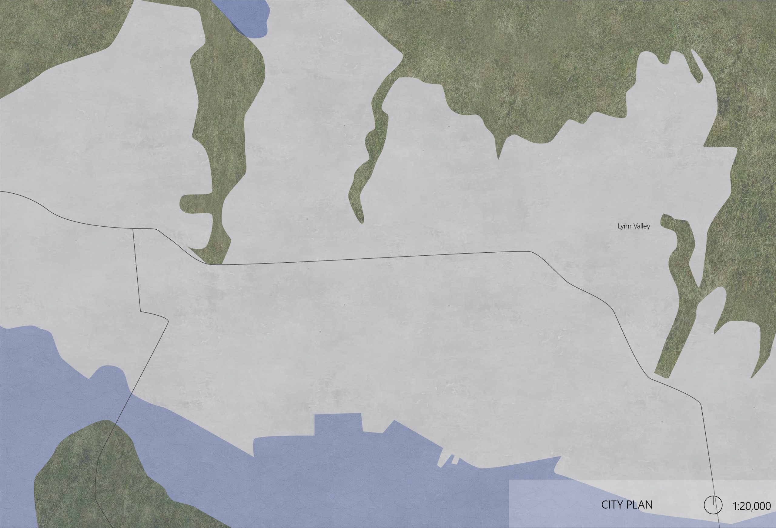
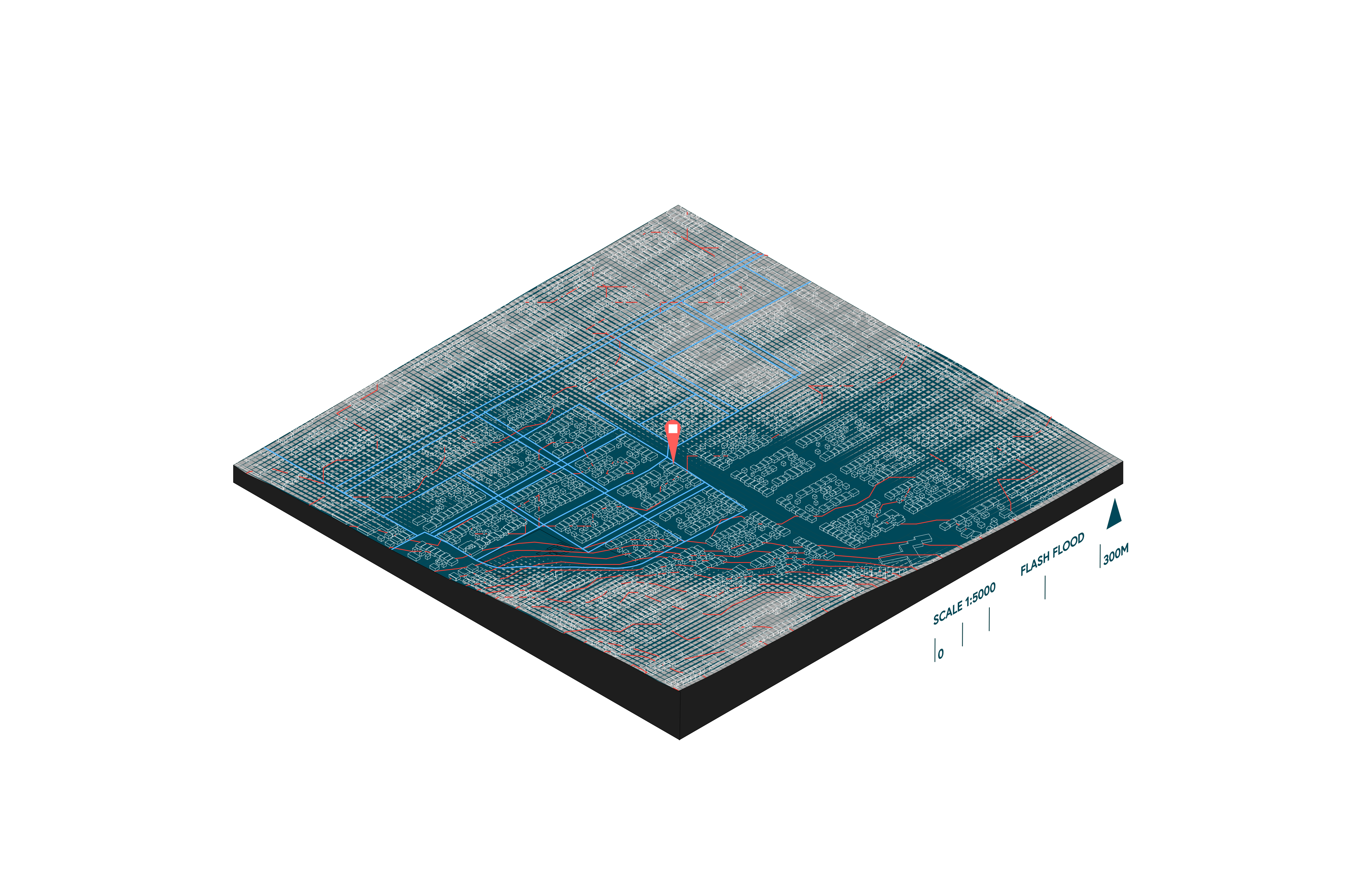
Soha Heydarian Assignment 01
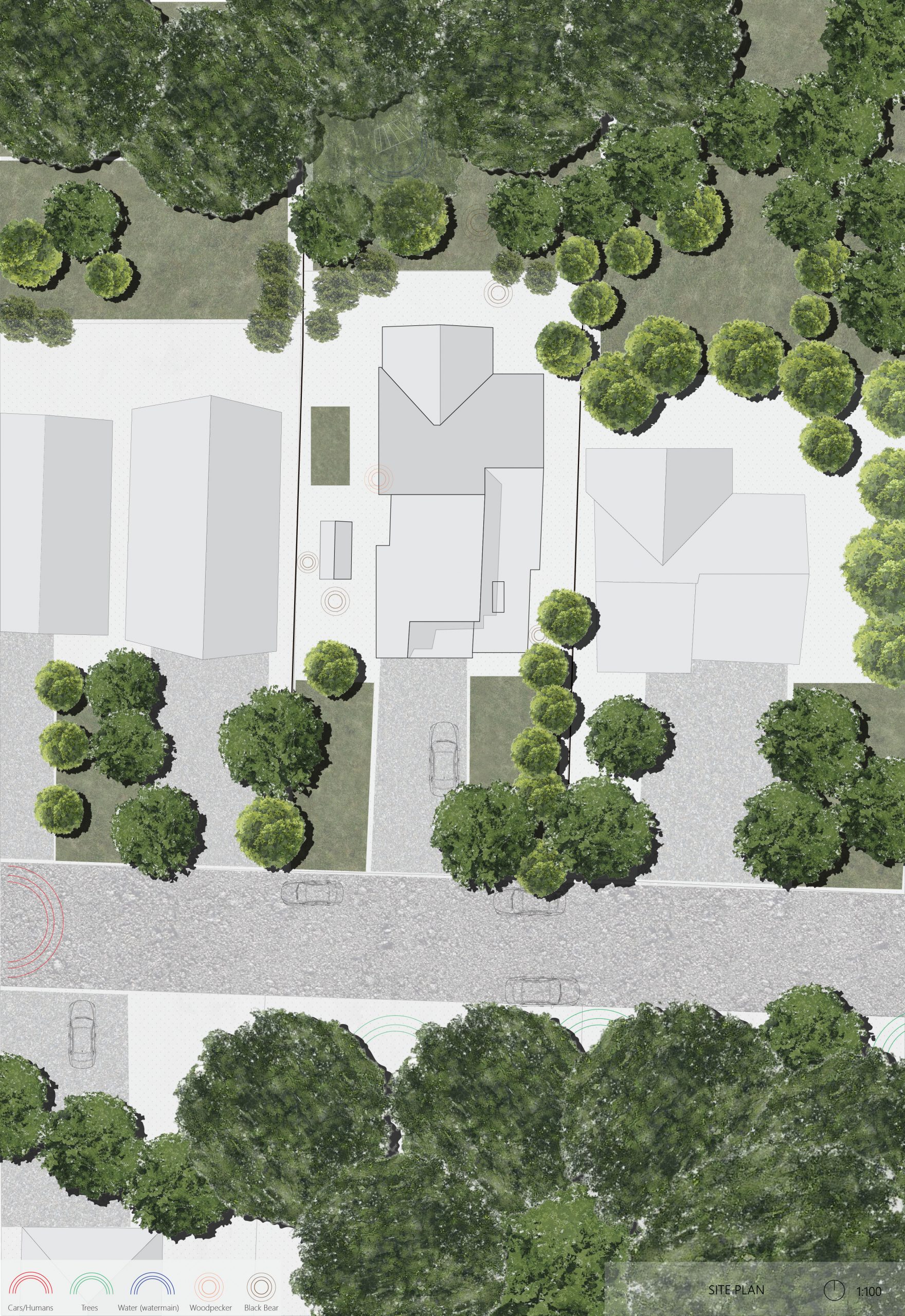
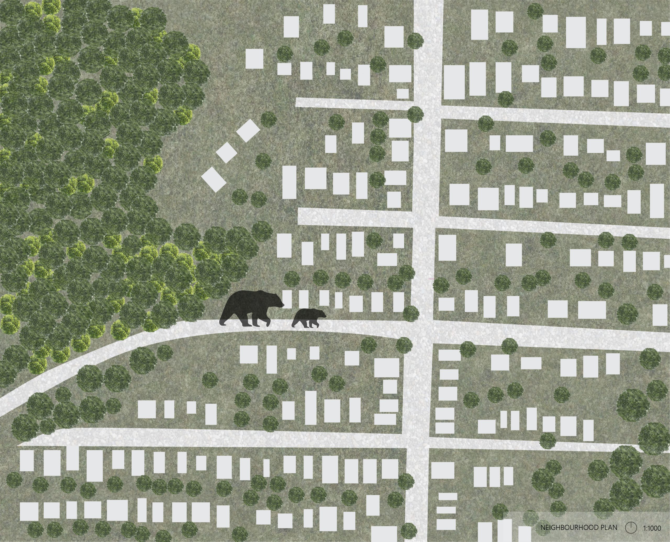

The maps and diagram depict unique attributes of my neighbourhood, specifically nature/animal sounds. It is not uncommon for me to wake up to the sound of a bear (sometimes a woodpecker) in my backyard, with the neighbourhood plan showcasing the distance between the bear’s home and mine.
ASSIGNMENT 1 – ALLEGRA HAYNES

01. Makena Smith
A1 | Ellen McElroy

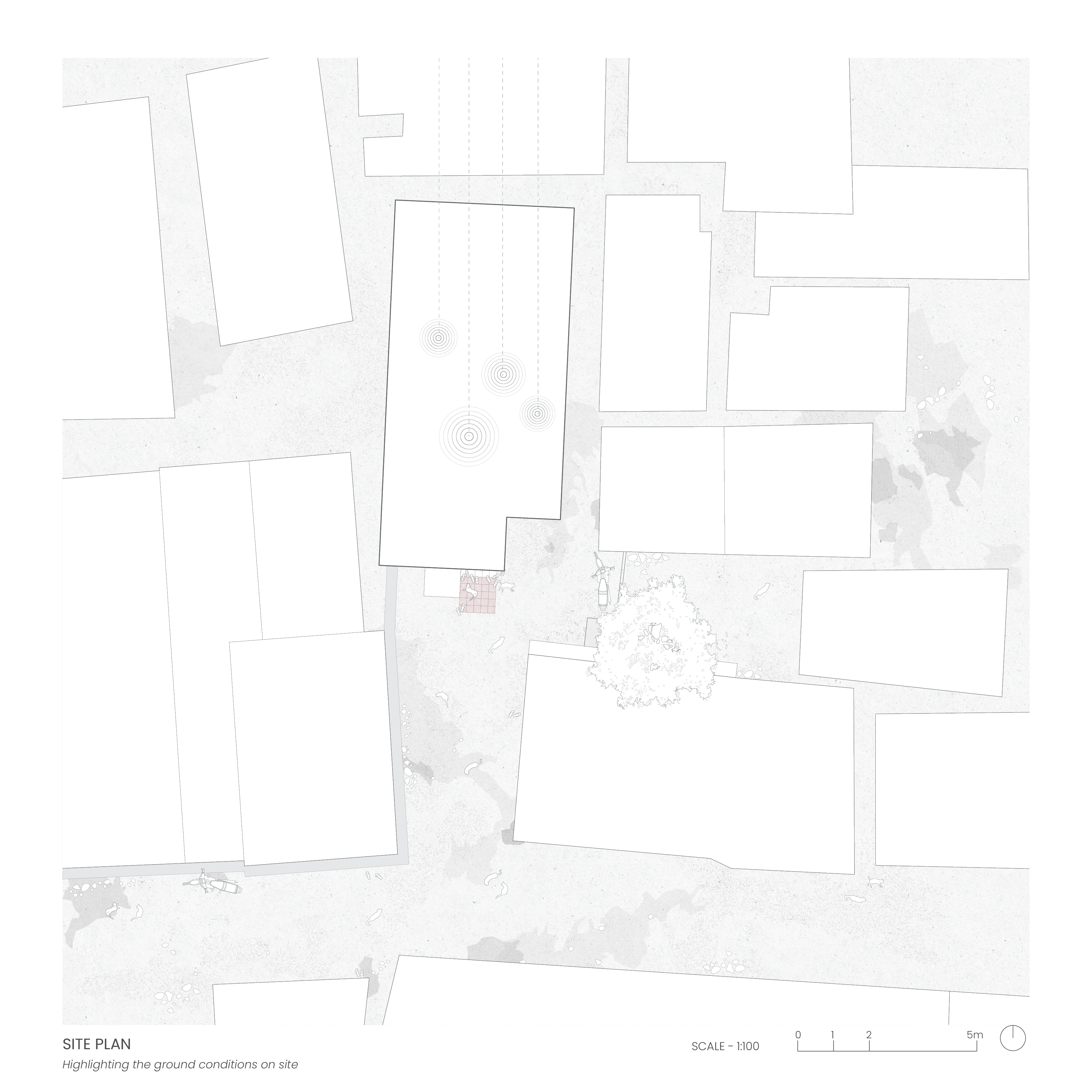
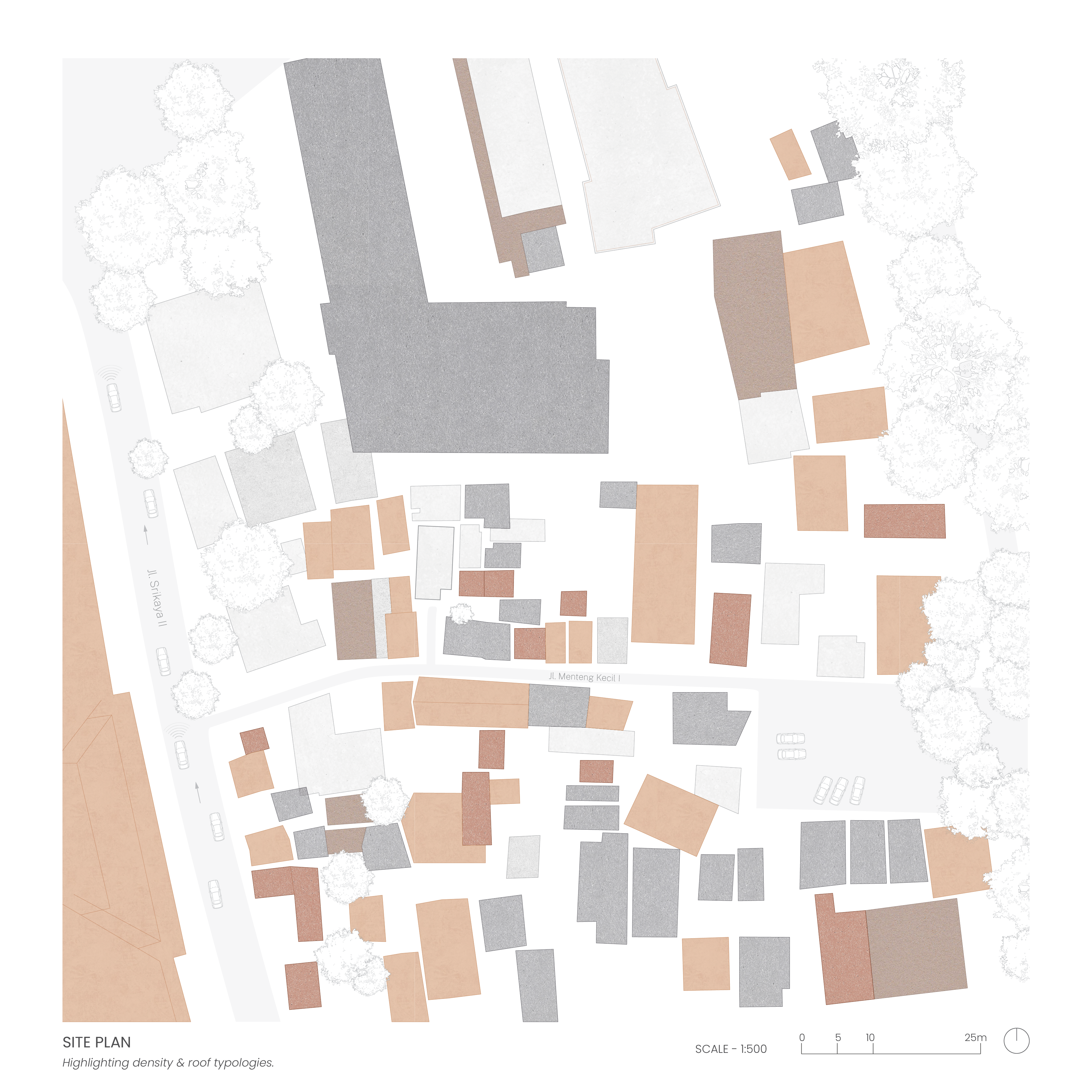
My grandmother’s house is situated in a dense, informal neighborhood in Central Jakarta, Indonesia. Due to the informality of the neighbourhood, it was difficult to gather visual information or references and for such reasons, I had to rely predominantly on my own memory as well as old photographs of the space to produce my drawings. When envisioning the space, the broken concrete and asphalt pathways are what first comes to mind, followed by the stray cats roaming around, and the abundance of sandals outside my grandmother’s house every time we held gatherings. The site plan captures these physical qualities primarily through the ground conditions while the neighbourhood plan highlights its informality, density and roof typologies.
Assignment 1: Cynthia San
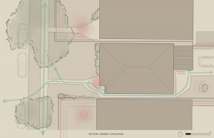
Noise and natural buffers along South East Marine Drive, Vancouver during rush hour.


Living along Marine Drive for the past 20 years, I have been use to the constant sounds emitted by vehicles in particular and wanted to map this feeling spatially. Noise is not always liner or physical, but is constantly spread over space in relation to buffers; buildings, hedges. distances etc. The overlapping of different sounds through trace paper resembles how sounds throughout this neighborhood often overlap and become chaotic and how different programs and zones dictate noise intensities and frequency throughout South East Vancouver.
Assignment 1 | Sharon Cheng