Category: Assignment
A6 – Kate Bonnell, Bella Gigone, Kaitlin Manuelpillai, Felix Jäger


Reference:
Roehr, D., & Fassman‐Beck, E. (2015). Living roofs in integrated urban water systems. In Routledge eBooks. https://doi.org/10.4324/9781315726472
Shahmohammad, M., Hosseinzadeh, M., Dvorak, B., Bordbar, F., Shahmohammadmirab, H., & Aghamohammadi, N. (2022). Sustainable green roofs: a comprehensive review of influential factors. Environmental Science and Pollution Research, 29(52), 78228–78254. https://doi.org/10.1007/s11356-022-23405-x


Mary Anne William A3


Mary Anne William A3


A06 | McNeil Fiesta, Nathan Chew, Fabien Kwan


Assignment 6_ Carol Zhao, YiLe Chen & Mary Zhu


Assignment 6 – Ella Dufresne, Talia Neufeld, Allegra Haynes


A3 – Felix Jager
![]()
![]()
A02 – Felix Jager


Assignment 6 – Kaitlin Pranoto, Jessica Lin, Deryck Bagui


Assignment 6 – Cedric Li, Sharon Cheng, Angela Chen
![]()


Assignment 06 – Kai, Max, Av
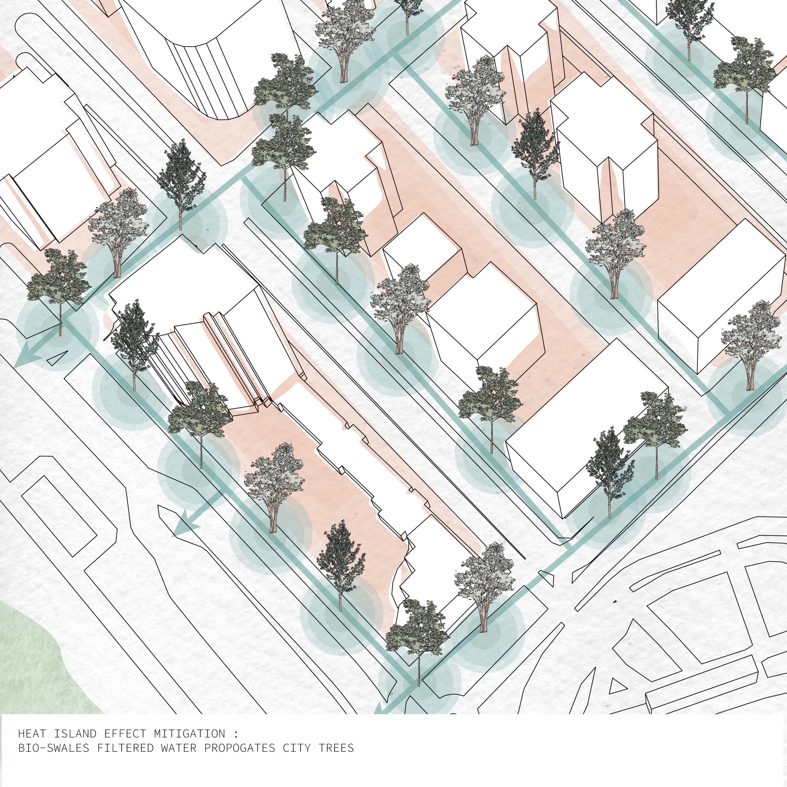
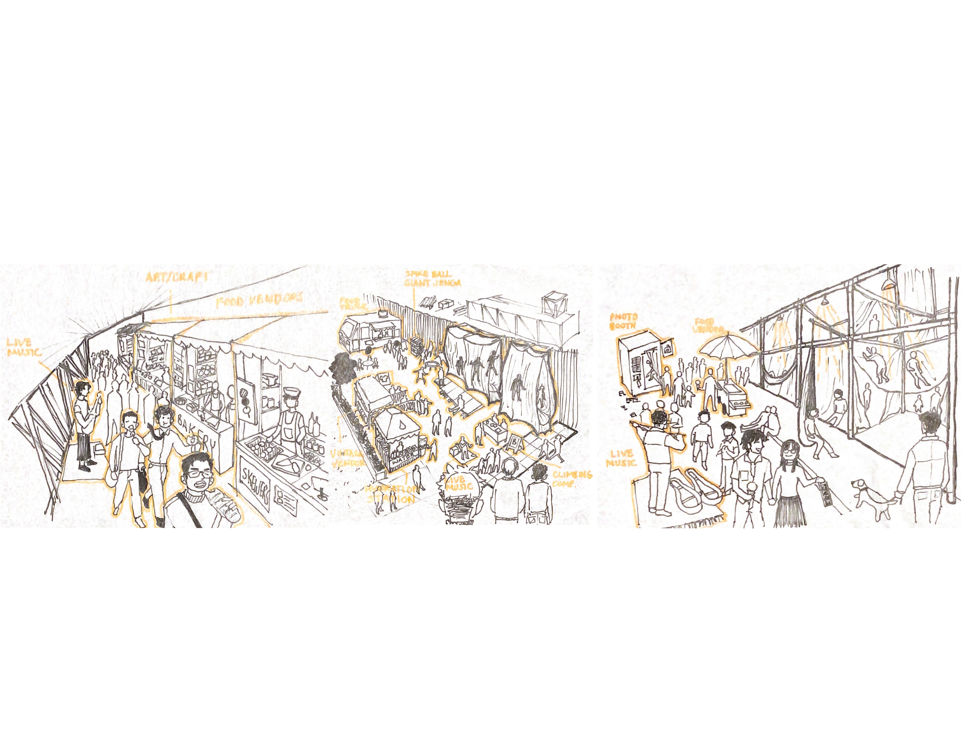
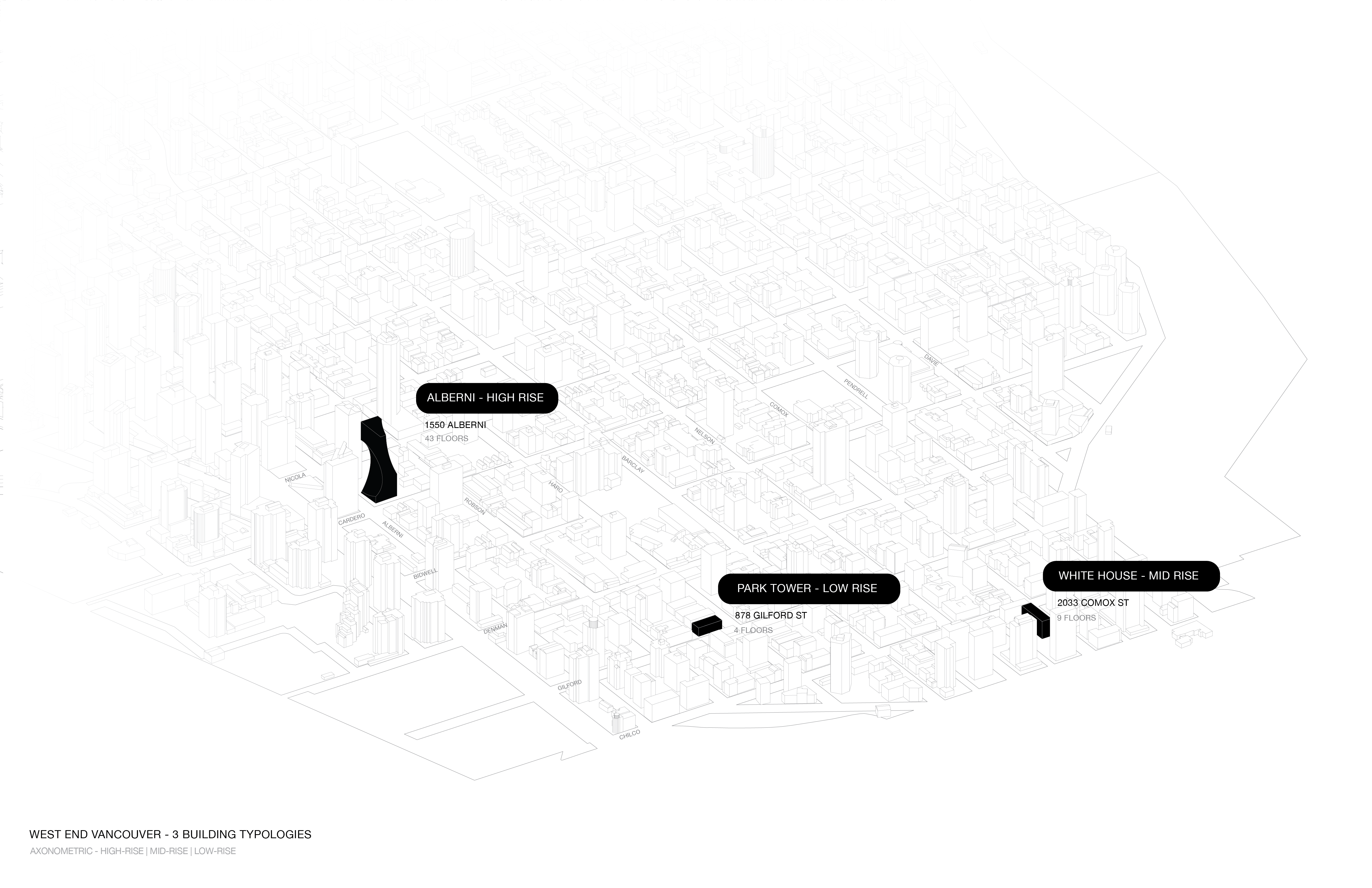
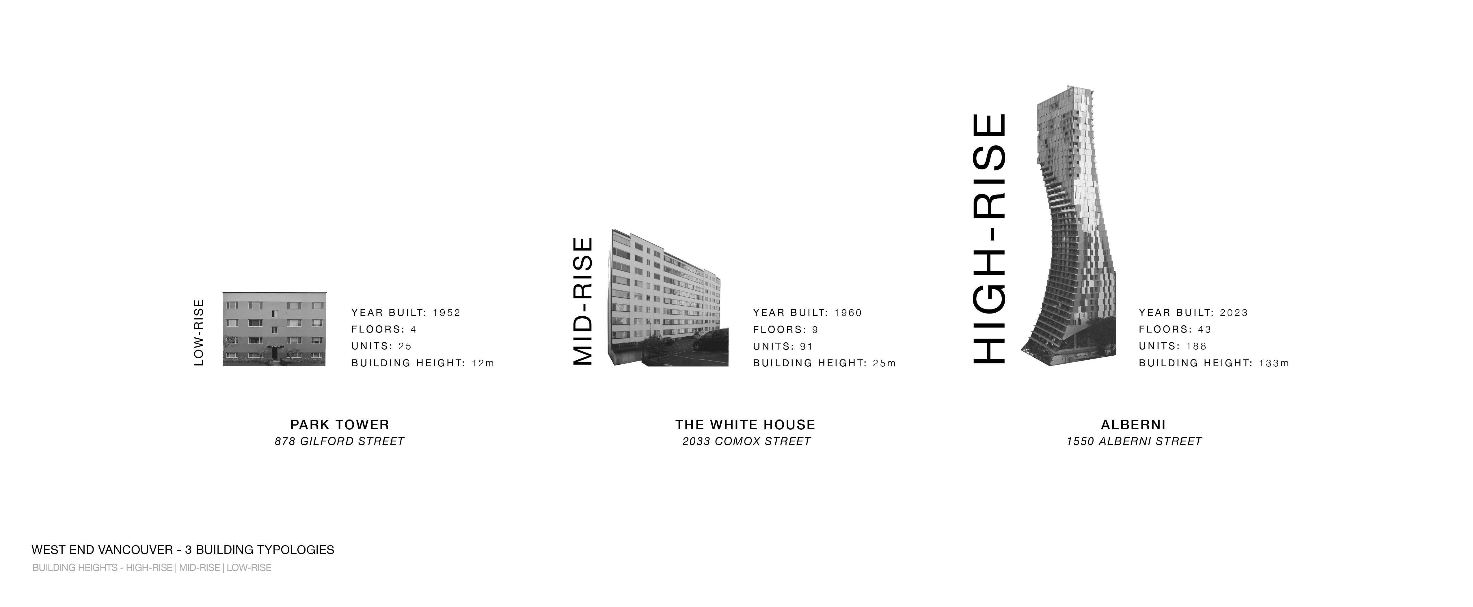
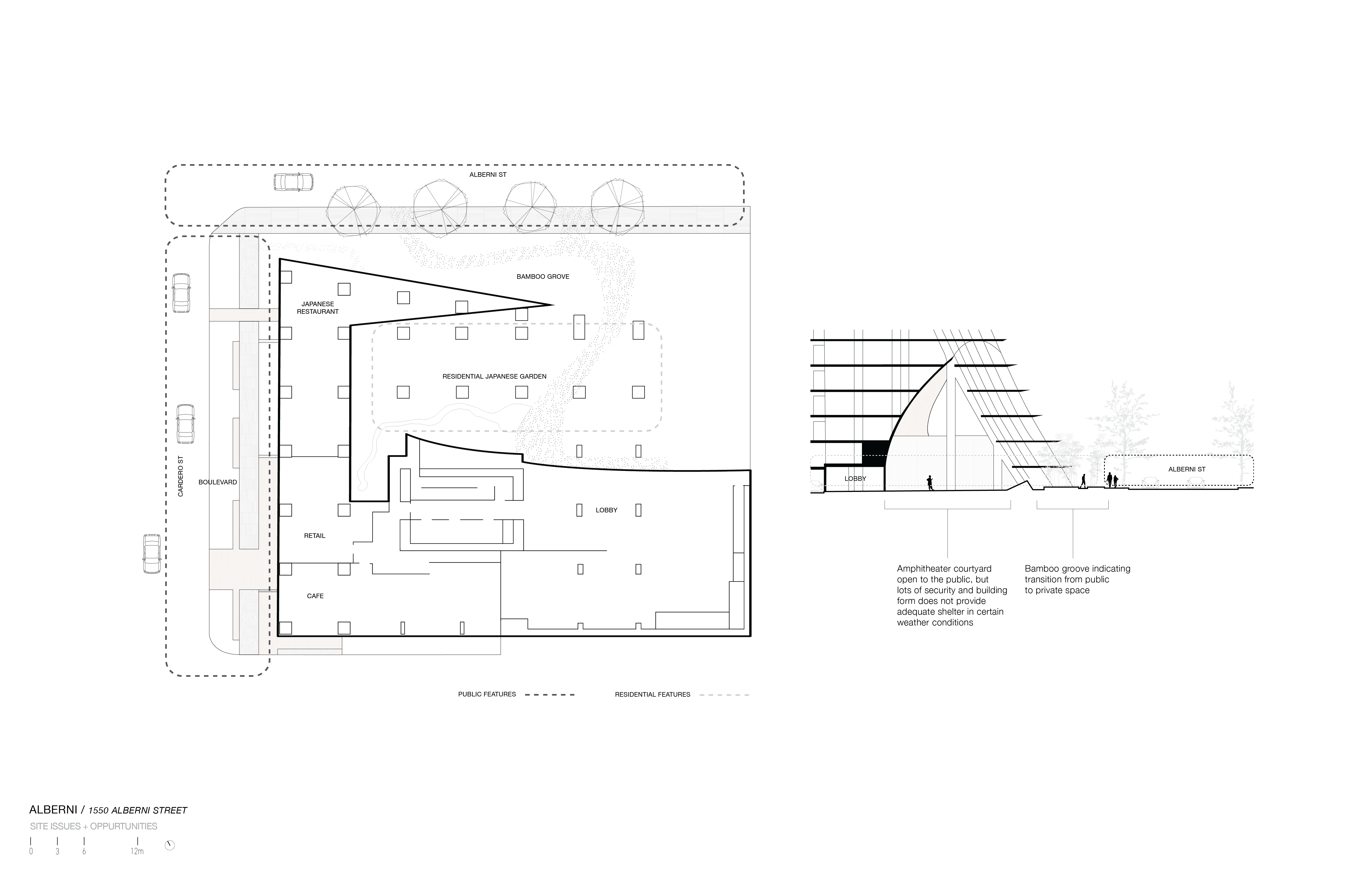
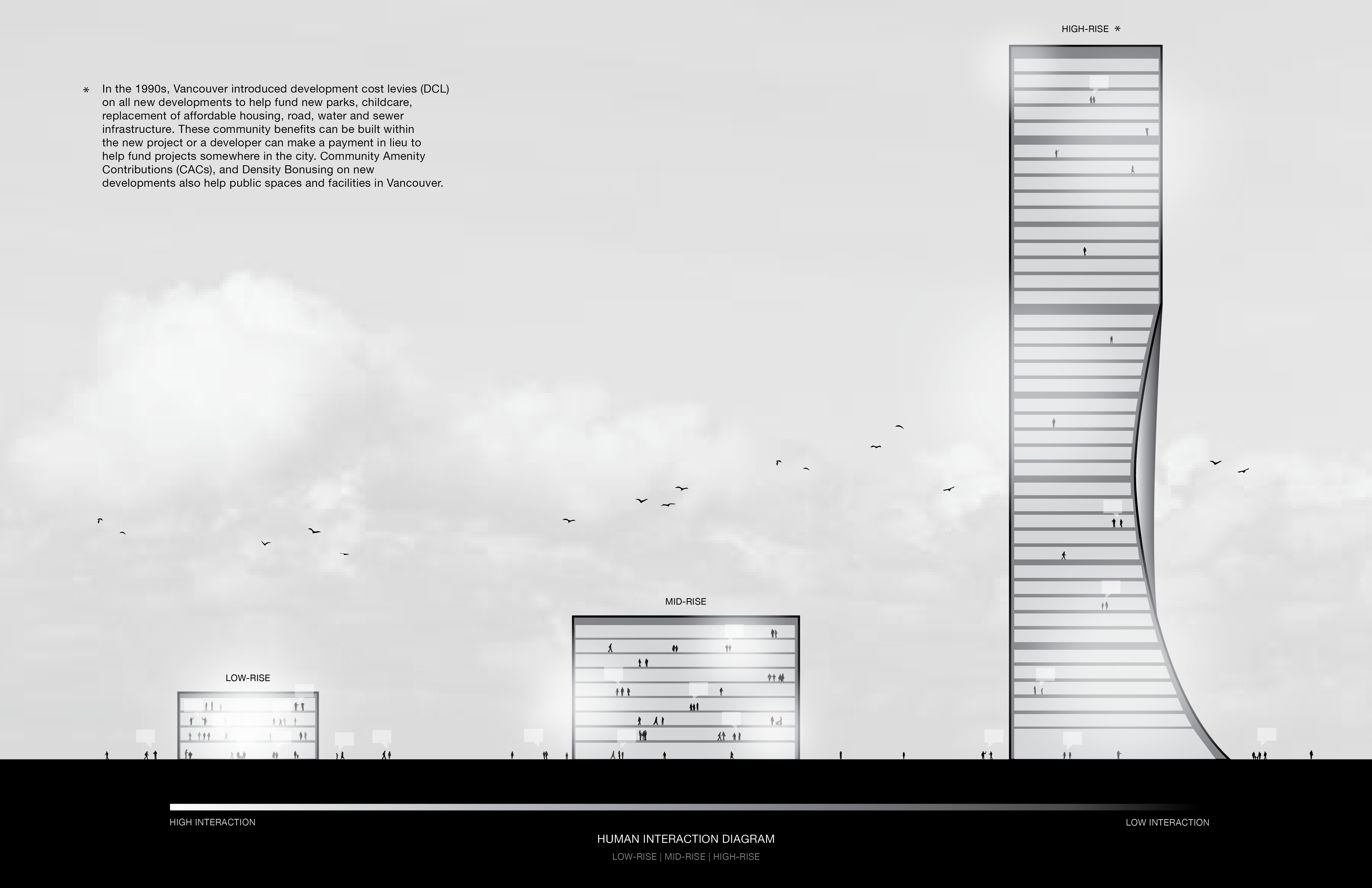
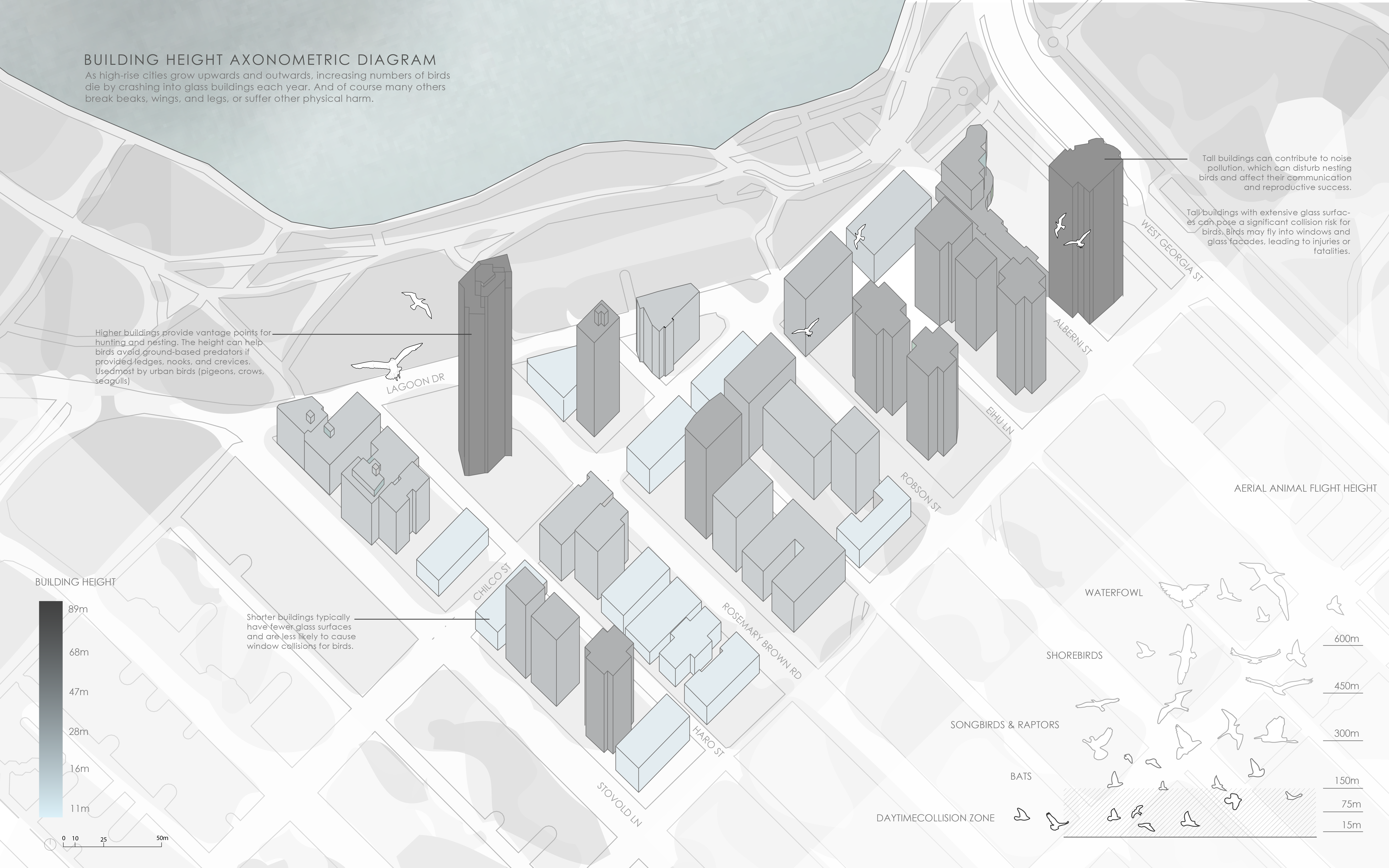
Having focused our previous analysis on the history of real estate development in the West End, we were able to form an understanding of a few key consequences of these events. As speculation and the ongoing housing crisis incentivizes building higher, human-level community spaces are either taken away or neglected, along with the urban canopy. Further, buildings of these heights more often require strong and mass-producible materials that can only be created through harsh, carbon intensive processes. Despite creating density, this model does not necessarily correlate to sustainable communities, and takes away from the experience at ground level.
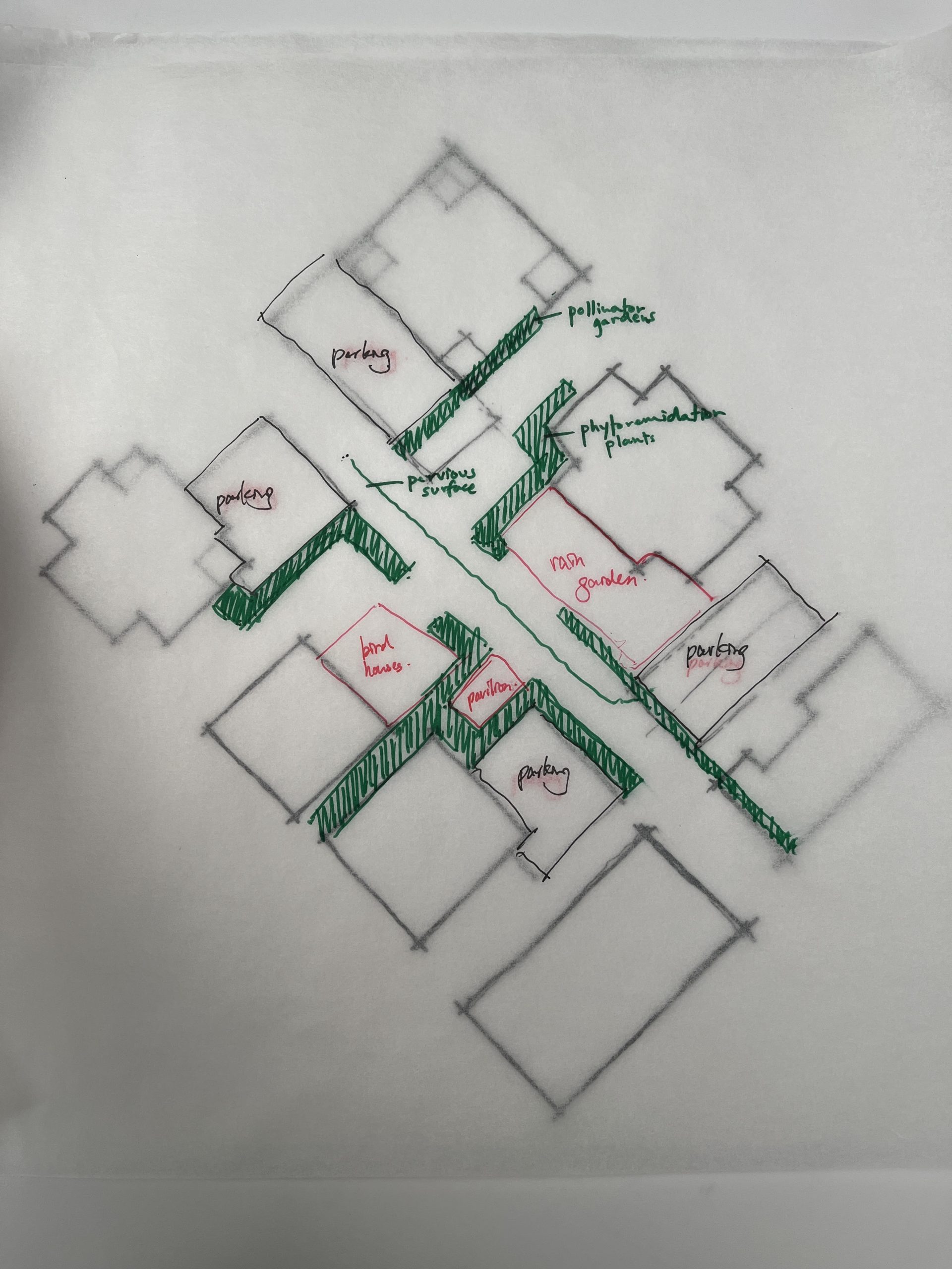
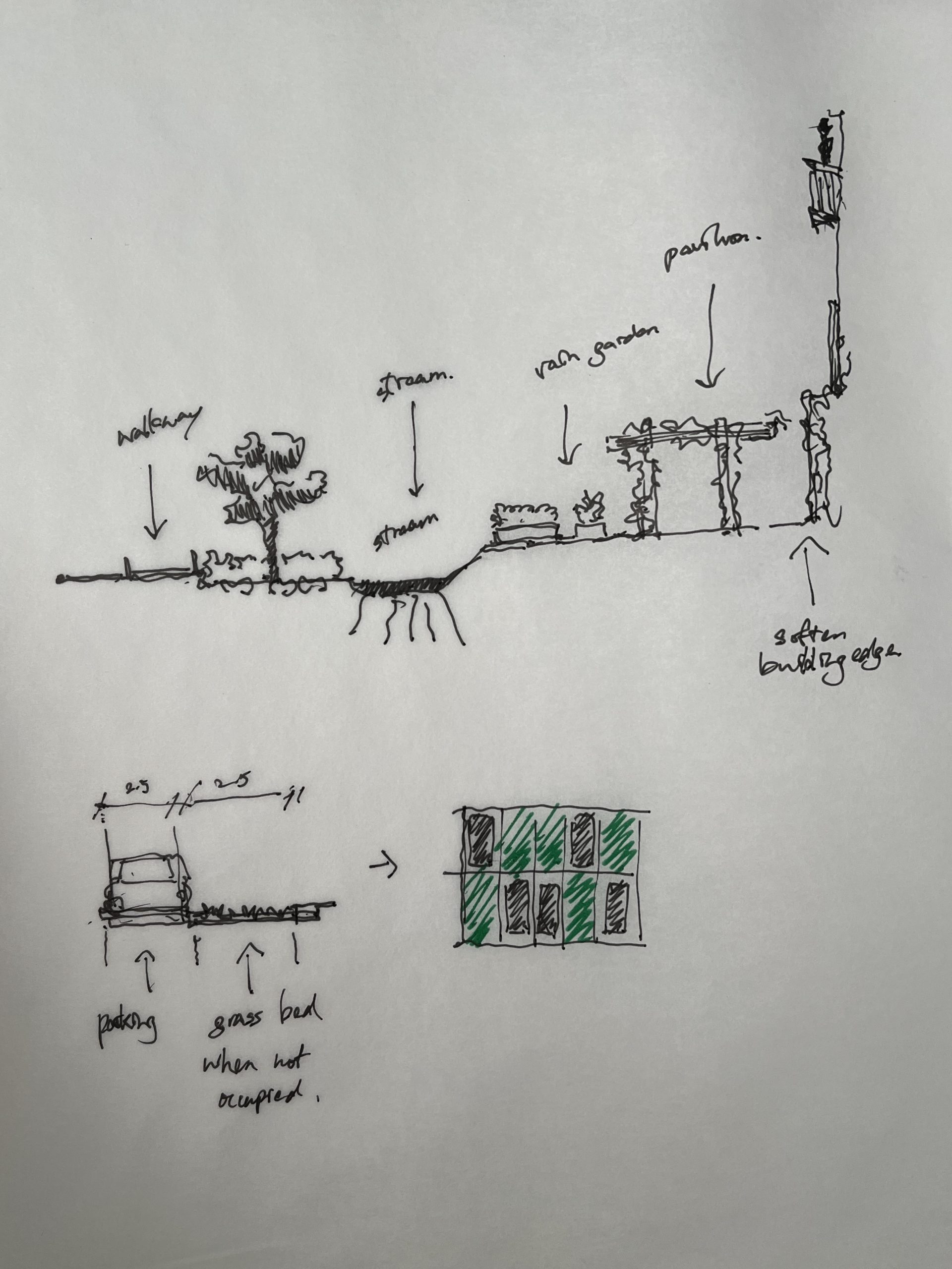
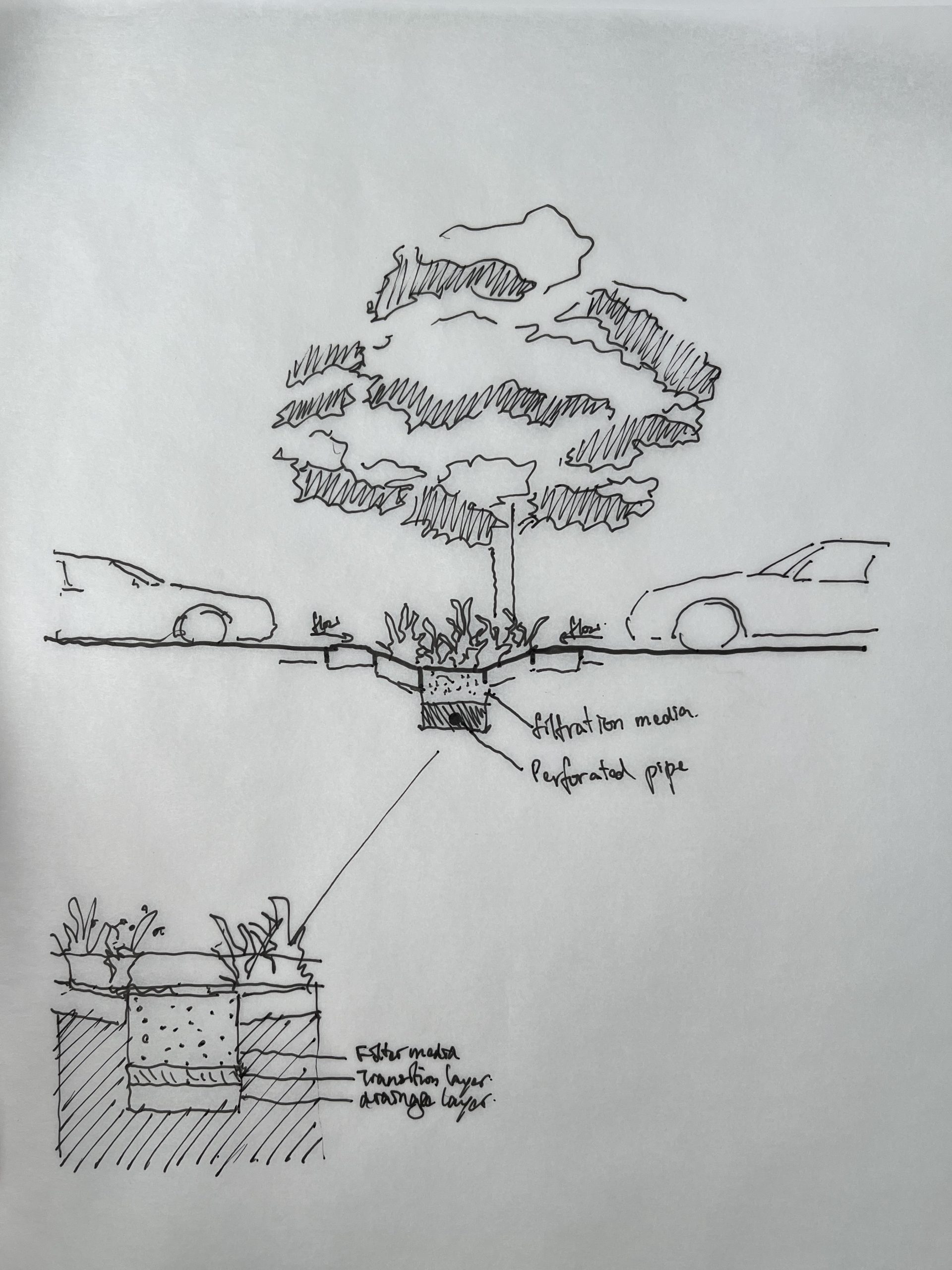
A possible manner of addressing these concerns is through re-thinking the responsibilities of developers to maintain ground level community-oriented spaces adjacent to where they profit. Through this series of small-scale interventions, we hope to prioritize design for recycling, sourcing materials from buildings that are destroyed for redevelopment, and designing such that what is built can be easily unbuilt and rebuilt into something new. Focusing on two sites adjacent to future approved developments, we are proposing the following spaces: Play, Production, and Pavilion.
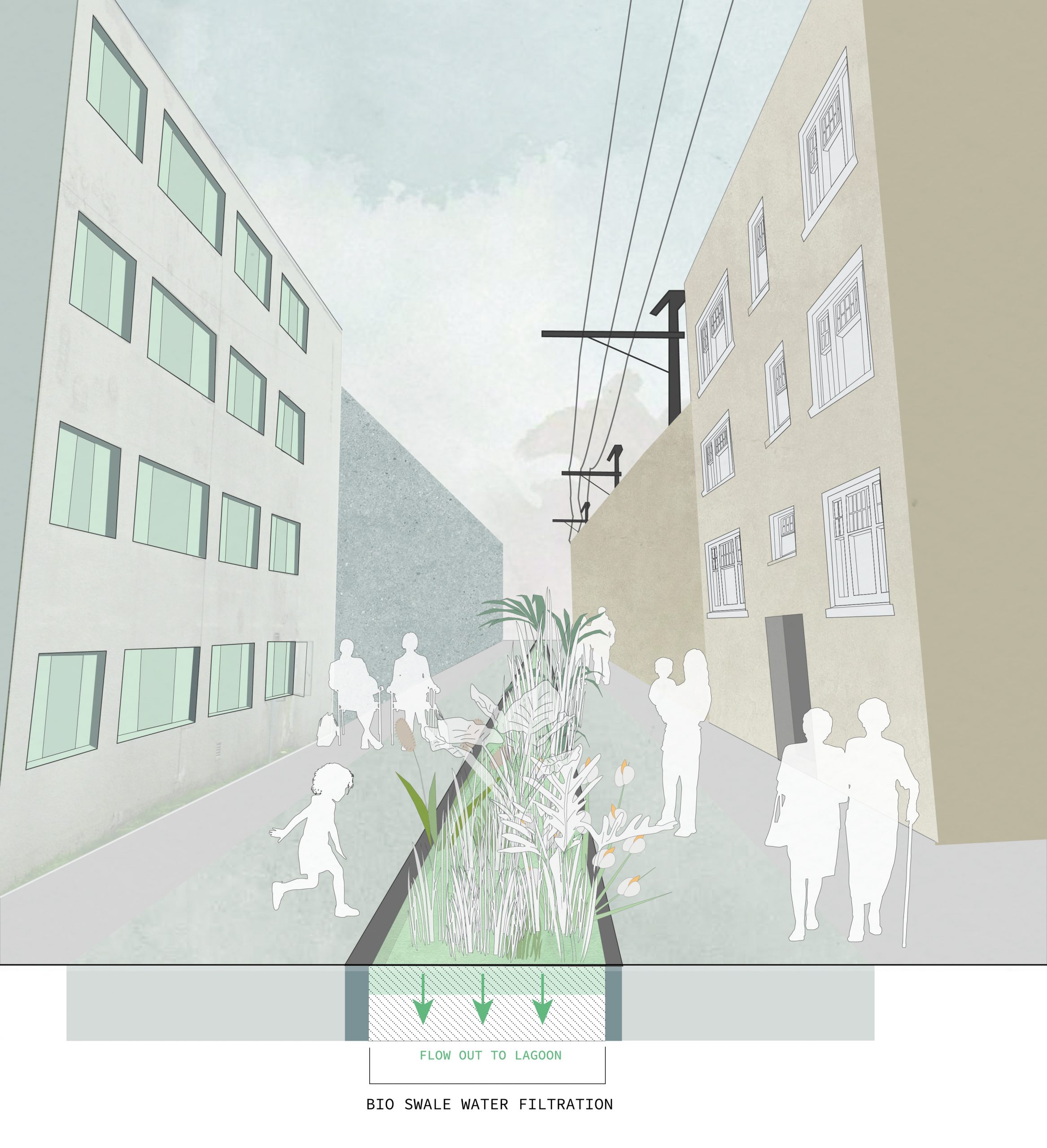
The play and production spaces, located on the same site, rethink the existing community garden site into a rain garden and playground, where the entire community can be given access to growing and preparing fresh food while remaining close to their children. Through new infrastructure, the site serves to further remediate ecological impacts of density, while producing healthy food for the community, which can be enjoyed at the pavilion space, providing seating and vibrancy a short distance away.


Sources:
References – Plants
https://www.wildflower.org/plants/result.php?id_plant=ROTE
https://www.wildflower.org/plants/result.php?id_plant=gash
https://www.wildflower.org/plants/result.php?id_plant=SALA2
https://www.wildflower.org/plants/result.php?id_plant=asca
https://www.wildflower.org/plants/result.php?id_plant=MOAR
https://www.gardeningknowhow.com/edible/vegetables/alfalfa/growing-alfalfa.htm
References – Rain Gardens
https://www.dauphincd.org/swm/BMPfactsheets/Rain%20Garden%20fact%20sheet.pdf
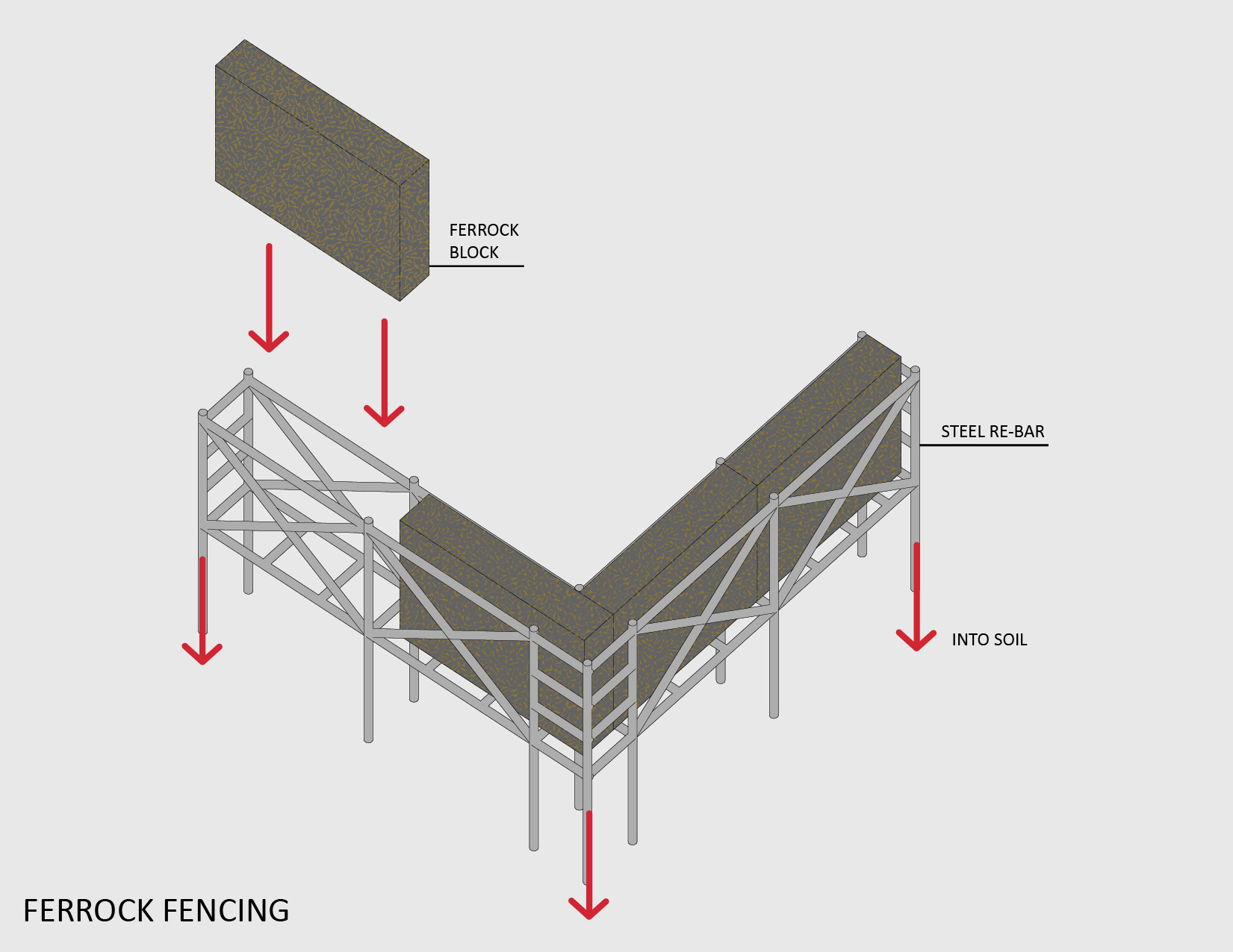
Other Research (Sustainability and Ferrock)
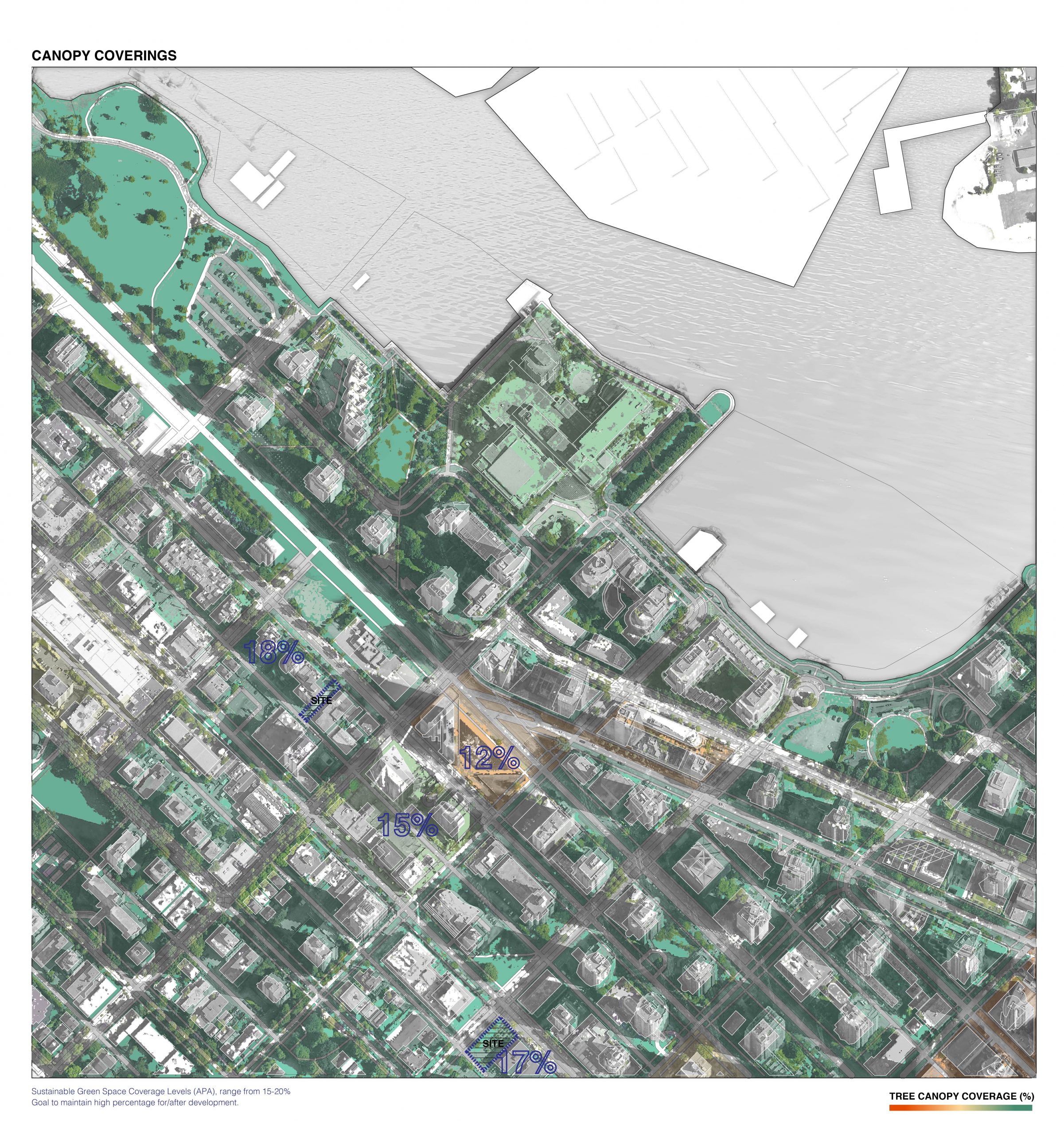
vancouver.ca/files/cov/urban-forest-strategy.pdf
ironkast.com/wp-content/uploads/2017/11/USC-Ferrock-Final-Paper-4.24.17.pdf
A6- Adam, Ewuraba, Nyah
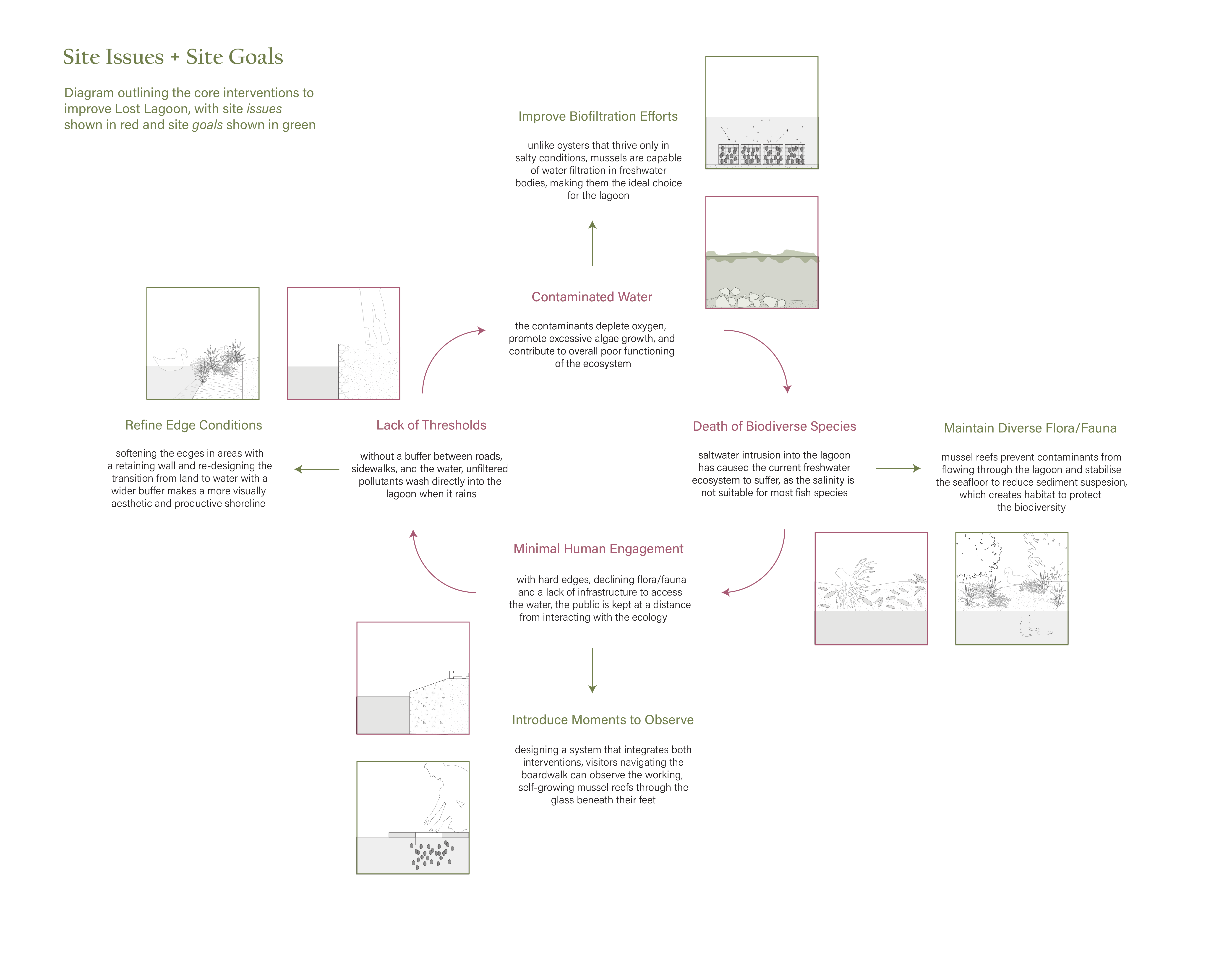
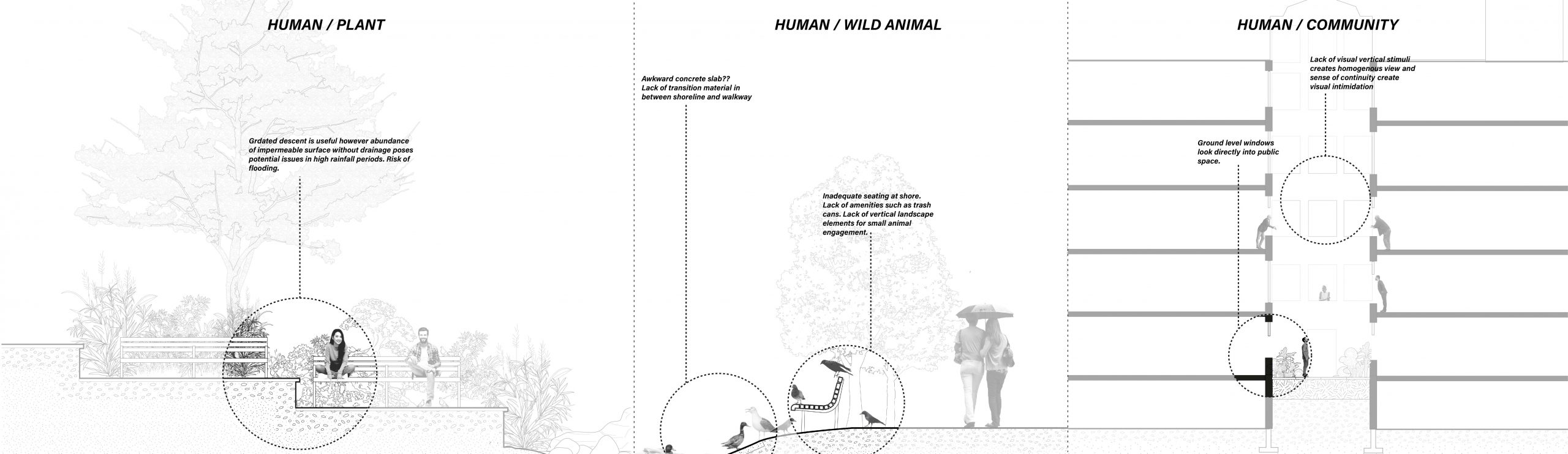
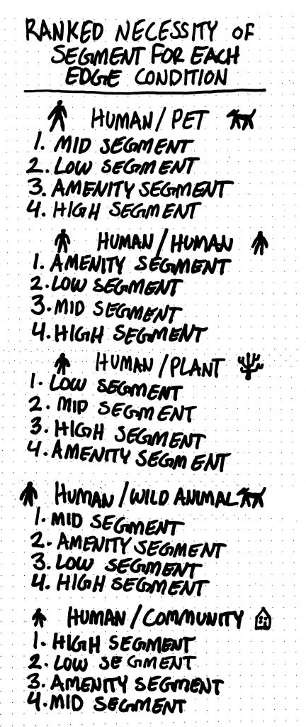
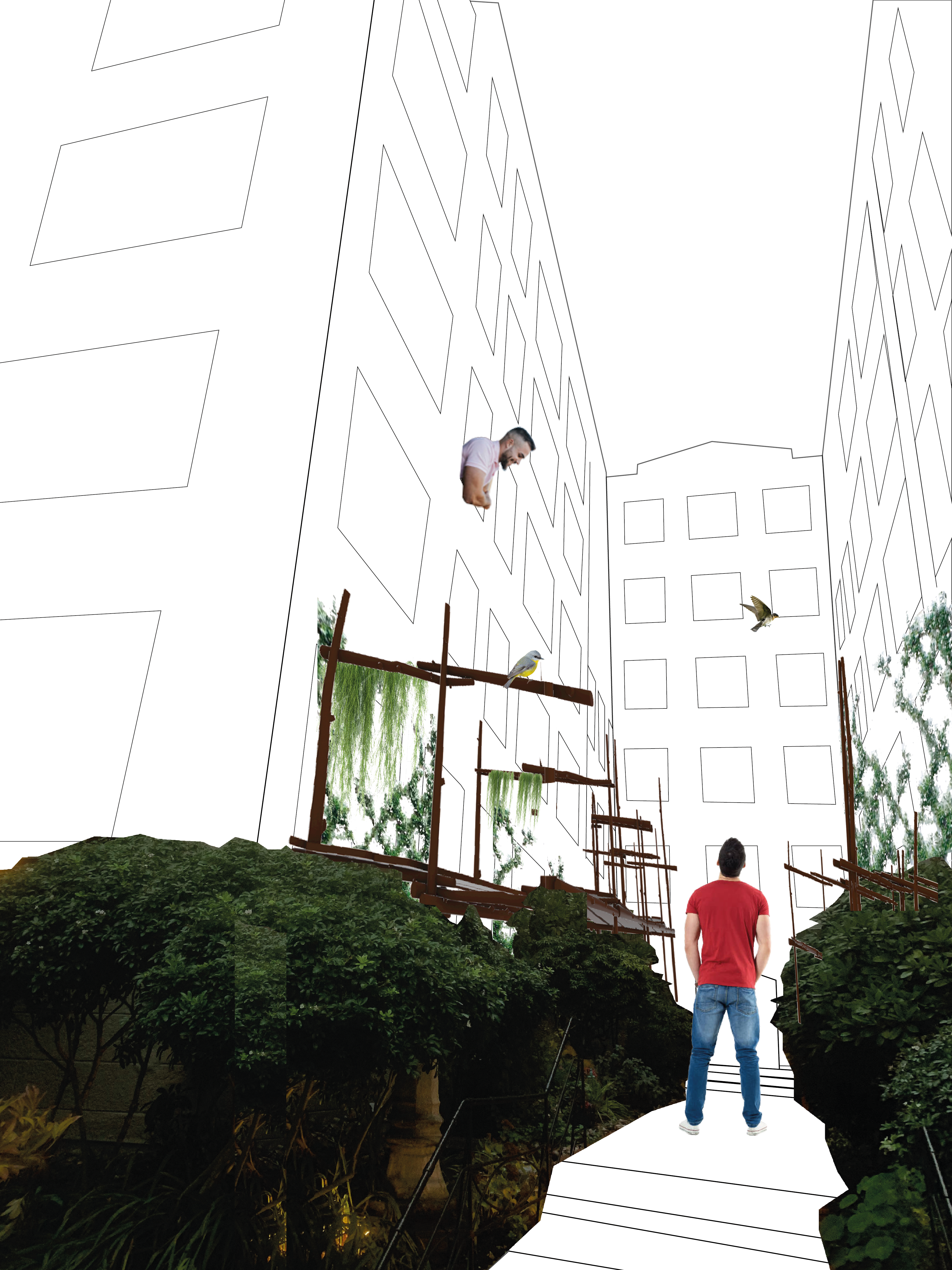
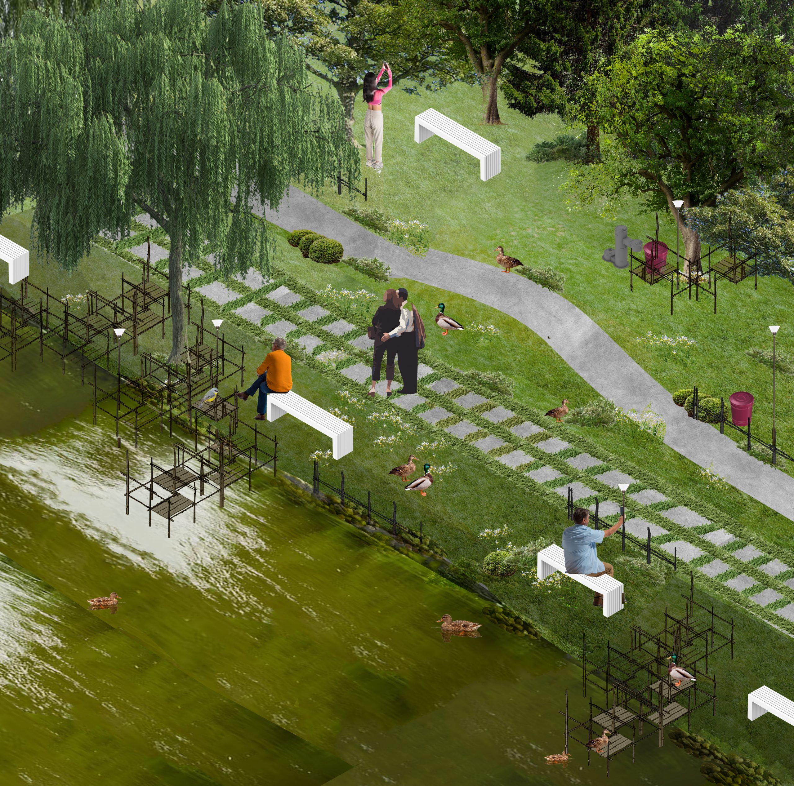
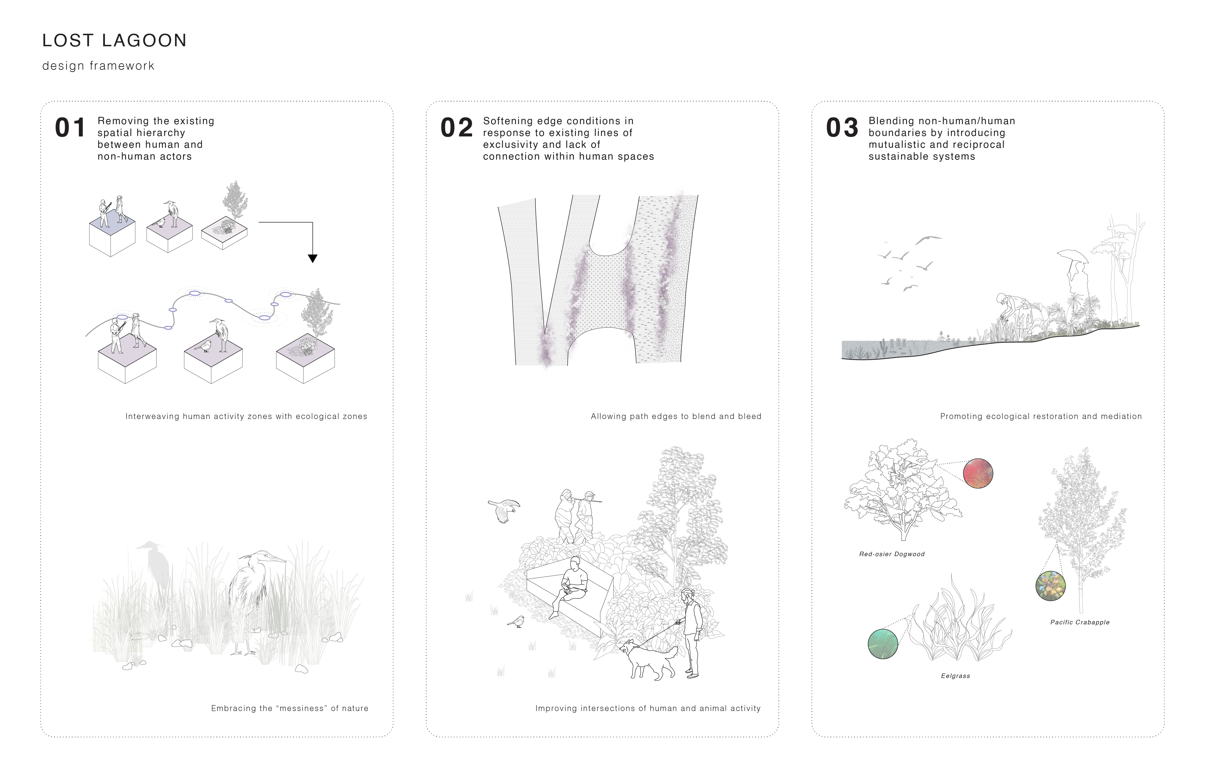
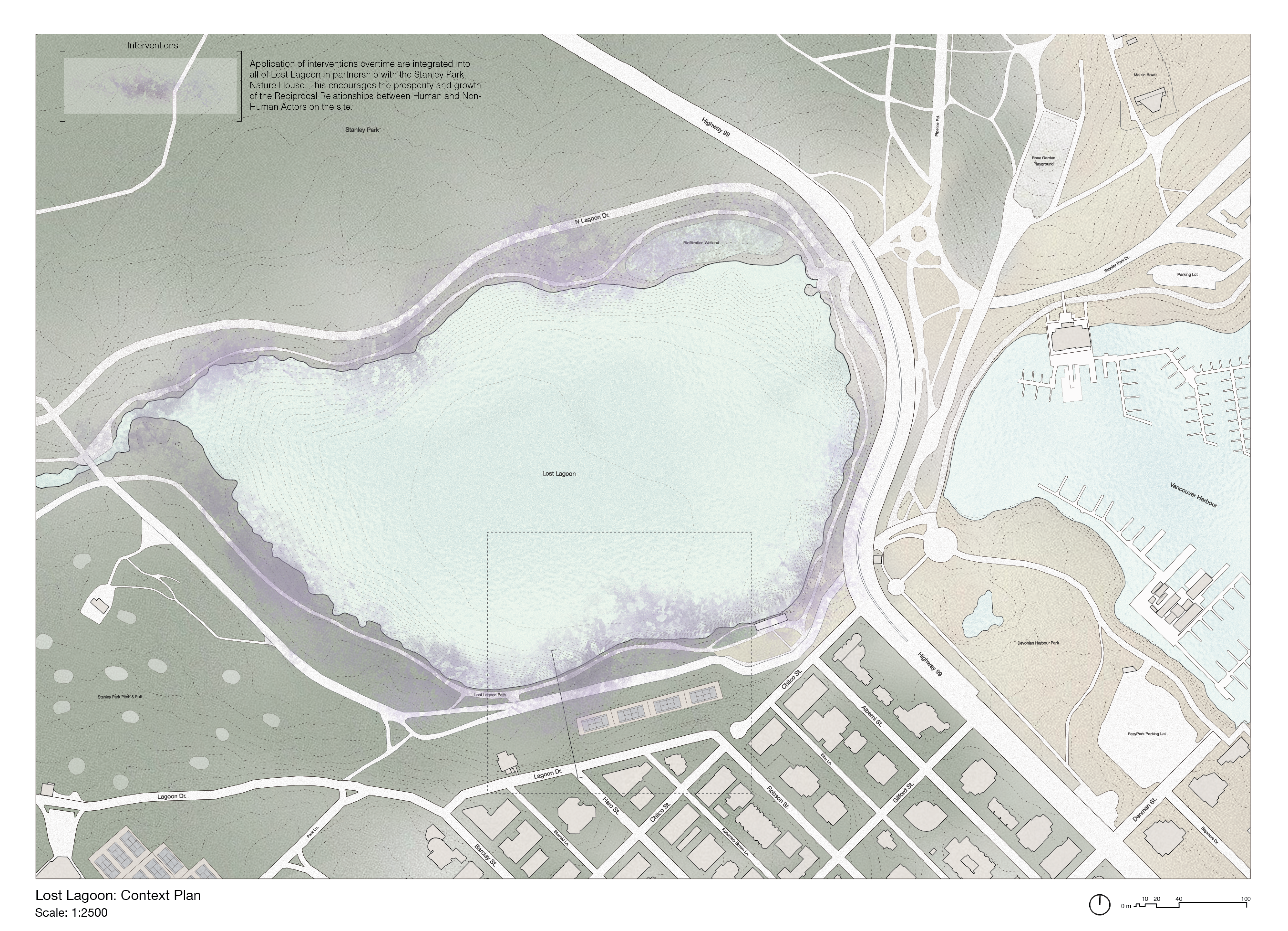
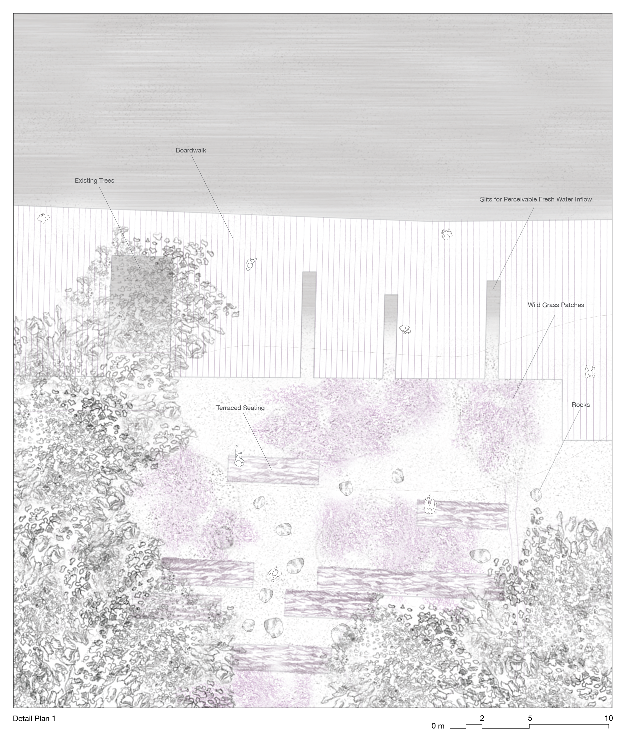
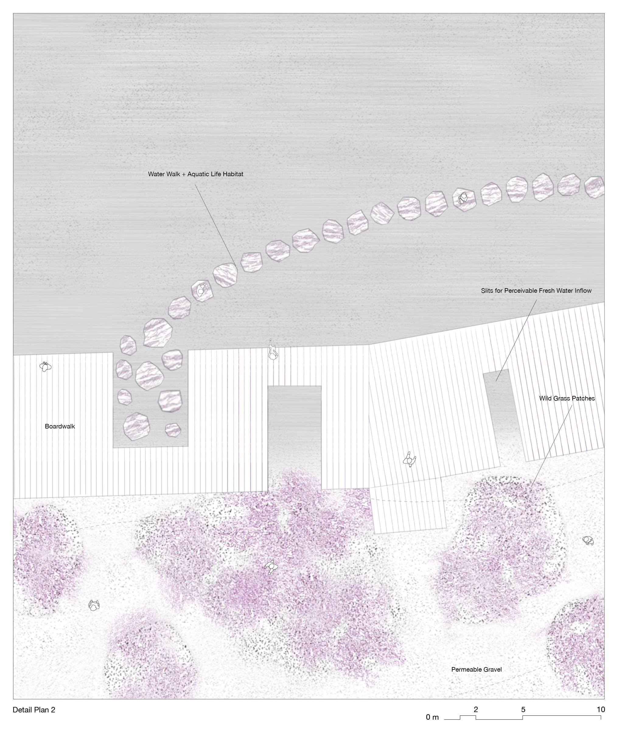
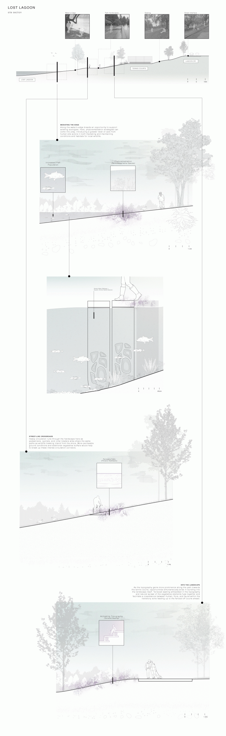
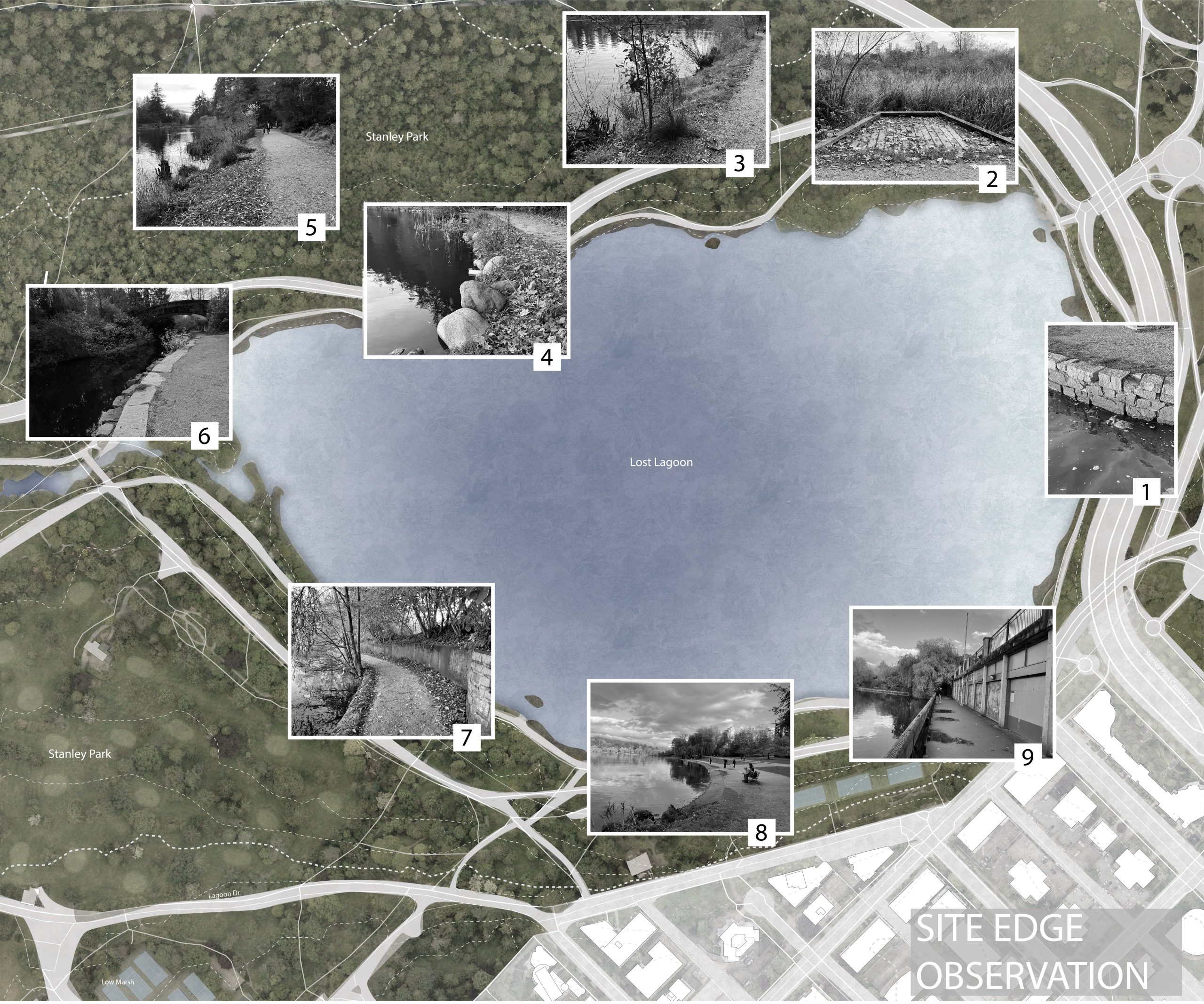
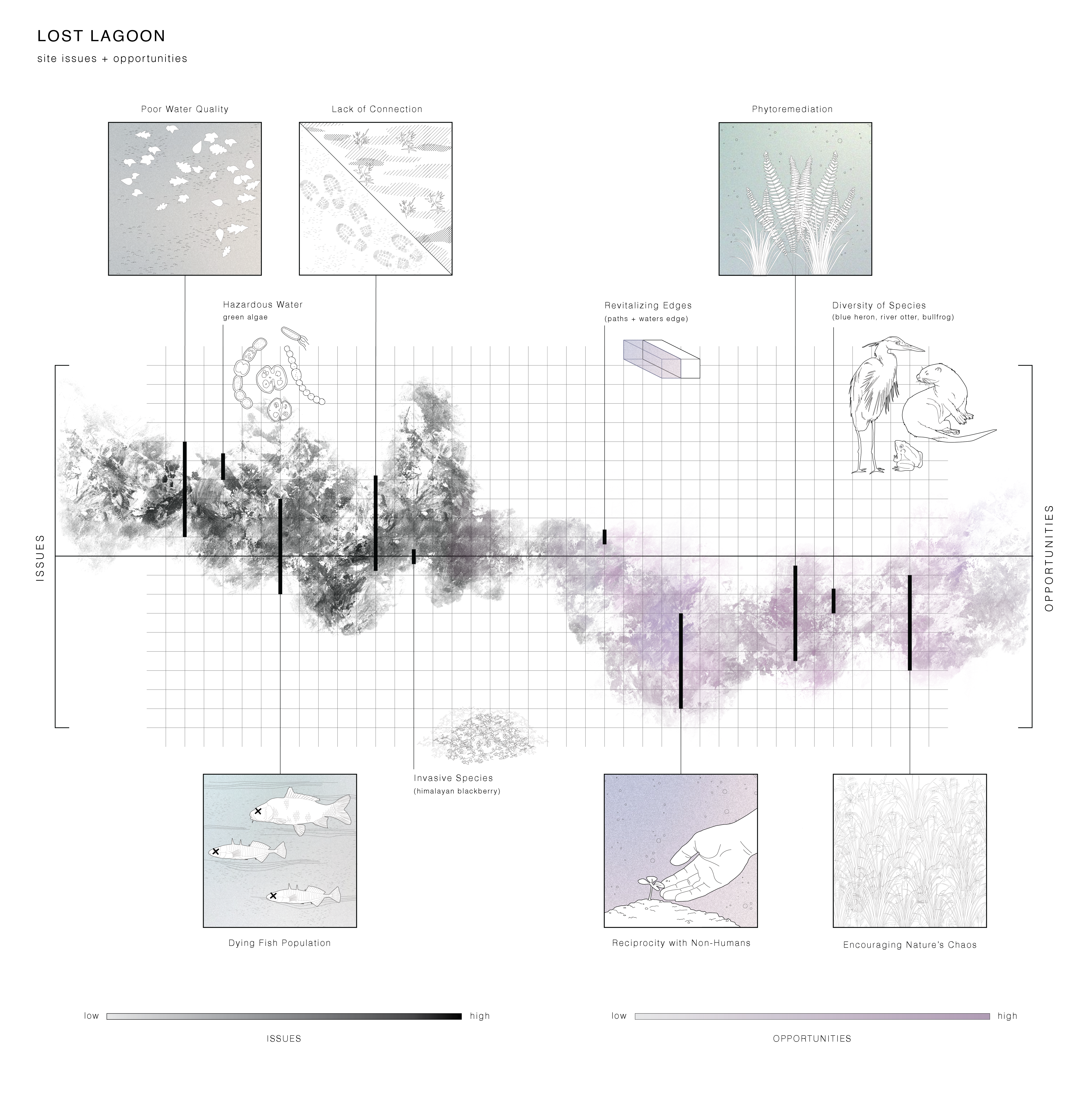
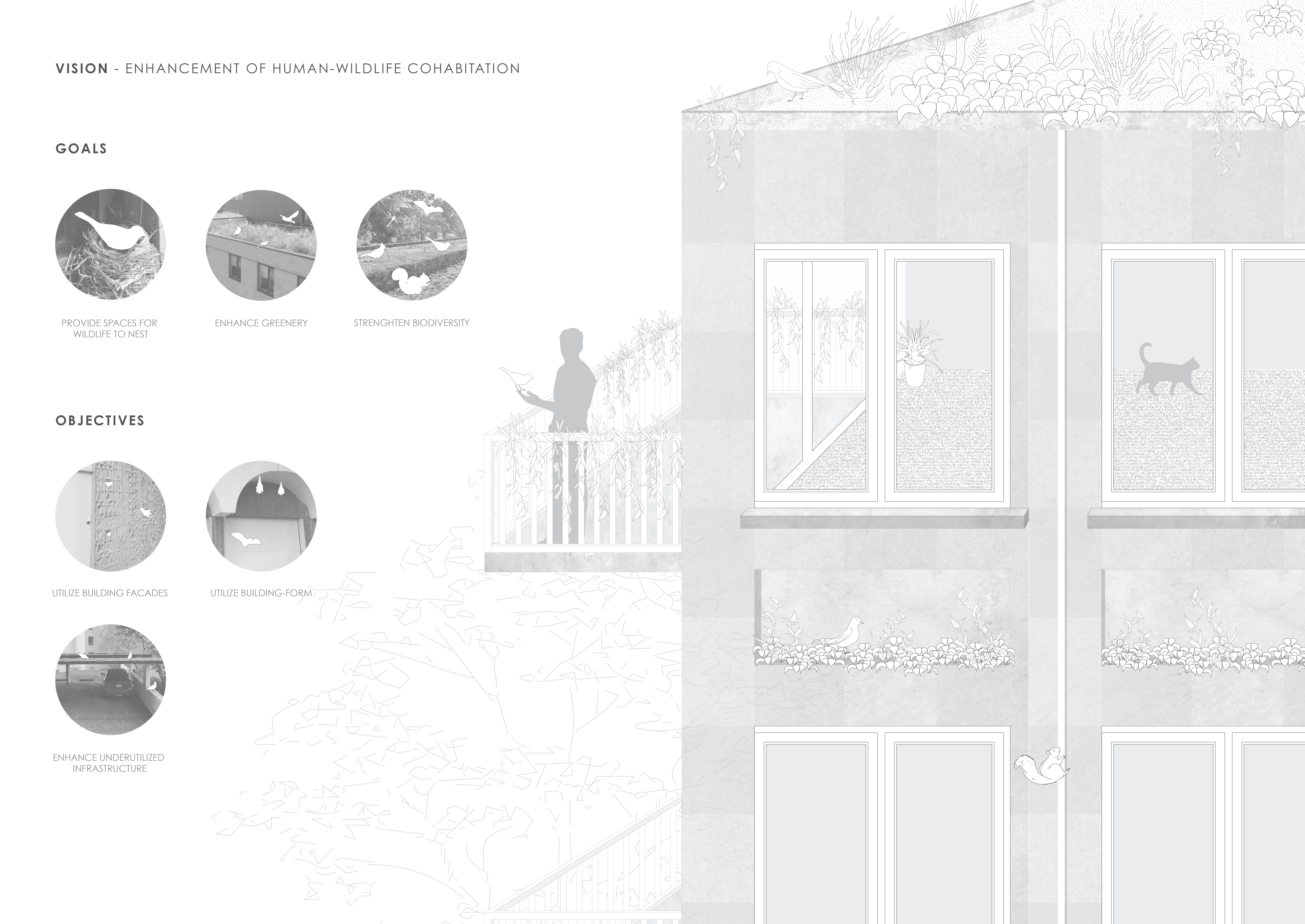
The urban environment often fails to consider relationships between informal stakeholders in the environment. This submission made an analysis of how the urban environment has characterised relationships between living things at different scales, particularly regarding edge conditions between the different actors, based on personal observations of several sites surrounding lost lagoon. We grouped urban stakeholders at different scales and examined the points on interaction between them, observing how the infrastructure aided/disrupted these interactions. One running thread we observed throughout our visual analysis of the built environment was that the harsh transition between elements and edges causes social hostility within the built environment between humans and other actors. One flaw of the urban environment is that it focuses more on formal built infrastructure and not on the informal elements. Another flaw is the solely human-centric approach to design, which is inherently negligent of other organisms and their patterns of engagement with the environment. In this submission, we propose a framework for analysis of the effectiveness of different urban edge conditions in facilitating streamlined social interaction and cohabitation between humans, pets, wild animals, and plants. Having qualified the levels of effectiveness, we then propose ways to boost the synergy between this chosen set of actors, in any given urban condition: by blurring the margins and magnifying fluidity in the built environment.
Edge relationships along lost lagoon

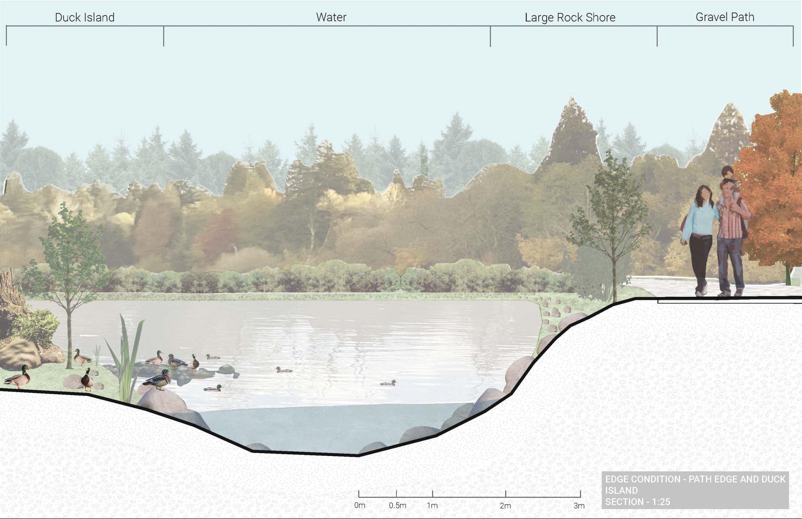
Edge conditions section(broken up for visibility)

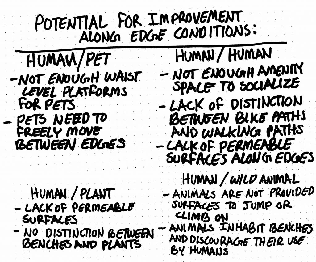
Segment options
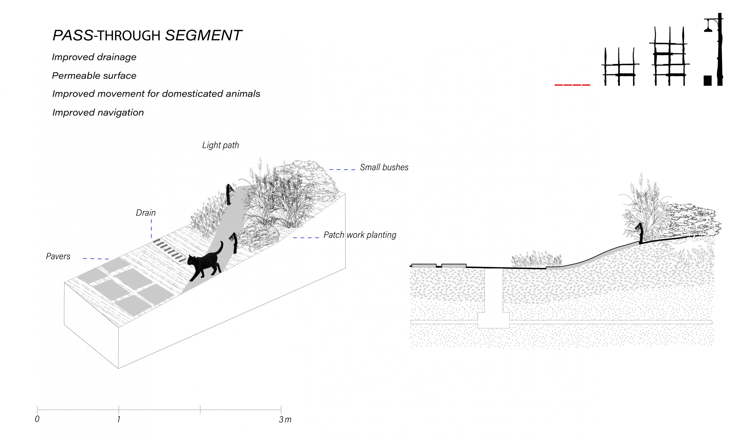
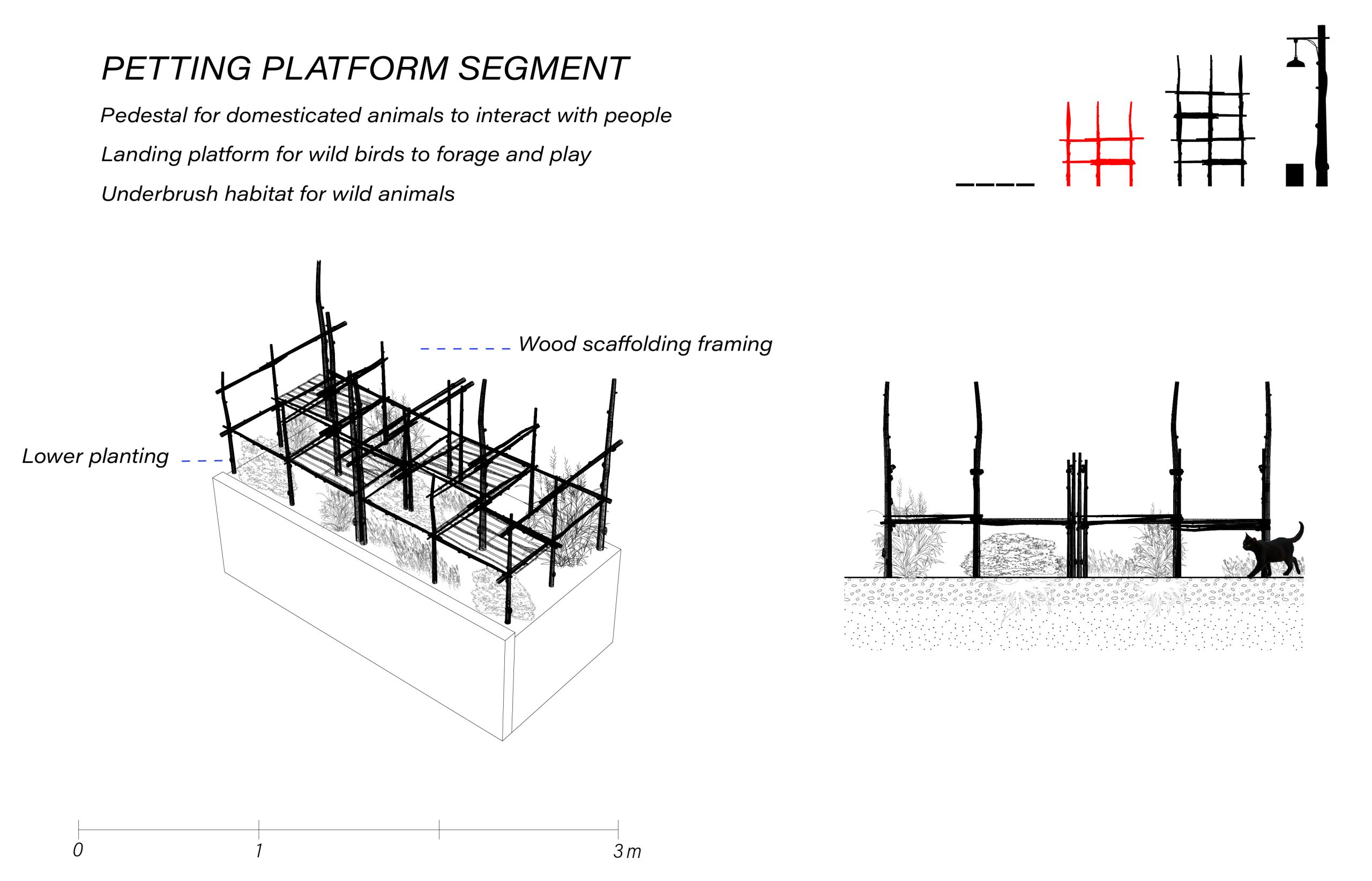


The breakdown of segments

What it could look like


Assignment 06 | Hana Kang, Mary Anne William, Ellen McElroy


06 | ANNIKA, ALENA, MAKENA & FREYA


Please review our research and the sketches that informed the development of our design
https://miro.com/app/board/uXjVNGOz-wE=/?share_link_id=232053429519
A06 | Fabien Kwan, Nathan Chew, McNeil Fiesta
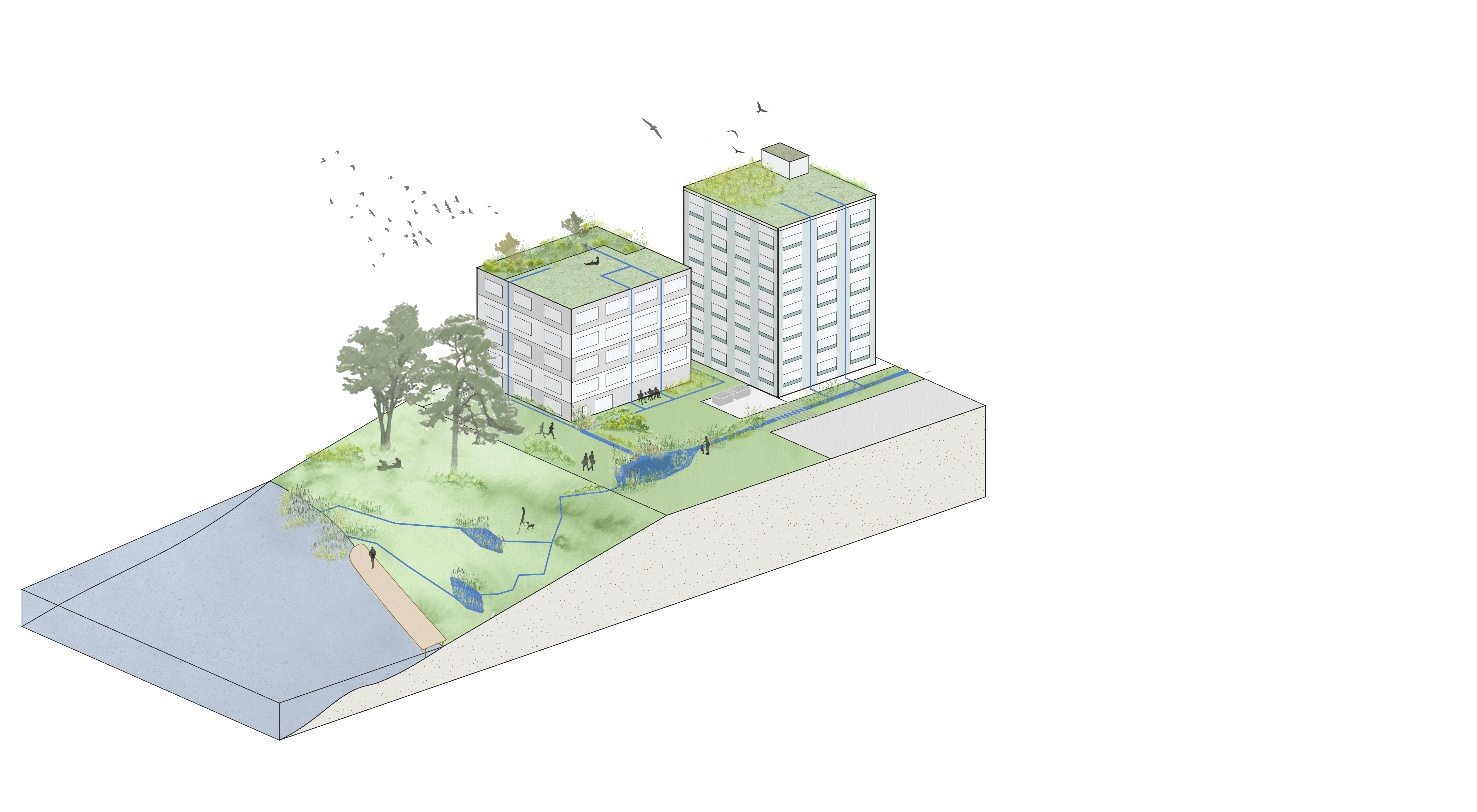
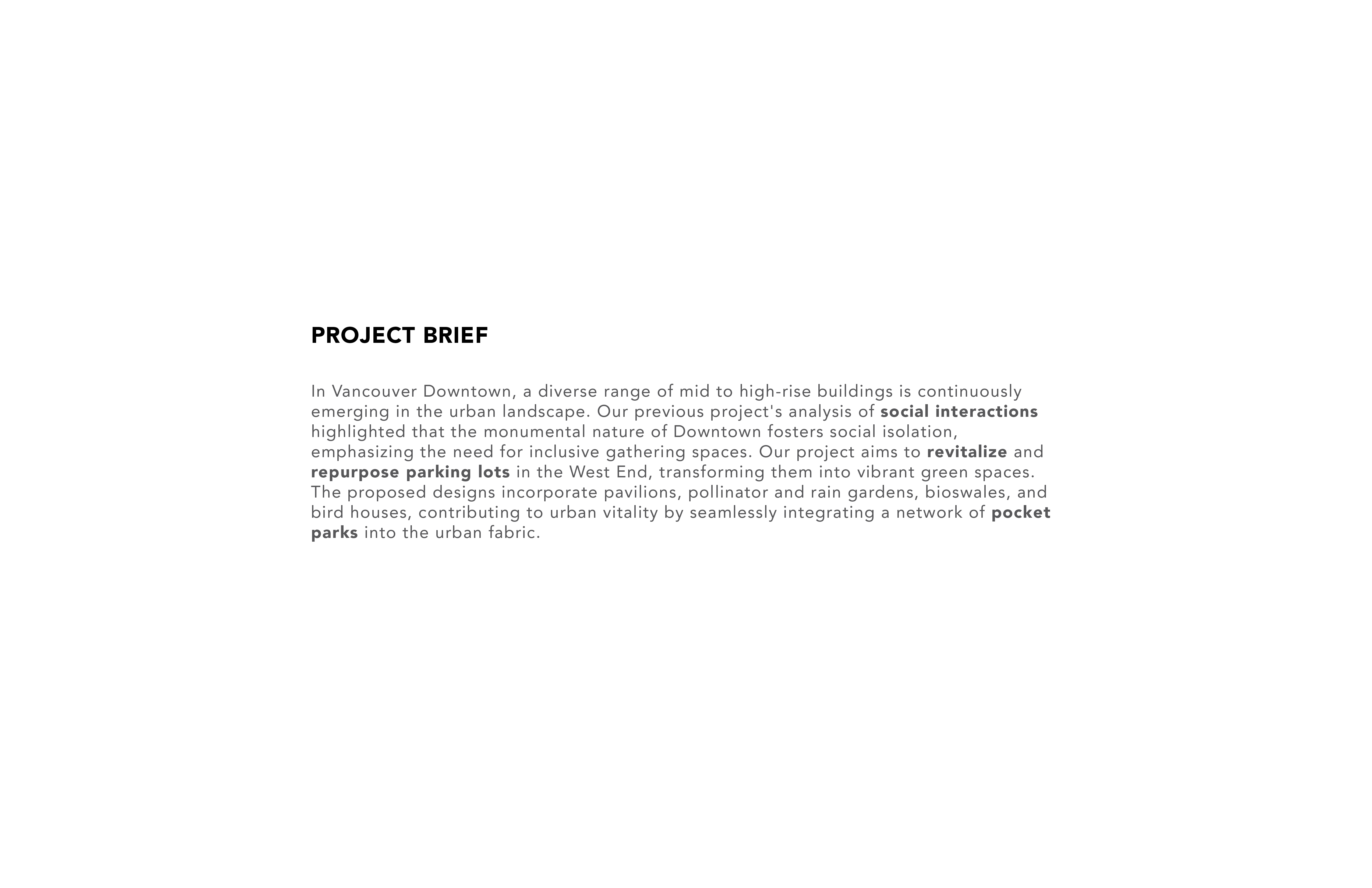
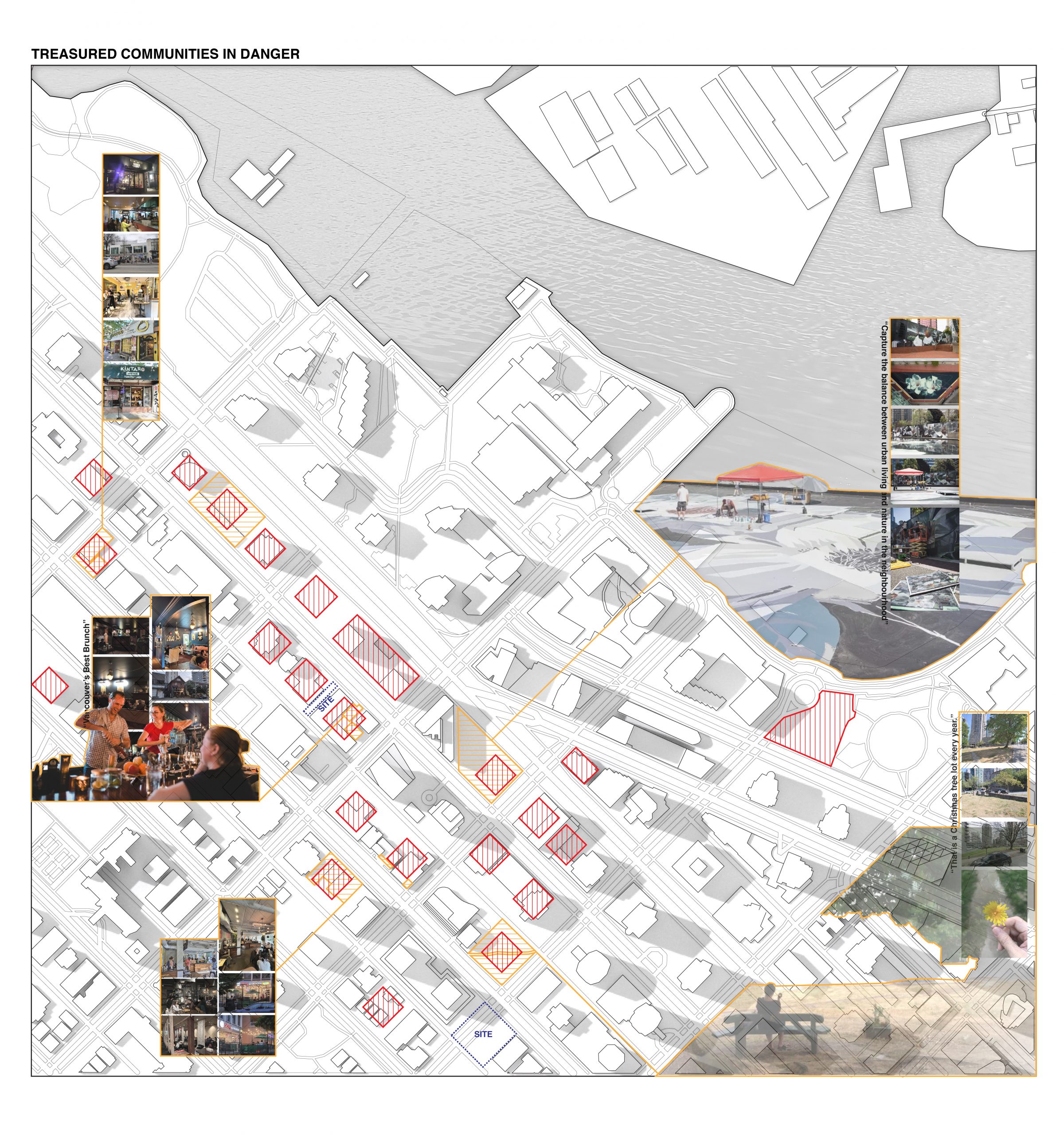
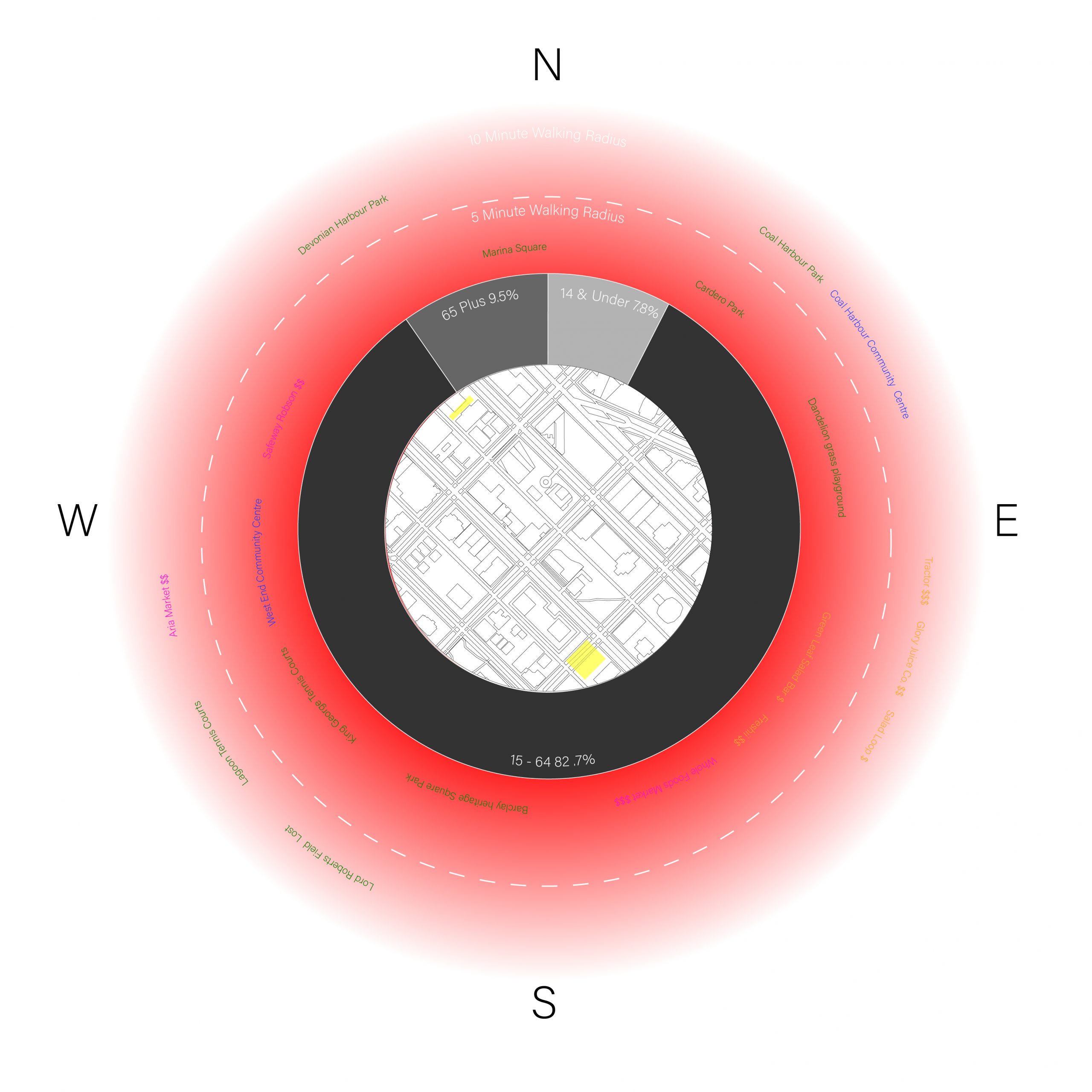
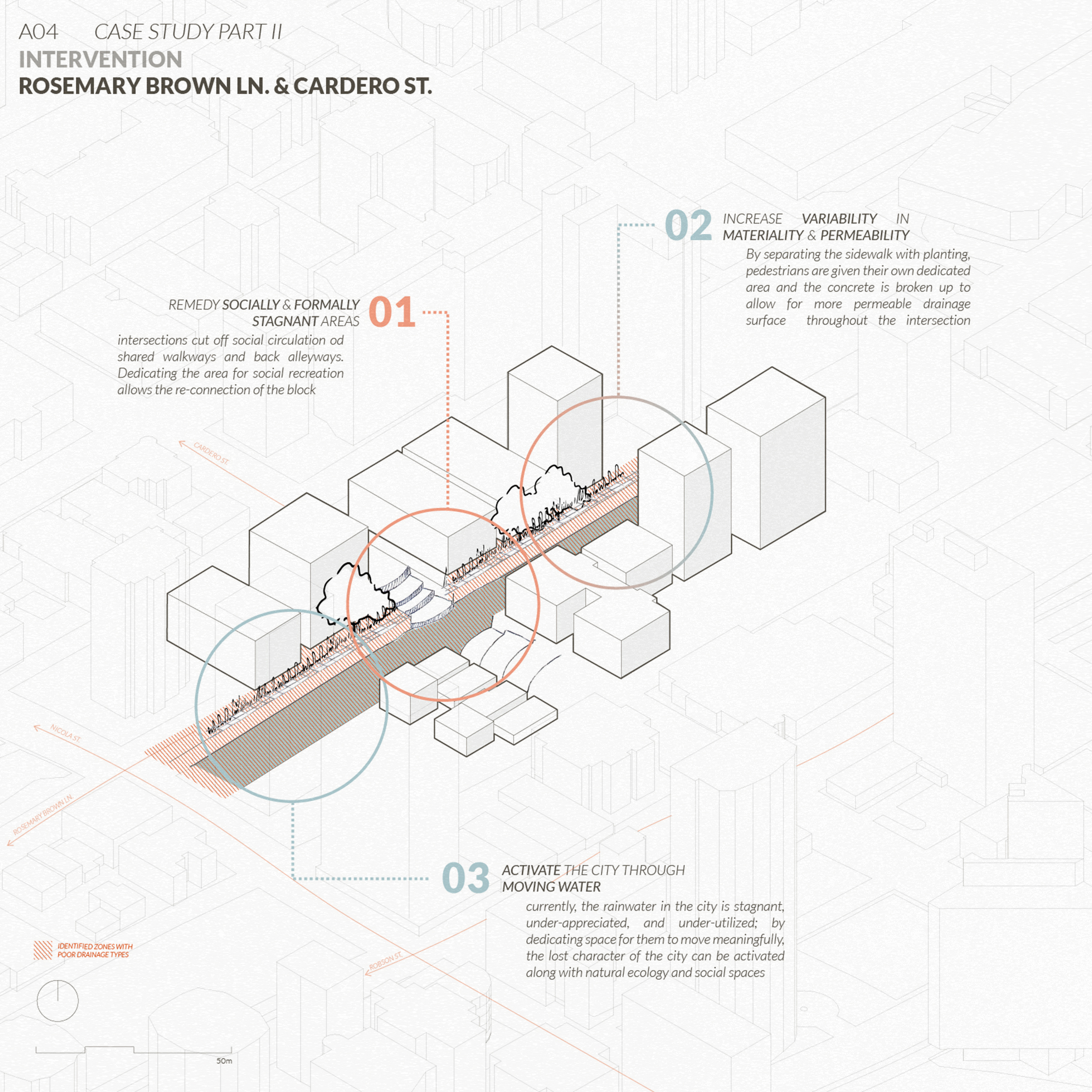
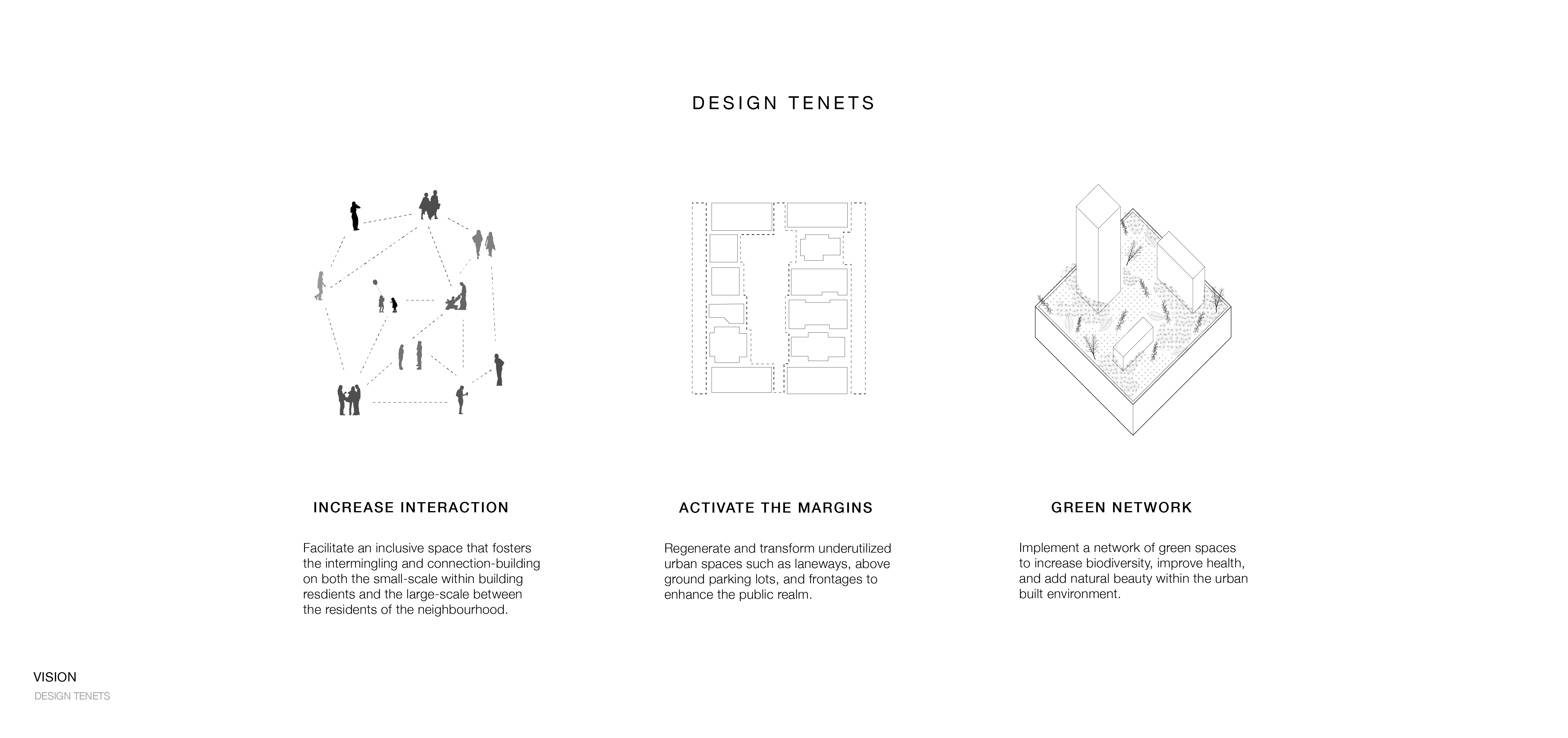
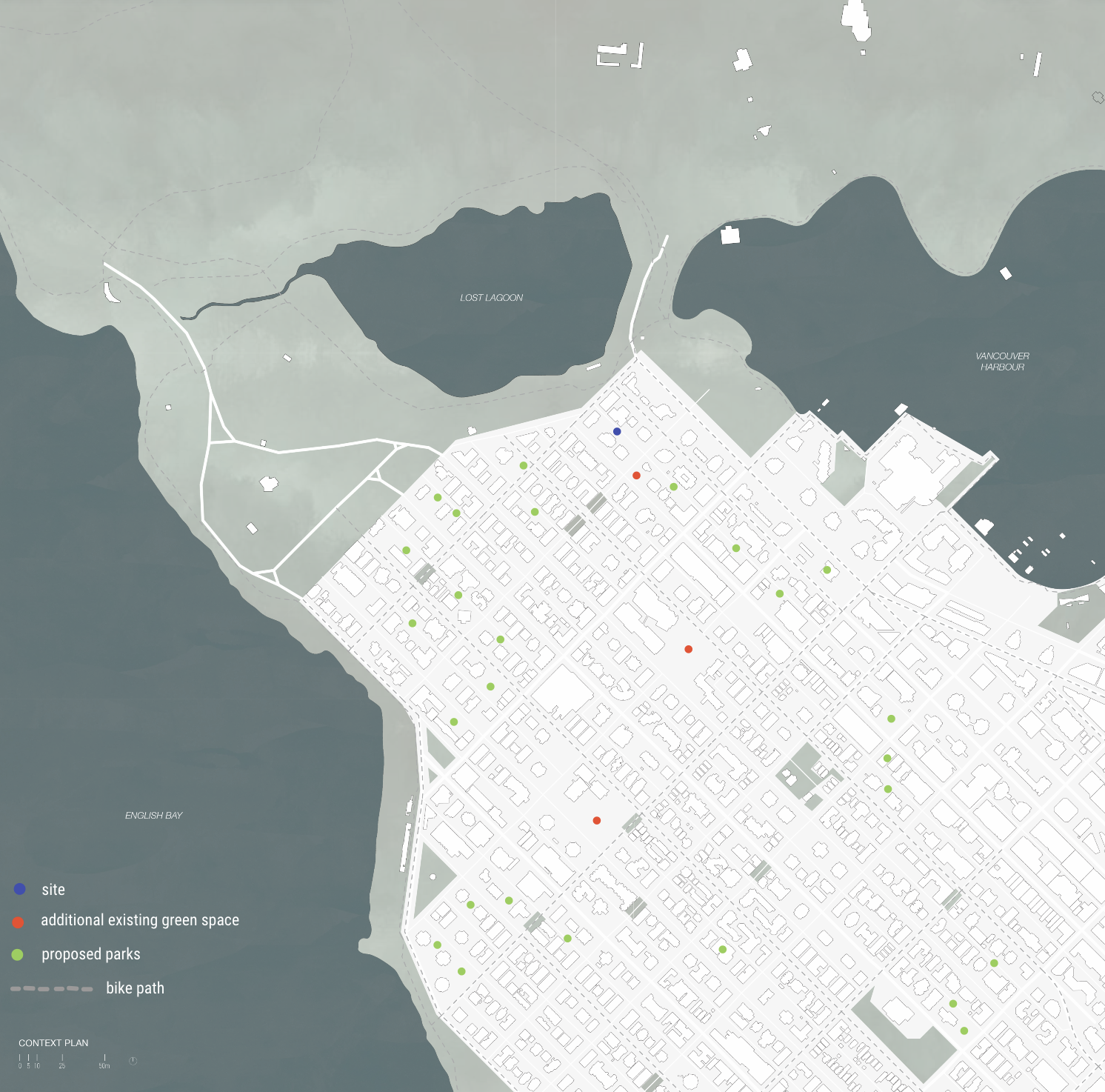
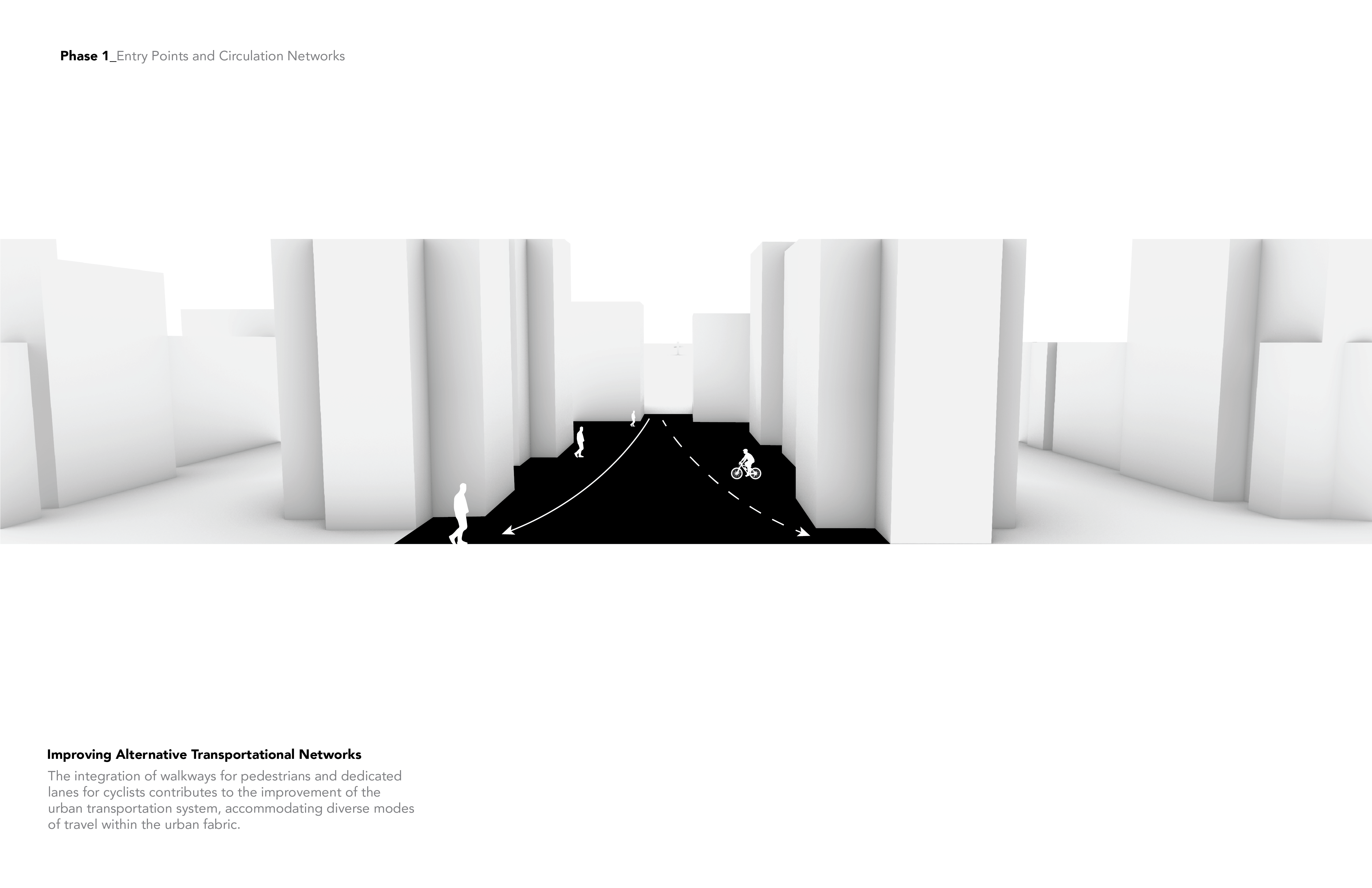
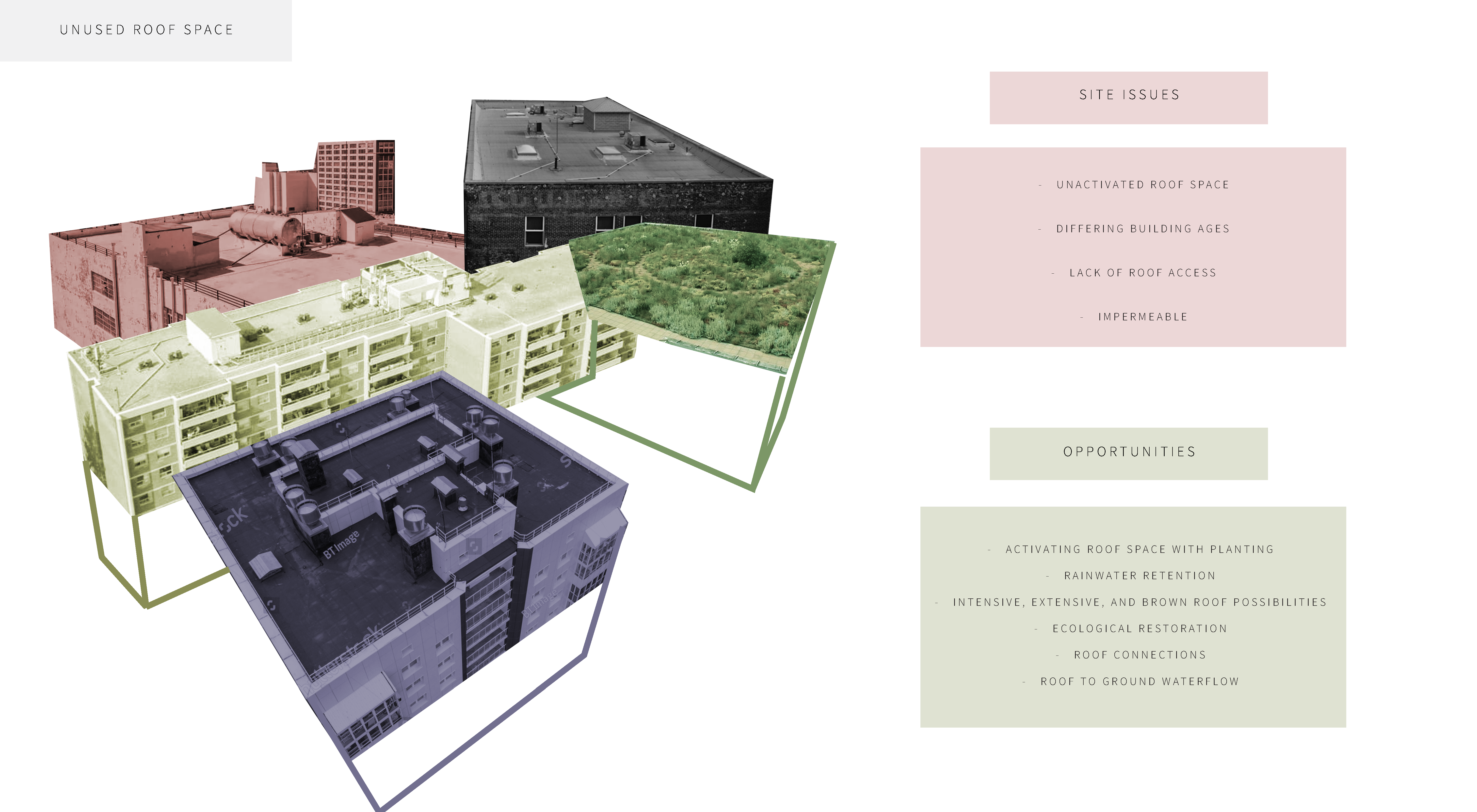
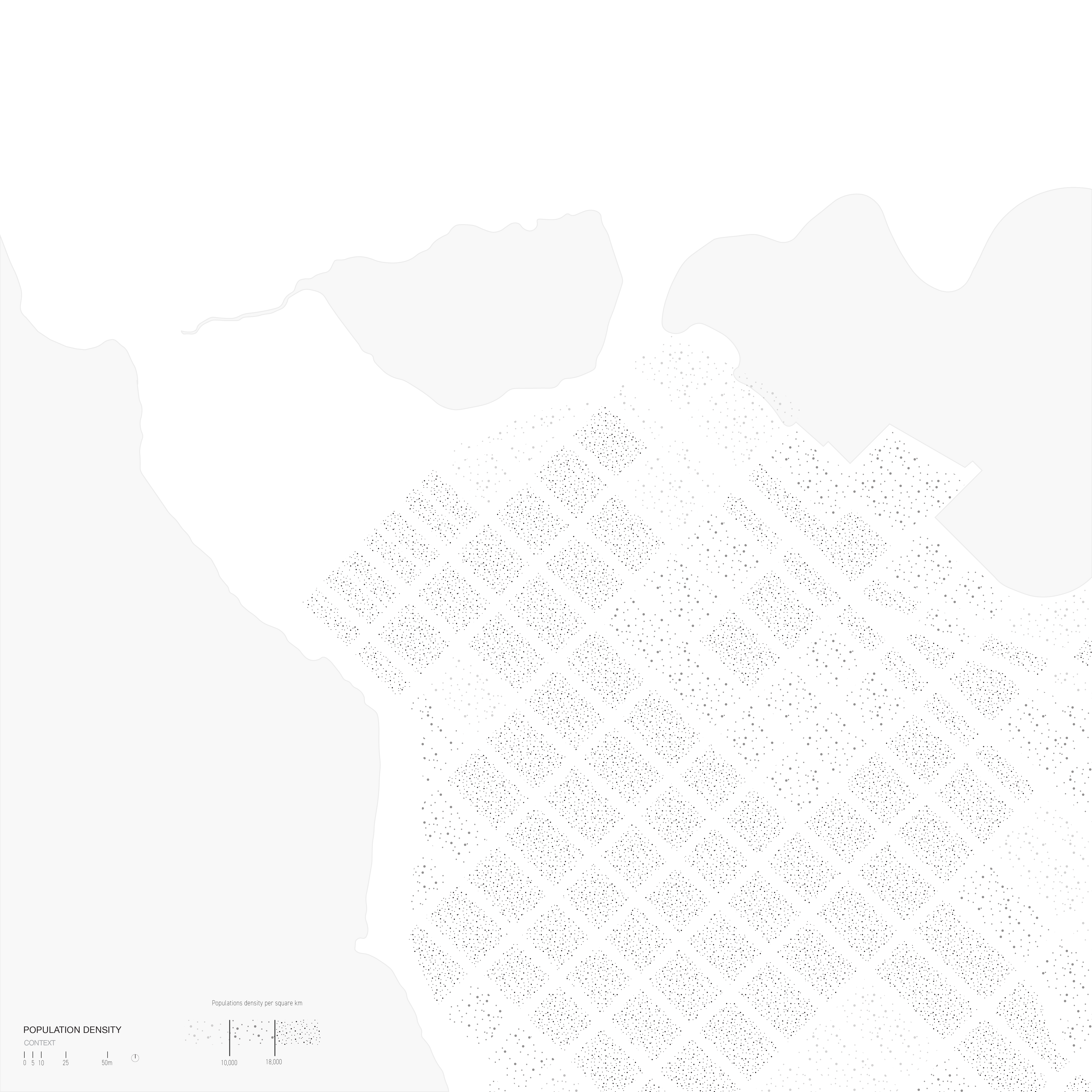
Located between Stanley Park, Vancouver Harbour, the Downtown Core, and English Bay, Vancouver’s West End is home to a diverse and eclectic mix of low to high-rise residential buildings. The neighbourhood has been and continues to be the subject of new high-rise development projects conducive to the economic interests of city developers and investors. However, the monumental nature and the lack of resident presence results in a breeding ground for social isolation raising the need to provide equitable and inclusive gathering spaces within the urban environment. The West End’s overabundance of above-ground off-street parking lots and the scarcity of green space provide an opportunity to remediate and create a network of pocket parks in the neighbourhood.
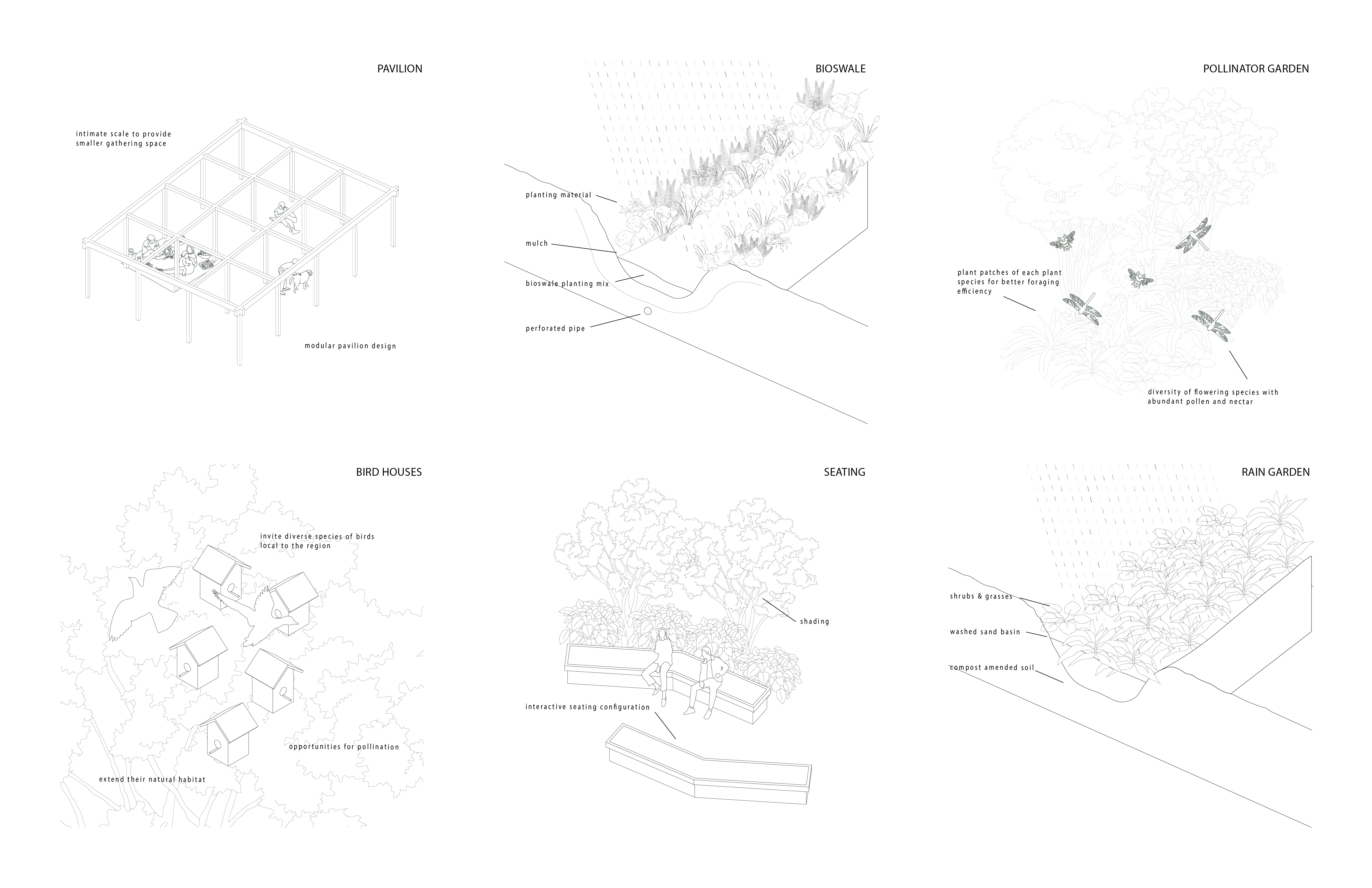
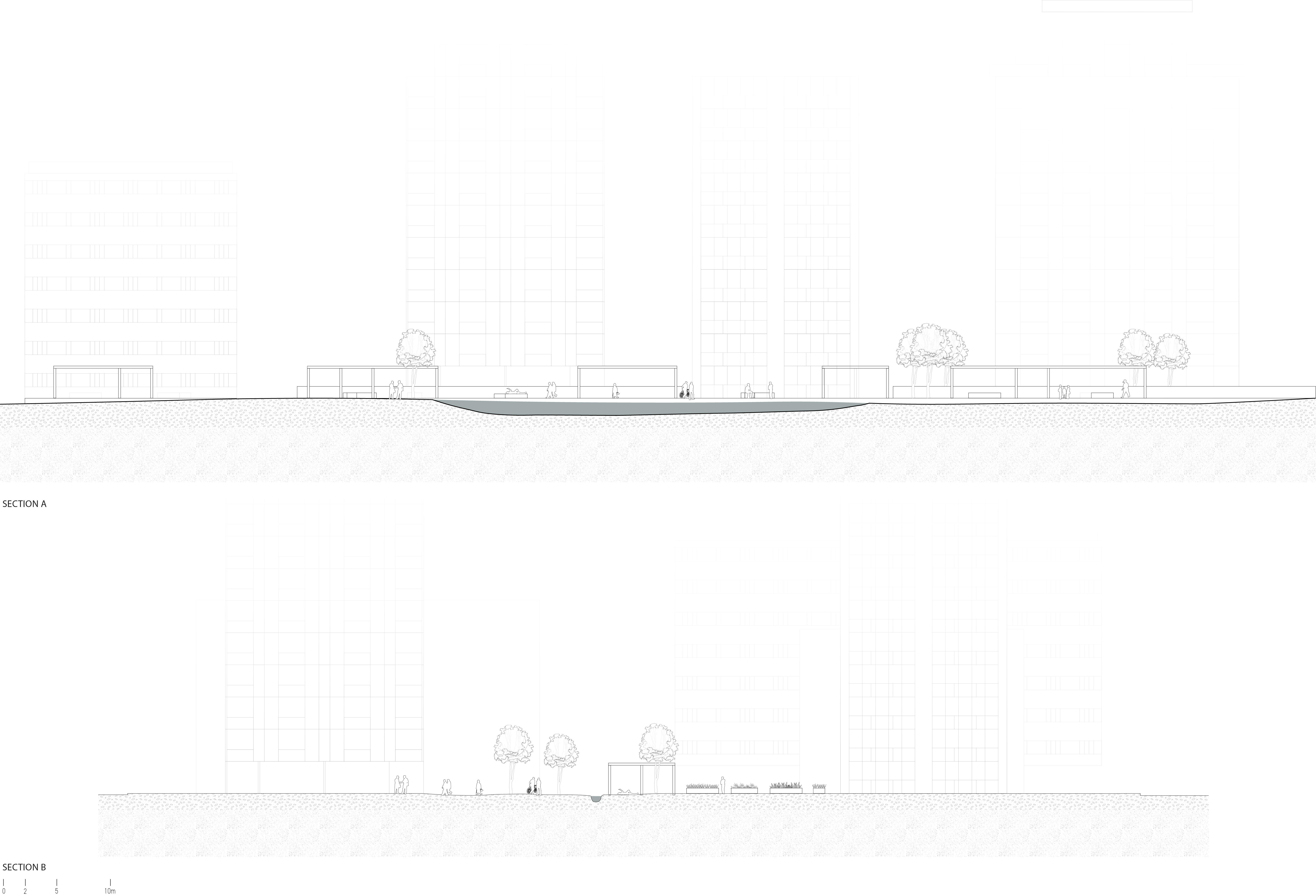
Through a phased design approach, our project aims to revitalize and reclaim parking lots in the West End and transform these margins into destinations of green spaces that can facilitate levels of interaction between the community, building residents and nature. The design features previous ground conditions, pollinator gardens, a pavilion, and rain gardens. Overall, our project intends to foster urban vitality by introducing a network of accessible green spaces woven into the urban fabric.


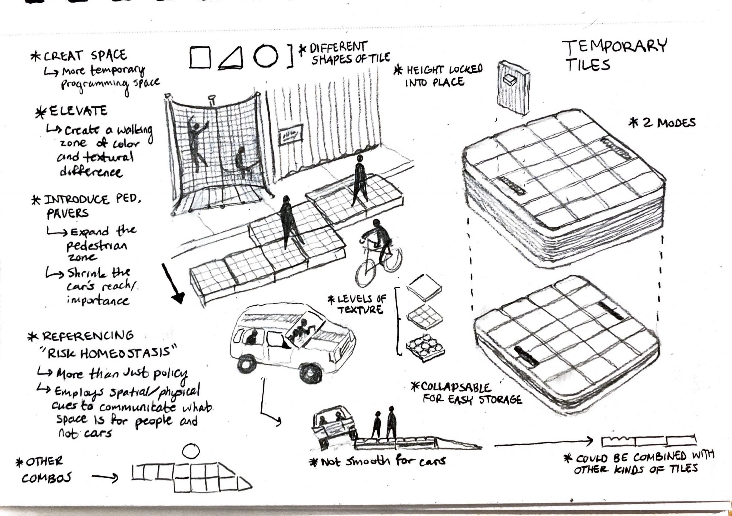
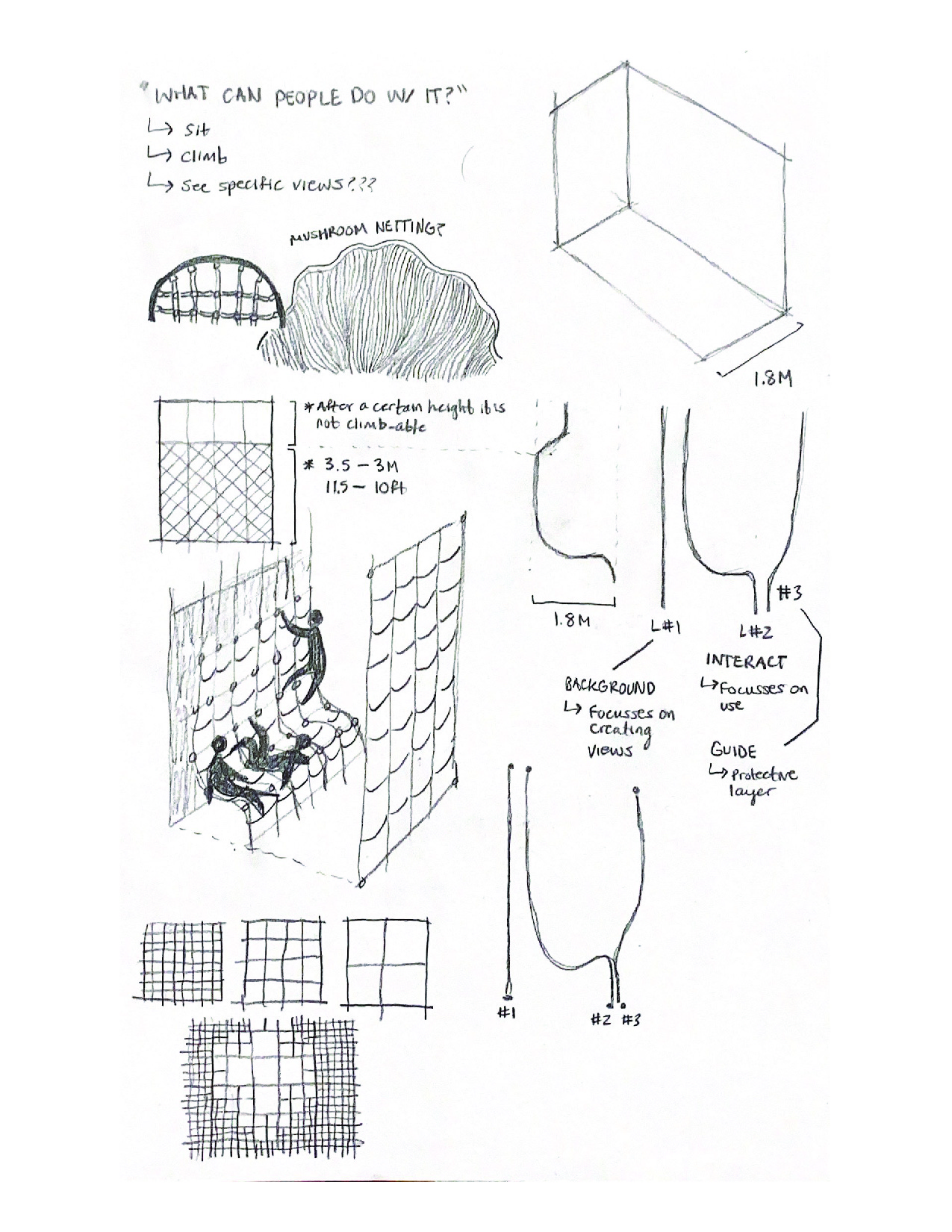
Assignment 6: Jacob Camino, H Brogan Gealey, Cynthia San


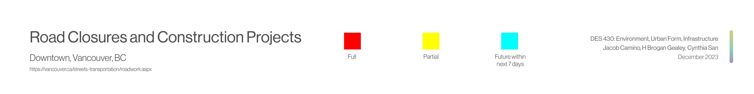


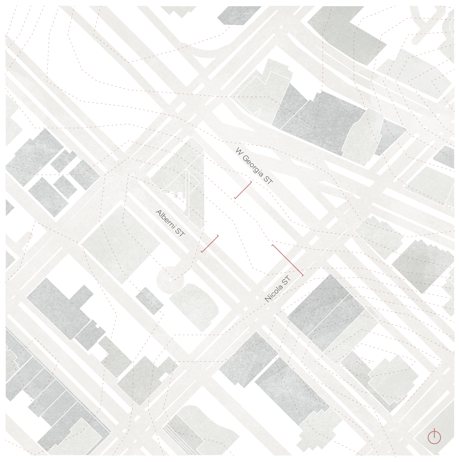

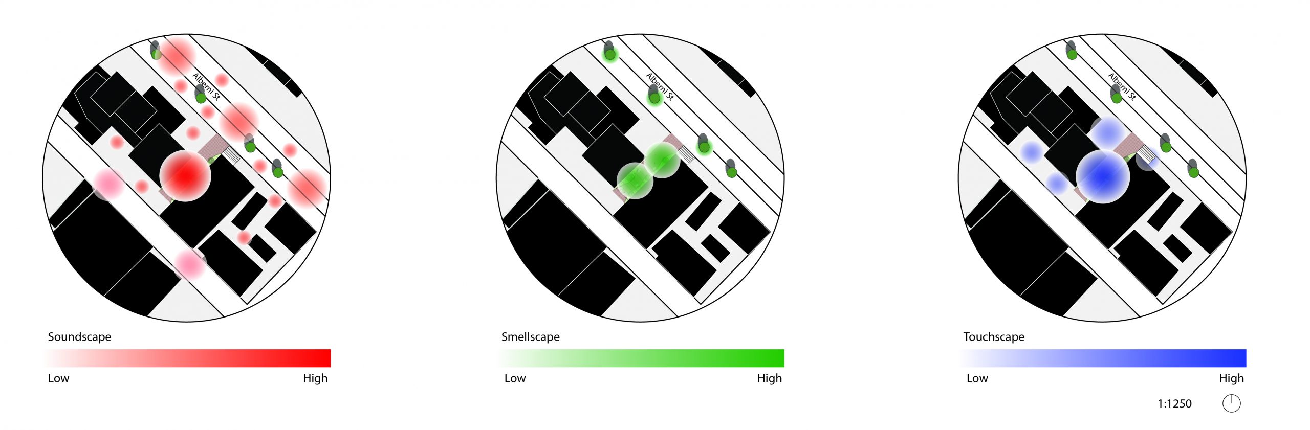
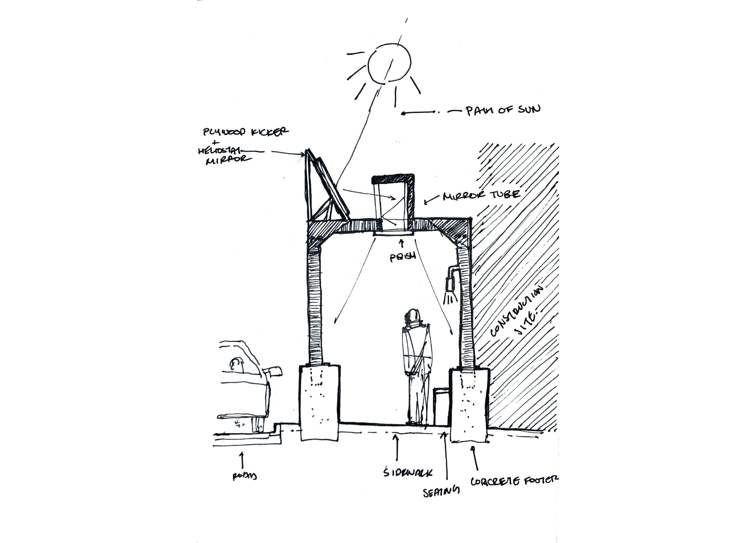
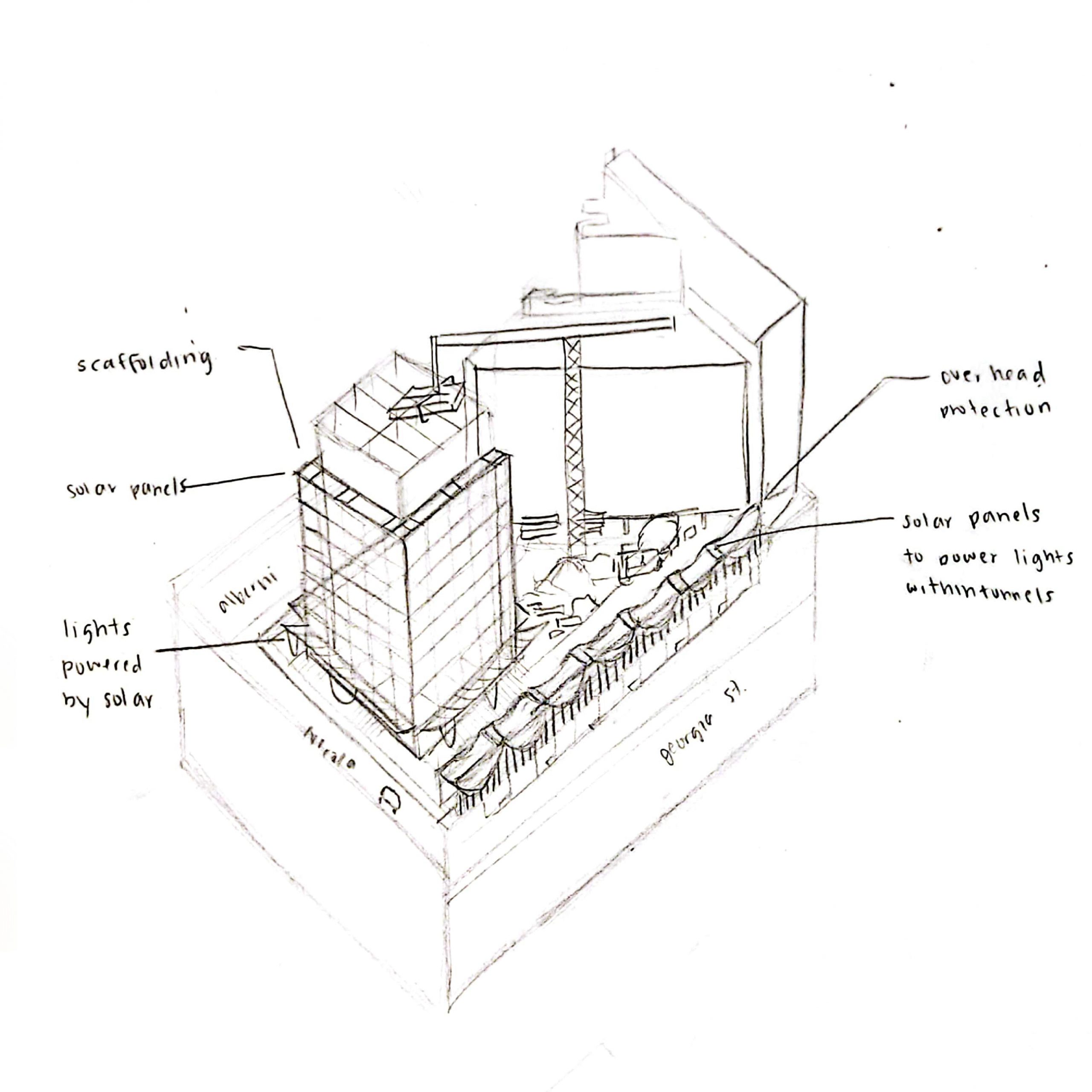
Sidewalk Pedestrian Overhead on W Georgia

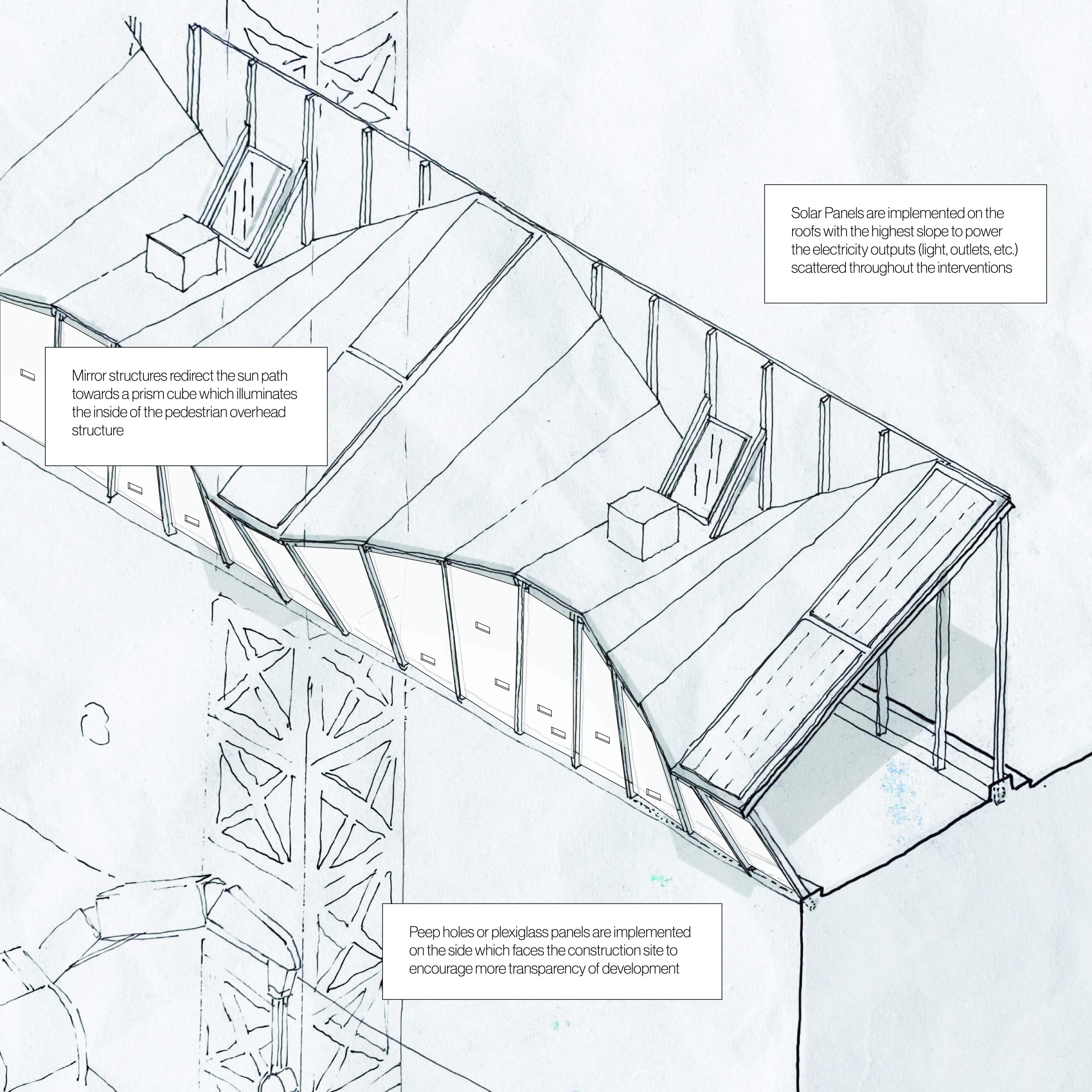


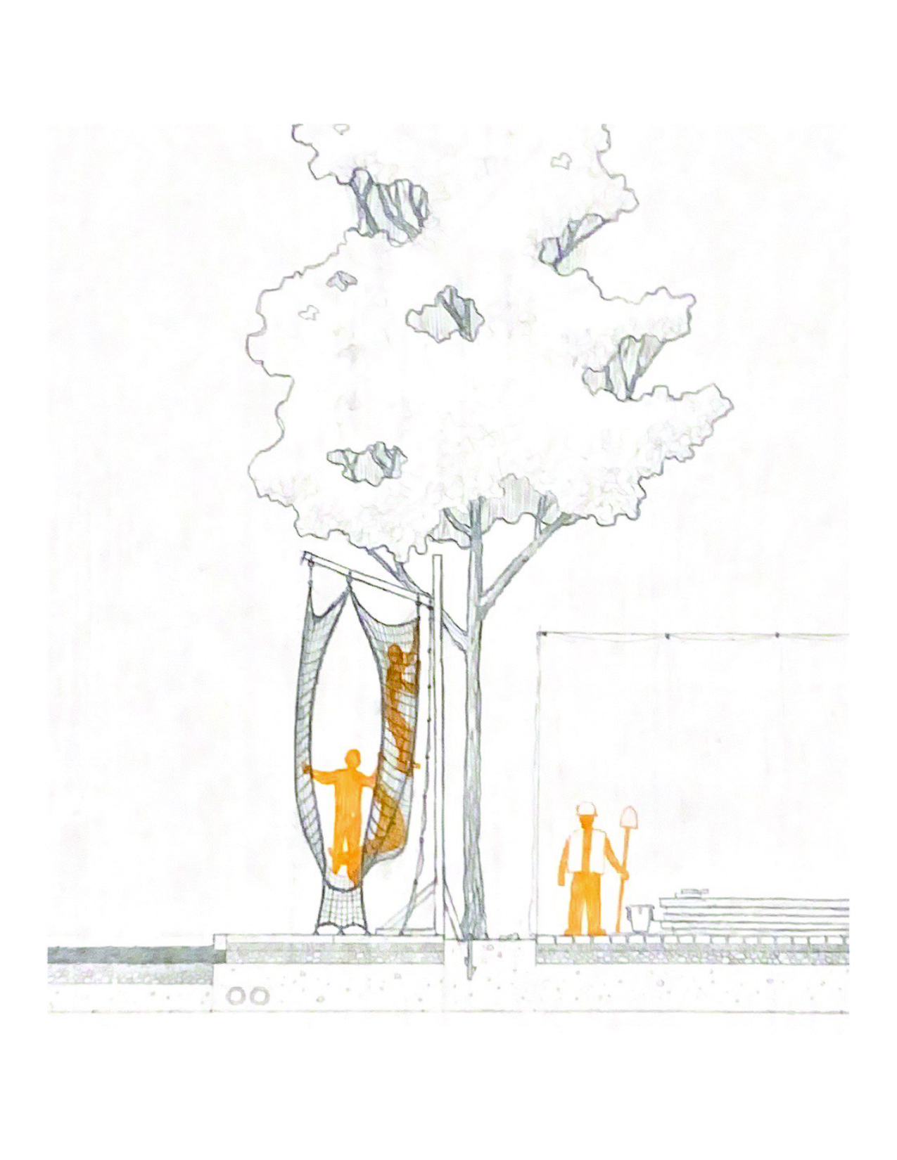
Netting on Nicola St.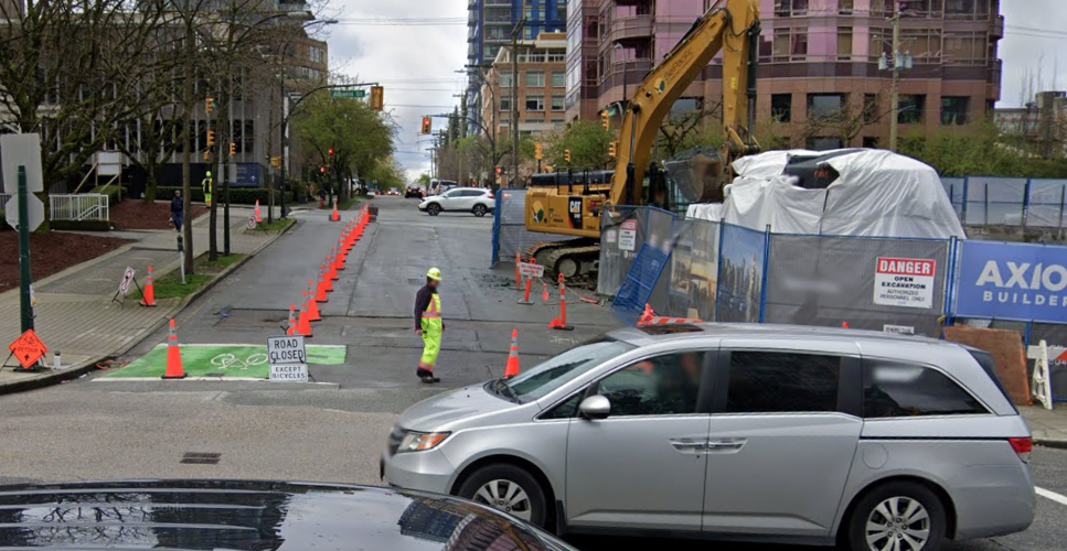


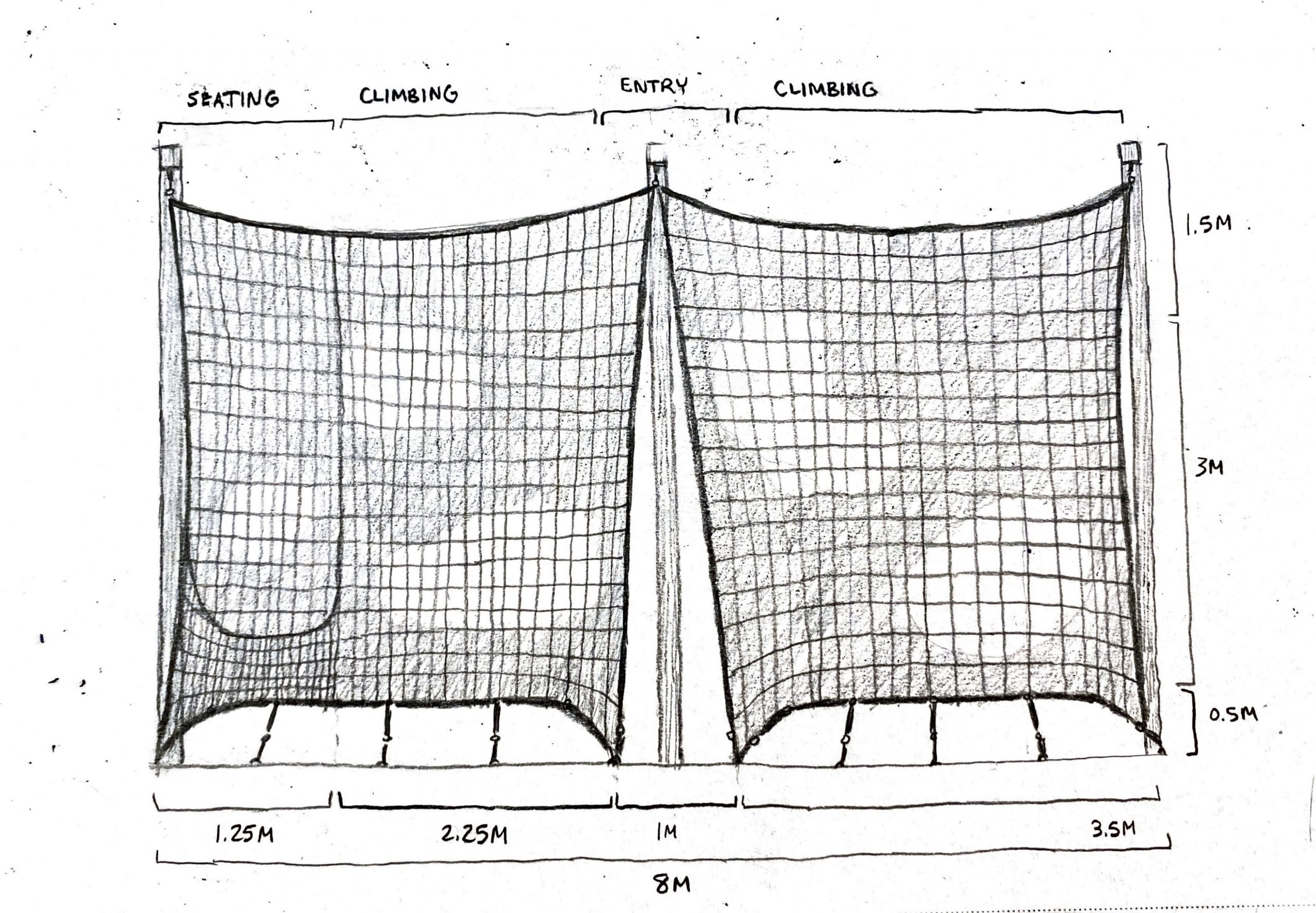

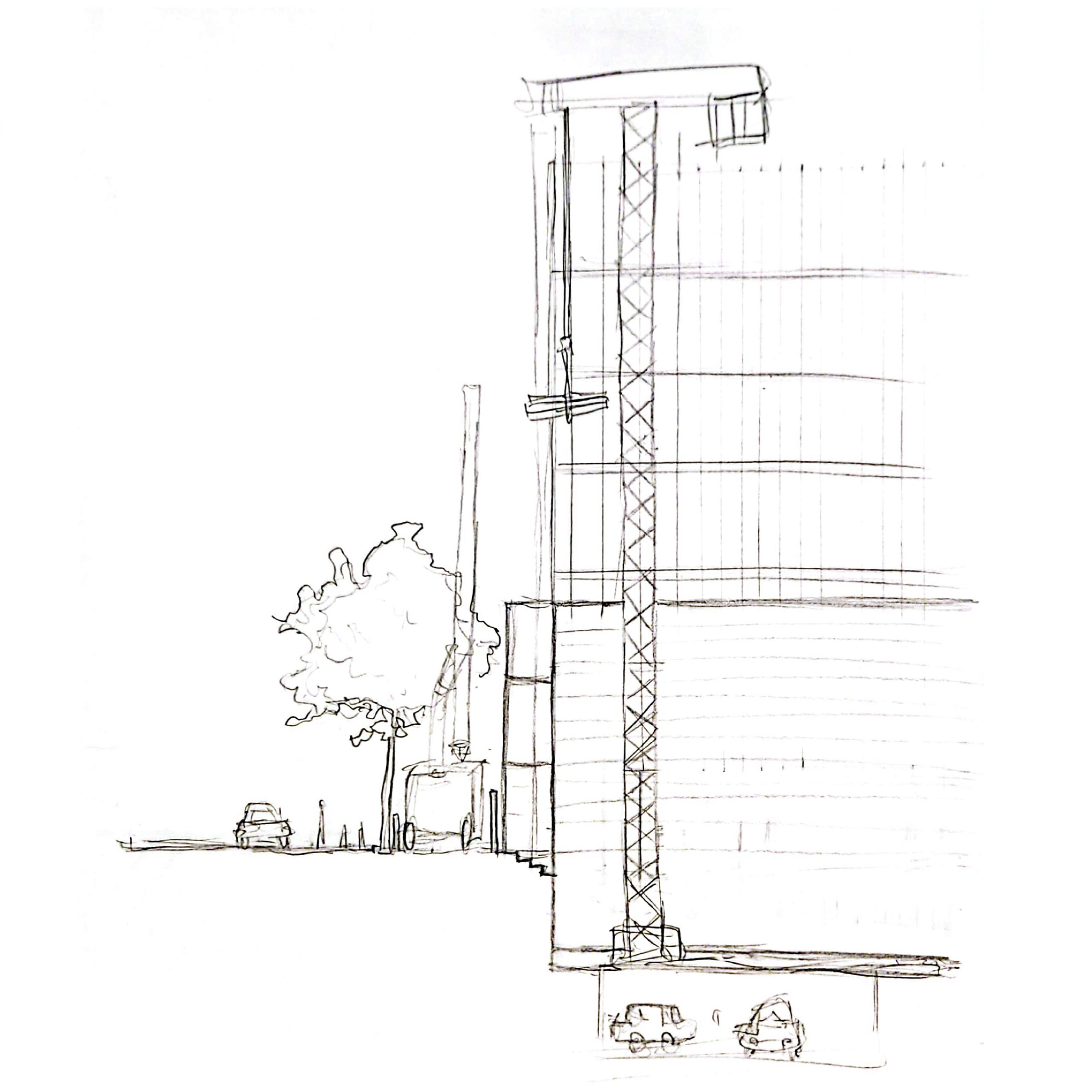
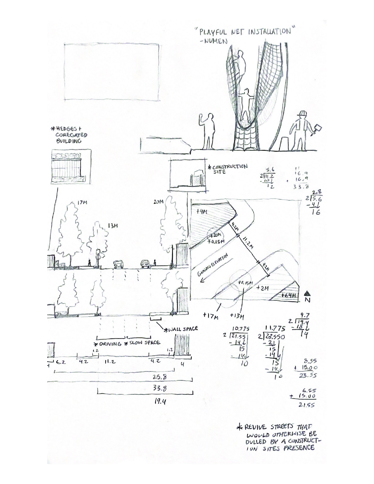 Scaffolding on Alberni St.
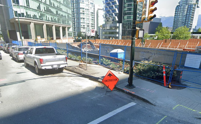


Assignment 6_ Carol Zhao, YiLe Chen & Mary Zhu


Assignment 6: Anastasia Simonovich, Lisa Besnier, Mia Torrence
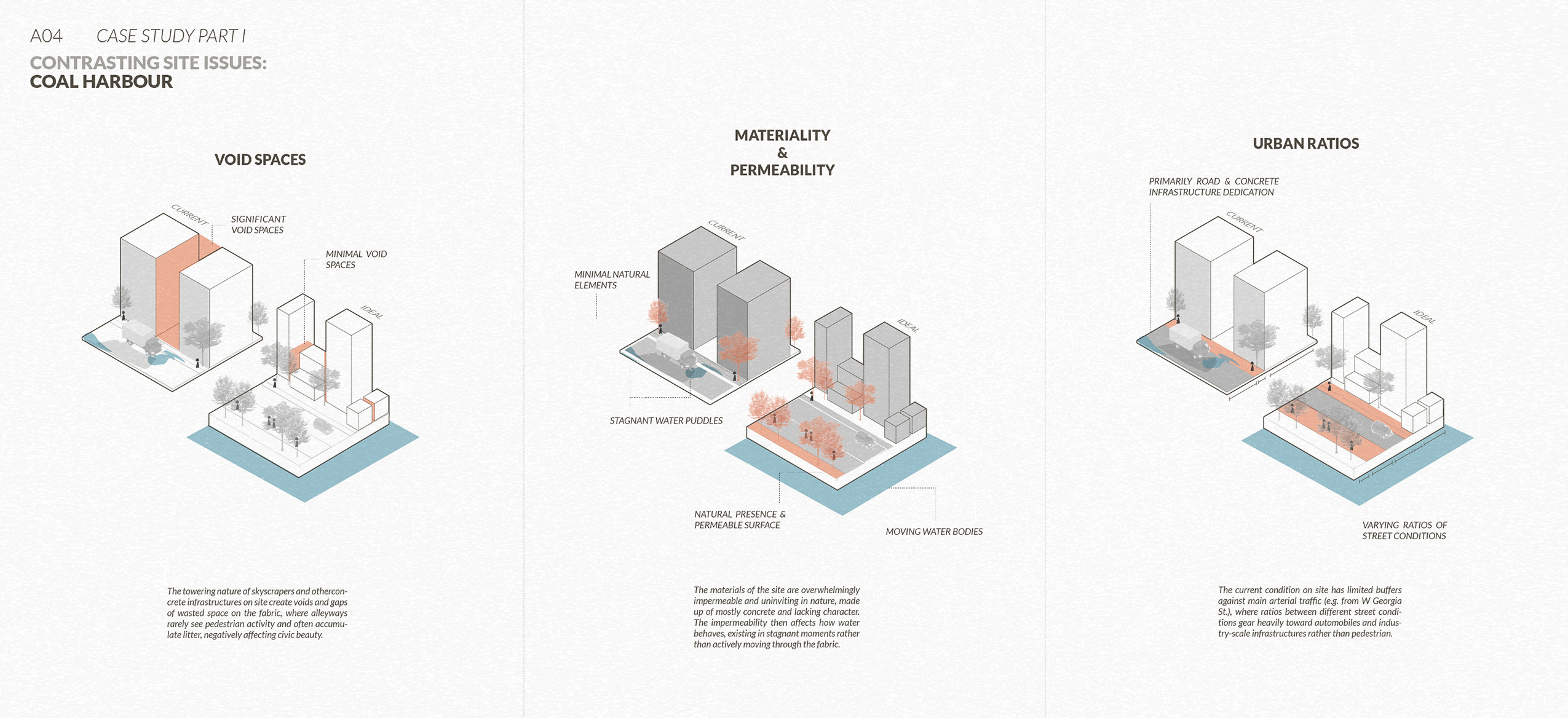
Through our prior investigations of Coal Harbour in Assignment 5, we developed a critique of the architectural manifestations of speculative finance. Considering the “Vancouverism”-style glass tower typology that is now ubiquitous in the neighborhood, we found that the architecture serves primarily as a vehicle for capital, resulting in housing units that are:
- disengaged from the urban fabric
- unlivable and unsustainable, as thermal comfort and environmental sustainability are sacrificed for commodifiable views (Schmunk, 2023)
- often unoccupied, as many units serve as secondary homes or investments rather than housing (Fumaro, 2023).
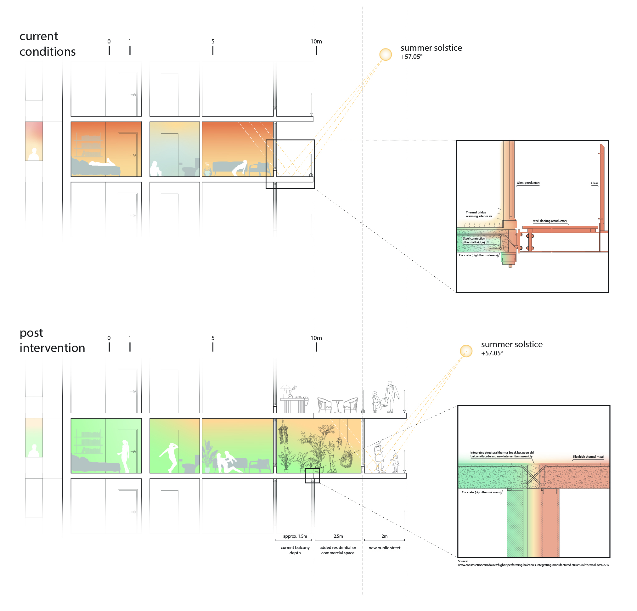
Furthermore, the condos are not only deeply impractical, but also have a particularly short life cycle, as experts estimate that glazed facades require retrofitting between 15 and 30 years after construction. These repairs could prove to be extremely expensive for building owners and homeowners, with more comprehensive retrofits costing millions of dollars (see drawing for sources).

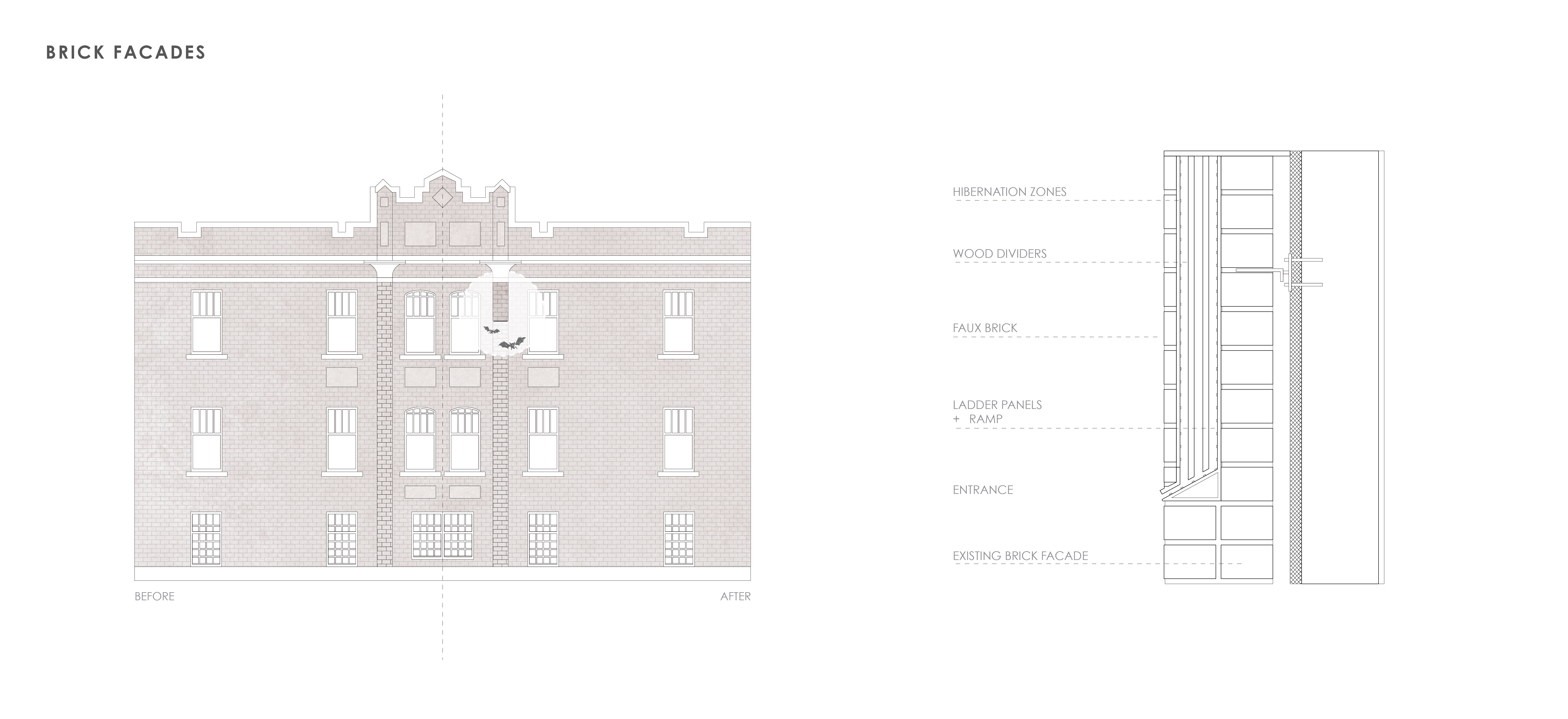
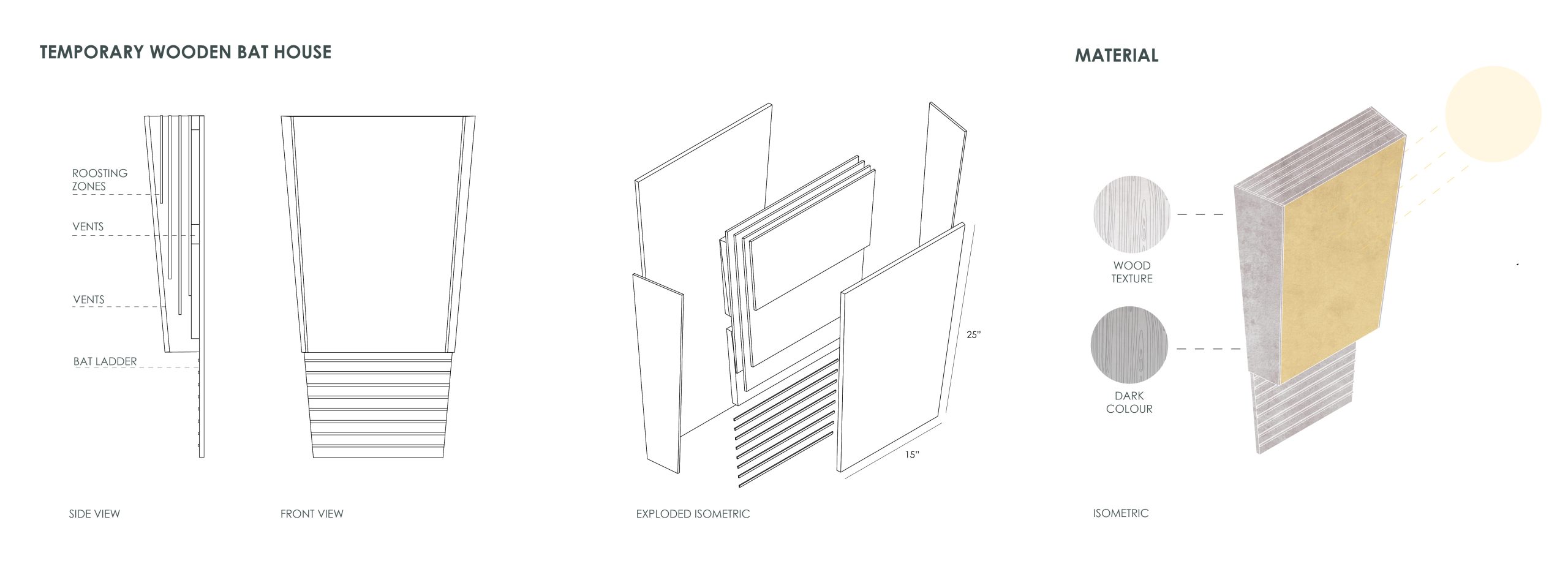
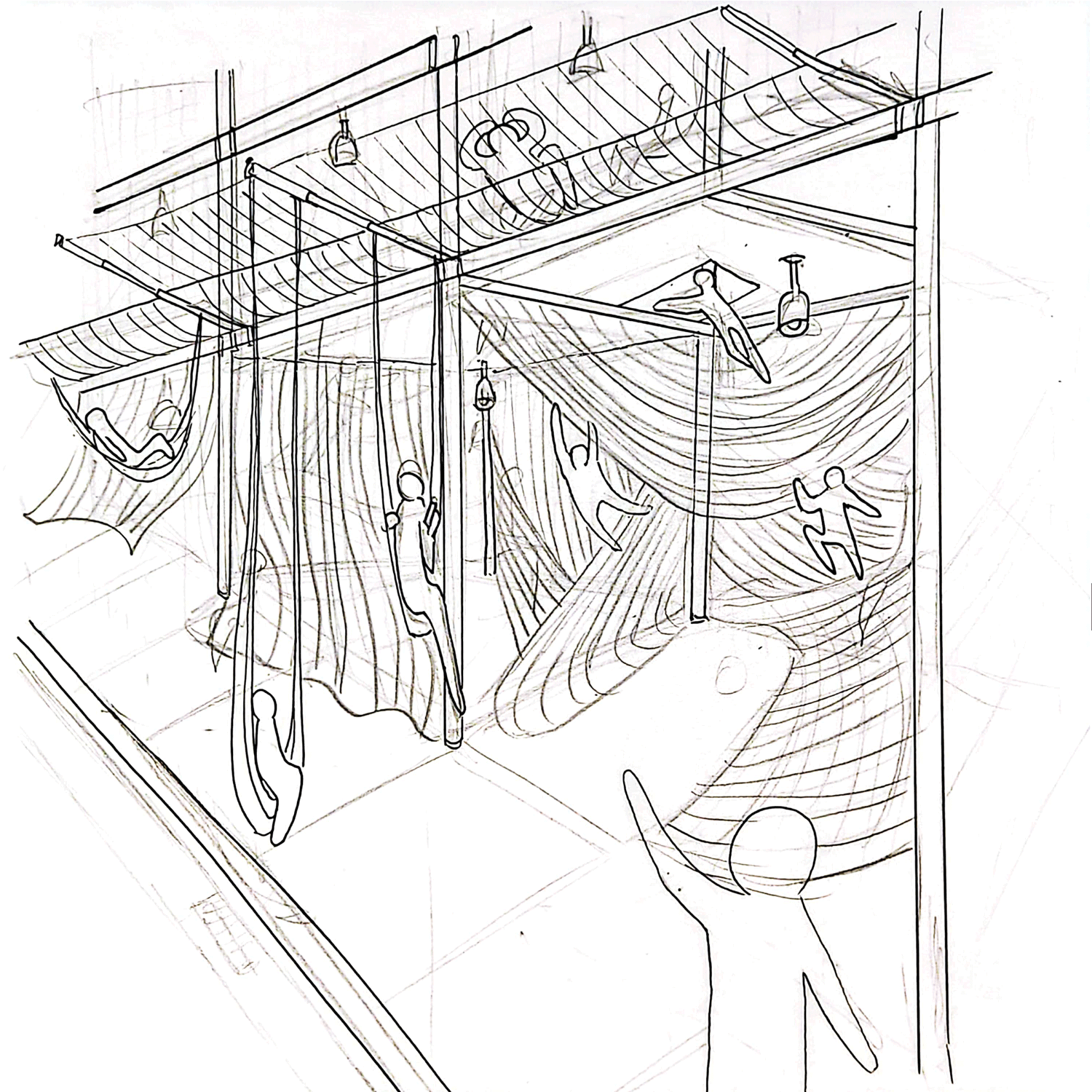
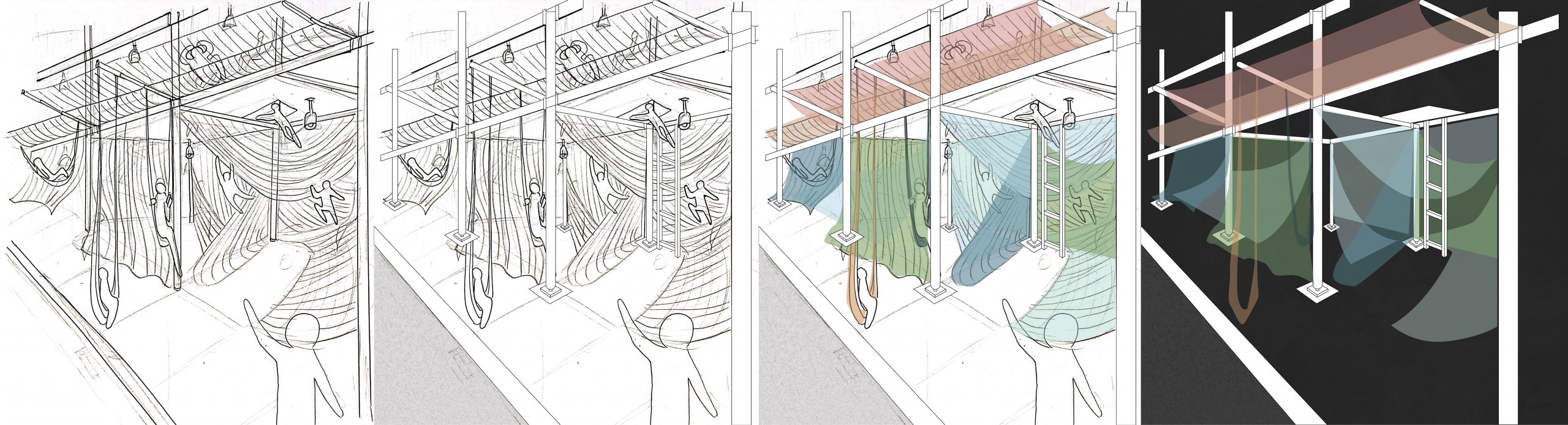
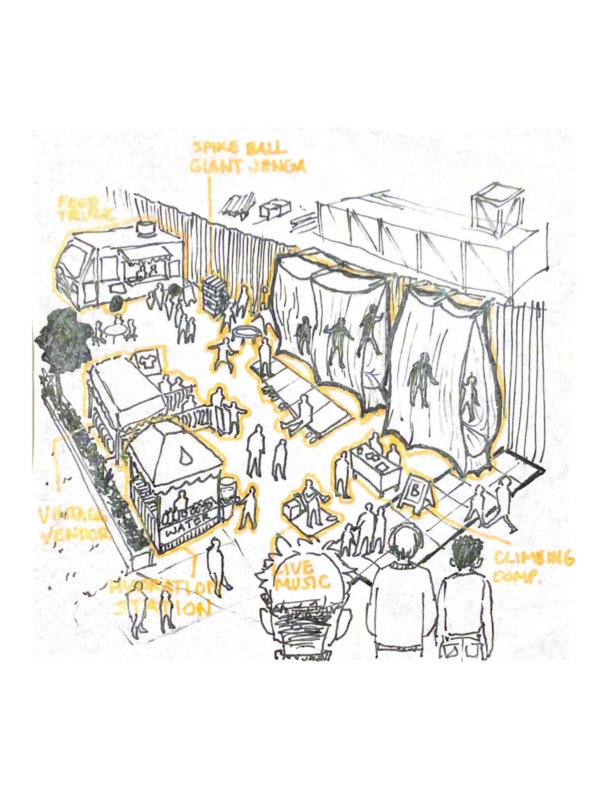
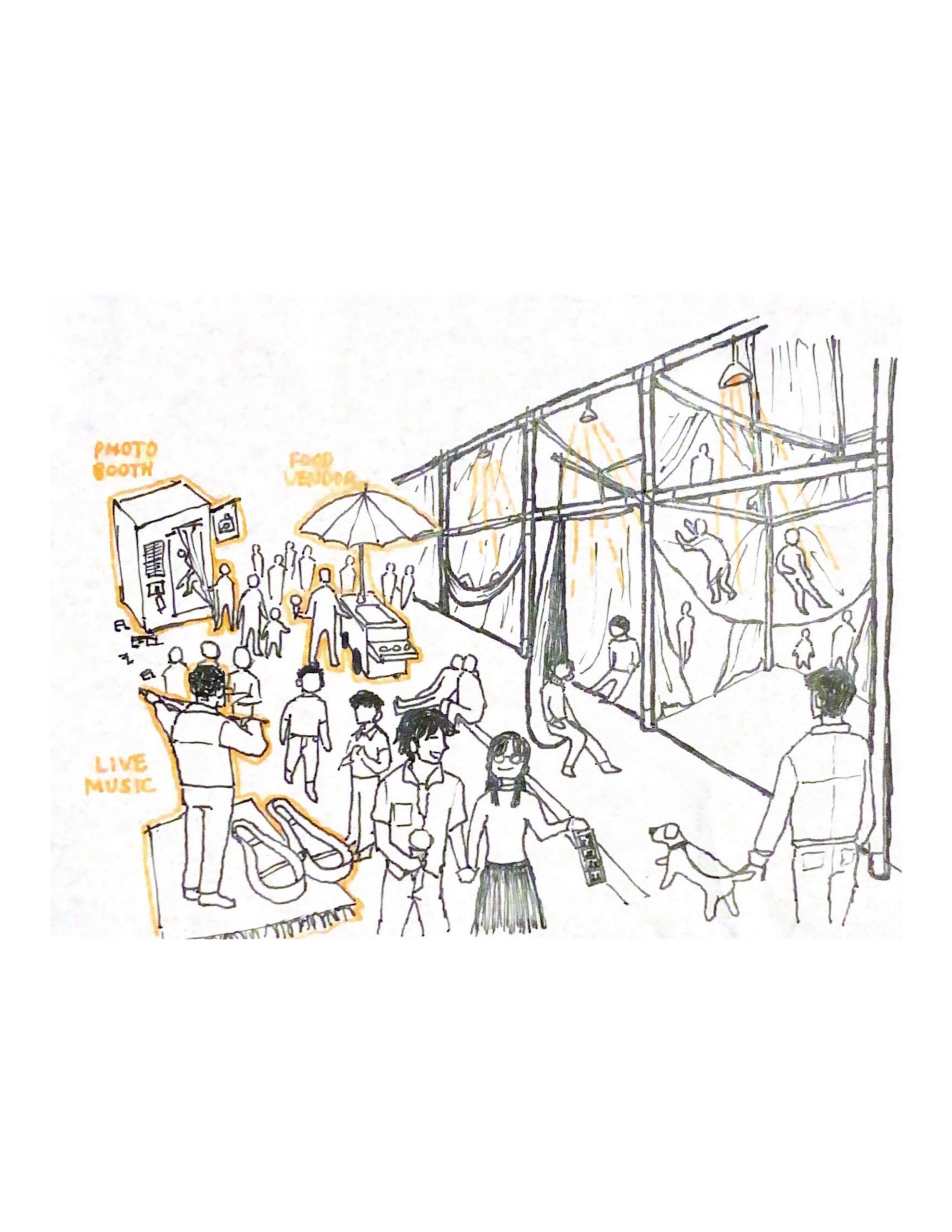
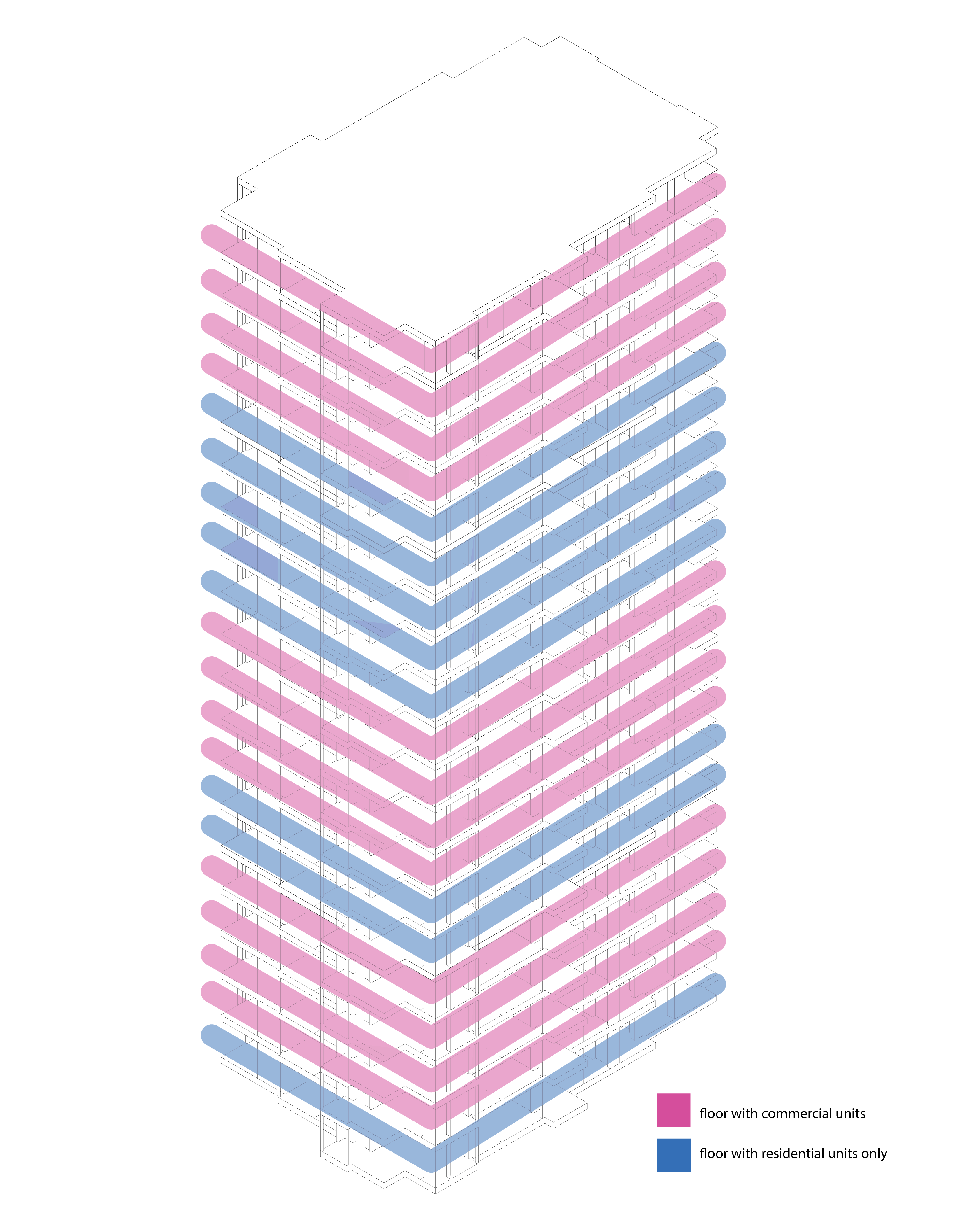
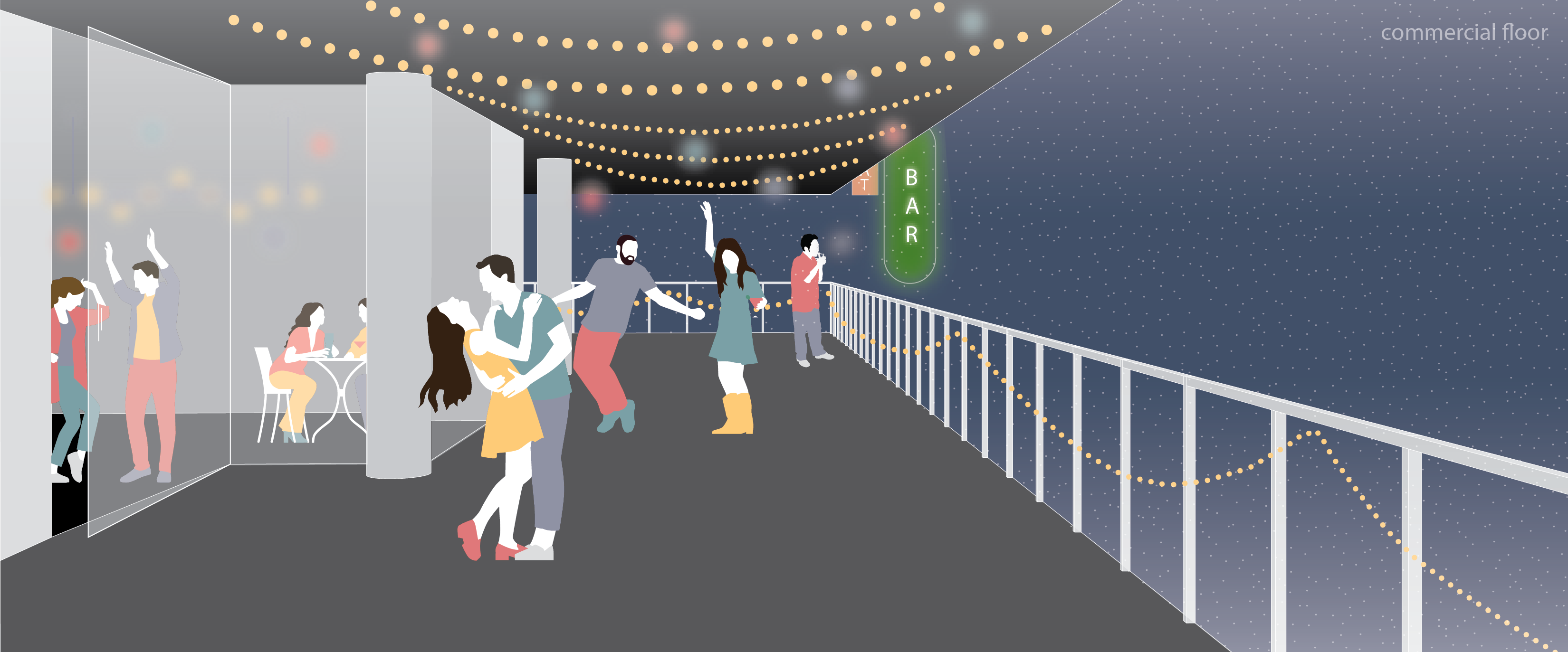
 This leads us to our proposal of an external “second skin” to Vancouverism-style high-rises in Coal Harbour. Taking into account the fact that these buildings will require expensive modifications regardless, we propose adding an external structure to apartment buildings that will provide a new facade without requiring major modifications to the existing architecture. The new facades, in addition to adding square footage to the building, will be paired with a conversion of unoccupied apartments into mixed-use spaces: either commercial (small business) or a public third space. This structure will shade apartments, add greenery to the facade, and create a public “street” along the exterior of previously inaccessible apartments. These new commercial spaces will be converted from existing apartments that were purchased as investment properties. The city of Vancouver will purchase these apartments from investors at a tax-free incentivized cost based on the fact that investments are not going to pay off in the long run due to envelope repairs that are needed in the future (Kholstedt, 2019).
Precedents:
Bordeaux Modernist Social Housing by Christophe Hutin architecture, Frédéric Druot, Lacaton & Vassal
Vancouver Retrofit with Green Exoskeletons by Genta Ishimura
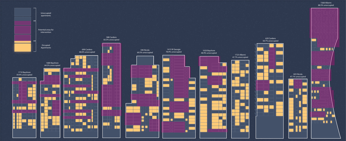
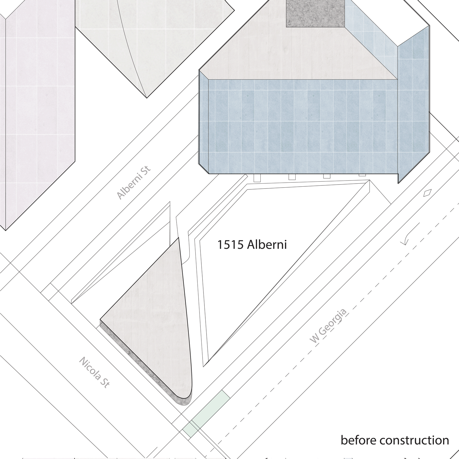
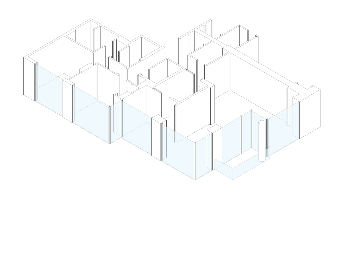
The following drawings use 590 Nicola as a case study for our proposal.


CITATIONS
Fumaro, D. (2023, August 30). Some new Vancouver condos held empty for years: internal city memo. Vancouver Sun. Retrieved November 28, 2023, from https://vancouversun.com/news/local-news/dan-fumano-some-new-vancouver-condos-held-empty-for-years-internal-city-memo.
City of Vancouver. (2023). “Green Grants”. City of Vancouver Sustainability Group. Retrieved November 28, 2023 from https://vancouver.ca/people-programs/green-grants.aspx
Chan, Cheryl. (2023, July 21). “Here’s how Vancouver is planning to spend millions from a one-time infrastructure grant”. Vancouver Sun. Retrieved November 28, 2023 from https://vancouversun.com/news/local-news/six-projects-vancouver-bc-49-million-grant
City of Vancouver (n.d.) “Community Benefits from Development” City of Vancouver Urban Planning. Retrieved November 21, 2023 from https://vancouver.ca/home-property-development/how-development-funds-communities.aspx
Walsh, R. M. (2013) The Origins of Vancouverism: A Historical Inquiry into the Architecture and Urban Form of Vancouver, British Columbia. https://www.researchgate.net/publication/295263050_The_Origins_of_Vancouverism_A_Historical_Inquiry_into_the_Architecture_and_Urban_form_of_Vancouver_British_Columbia
Schmunk, Rhianna. (2023, September 1) “Vancouver’s architecture, by design, was never meant to handle extreme heat”. CBC British Columbia. https://www.cbc.ca/news/canada/british-columbia/vancouver-architecture-never-designed-for-extreme-heat-1.6953003
Kholstedt, Kurt. (2019, October 4). “Second Skins: Retrofitting Flawed Glass Condo Buildings with Greener Exoskeletons”. 99% Invisible. https://99percentinvisible.org/article/second-skins-retrofitting-flawed-glass-condo-buildings-with-greener-exoskeletons/
https://www.betterbuildingsbc.ca
https://vancouver.ca/green-vancouver/green-large-commercial-and-multi-family-buildings.aspx
https://vancouver.ca/green-vancouver/zero-emissions-buildings-tools.aspx
Assignment 6 – Edita Martina Hruskovec, Nishi Praveen Kumar and Tatiana Babini

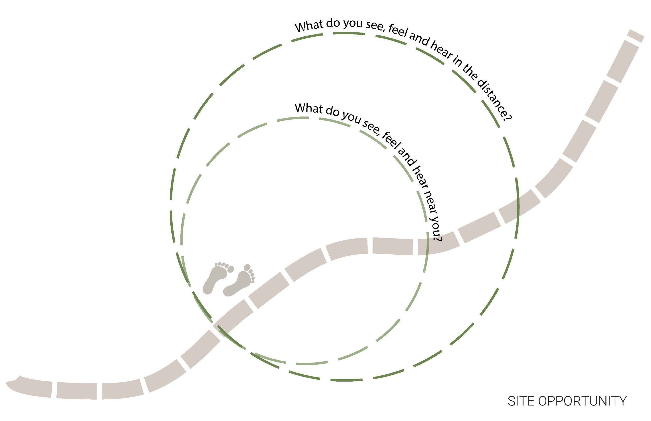
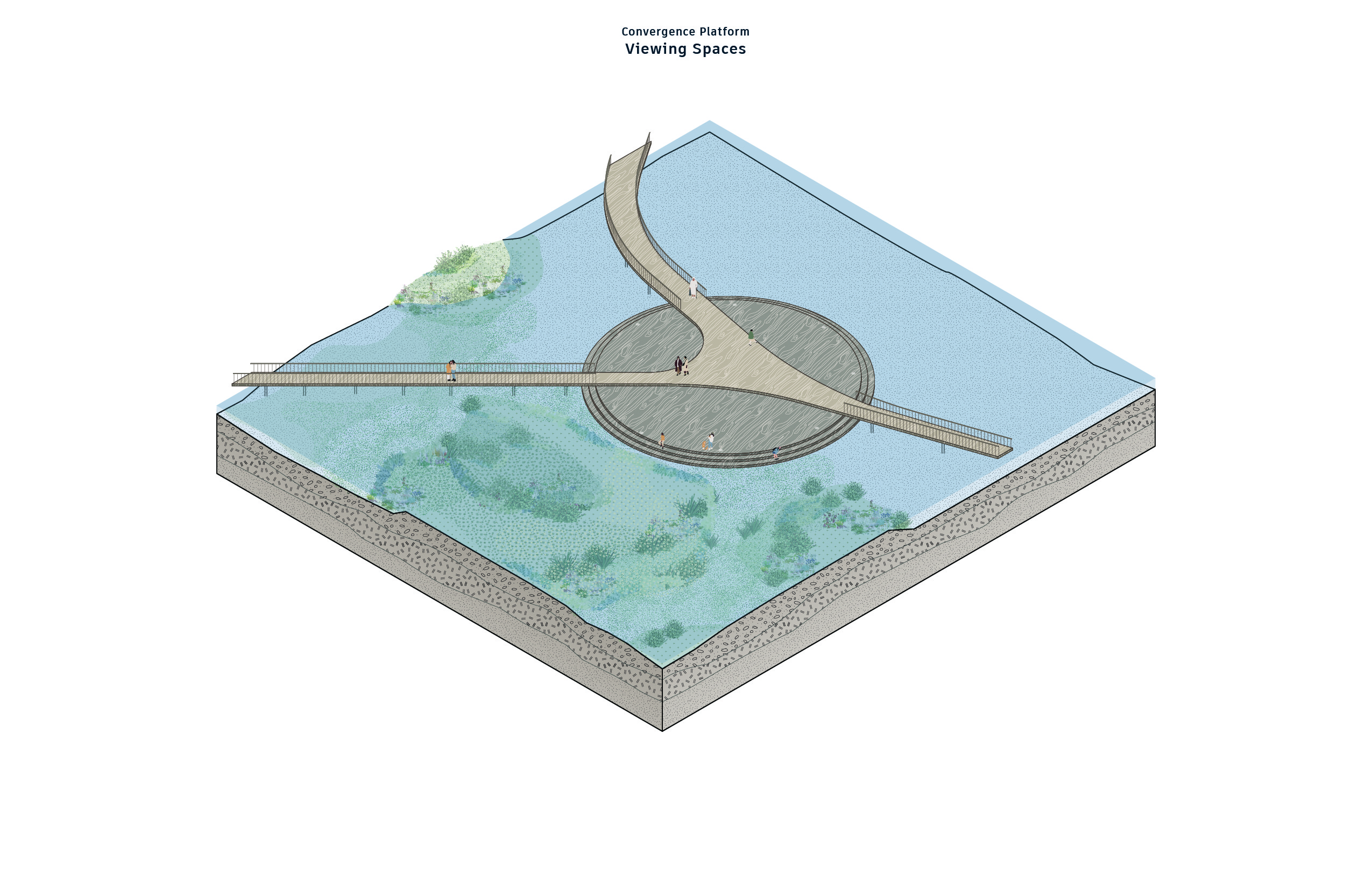
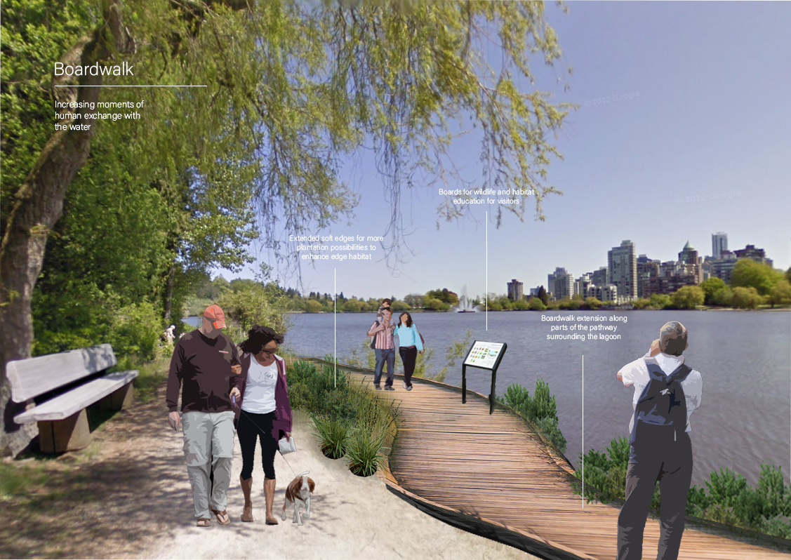
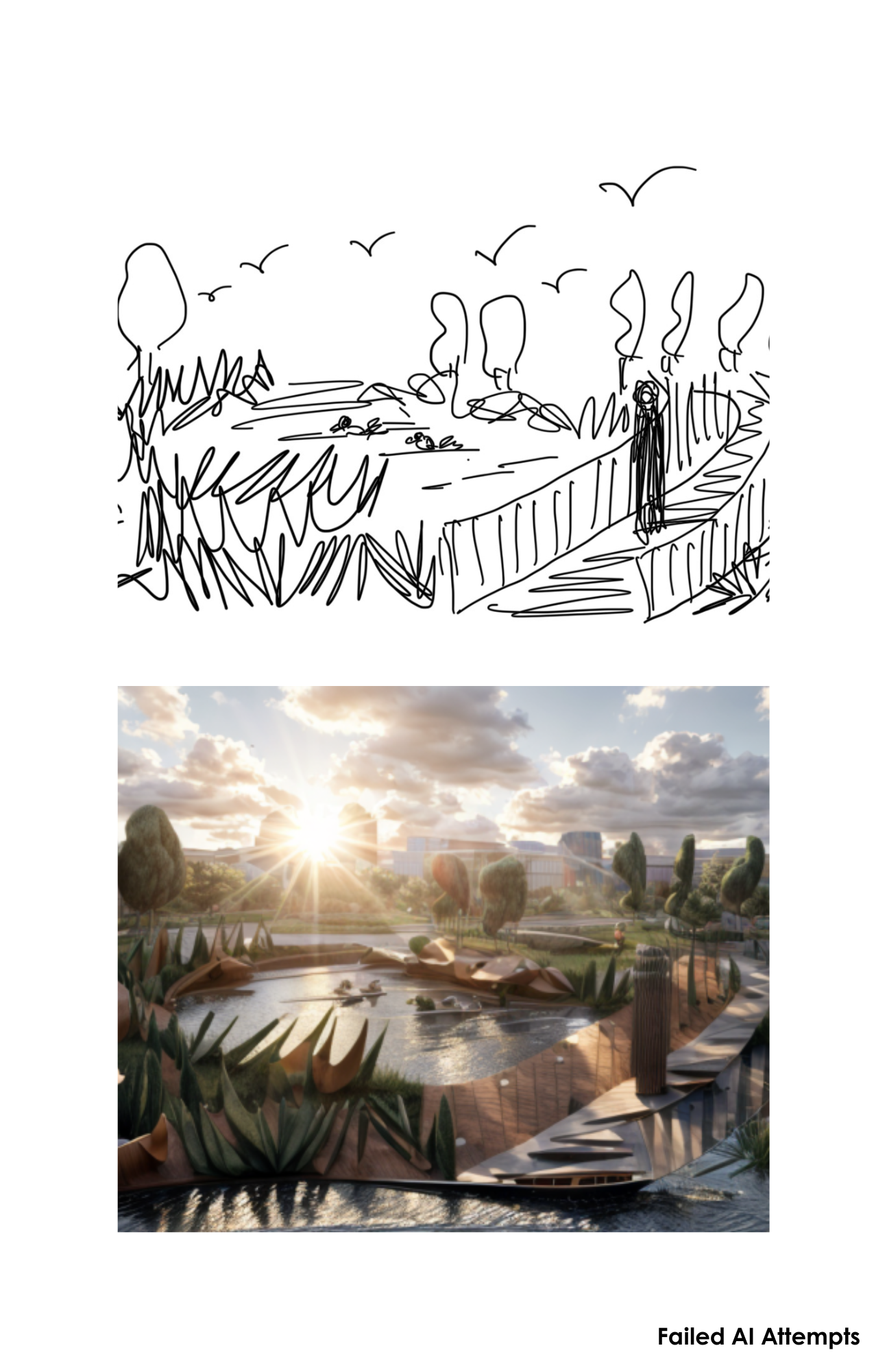
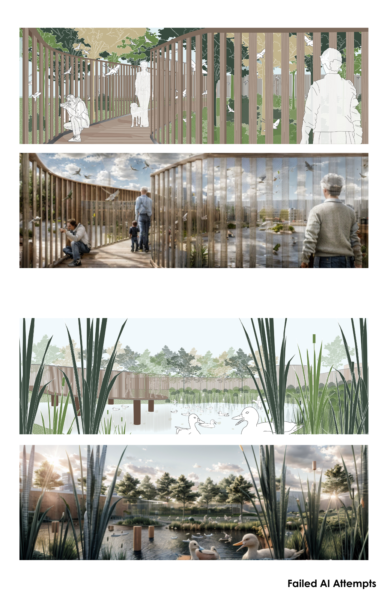
 This conceptual illustration guides us through a two-part process. In the initial phase, we engage in a sensory exploration of the environment, focusing on the auditory experience of bird calls, the tactile sensation of navigating through bushes where we can discern subtle movements of the birds, and the visual aspects of their elusive presence. The second part of the drawing introduces a visionary concept—a boardwalk equipped with bird blinds. This design aims to enhance bird habitat while fostering a harmonious connection between humans and birds. By providing a platform for observation, and exploration without disrupting the natural surroundings, the envisioned boardwalk serves as a testament to preserving and nurture the delicate balance of the avian ecosystem
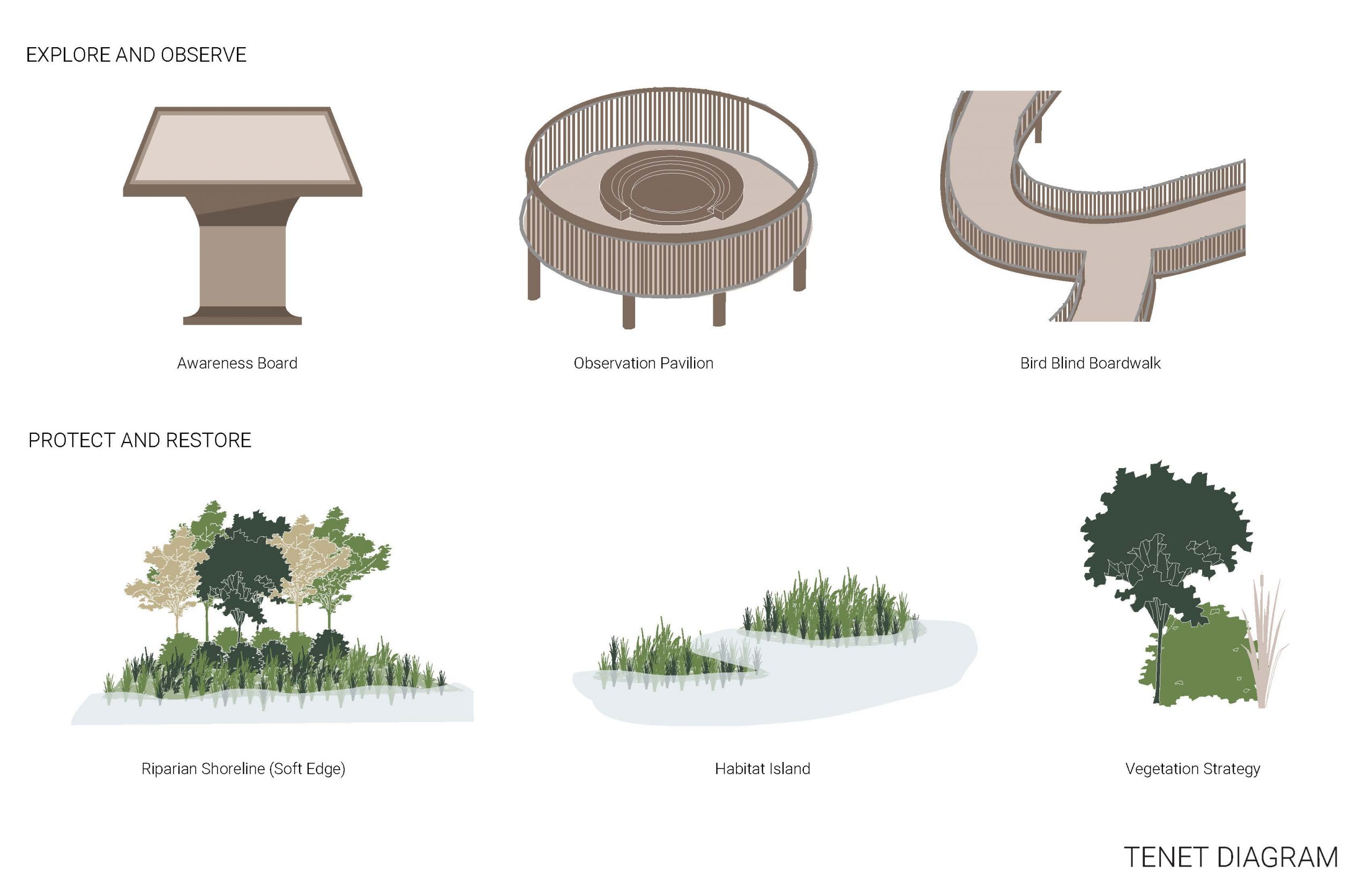 Our design principles center around the fundamental concepts of exploration and observation, as well as protection and restoration, striking a delicate balance between education and stewardship. The observation pavilion and boardwalk serve as dedicated spaces for immersing oneself in the rich tapestry of bird habitat, allowing visitors to keenly explore and observe these winged inhabitants. Complementing this experiential aspect is an education bulletin board, which imparts valuable insights into the diverse bird species populating the area.
In tandem, our design incorporates a soft shore edge, small island habitats, and a meticulous planting strategy. These natural methodologies collectively contribute to the enhancement of bird habitat while concurrently working towards bettering the current ecosystem. By seamlessly integrating exploration, education, and environmentally conscious practices, our design aspires to foster a symbiotic relationship between humans and the avian ecosystem.


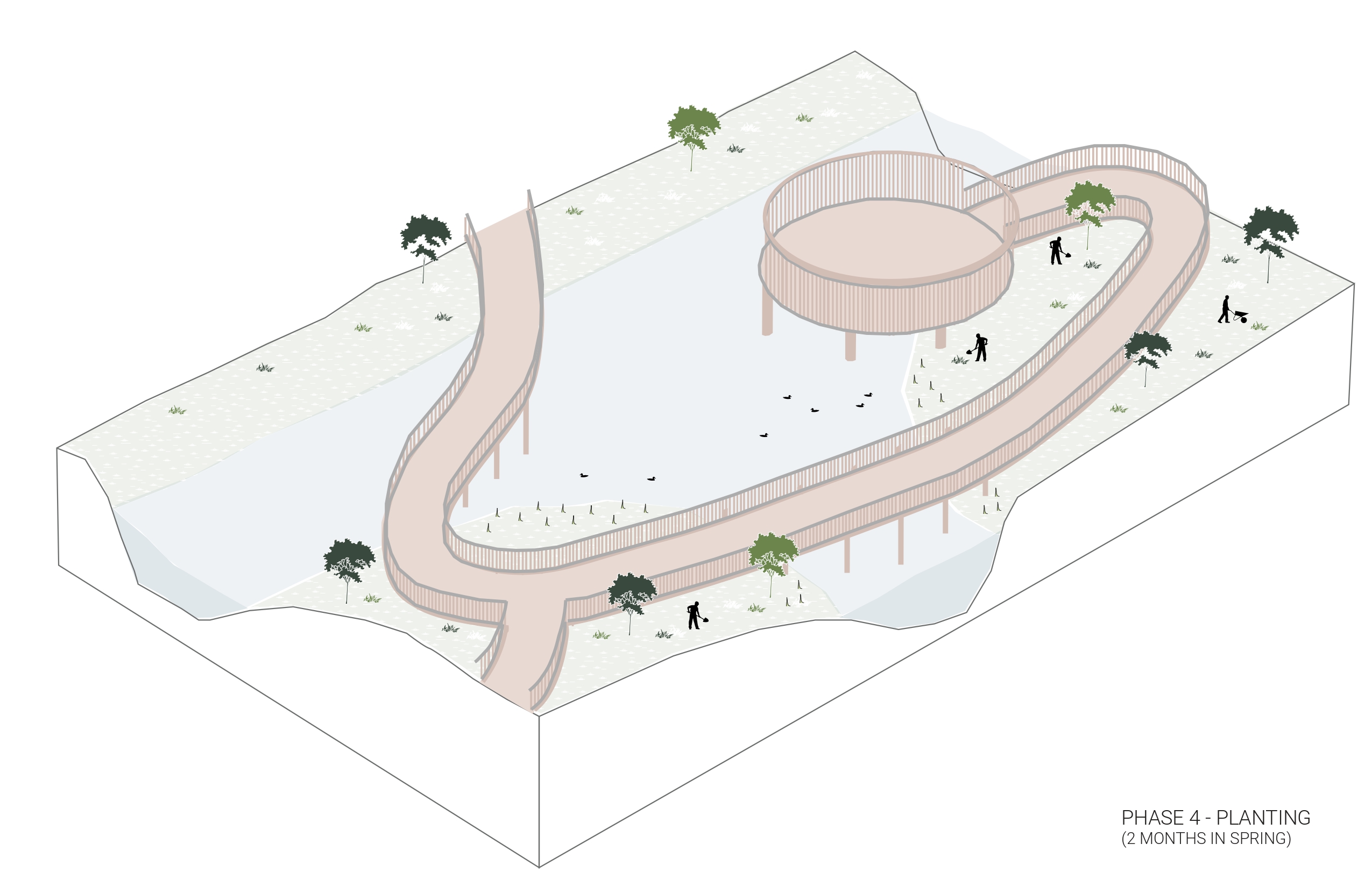
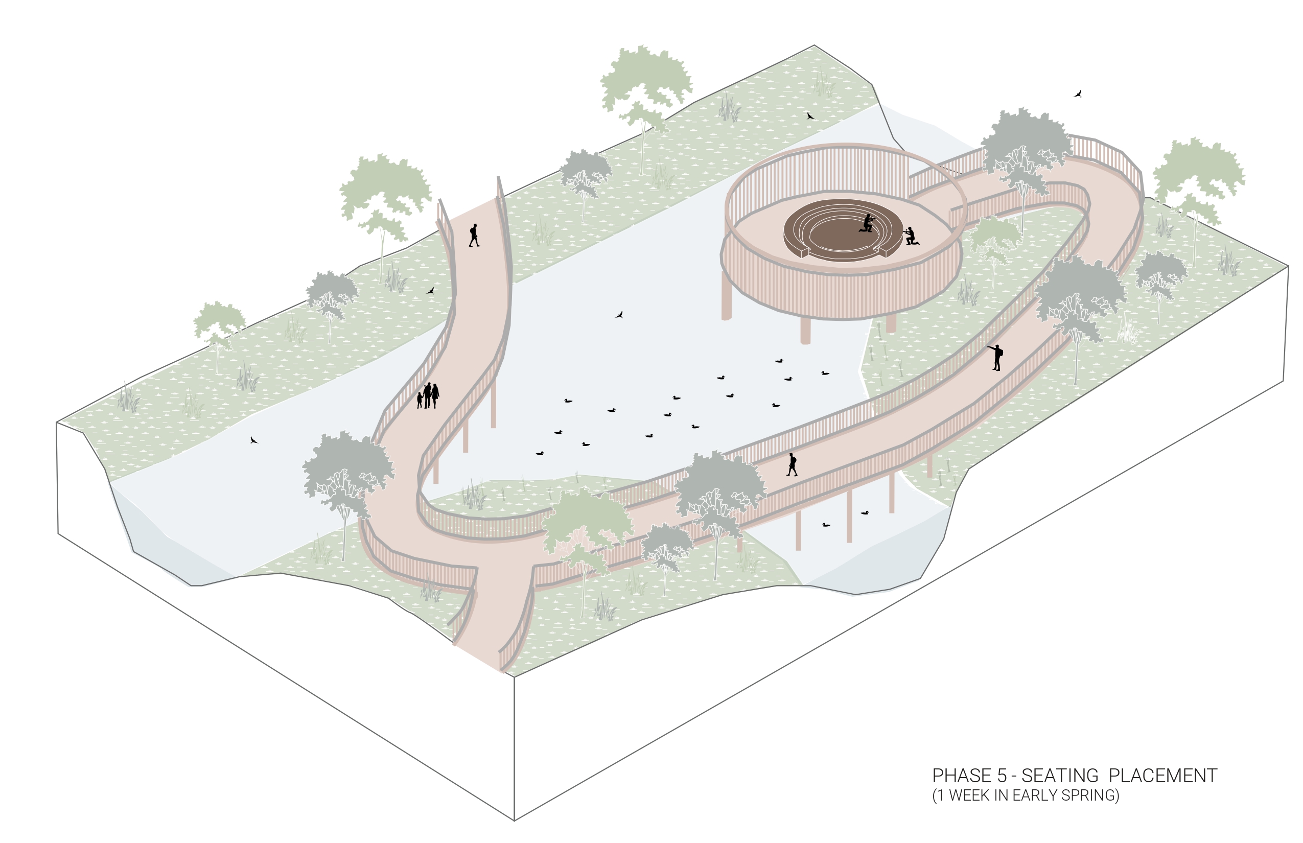
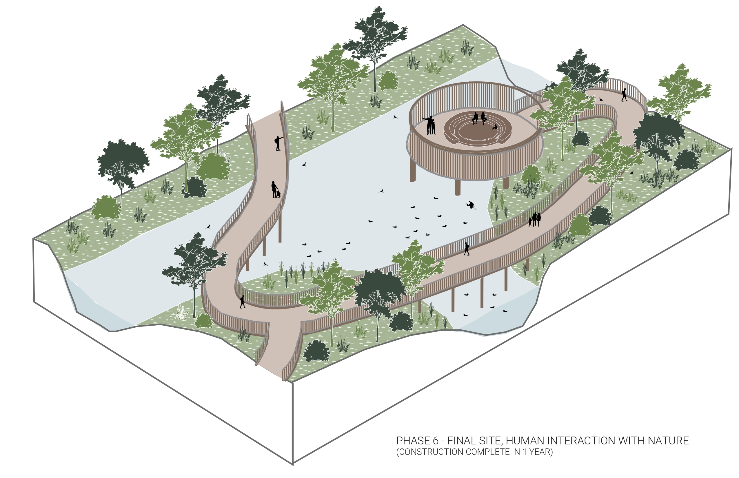


The isometric sequence unfolds the step-by-step implementation of our site design, showcasing the transformative journey towards projected habitat restoration that fosters a profound connection between humans and birds. 


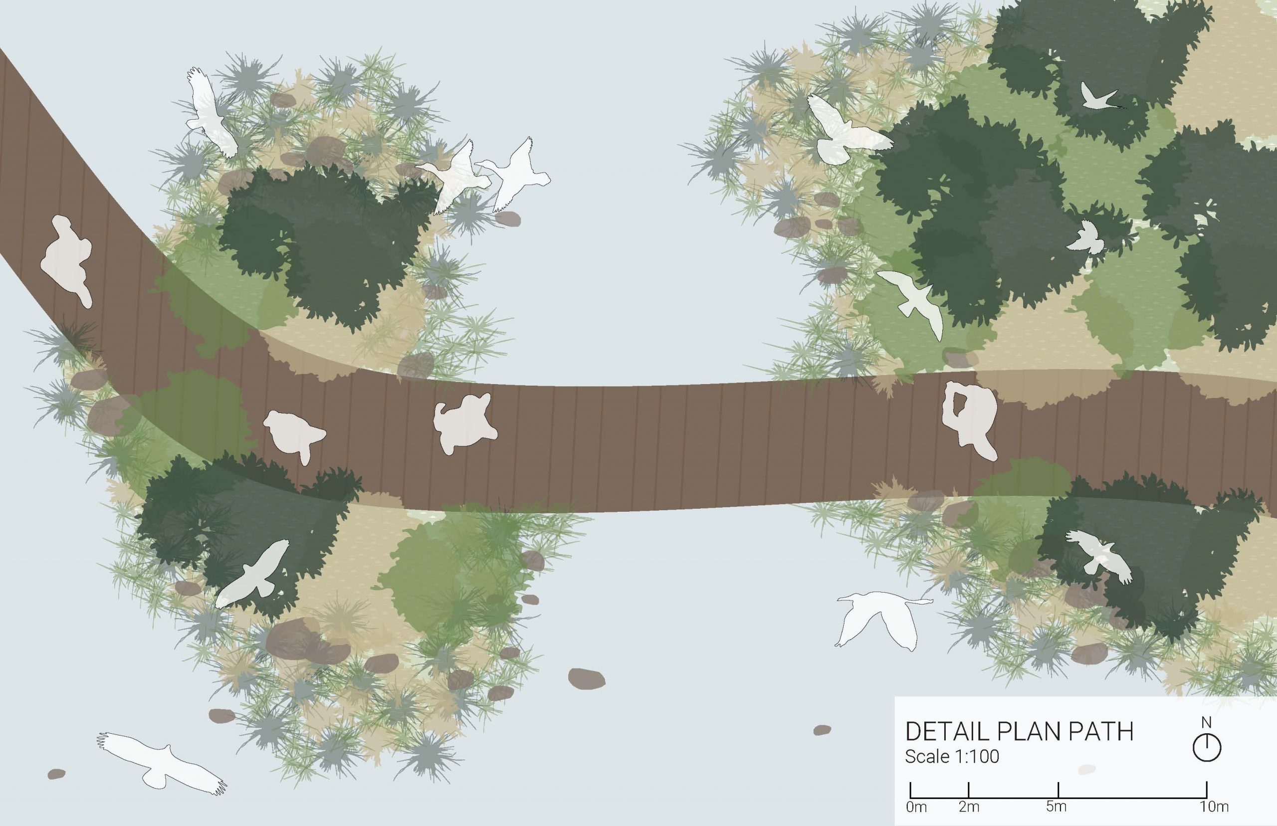
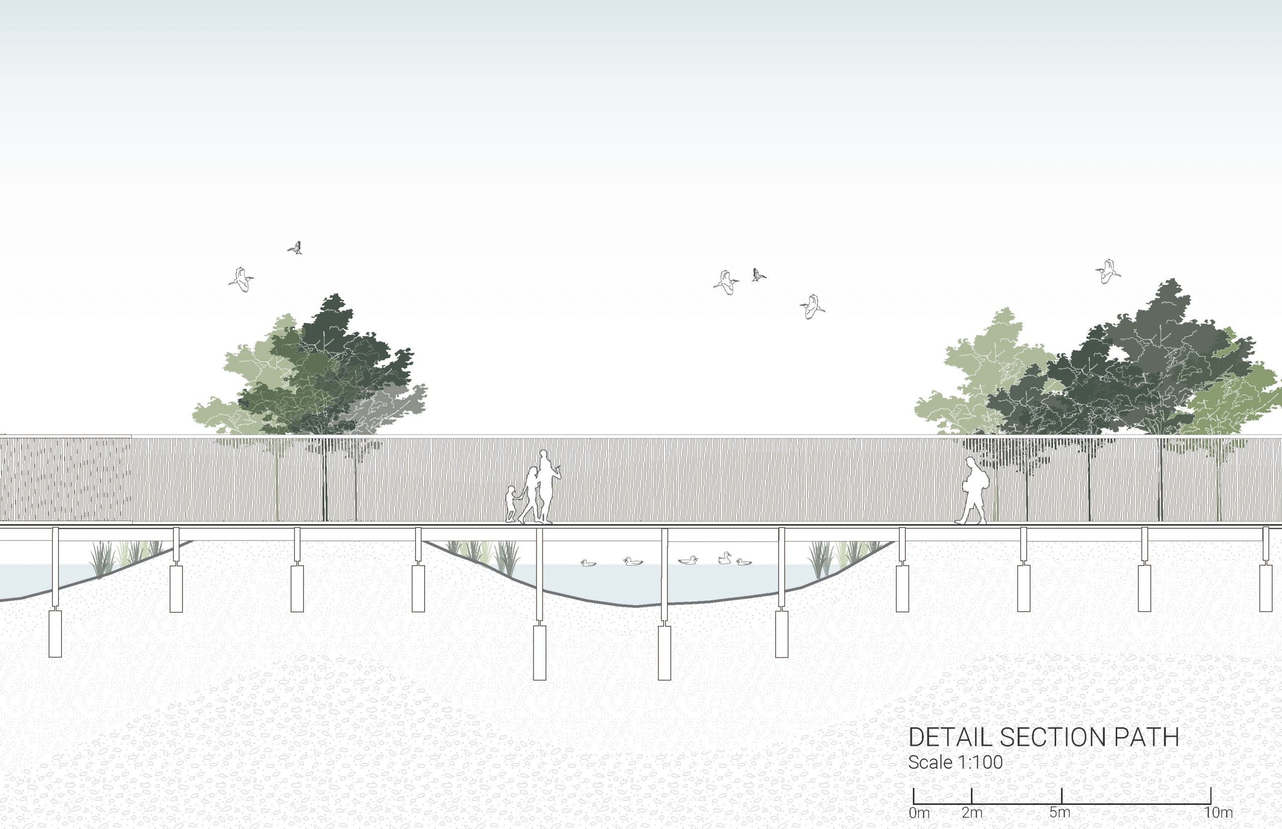
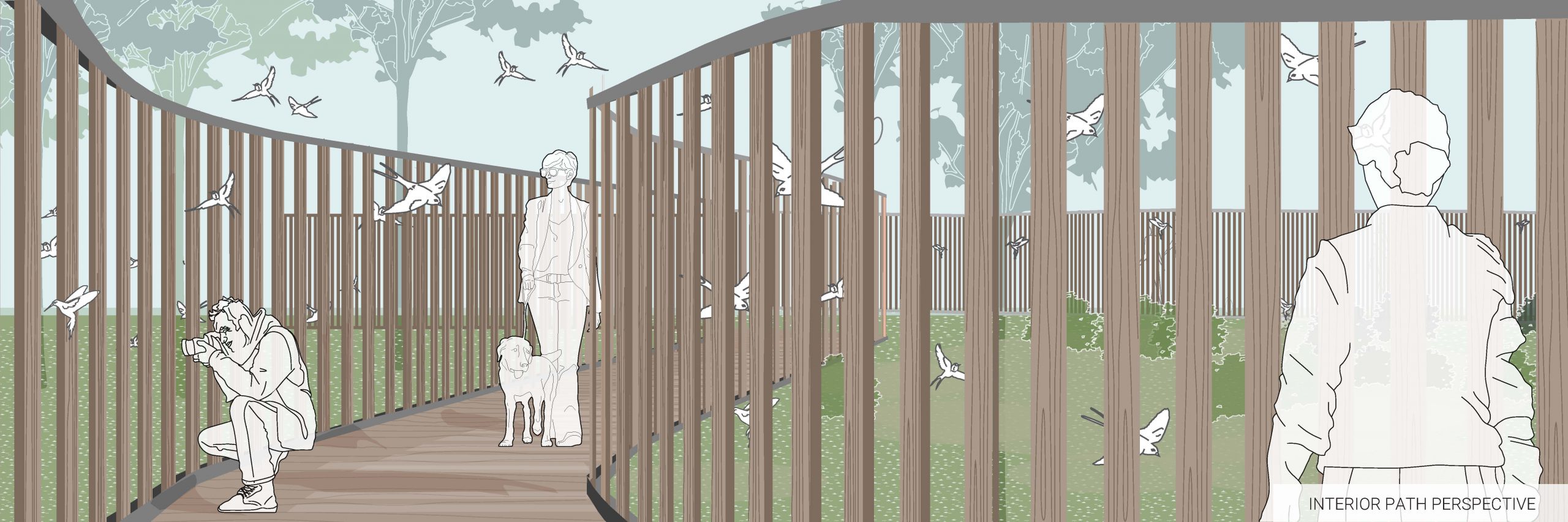
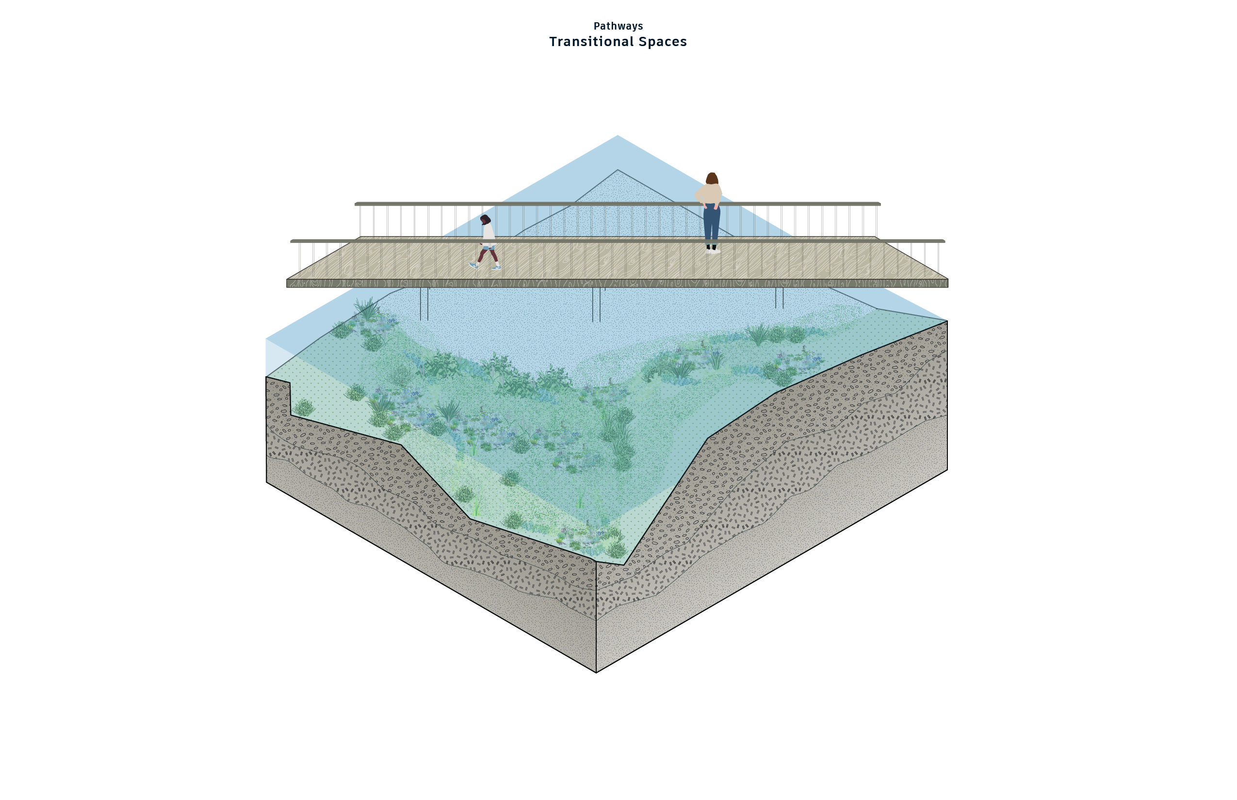
 These detailed depictions of the pathway, show both the form and construction with human usage while acting as an ideal vantage point for observing birds in their natural habitat. The composition of the bird blinds incorporates wooden blinds and steel top and bottom rails for stability.

 These detailed depictions of the pavillions show both the form and construction while acting as an ideal vantage point for observing birds in their natural habitat. The construction methods applied within the pavilion are the same as those applied through the pathways and through the incorporation of wooden blinds and steel top and bottom rails for stability.

Assignment 6 – Alyssa Cheung, Hedric Bernardino, Miucci Yung


GIF: Please wait for 10 seconds

Progress Work


A3. Makena Smith


Assignment 5: Case Study Part I – Tatiana Babini, Edita Martina Hruskovec, Nishi Praveen Kumar
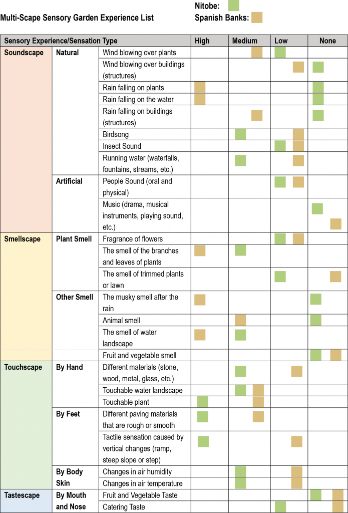
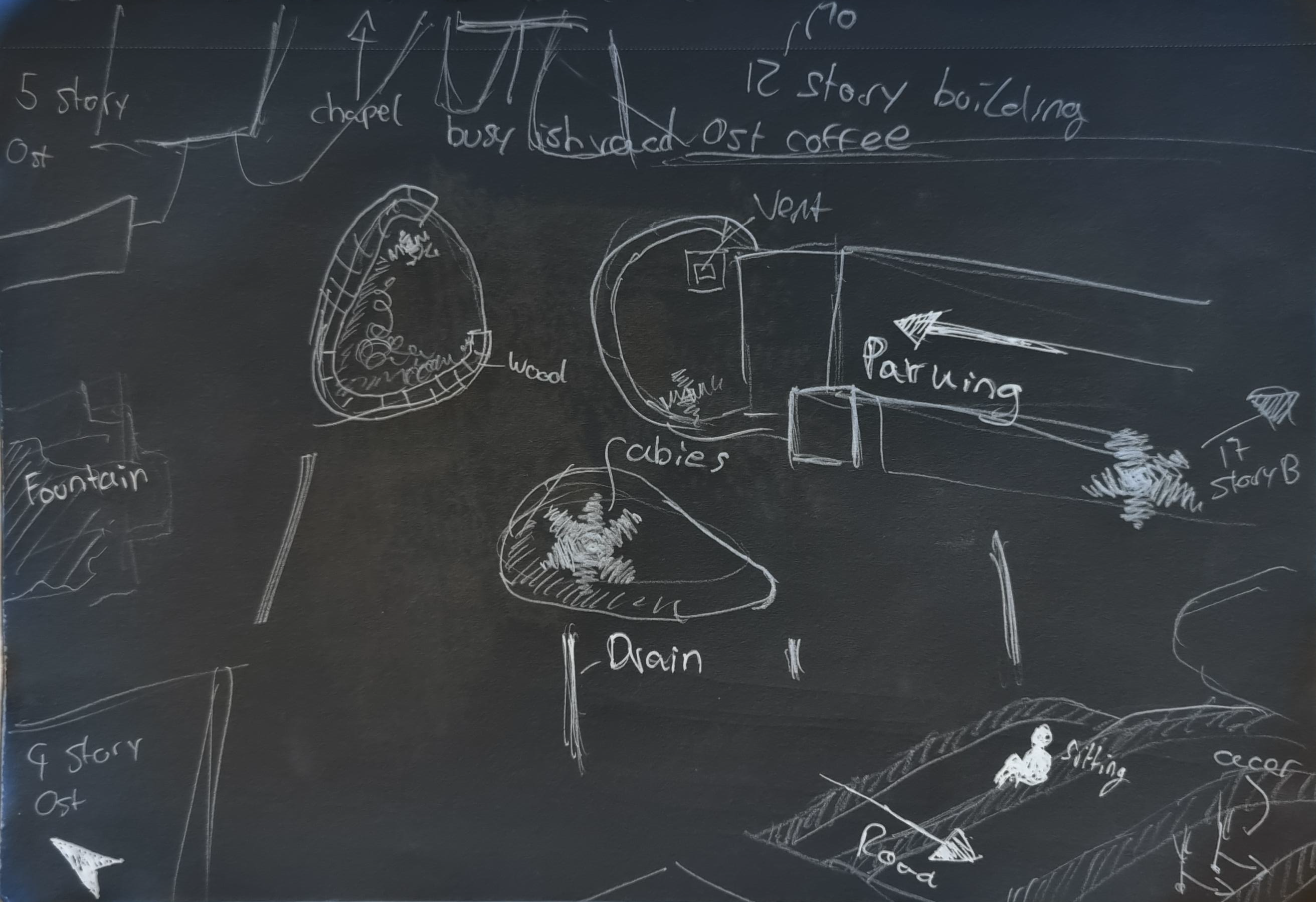
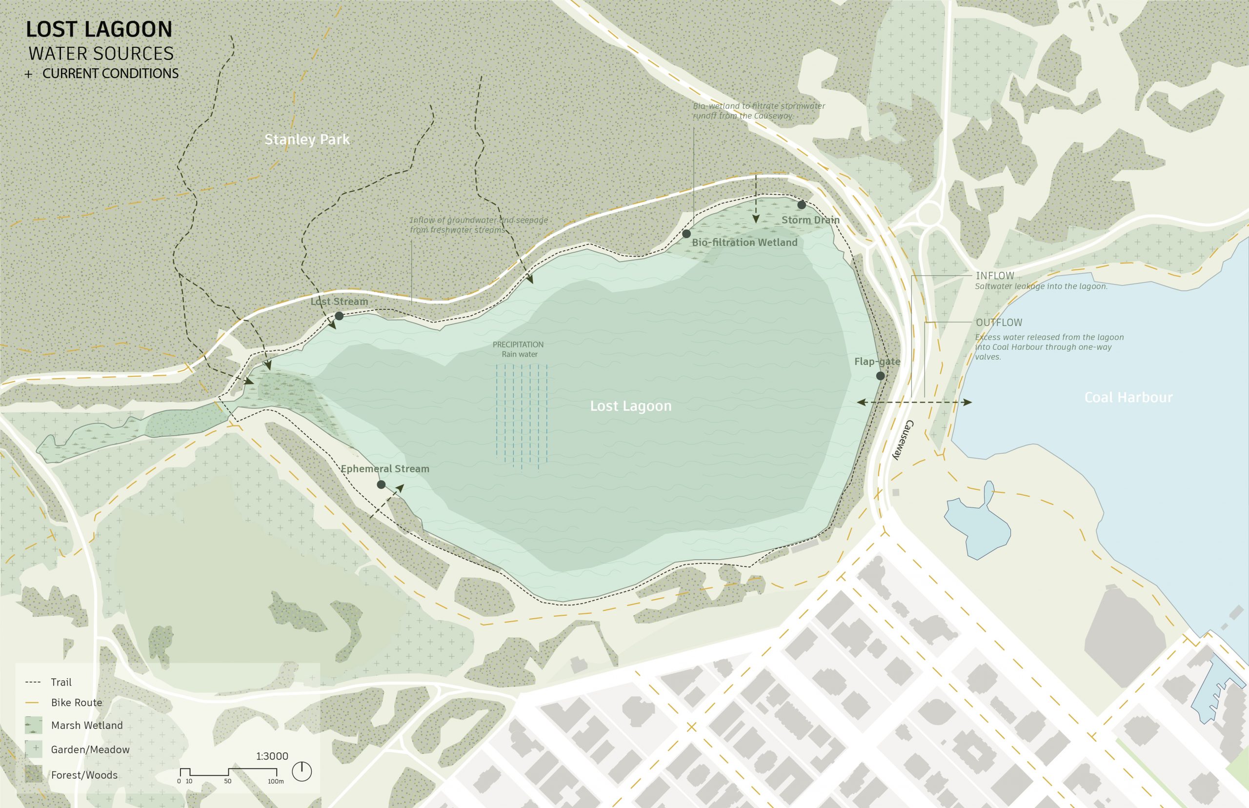
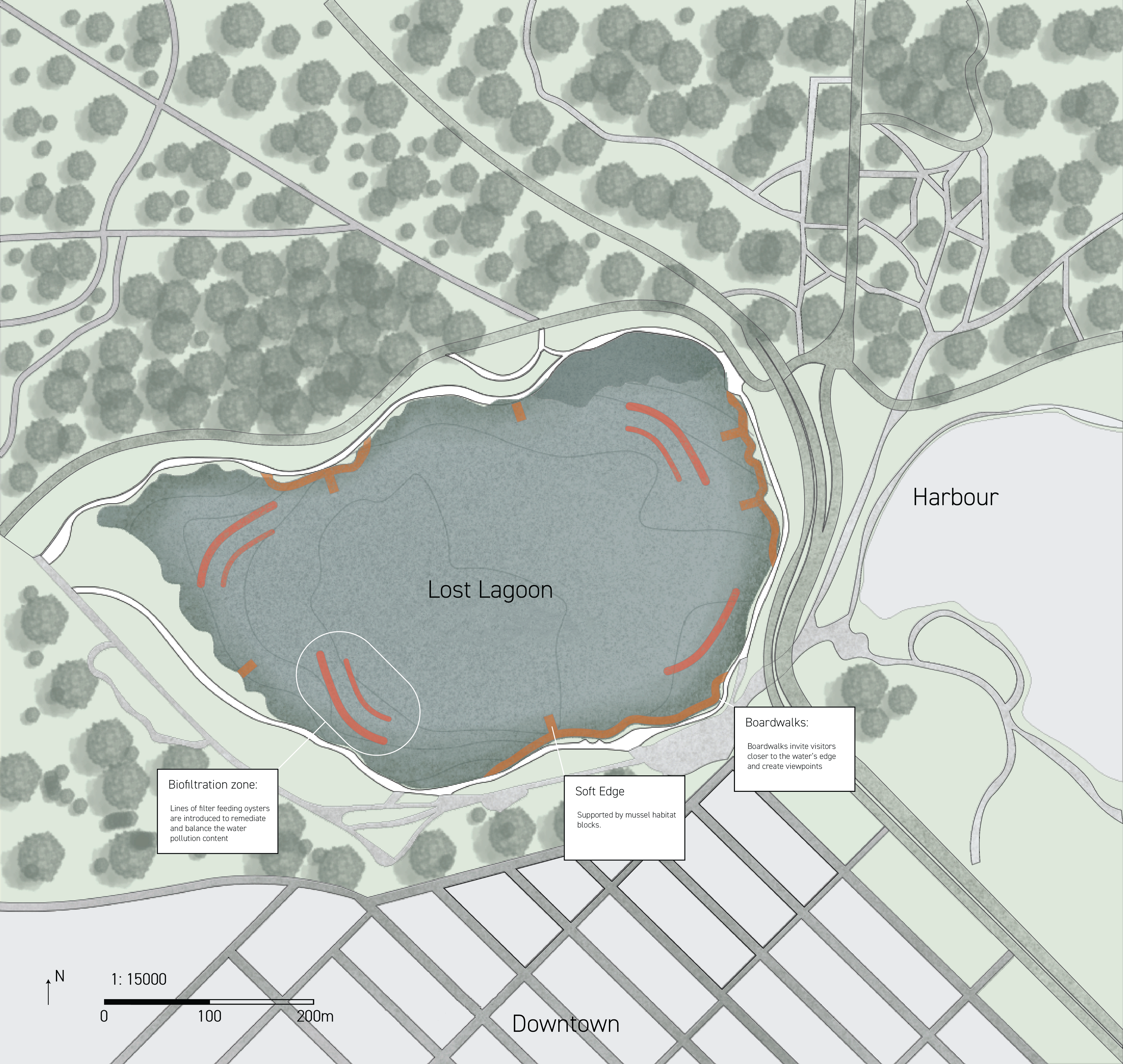
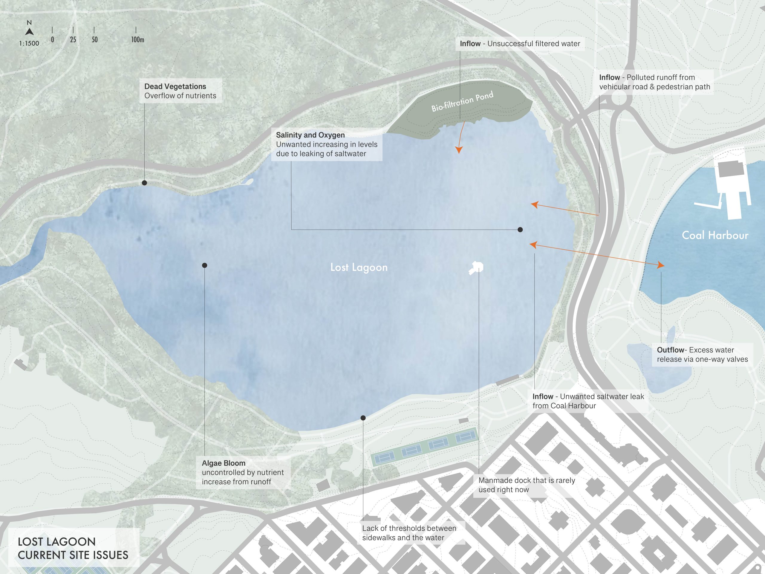
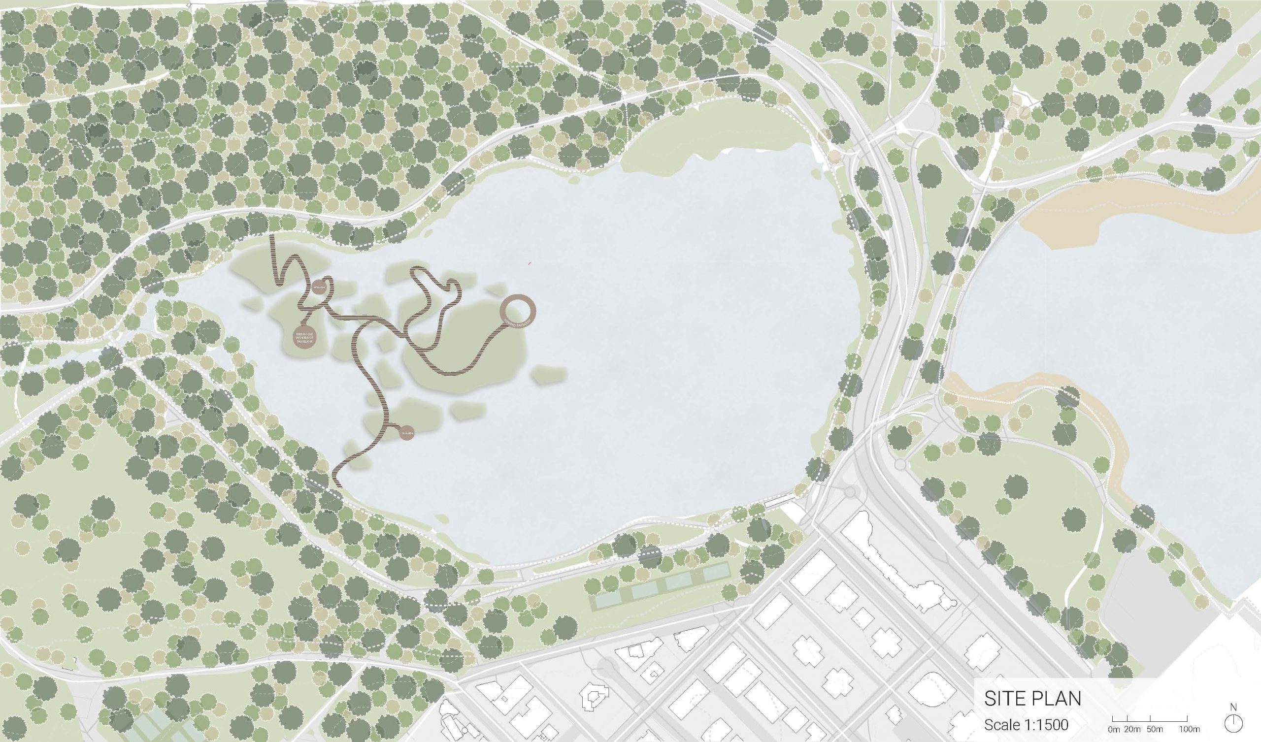
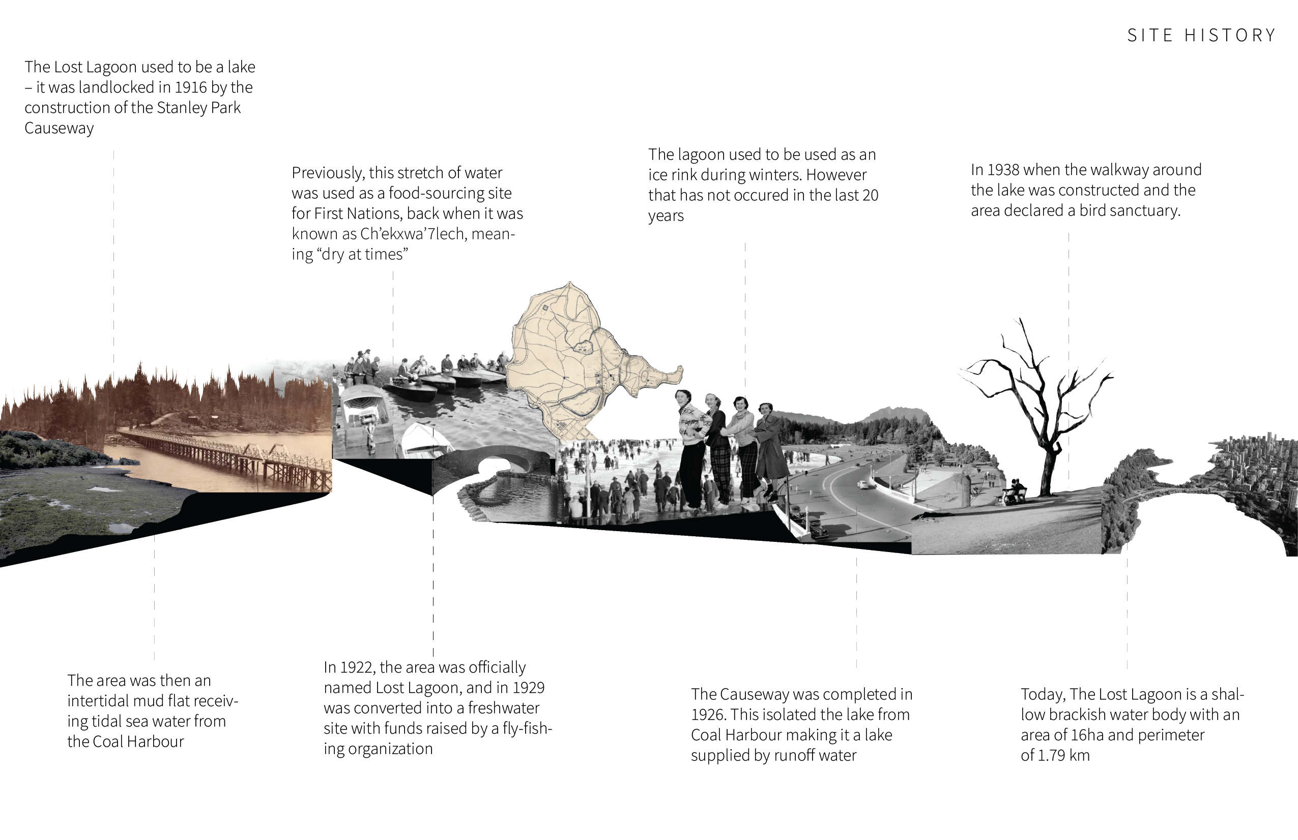
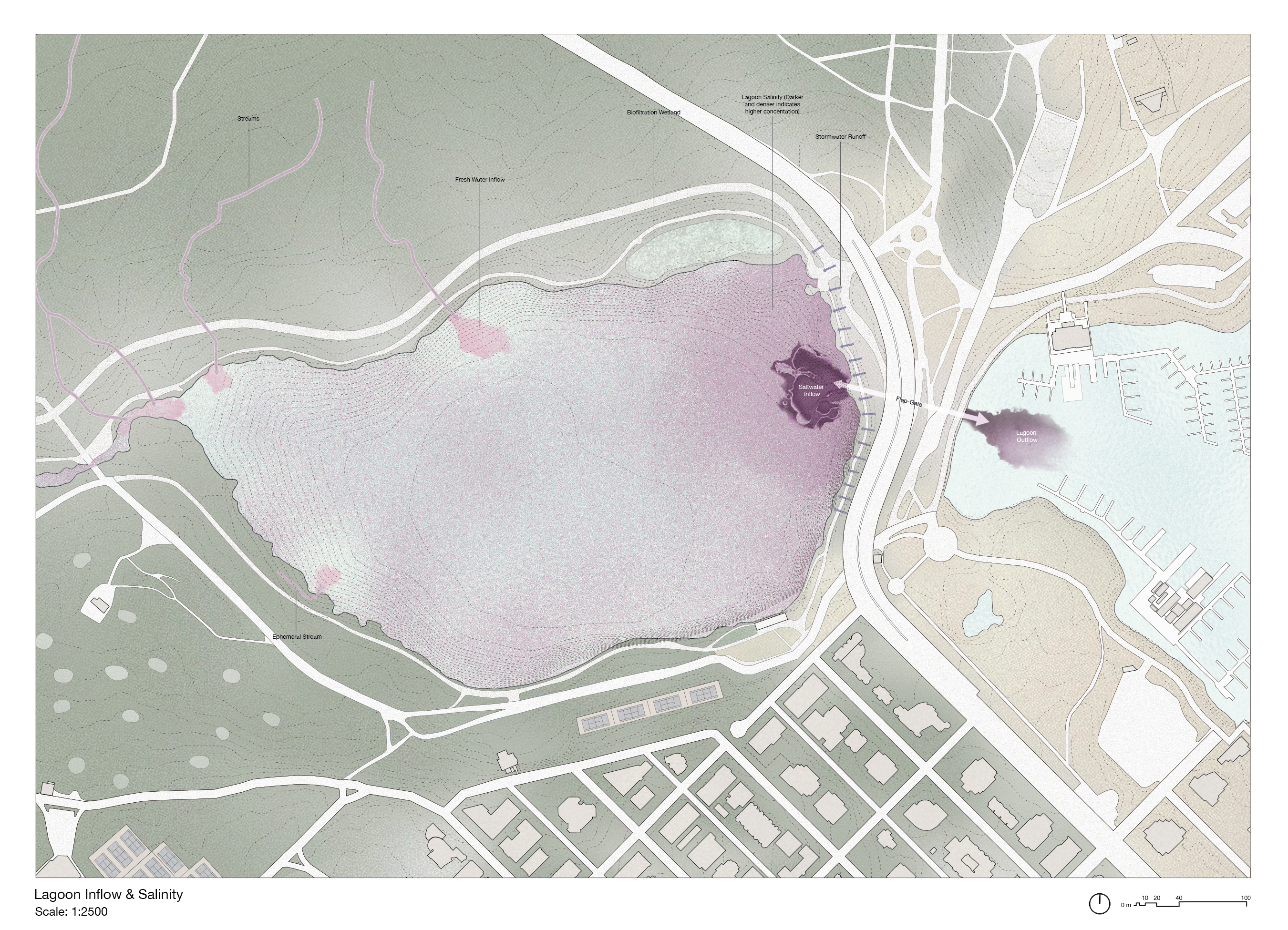
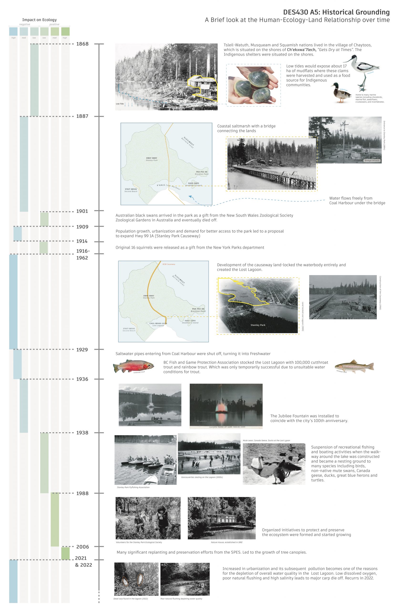
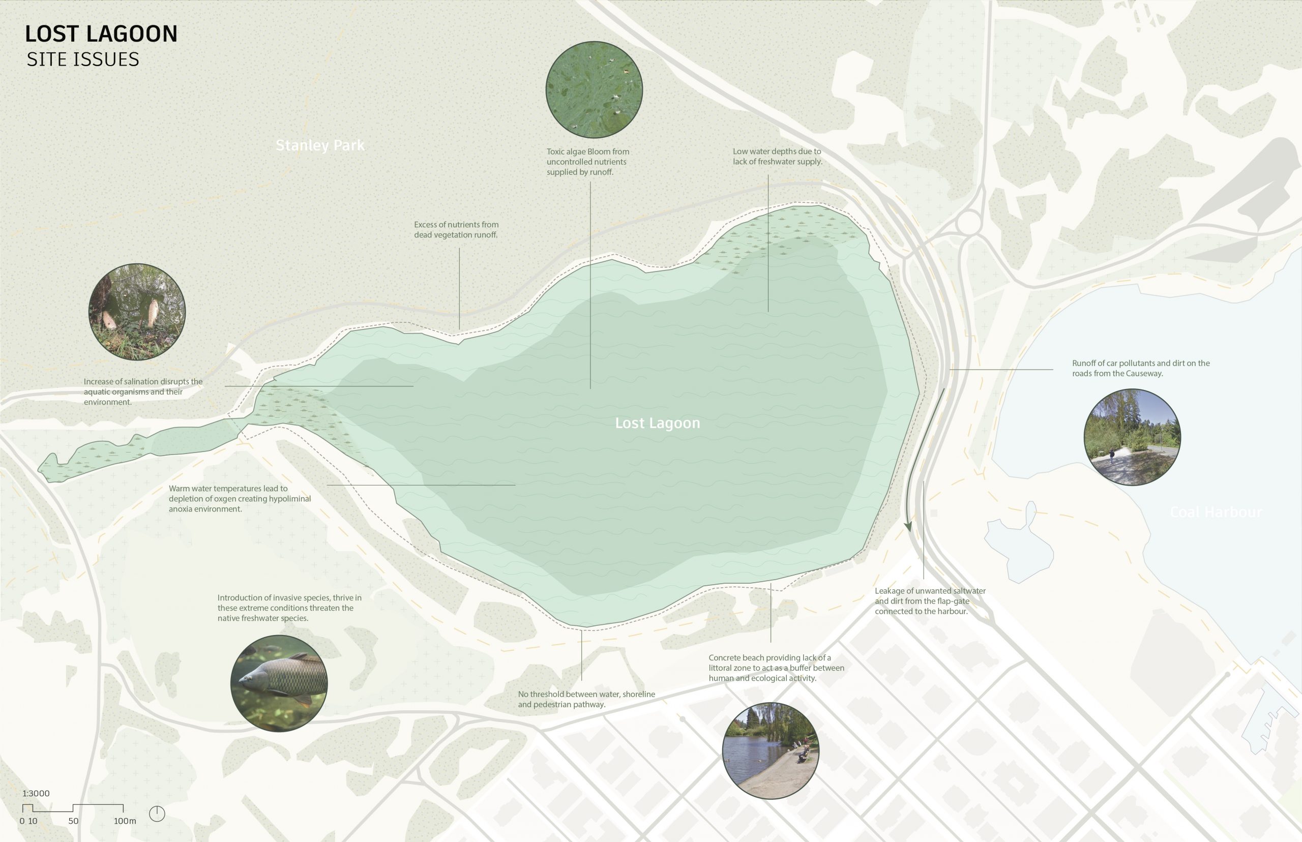
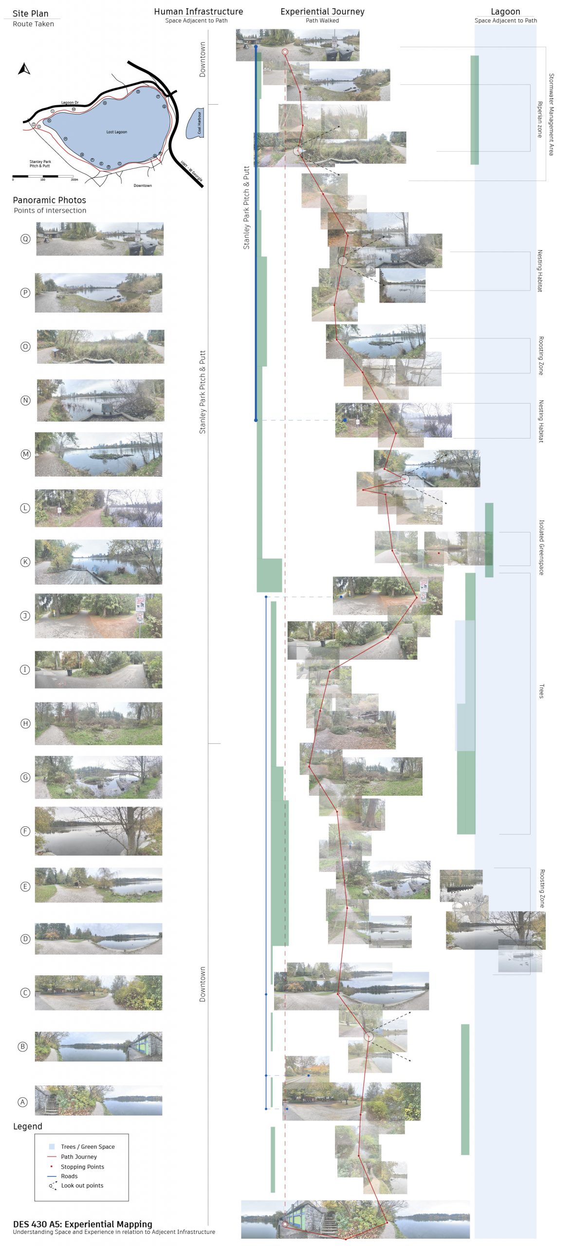
The site plan encapsulates the present state of affairs, delineating urbanized land, forested areas, streams converging into Lost Lagoon, the prominent causeway, noise pollution sources, and the intricate network of human circulation pathways—both pedestrian and vehicular. Each element intricately influences the edge conditions, shaping the living space for various species. Urban encroachment and land use directly impact biodiversity, altering the delicate balance of ecosystems. The water dynamics, with streams feeding into Lost Lagoon, play a pivotal role in sustaining aquatic life. Noise pollution poses a threat to the acoustic environment, impacting wildlife behavior. Human circulation patterns, on foot and by vehicle, introduce disturbances to the natural landscape. The marsh conditions, susceptible to alterations, further underscore the interconnected relationship between the diverse elements, highlighting the delicate coexistence of urban infrastructure and the ecological integrity of Lost Lagoon.
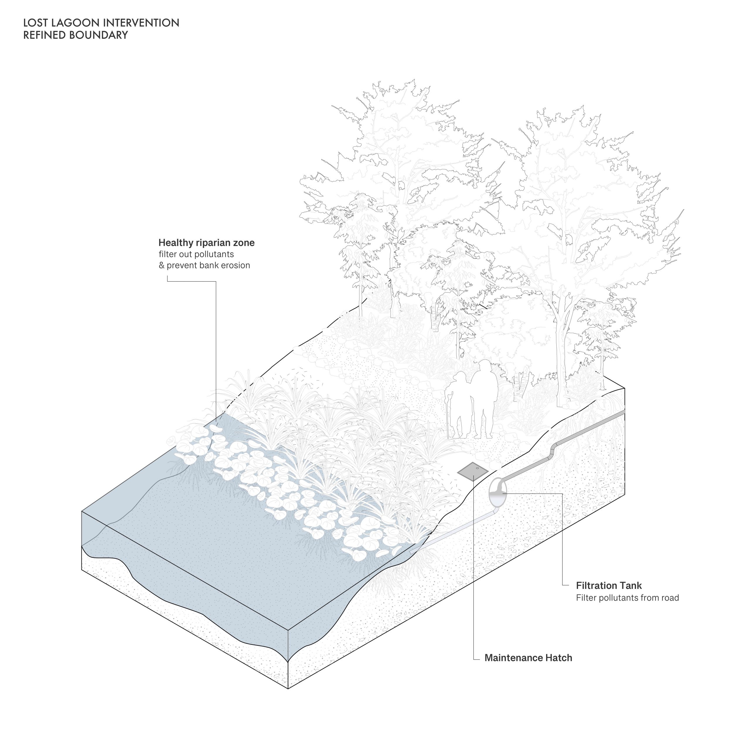
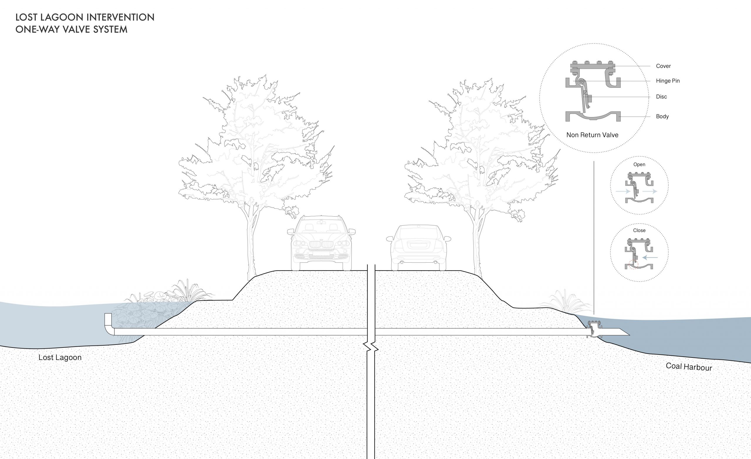
This analysis emphasizes key site observations that distinguish instances of current edge condition failure versus the habitat restoration efforts.
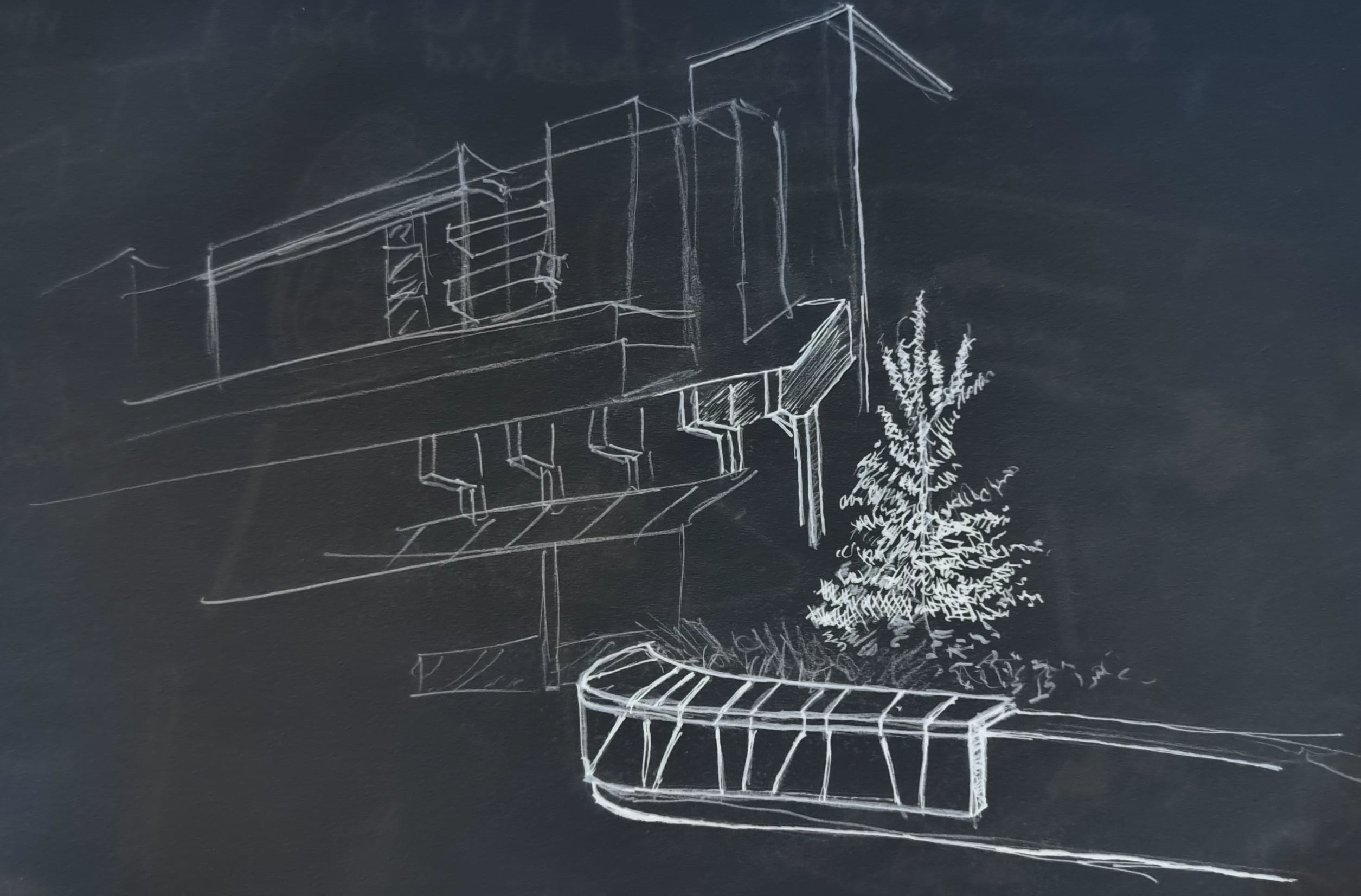
This analysis through charcoal rubbing discerns textures associated with both natural forces and human-built elements present on the site while capturing the nuanced surfaces and edge conditions, documenting their imprints within the landscape.

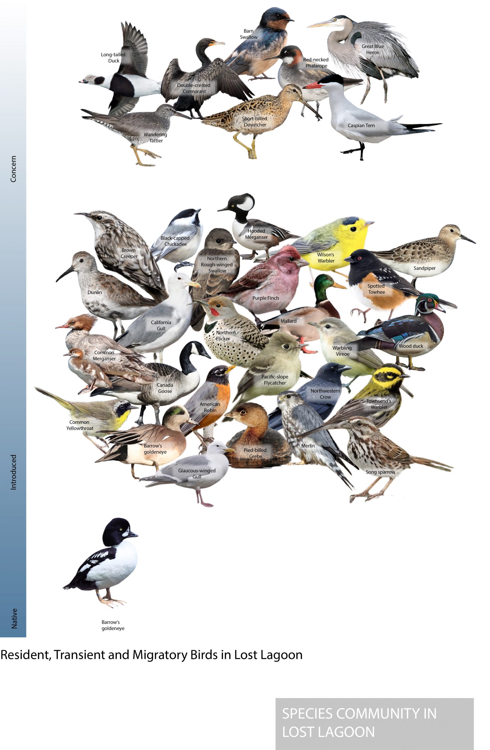

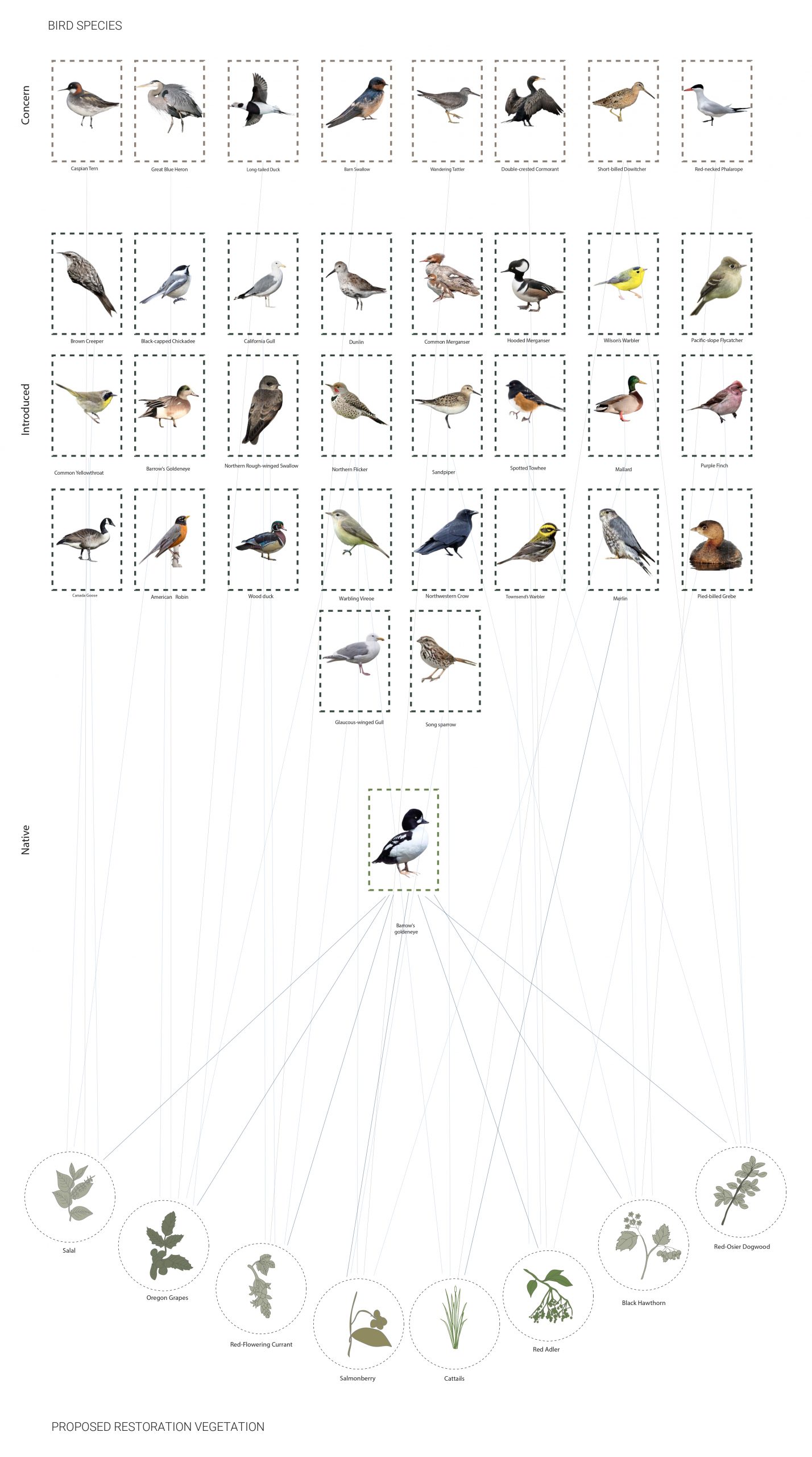
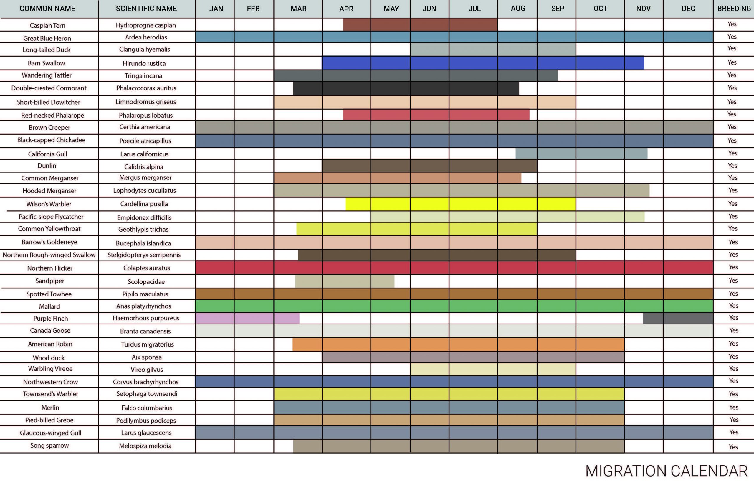
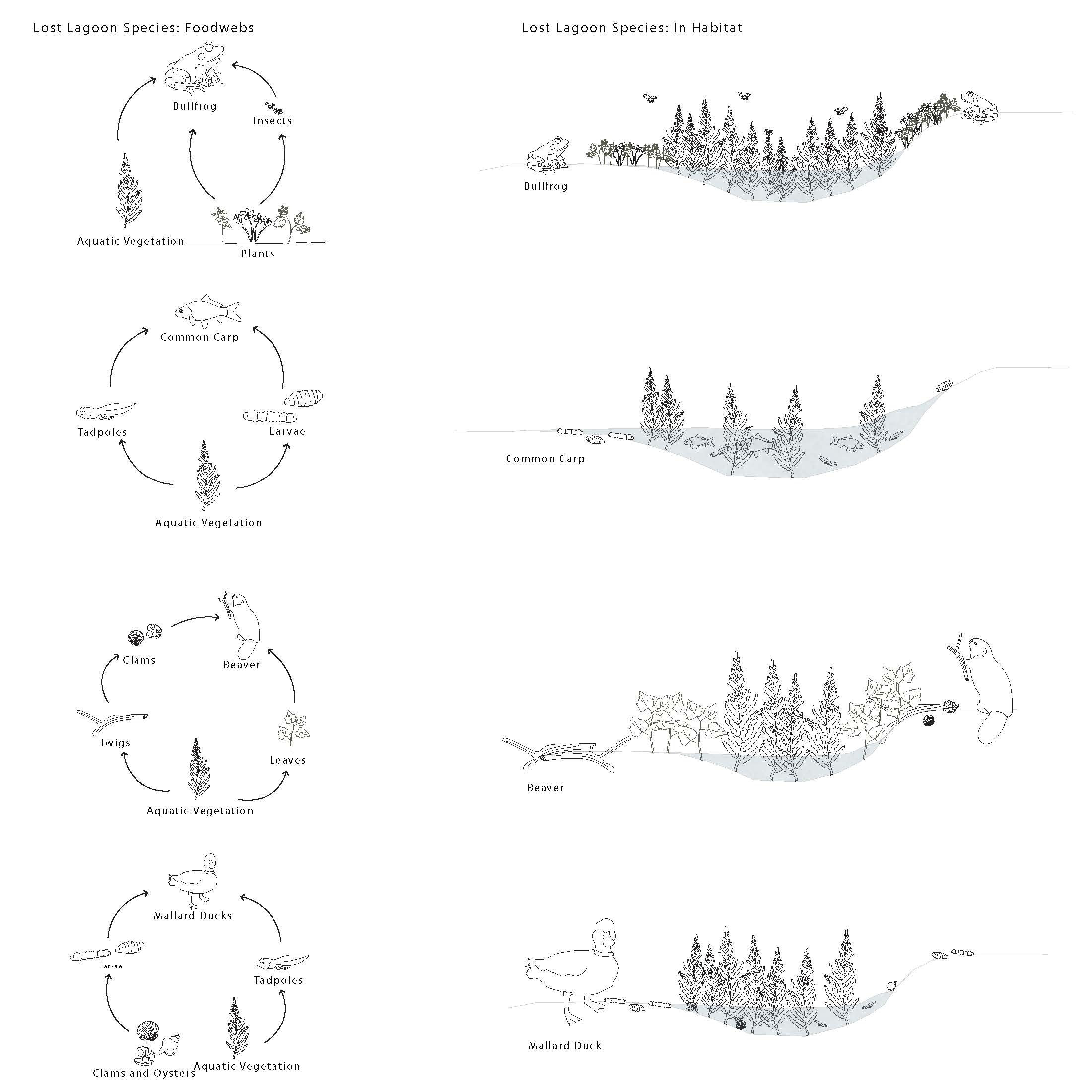
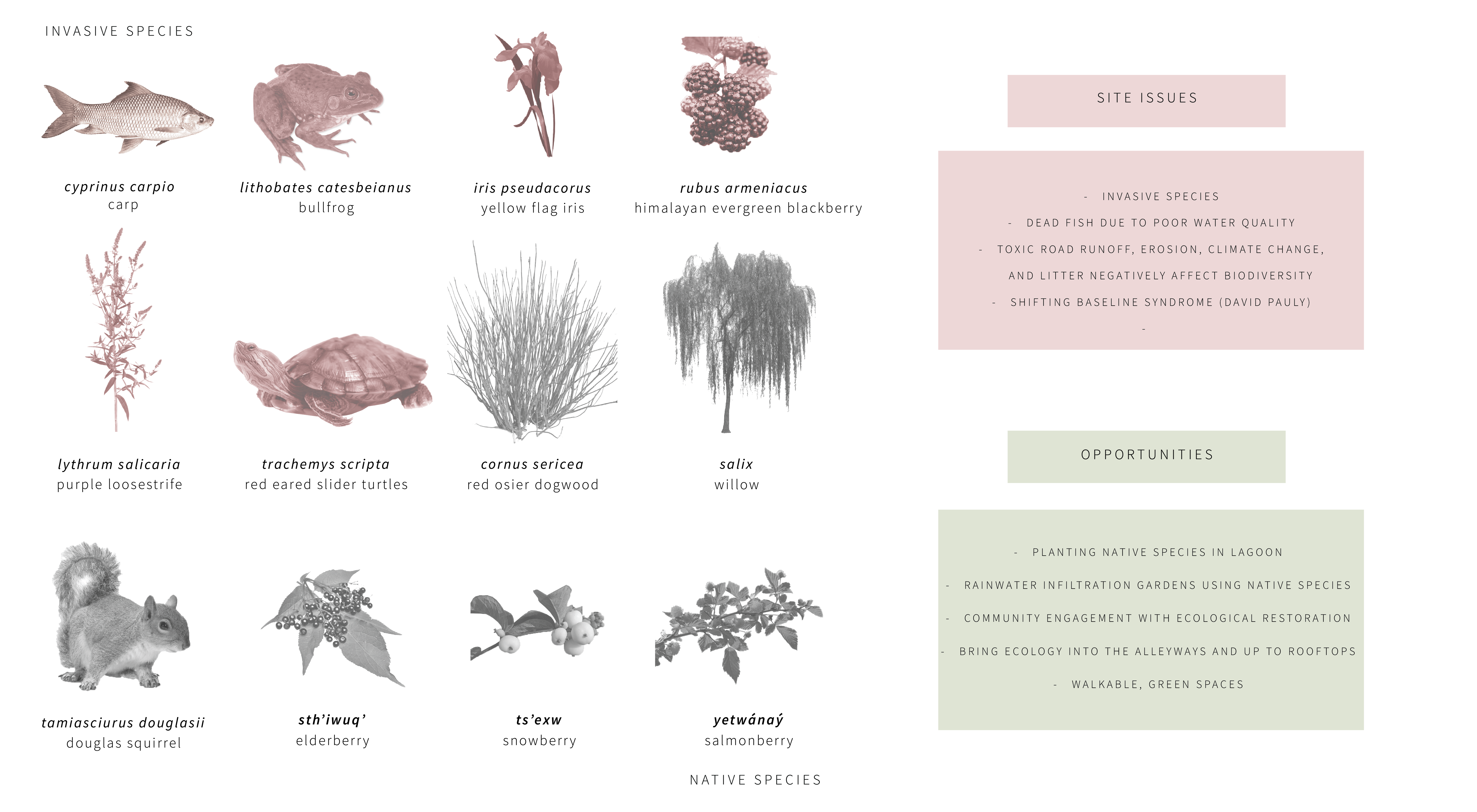
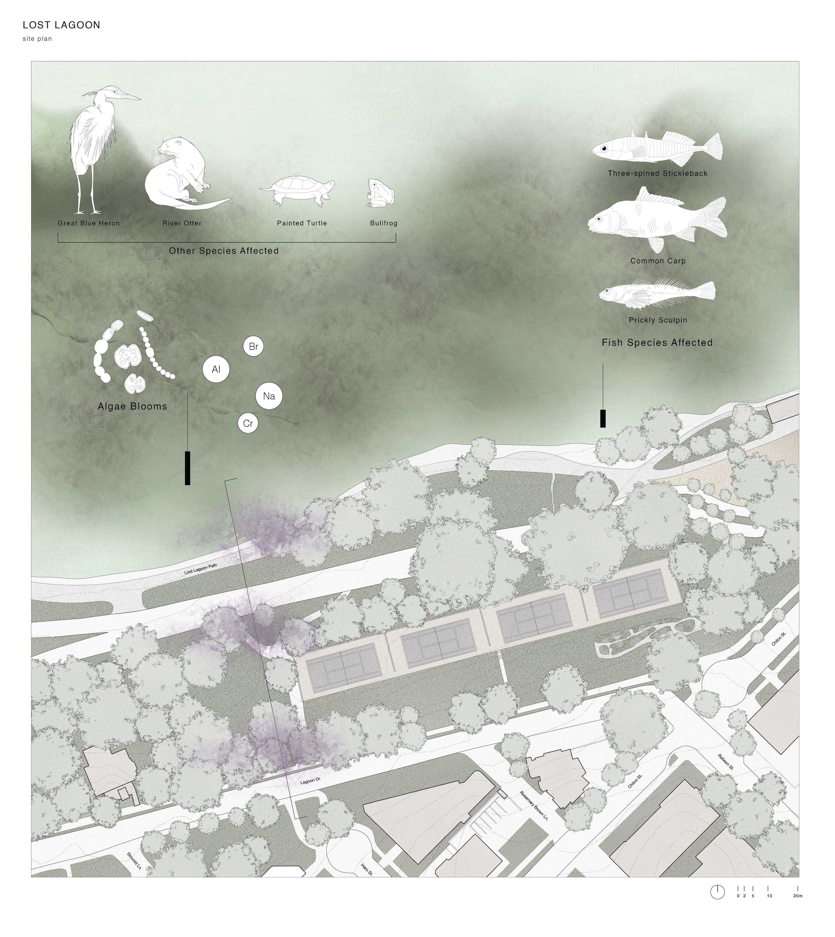
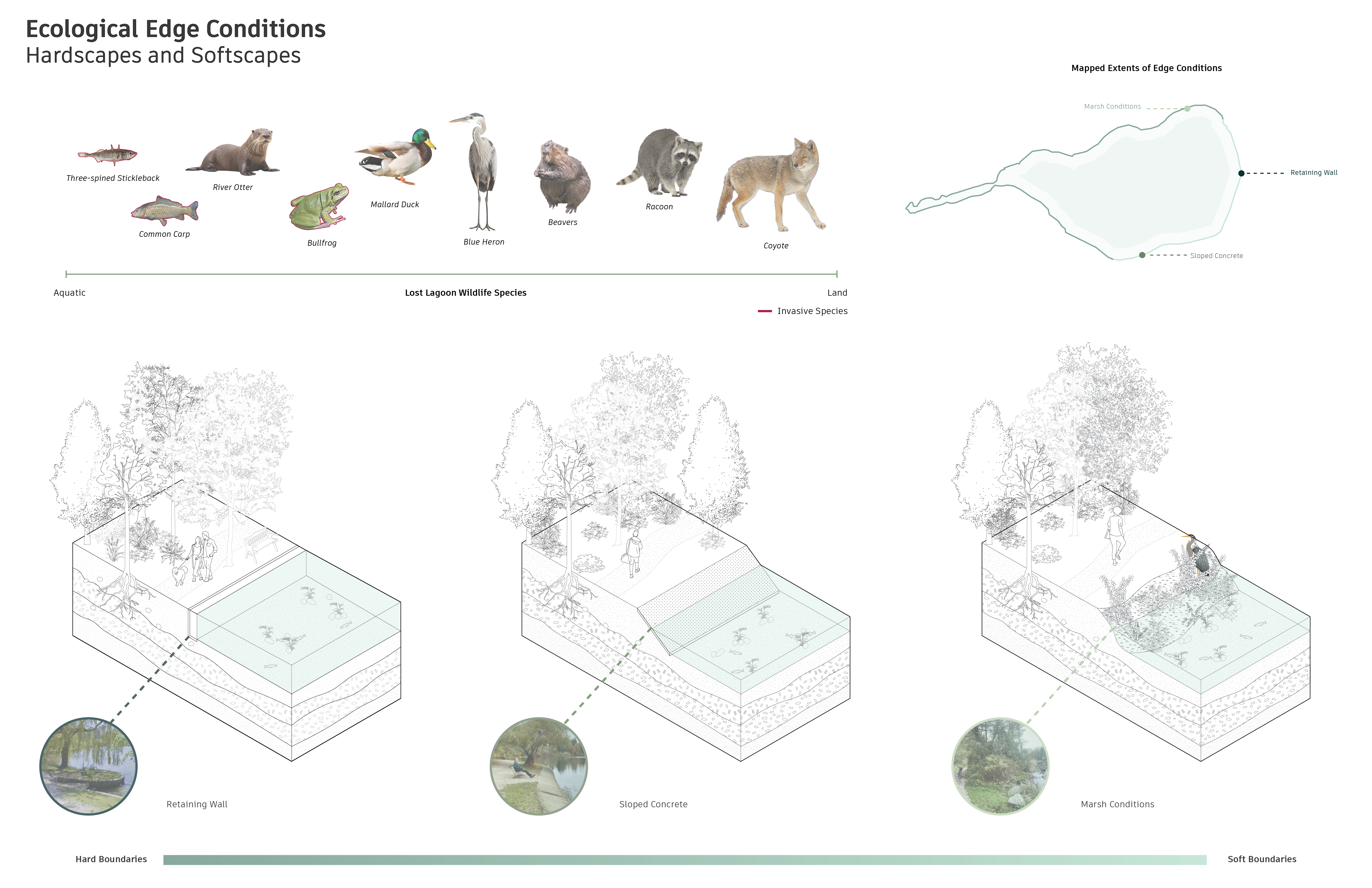
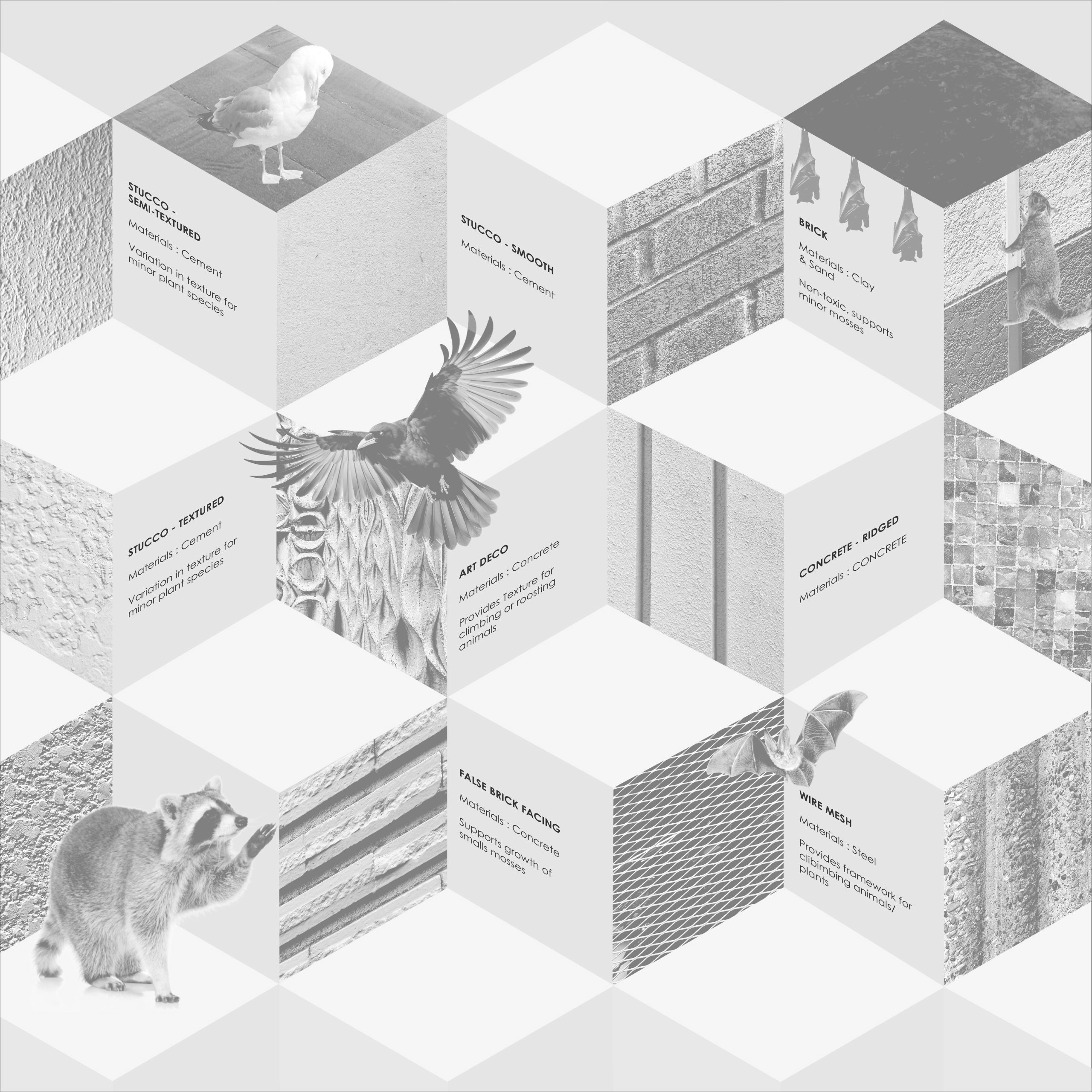
These diagrams show the species community observed, introduced, and threatened at lost lagoon
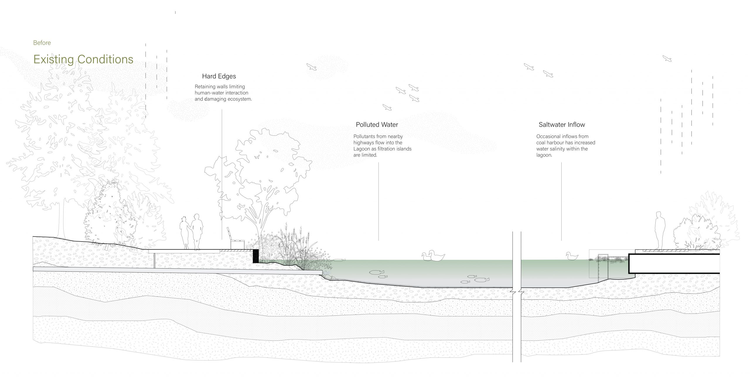
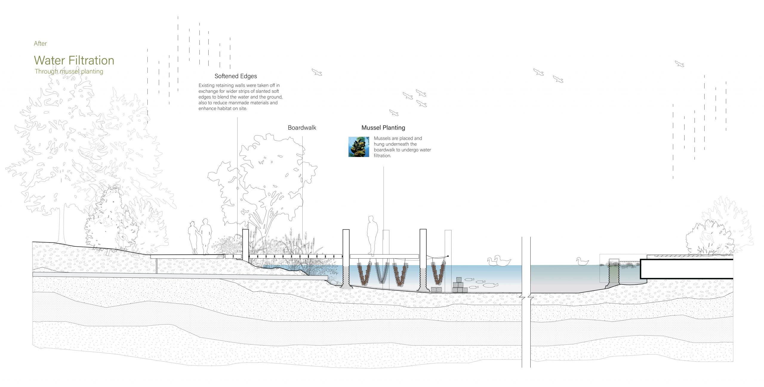
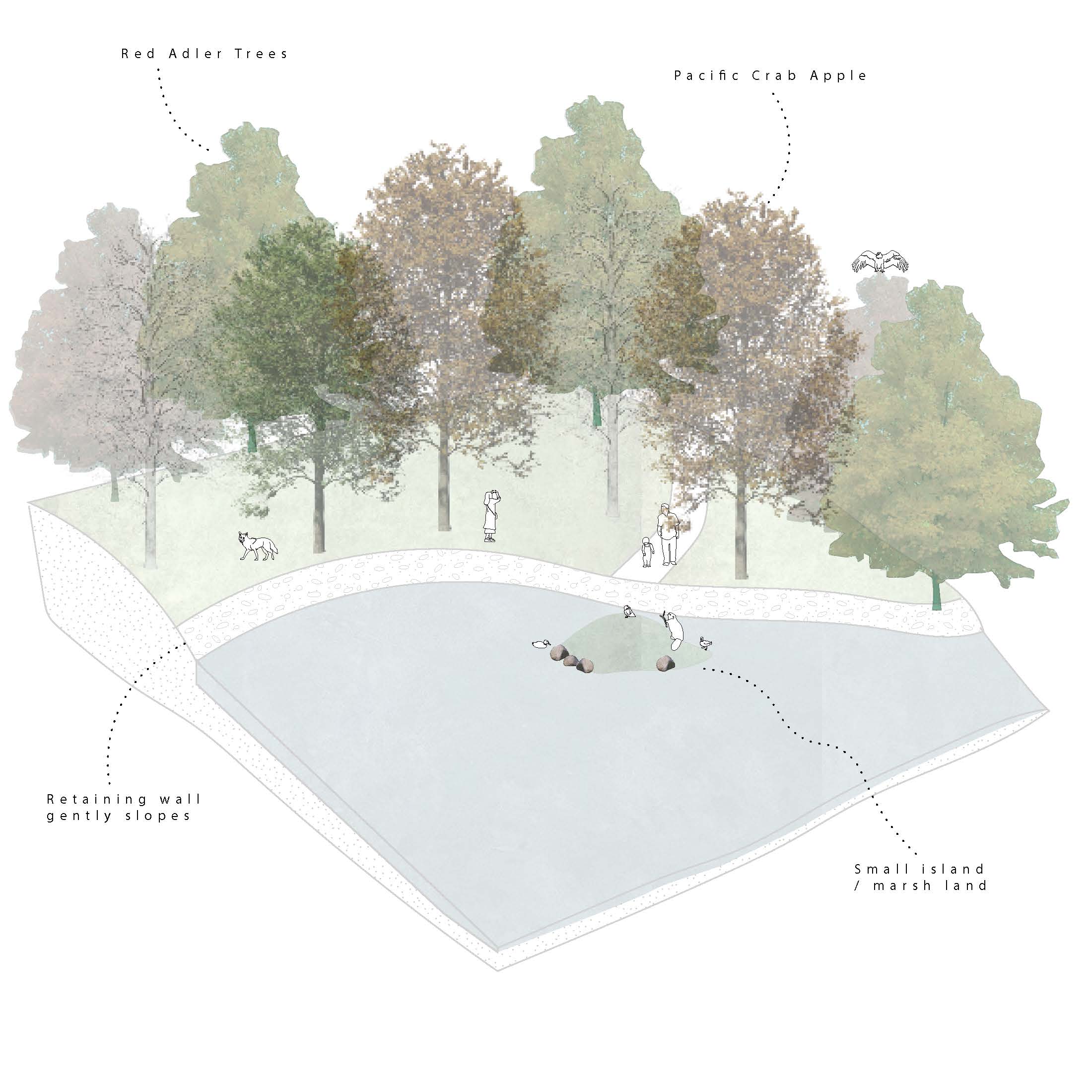
This diagram shows current edge conditions and how these conditions impact species habitat


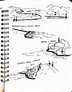
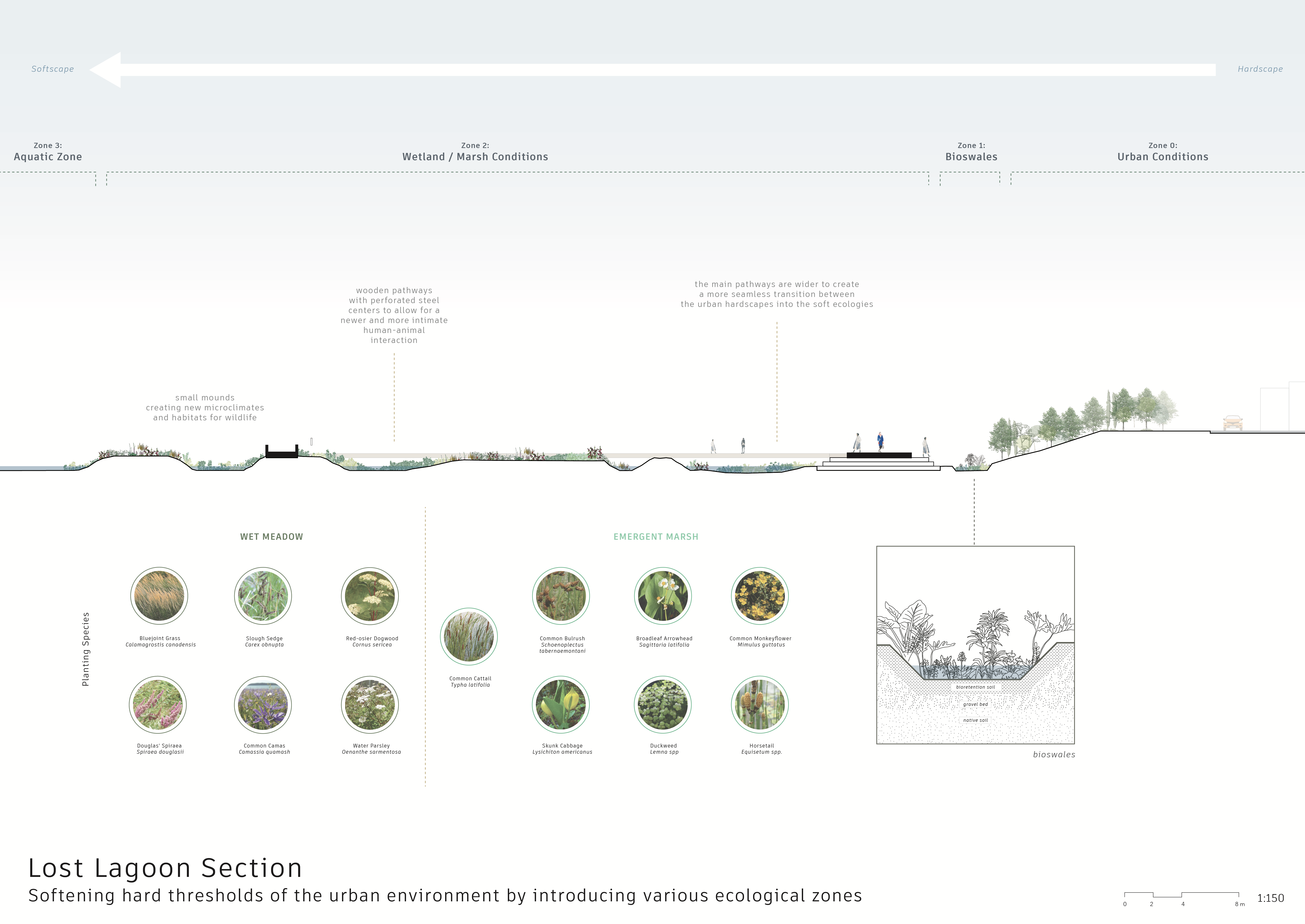
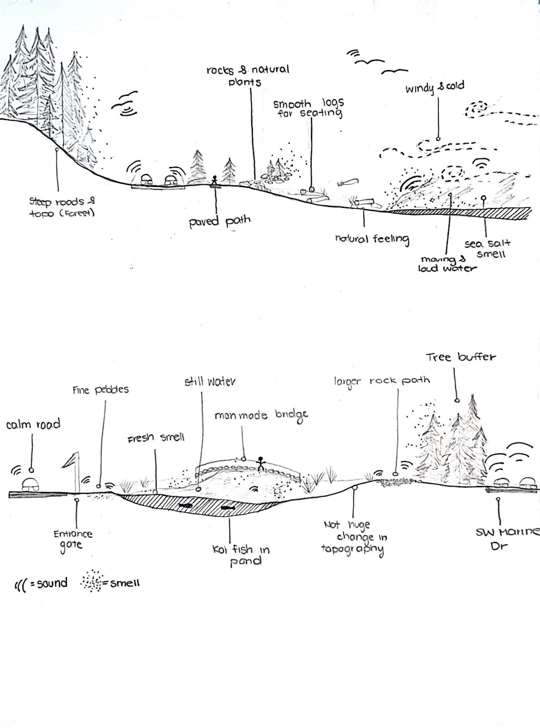
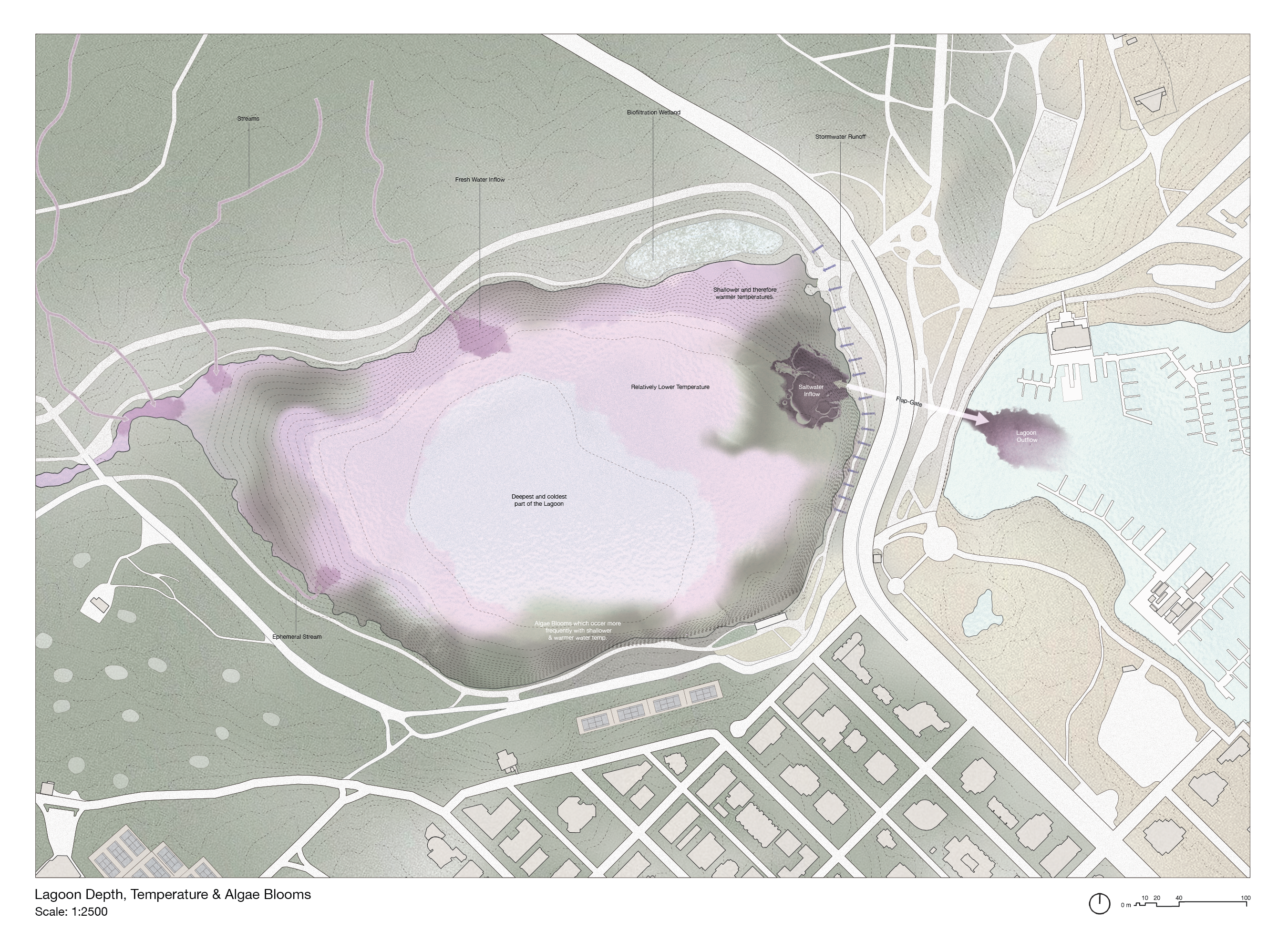
These sections reflect distinct environmental conditions, with edged conditions shaped by human interventions and naturally formed regions. Our research involved a detailed examination of the vegetation and wildlife distribution, revealing a notable concentration in the northern part of the lake. The two bottom sections are characterized by dense forests, serene nature paths, and rocky edge conditions,while the two top sections contrasts with the more human-developed areas like the Lost Lagoon boardwalk and the concrete slopes on its opposite side. Upon close observation, we noted a significant disparity in wildlife activity, with the northern, forested region exhibiting a higher presence. In contrast, the human-developed areas, particularly the boardwalk and concrete slopes, not only attract more people but also experience elevated noise levels due to their proximity to Vancouver's buildings. This heightened human impact and increased noise levels seem to discourage wildlife from inhabiting these areas, creating a marked difference compared to the quieter, tree-filled northern part of the lake, which provides more tranquil and reflective viewpoints.


Assignment 5: Case Study Part I – Adam Larsen, Ewuraba Essel-Appiah, Nyah LaMarre
The urban environment often fails to consider relationships between informal stakeholders in the environment. This submission made an analysis of how the urban environment has characterised relationships between living things at different scales, particularly regarding edge conditions between the different actors, based on personal observations of several sites surrounding lost lagoon. We grouped urban stakeholders at different scales and examined the points on interaction between them, observing how the infrastracture aided/disrupted these interactions. The second part of this assignment will assess and propose ways to boost the synergy between a chosen set of actors- likely by blurring the margins and magnifying fluidity in the built environment.


A5 | Kaitlin Manuel, Bella Gigone, Felix Jäger, Kate Bonnell


Assignment 5 – Alyssa Cheung, Hedric Bernardino, Miucci Yung


A05 | McNeil Fiesta, Nathan Chew, Fabien Kwan


Assignment 5 – Kaitlin Pranoto, Jessica Lin & Deryck Bagui


05 | ANNIKA, ALENA, MAKENA & FREYA


A5 | Hana Kang, Mary Anne William, Ellen McElroy