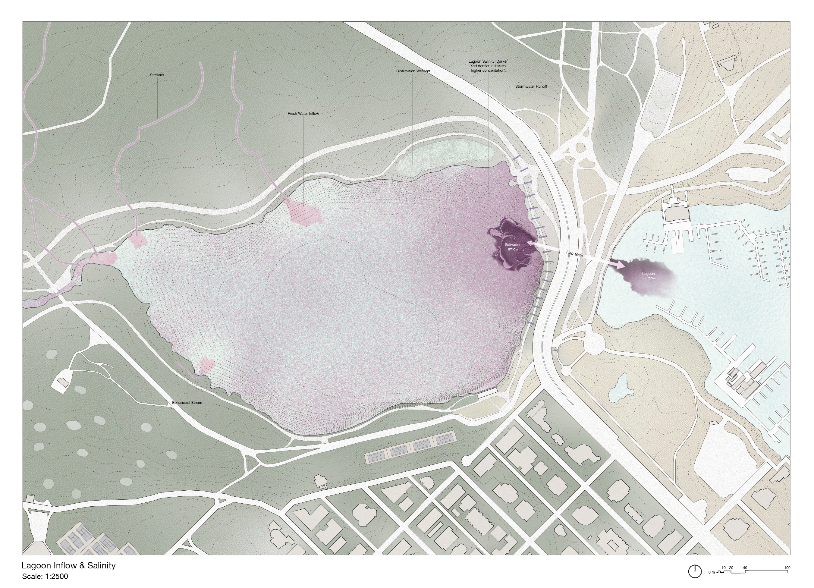
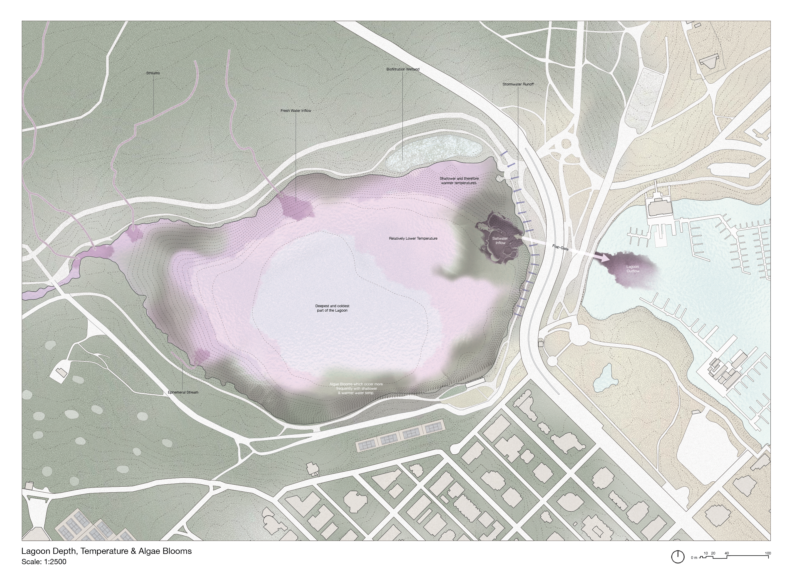
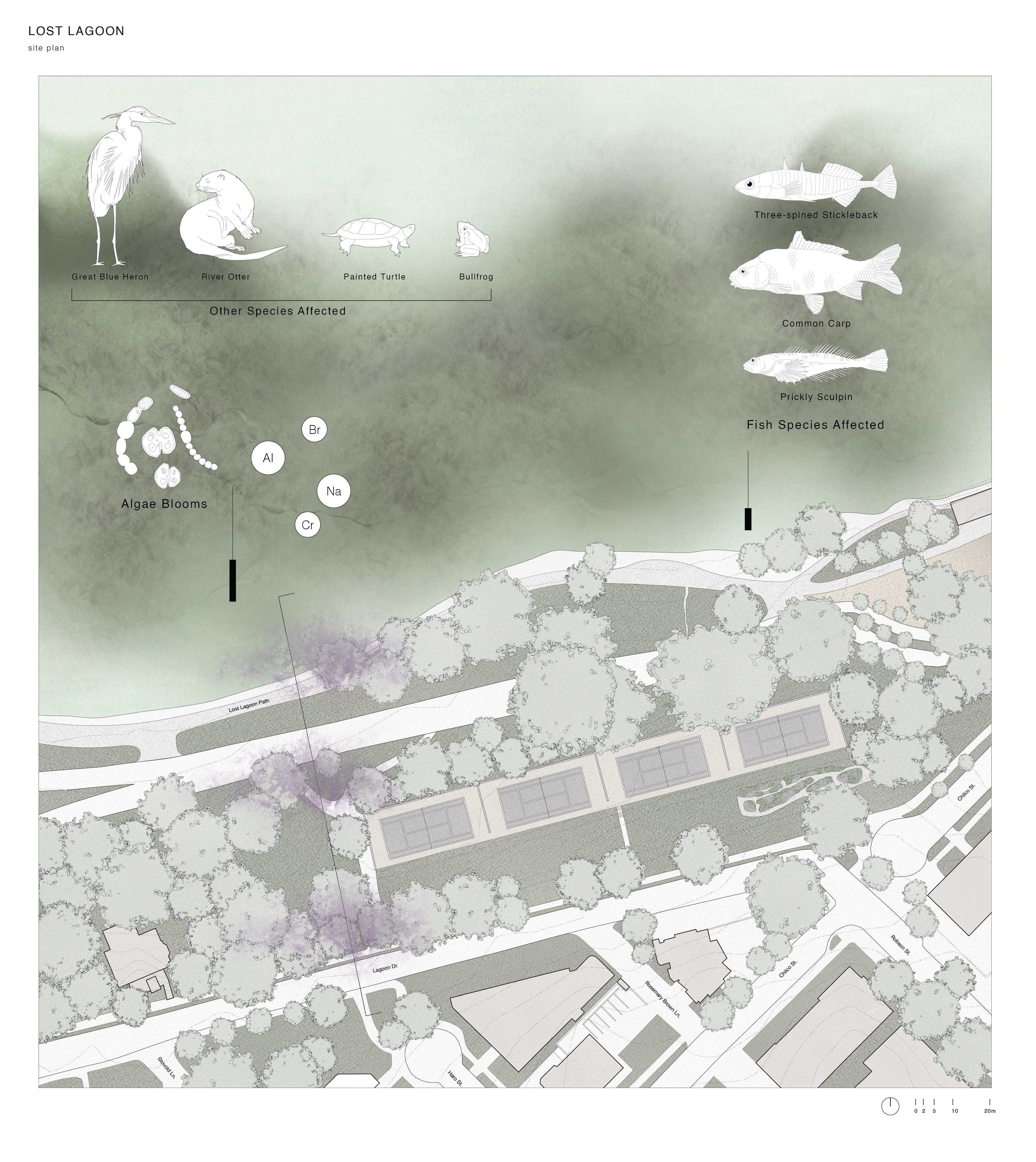
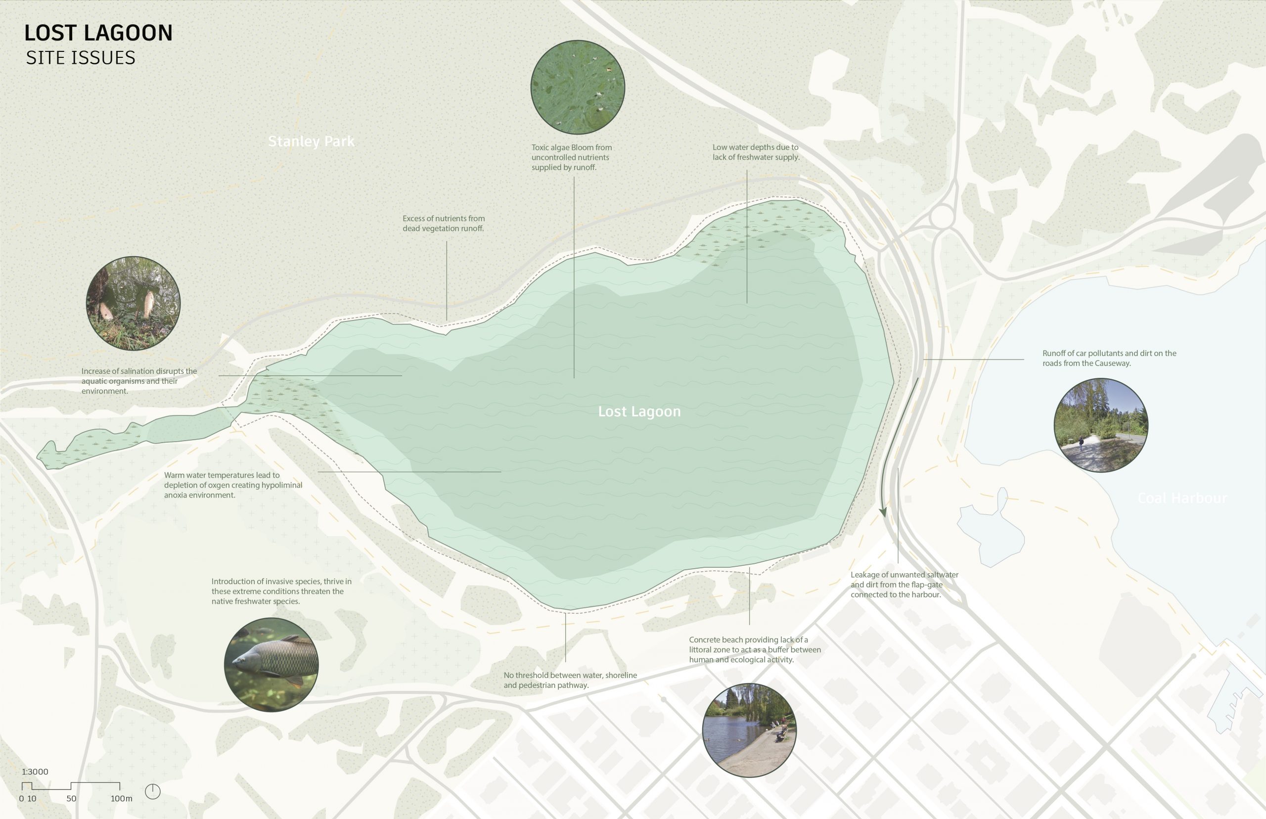
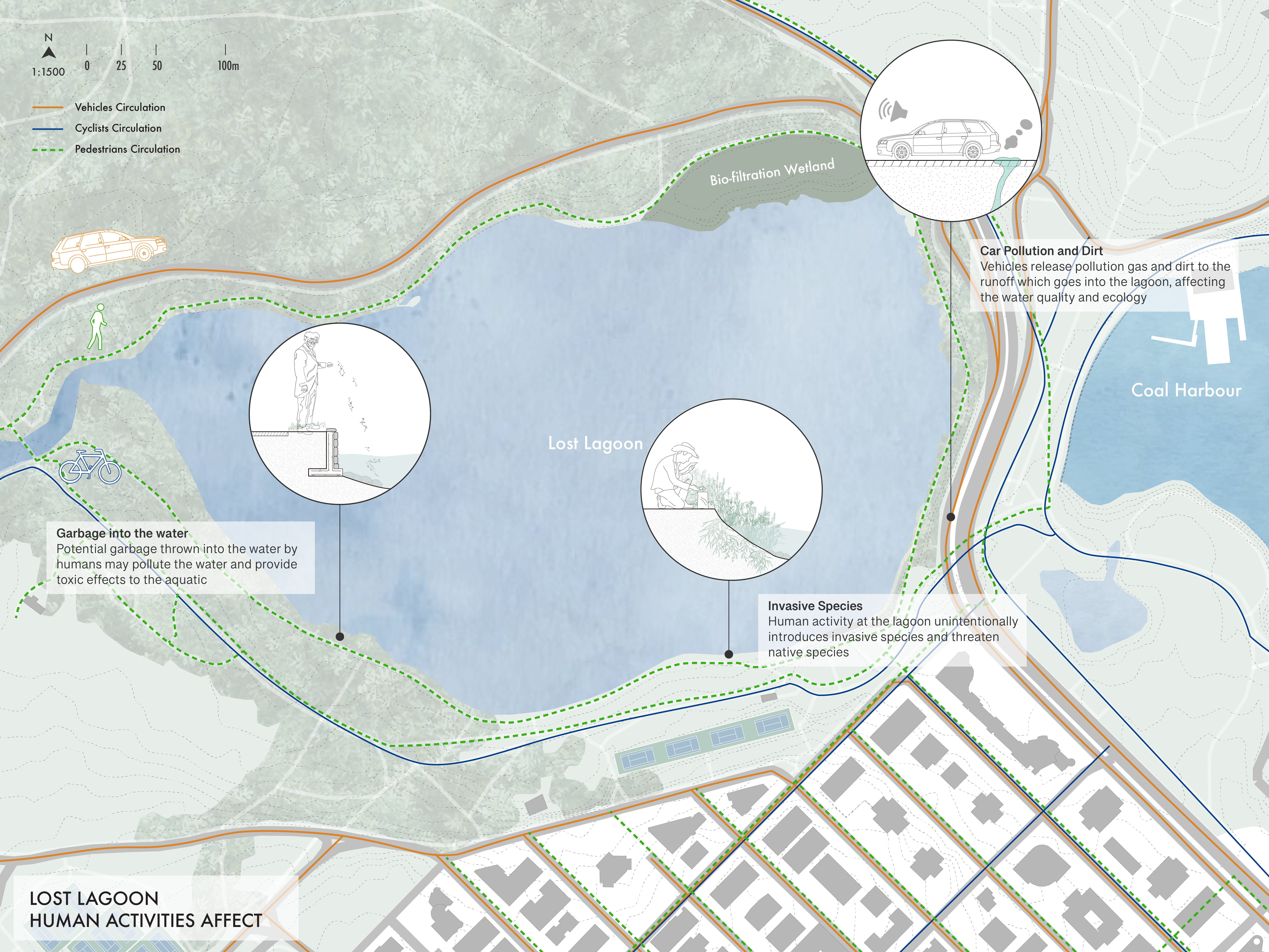
The site plan encapsulates the present state of affairs, delineating urbanized land, forested areas, streams converging into Lost Lagoon, the prominent causeway, noise pollution sources, and the intricate network of human circulation pathways—both pedestrian and vehicular. Each element intricately influences the edge conditions, shaping the living space for various species. Urban encroachment and land use directly impact biodiversity, altering the delicate balance of ecosystems. The water dynamics, with streams feeding into Lost Lagoon, play a pivotal role in sustaining aquatic life. Noise pollution poses a threat to the acoustic environment, impacting wildlife behavior. Human circulation patterns, on foot and by vehicle, introduce disturbances to the natural landscape. The marsh conditions, susceptible to alterations, further underscore the interconnected relationship between the diverse elements, highlighting the delicate coexistence of urban infrastructure and the ecological integrity of Lost Lagoon.
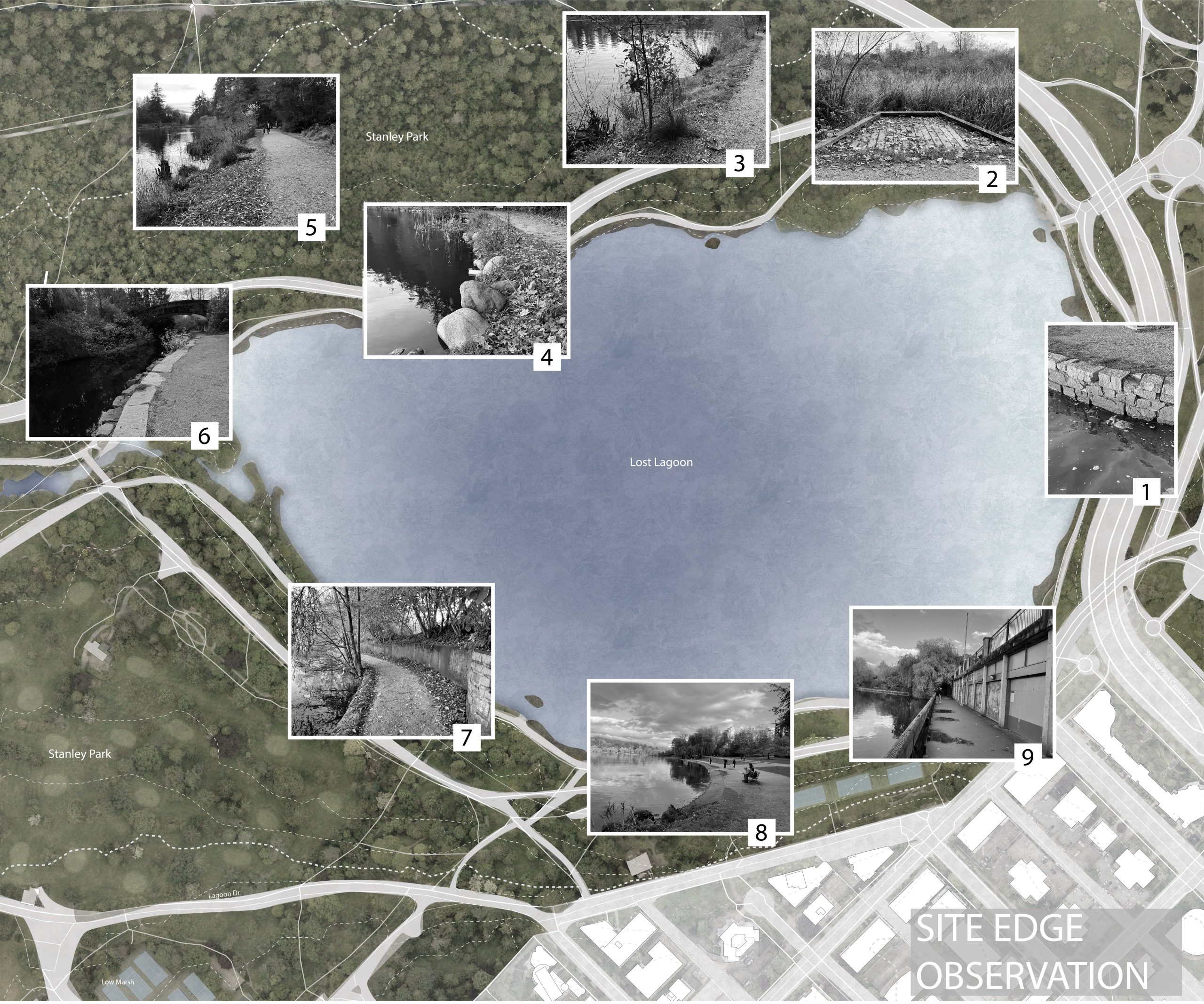
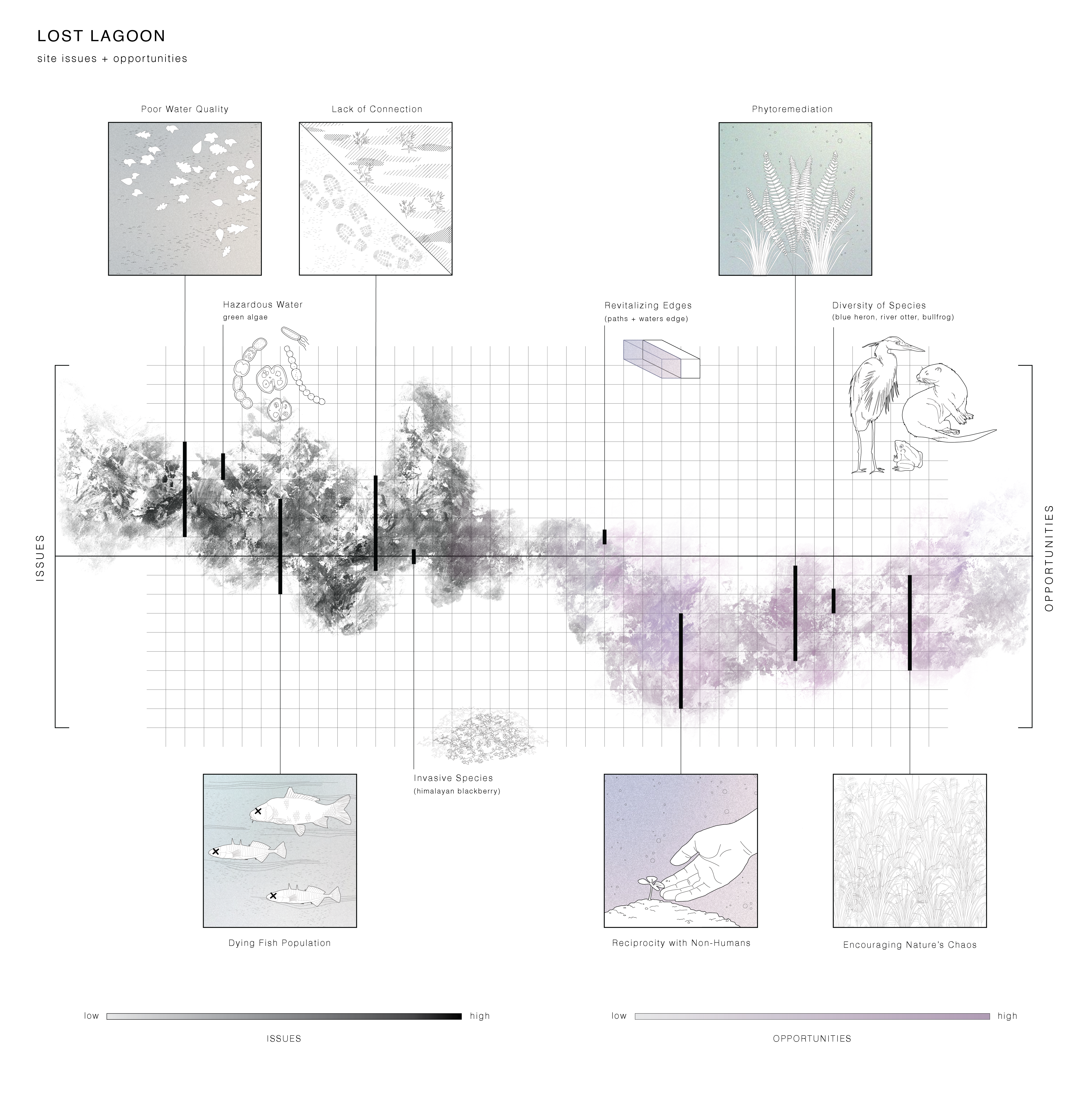
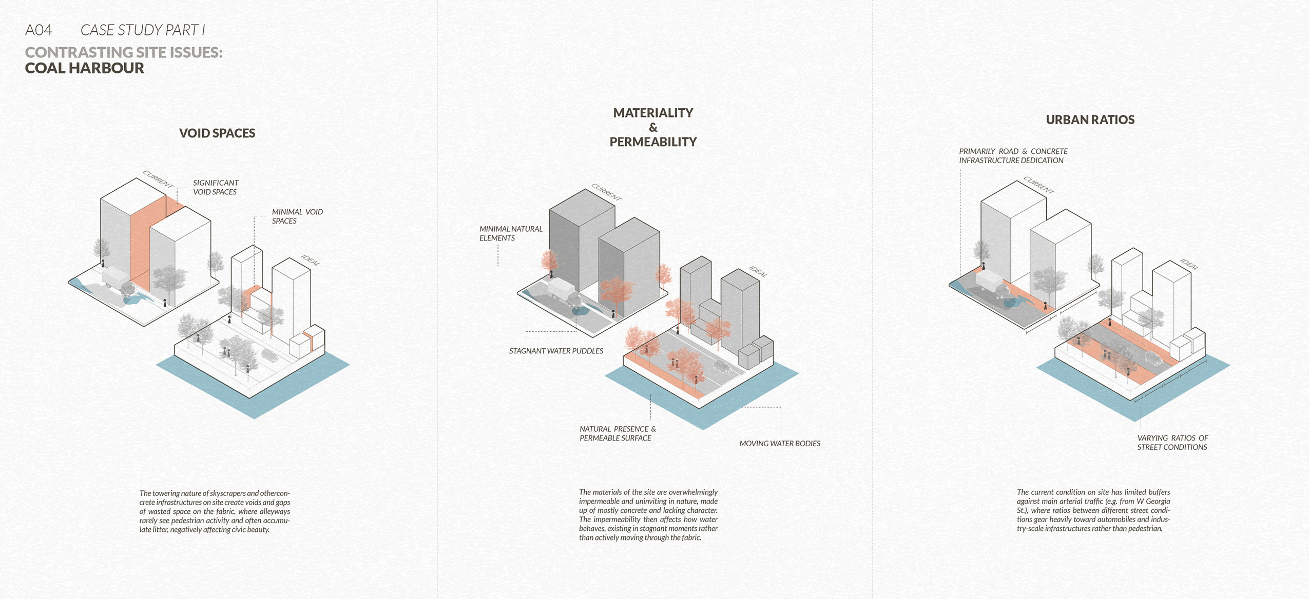
This analysis emphasizes key site observations that distinguish instances of current edge condition failure versus the habitat restoration efforts.
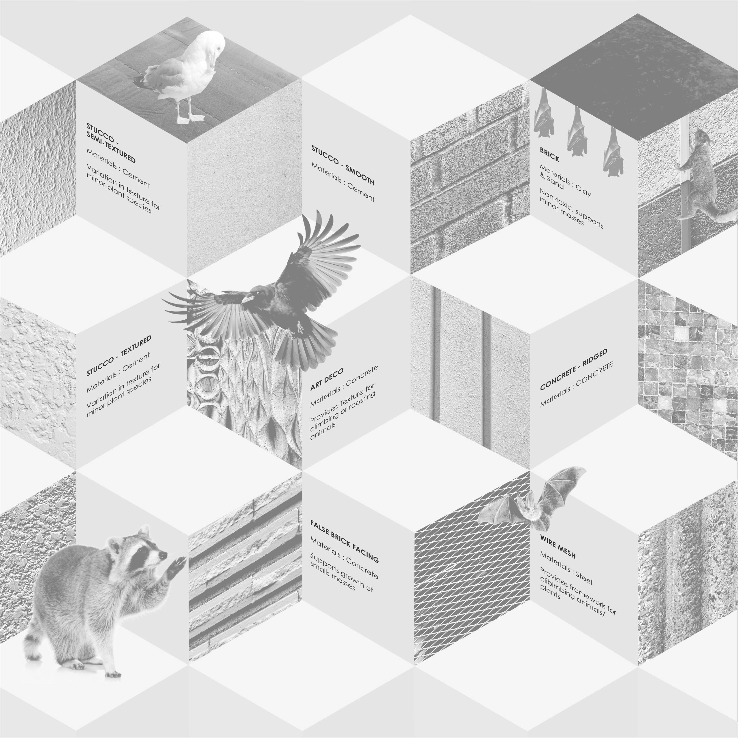
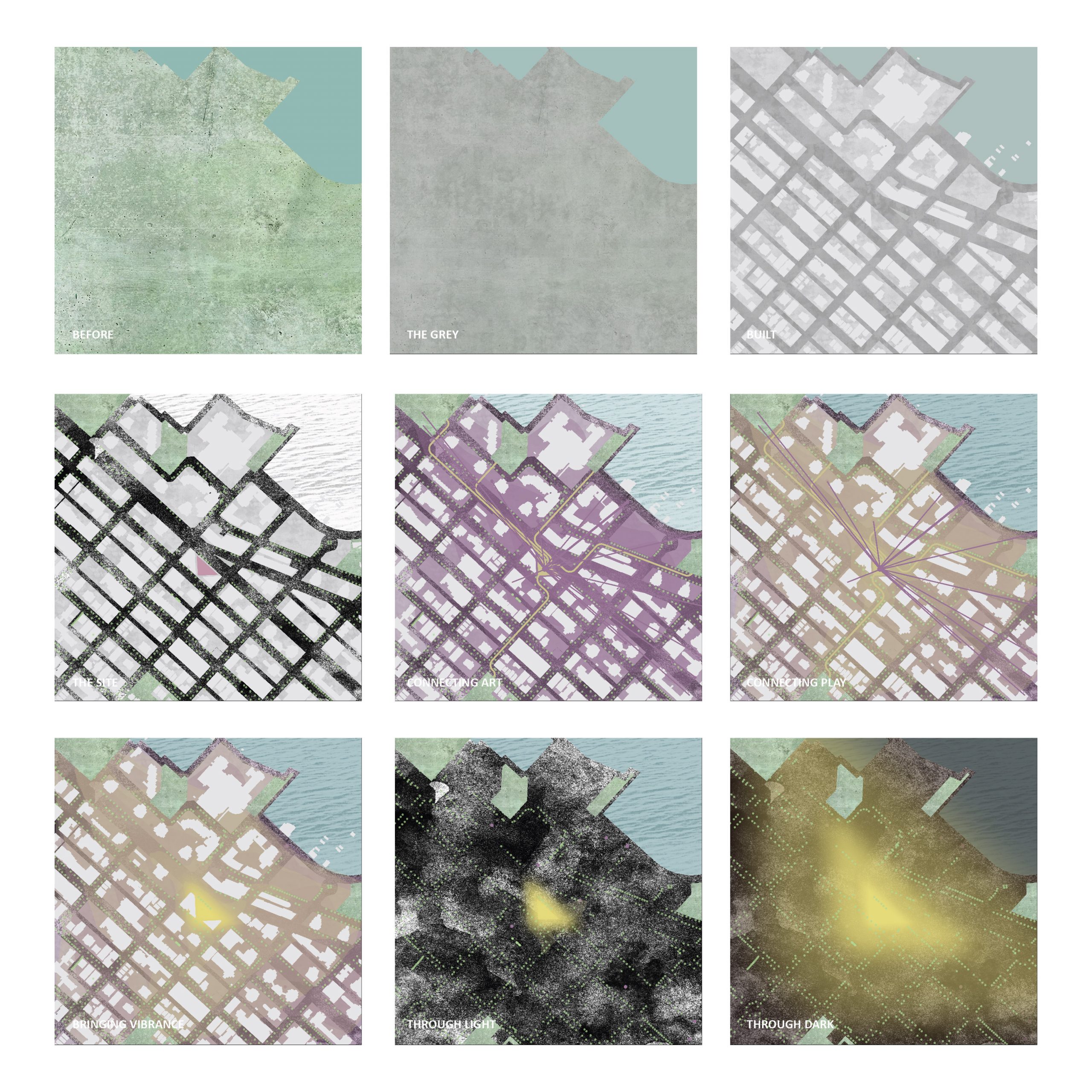
This analysis through charcoal rubbing discerns textures associated with both natural forces and human-built elements present on the site while capturing the nuanced surfaces and edge conditions, documenting their imprints within the landscape.

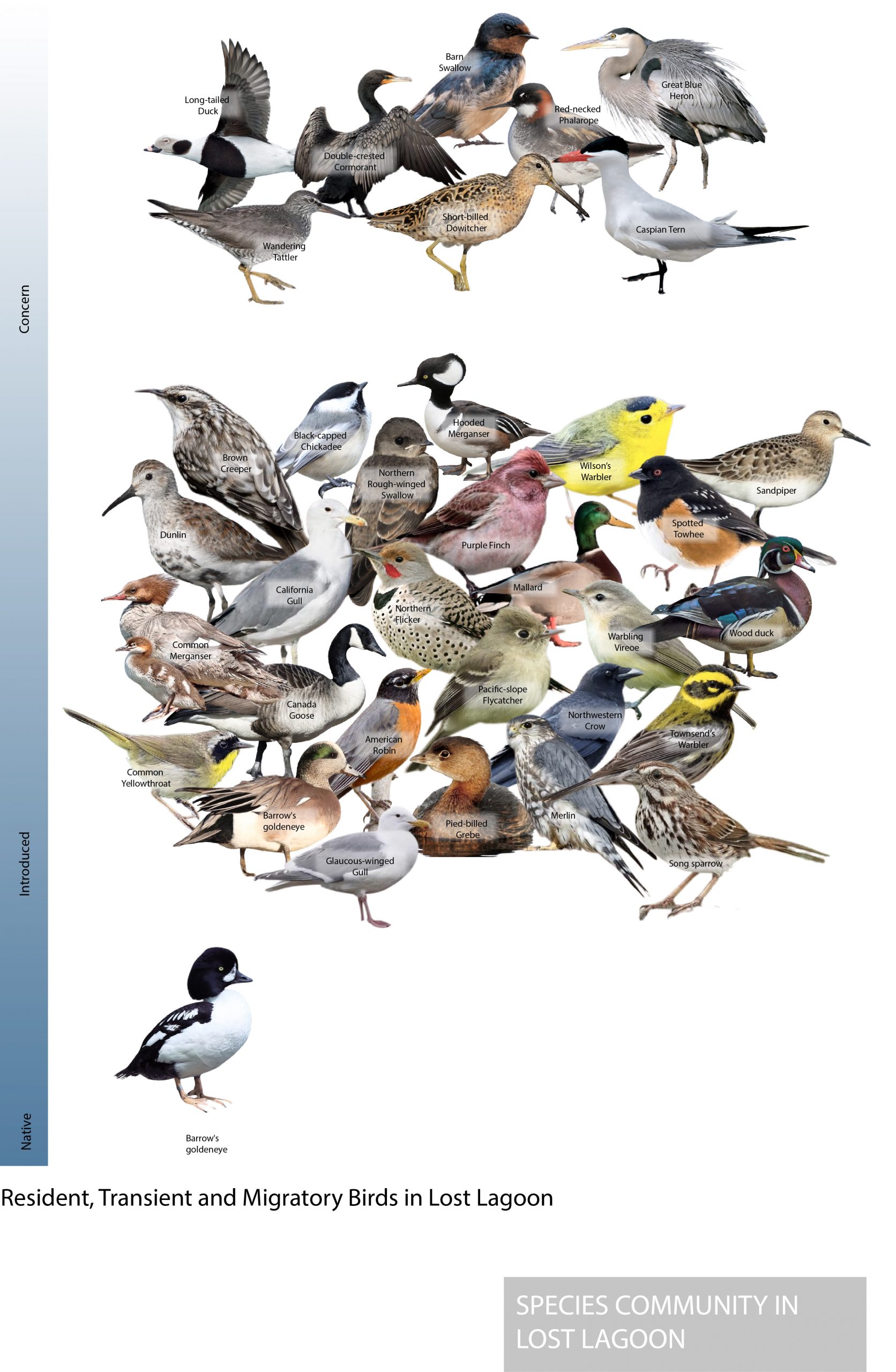

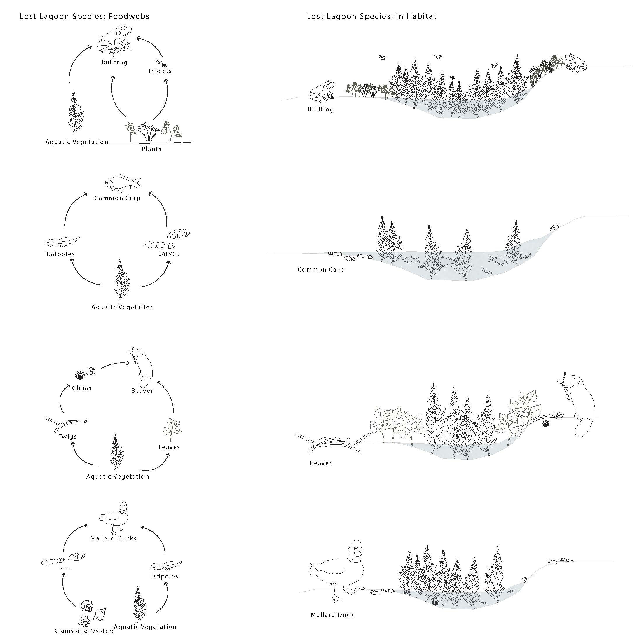
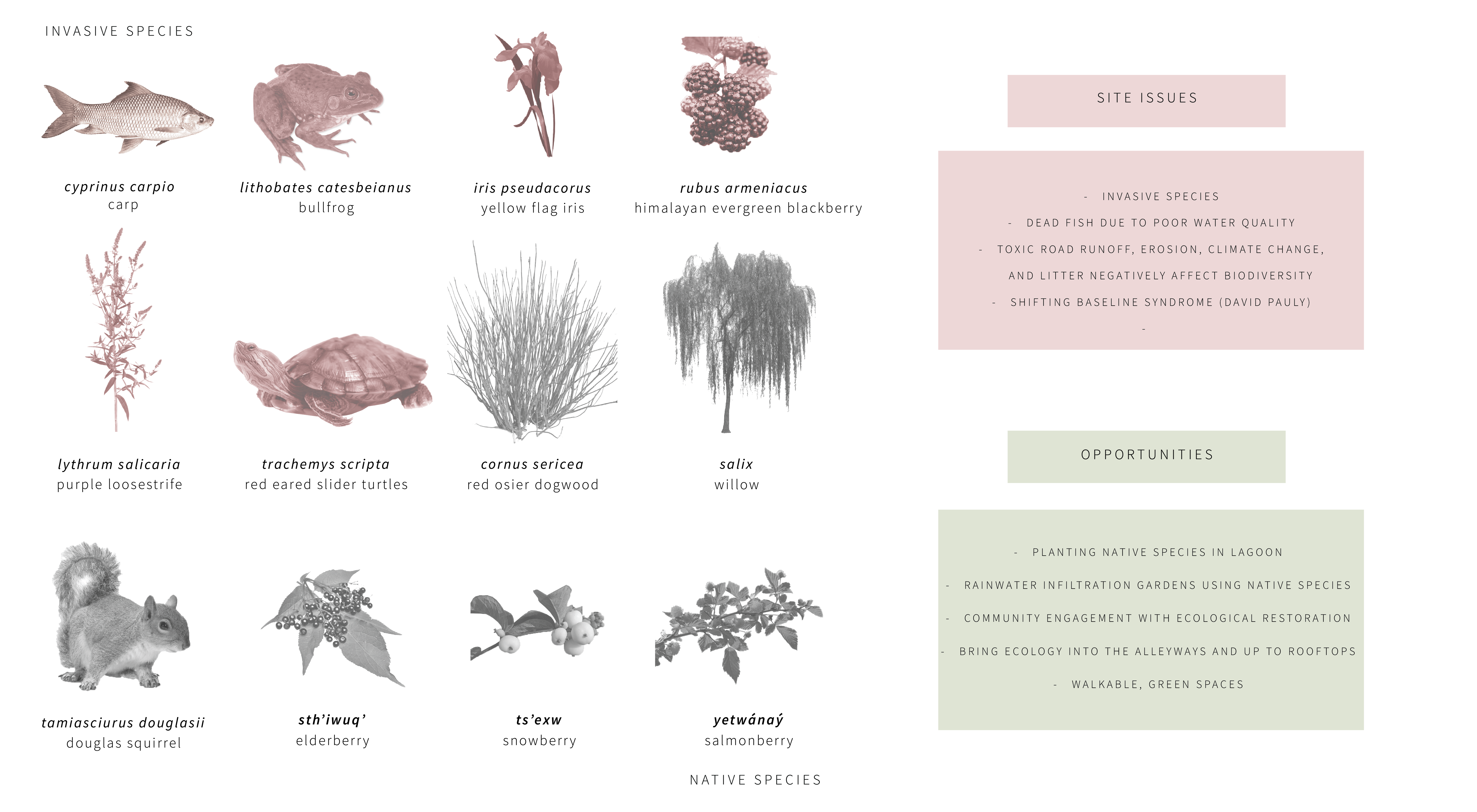
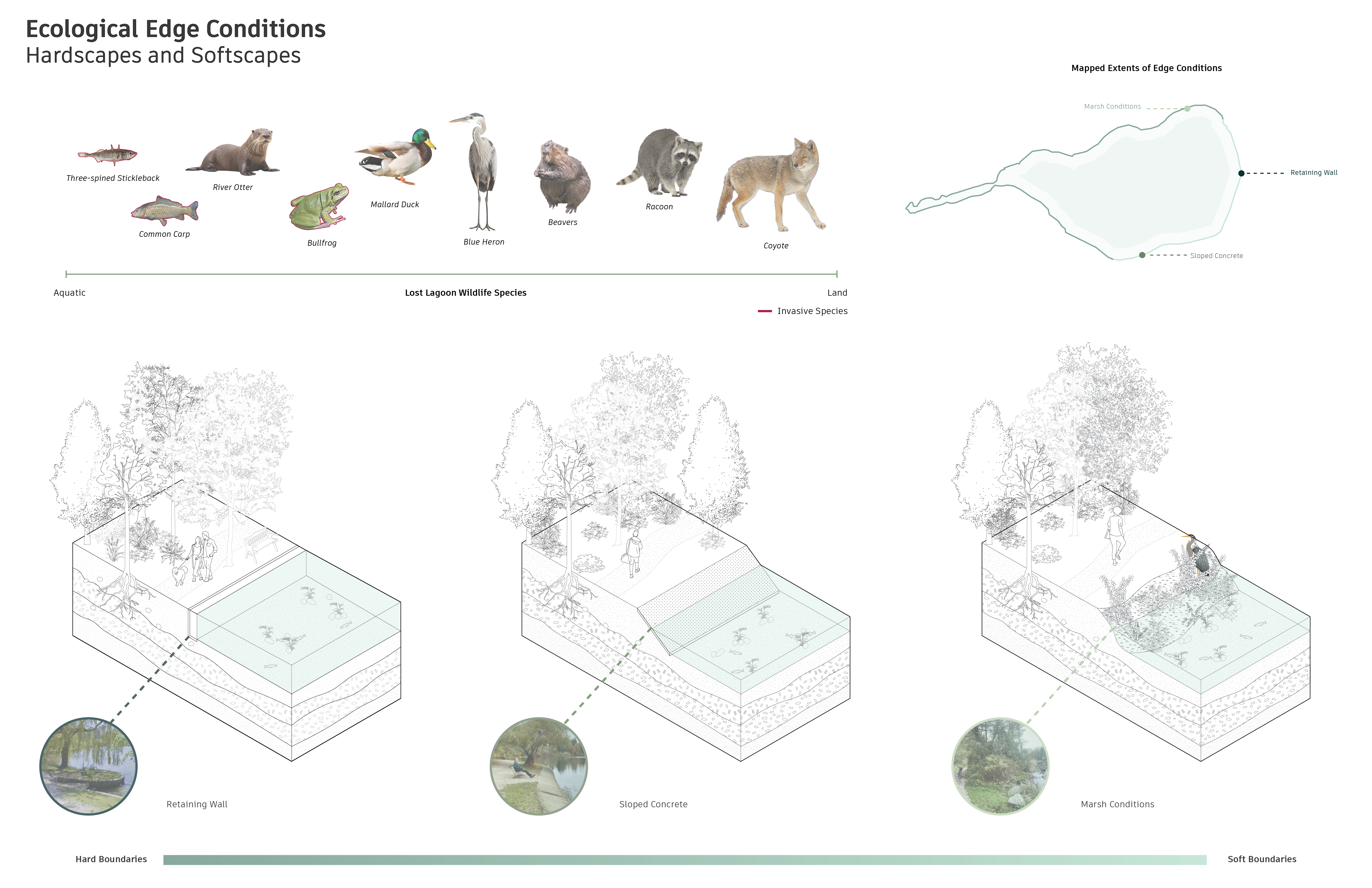
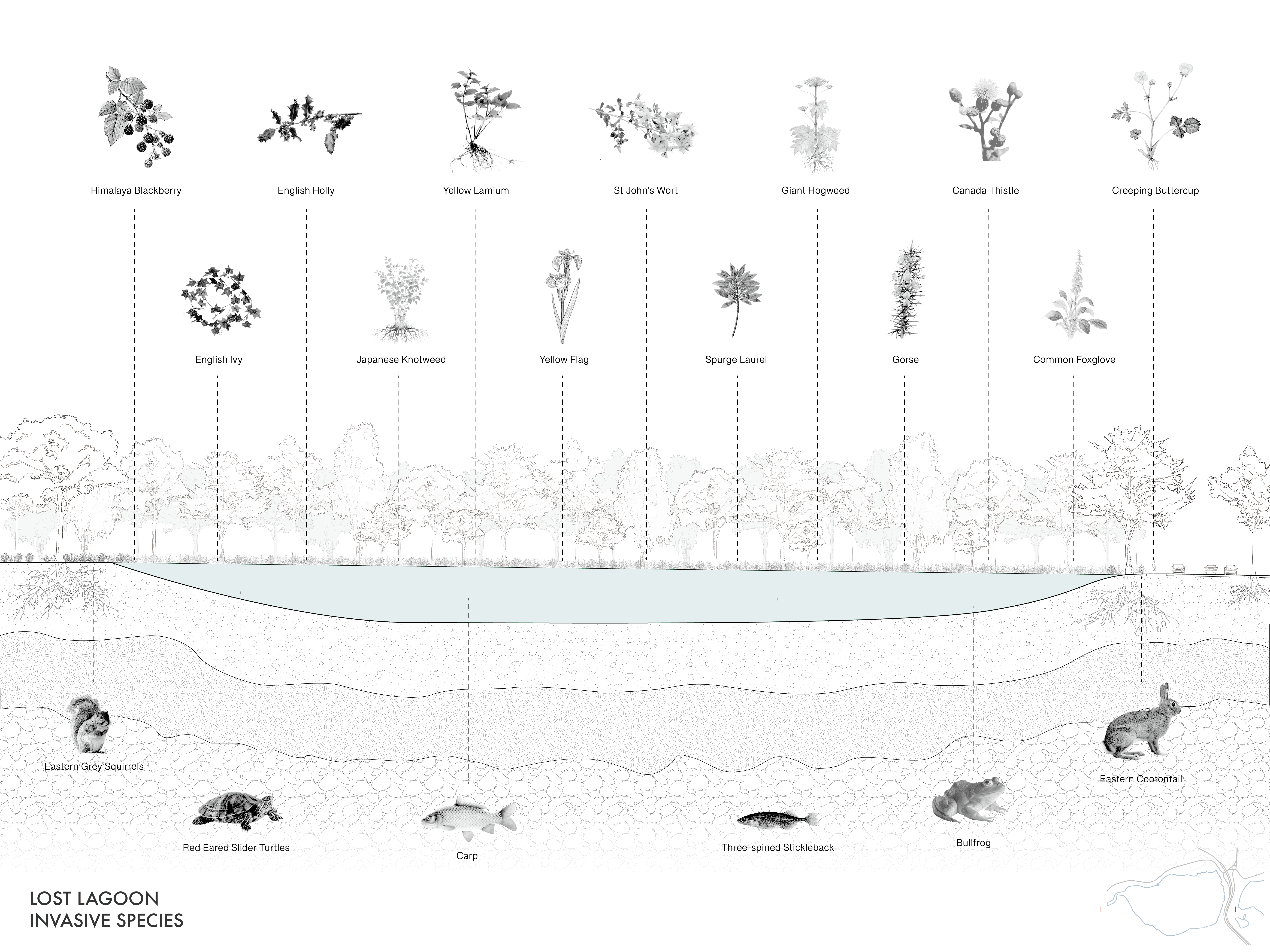
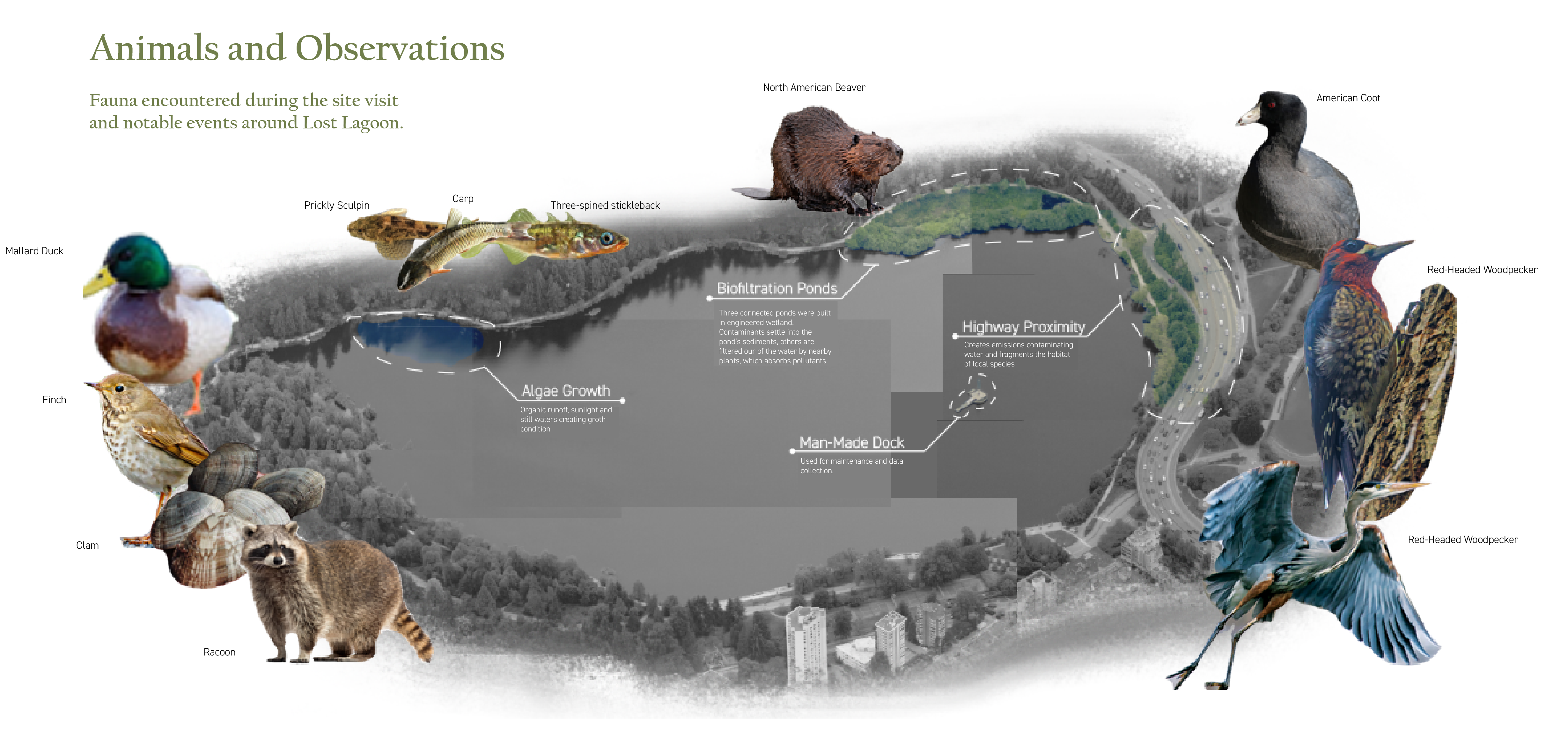
These diagrams show the species community observed, introduced, and threatened at lost lagoon
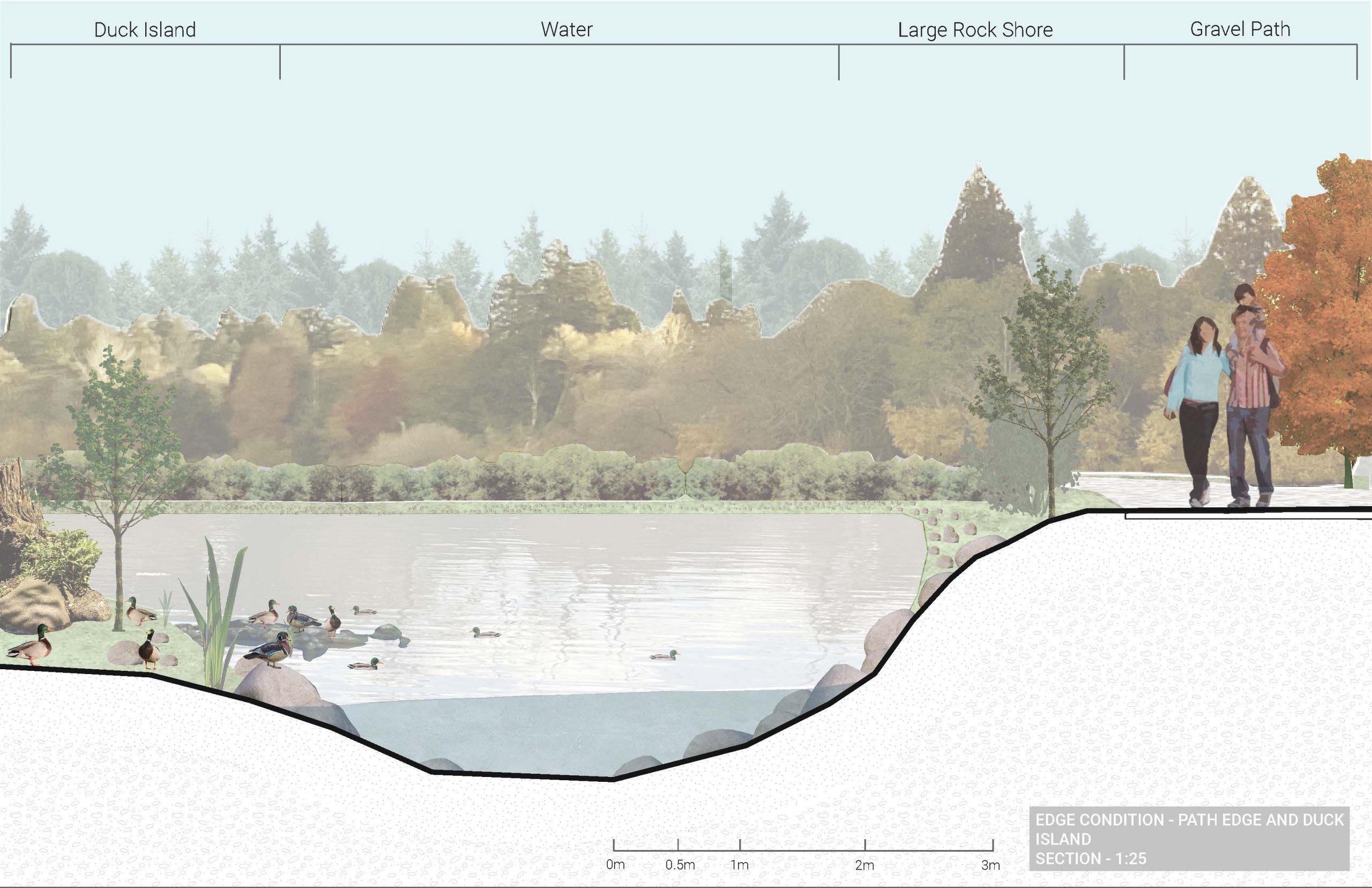
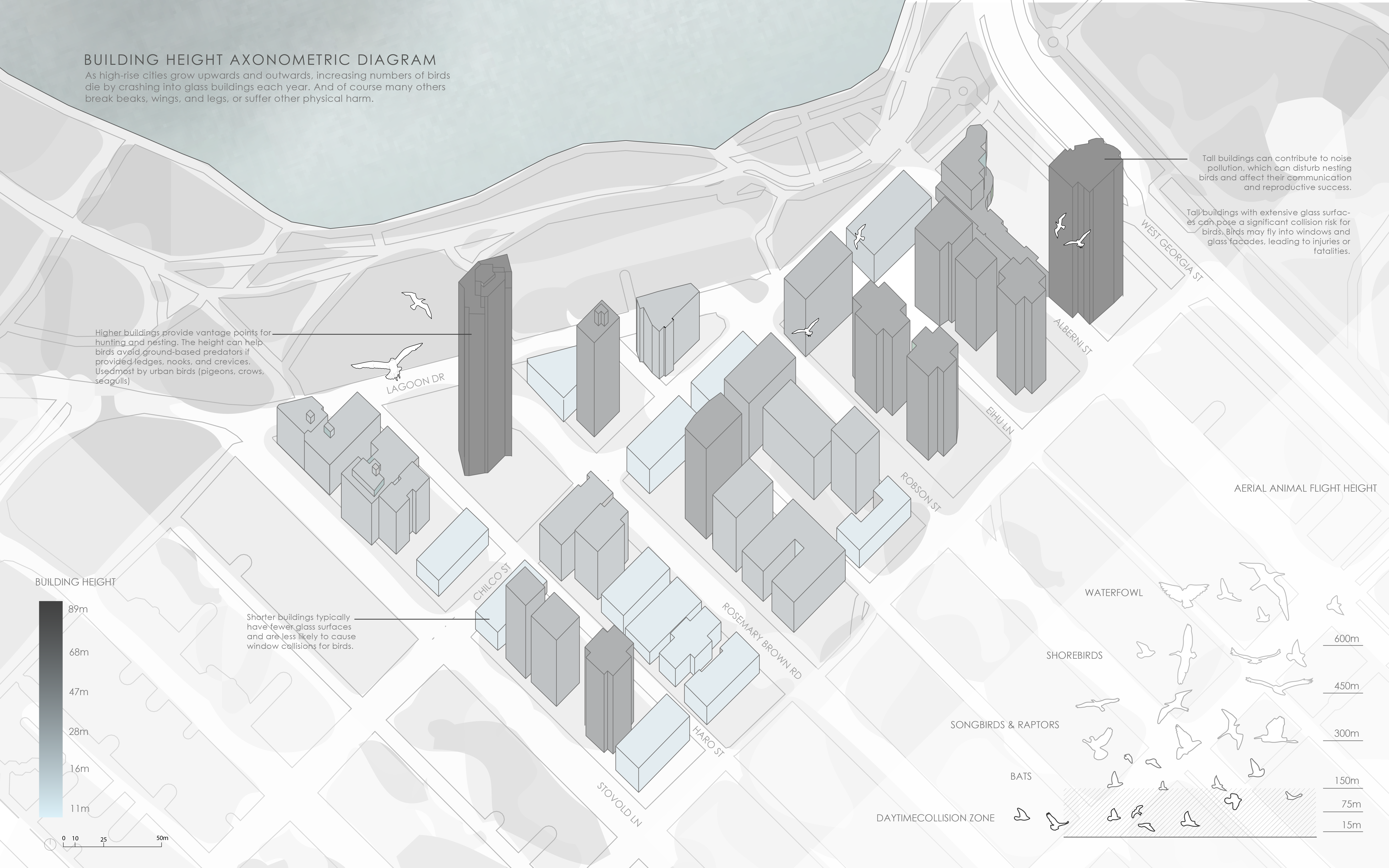
This diagram shows current edge conditions and how these conditions impact species habitat


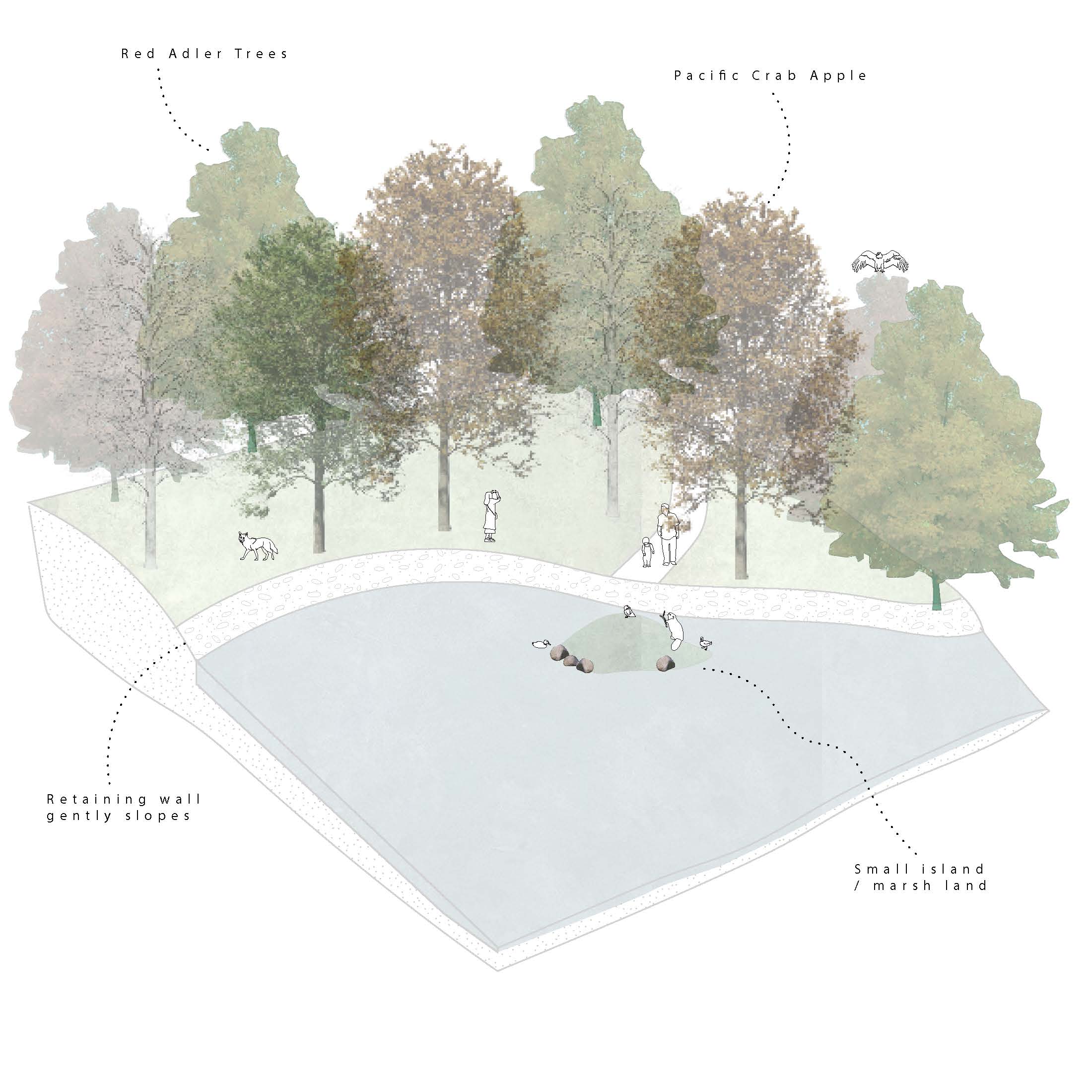
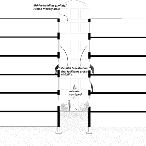
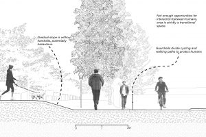
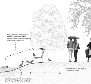
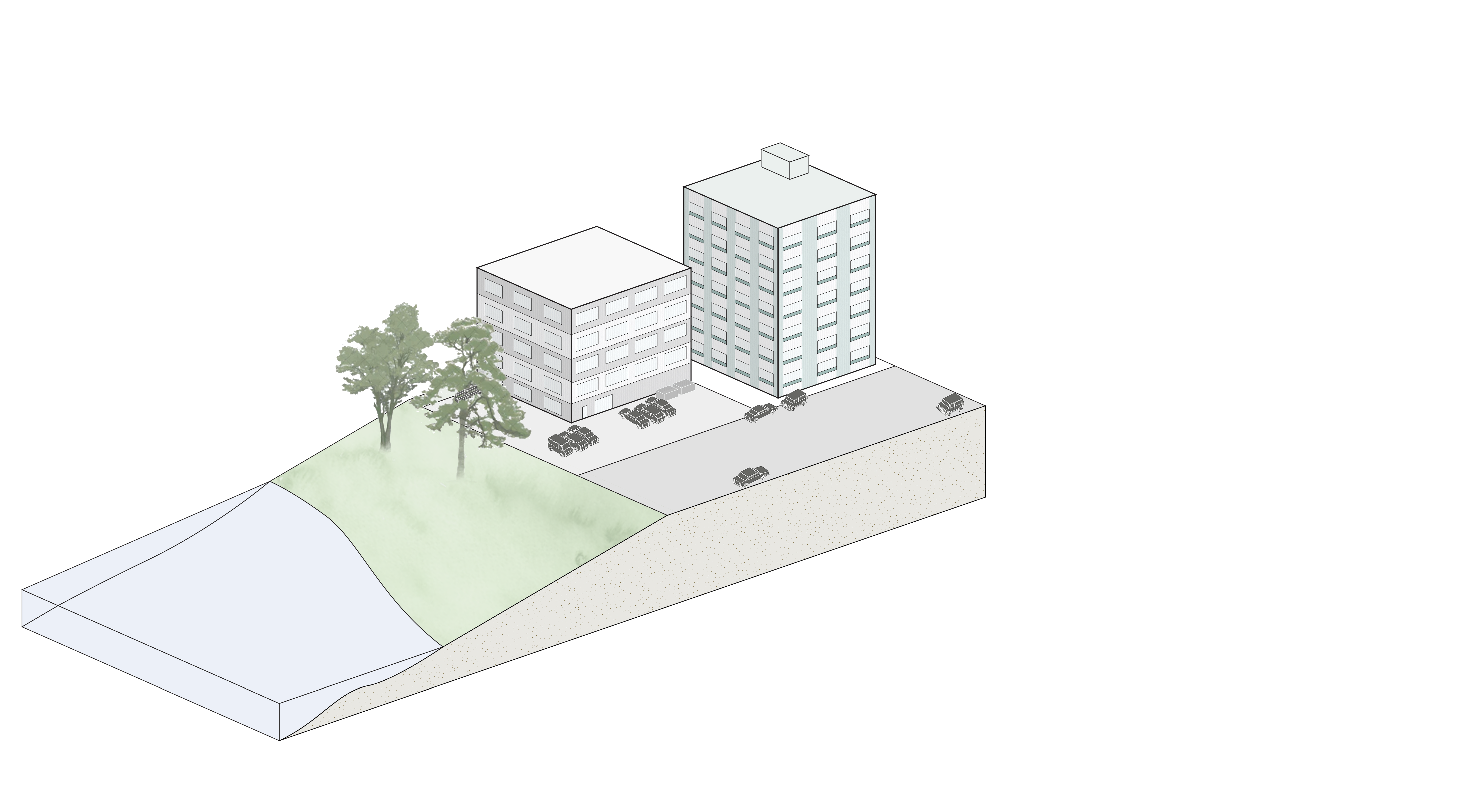
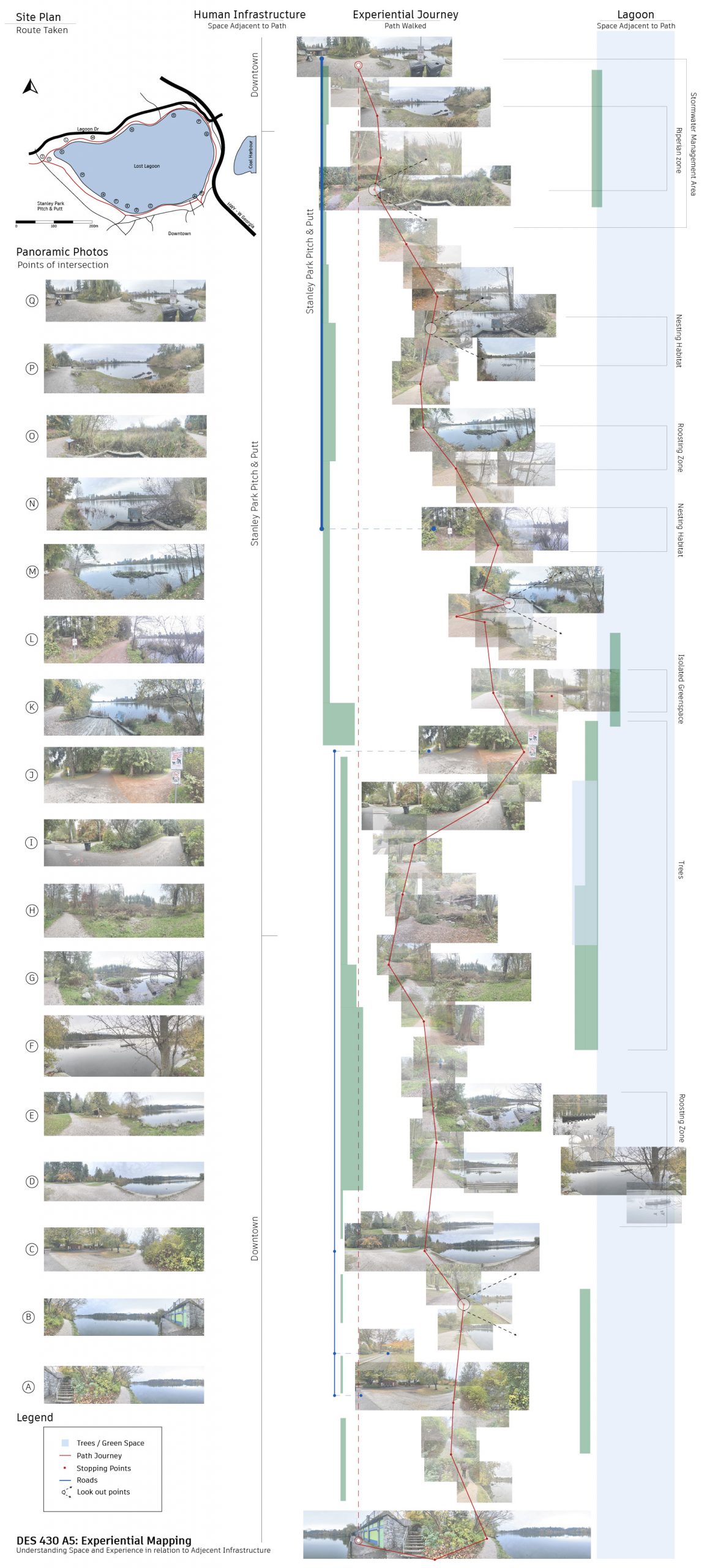
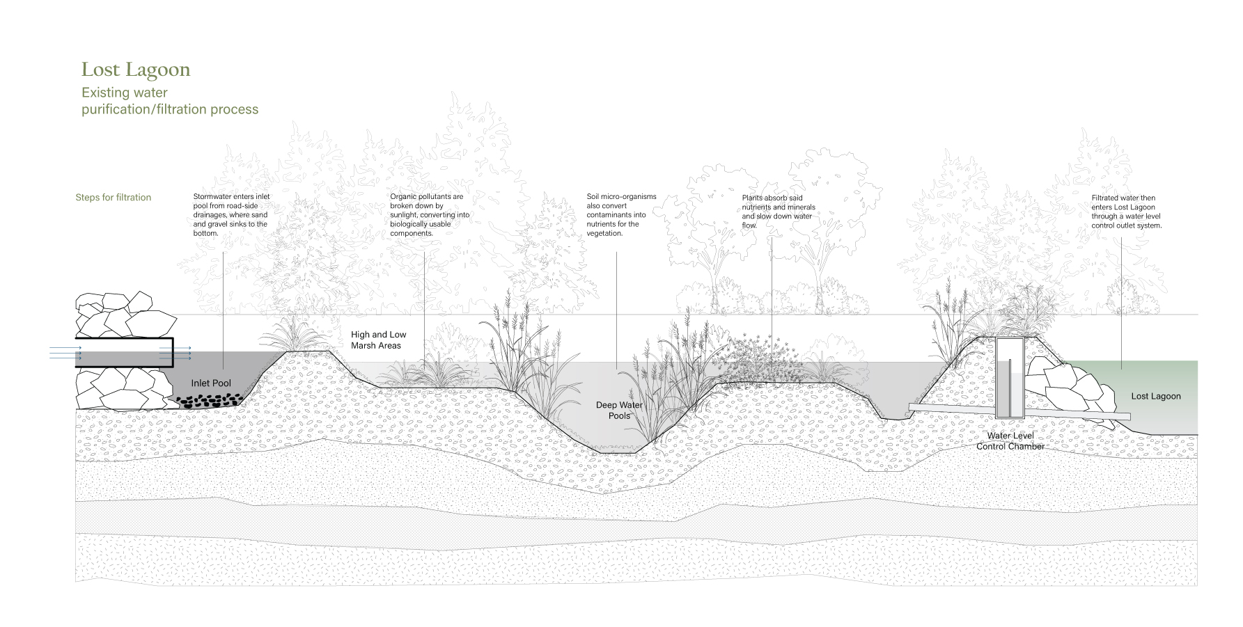
These sections reflect distinct environmental conditions, with edged conditions shaped by human interventions and naturally formed regions. Our research involved a detailed examination of the vegetation and wildlife distribution, revealing a notable concentration in the northern part of the lake. The two bottom sections are characterized by dense forests, serene nature paths, and rocky edge conditions,while the two top sections contrasts with the more human-developed areas like the Lost Lagoon boardwalk and the concrete slopes on its opposite side. Upon close observation, we noted a significant disparity in wildlife activity, with the northern, forested region exhibiting a higher presence. In contrast, the human-developed areas, particularly the boardwalk and concrete slopes, not only attract more people but also experience elevated noise levels due to their proximity to Vancouver's buildings. This heightened human impact and increased noise levels seem to discourage wildlife from inhabiting these areas, creating a marked difference compared to the quieter, tree-filled northern part of the lake, which provides more tranquil and reflective viewpoints.

Category: 05

Assignment 5: Case Study Part I – Adam Larsen, Ewuraba Essel-Appiah, Nyah LaMarre
The urban environment often fails to consider relationships between informal stakeholders in the environment. This submission made an analysis of how the urban environment has characterised relationships between living things at different scales, particularly regarding edge conditions between the different actors, based on personal observations of several sites surrounding lost lagoon. We grouped urban stakeholders at different scales and examined the points on interaction between them, observing how the infrastracture aided/disrupted these interactions. The second part of this assignment will assess and propose ways to boost the synergy between a chosen set of actors- likely by blurring the margins and magnifying fluidity in the built environment.


A5 | Kaitlin Manuel, Bella Gigone, Felix Jäger, Kate Bonnell


Assignment 5 – Alyssa Cheung, Hedric Bernardino, Miucci Yung


A05 | McNeil Fiesta, Nathan Chew, Fabien Kwan


Assignment 5 – Kaitlin Pranoto, Jessica Lin & Deryck Bagui


05 | ANNIKA, ALENA, MAKENA & FREYA


A5 | Hana Kang, Mary Anne William, Ellen McElroy


Assignment 5_ Carol Zhao, YiLe Chen & Mary Zhu


Assignment 5 – Angela, Cedric, Sharon

![]()

Assignment 5 – Lisa Besnier, Anastasia Simonovich, Mia Torrence


DES 430 Assignment 5 – Displacement and Replacement – Kai, Max, Av
INVESTIGATION: Coal Harbour + West End
INVESTIGATION: Denman + W Georgia St
INVESTIGATION: Melville, Hastings, Pender


Assignment 5: Jacob Camino, H Brogan Gealey, Cynthia San


Assignment 05 – Ella Dufresne, Talia Neufeld, Allegra Haynes


Assignment 5 – Case Study Part I
Assignment 05: Case Study Part I
Group – Delivery Time 3 Weeks
In this assignment, students will evaluate urban form.
Objective: Use methods of site analysis to identify and document open space, urban form, and infrastructure across Vancouver’s urban environment. Work collaboratively to identify strategic urban planning priorities and tackle complex issues.
Process:
- Visit and analyze the environment (open space, urban form and infrastructure) of a site near downtown Vancouver. Student groups will be provided with options for site selection via Canvas.
- Using the knowledge you have gained in class thus far, identify priorities for improving the urban fabric. Develop a hierarchy of priorities and justify your rationale. What would be your first priority, second and third? Is there a hierarchy at all?
- Develop a broad design strategy. Create a framework for how your group plans to address the urban environment (open space, urban form, and infrastructure). Document your process. Use a combination of brief written statements and annotated sketches, diagrams, and photographs to convey your strategy. A clear example of this is Vancouver Rain-City Strategy, found in the required readings.
- Be prepared to discuss your conclusions in class and compare your findings with other groups.
Deliverables*:
Using written and graphic communication:
- Summarize site issues and design priorities, presented as a single (or multiple) infographic.
- Define a clear and concise description of the vision, goals, and objectives your group will take forward in part II.
Ensure the scale of your drawing is clear. Include a scale bar and north arrow when appropriate. The deliverables can be drawn analog, digitally or as a combination of both.
Please submit your work to the blog by Tuesday, October 31st at 11:59 pm.
* In general, the number of deliverables is flexible for this course. We encourage students to make their own decision about what drawings are needed; the deliverables are a suggestion. For example, students may wish to alter the scale or add additional drawings to explain their observations.
References:
Required
City of Vancouver. (2019). Rain city strategy. https://vancouver.ca/files/cov/rain-city-strategy.pdf
Haaland, C., van den Bosch, C.K. (2015). Challenges and strategies for urban green-space planning in cities undergoing densification: A review. Urban Forestry & Urban Greening, 14(4), 760-771. https://doi.org/10.1016/j.ufug.2015.07.009
Recommended:
Joist, D. (2012). The measured response. Landscape Architecture Magazine. https://www.designworkshop.com/docs/news/measured-response.pdf
Nesbitt, L., Meitner, M. J., Girling, C., & Sheppard, S. R. J. (2019). Urban green equity on the ground: Practice-based models of urban green equity in three multicultural cities. Urban Forestry & Urban Greening, 44, 126433. https://doi.org/10.1016/j.ufug.2019.126433
DES430 2022 Student Examples:
Cole Quist, Kristina Kozlitina, Zacharie Lauziere-Fitzgerald: https://blogs.ubc.ca/des430x2022w1/2022/11/16/a_05-cole-kristina-and-zach/
April Liu, Jenny Ye, Nicola Chau, Soyeon Park: https://blogs.ubc.ca/des430x2022w1/2022/11/08/assignment-5-april-jenny-nicola-soyeon/