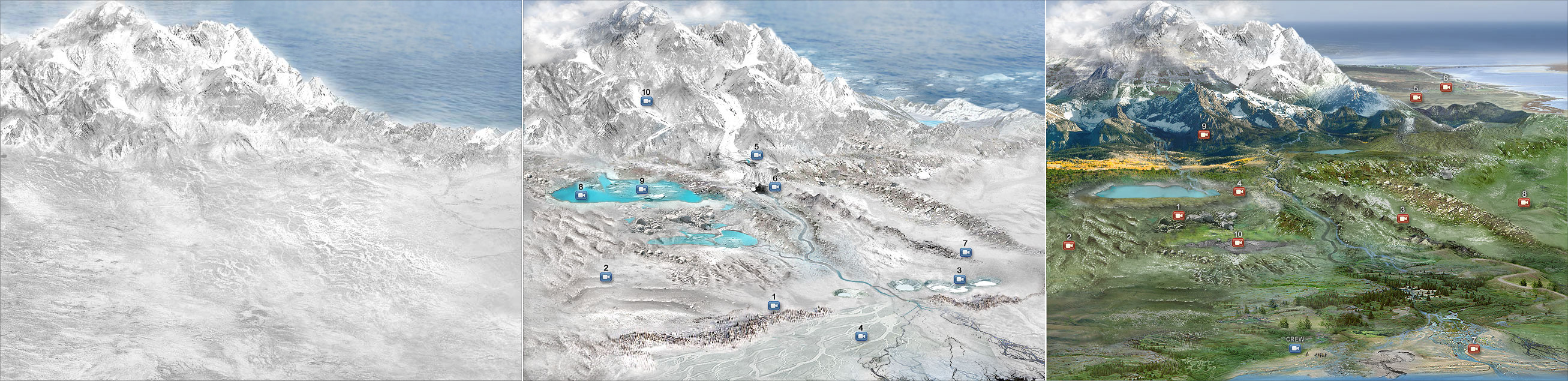
Click to two times to enlarge. Soil formation takes a very long time. For example, in areas such as Canada that were completely covered by glaciers, soil formation started as soon as glaciers retreated. The graphics illustrate evolution (progression) of landscapes during the past 25,000 years. At the peak of the last glaciation, about 25,000 years ago, the land was covered by ice. Glaciers retreated around 10,000 years ago and revealed a barren landscape blanketed by glacial deposits and meltwater. In the present day, glacial deposits are covered by vegetation. This illustration was designed for the the Virtual Soil Science Learning resources project, which is a very exiting project I’ve had the opportunity to work on, in collaboration with Dr. Maja Krzic and Dr. Stephanie Grant. This is just one piece of the Virtual Soil Web mega project, which has won the Award of Excellence and Innovation in Graphic Design and Web from CNIE (Canadian Network for Innovation in Education).
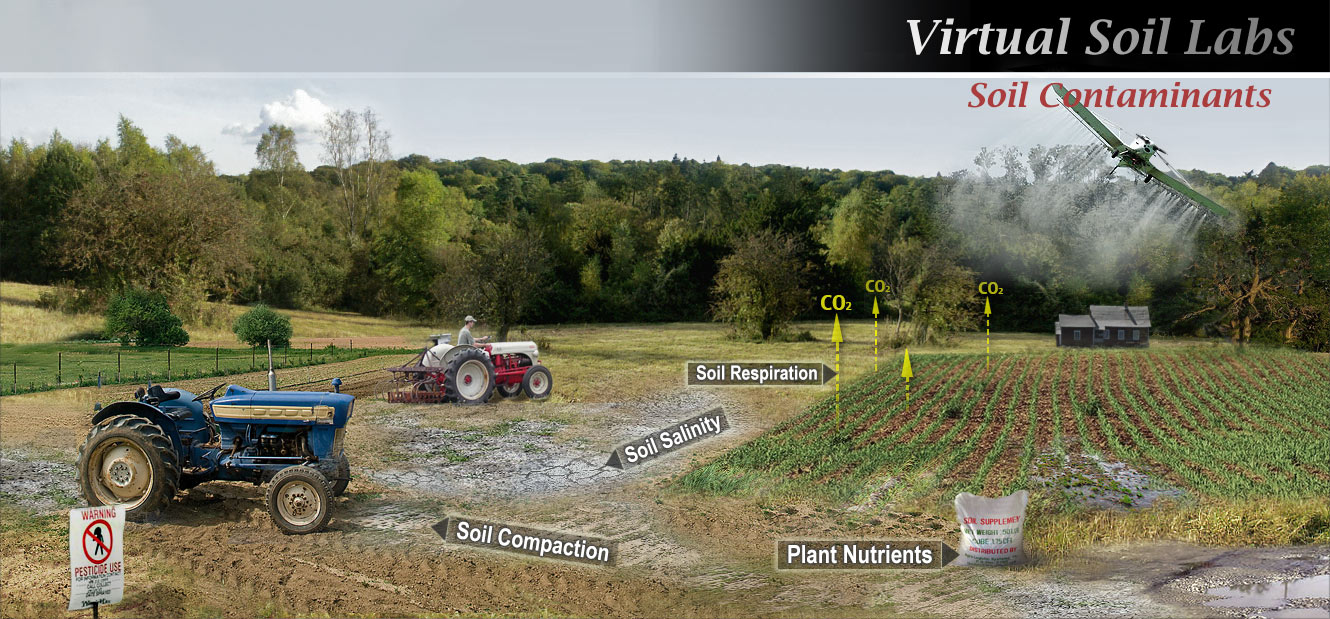
Soil Contaminants virtual composition. It might look like a panoramic photograph, which was in fact the exact intent, except that the image you see here was composed in Photoshop by merging and heavily tweaking at least 7 unrelated photographs followed by adding realistic textures and objects (e.g. the puddles of water, the different soil structures, the tractors, the house, the airplane, etc.). This composition along with other graphic design and multimedia creations have won the award for Excellence and Innovation in Graphic Design from CNIE/RCIE.
graphic design and illustration, multimedia, corporate photography, infographics, university online course visual content, visual identity, vr, 3d modelling, interior design, design for marketing, 360 vr, augmented reality, logo design, banner design, panoramic photography, and more.