Regional Topography
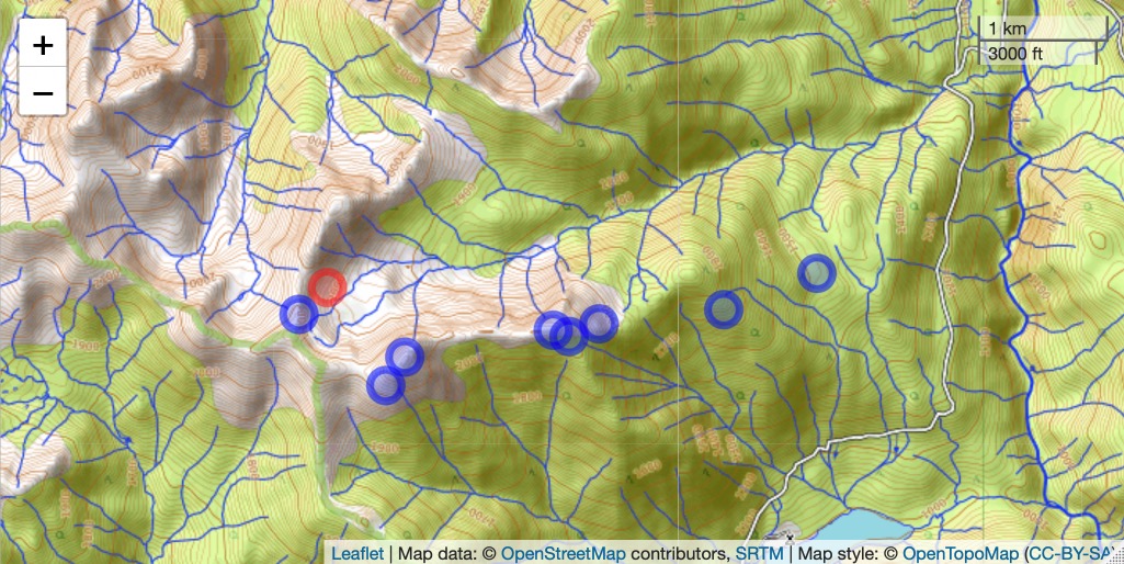
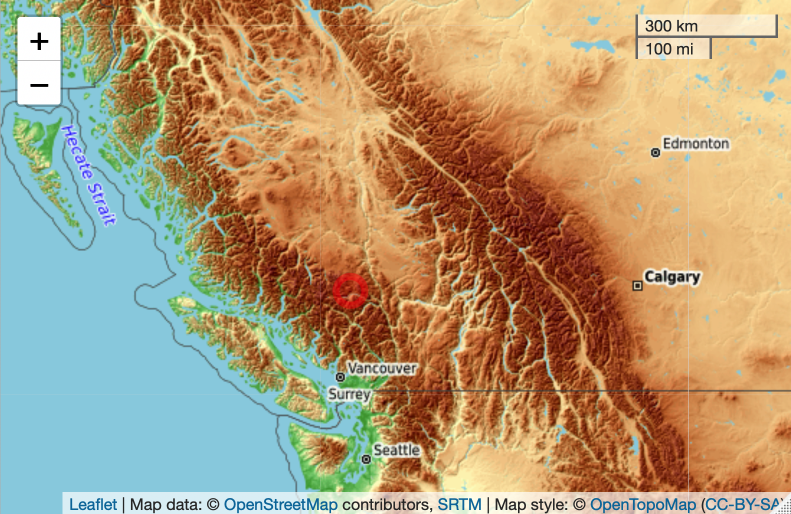
Figure 1. Location of the tour stops where 360 photos were taken (top) and the meadow location (-122.7942 W, 50.9650 N) in the larger region (bottom). Maps created by NH in RStudio using the Leaflet package with OpenTopoMap.org. R code available upon request.
Regional Geology
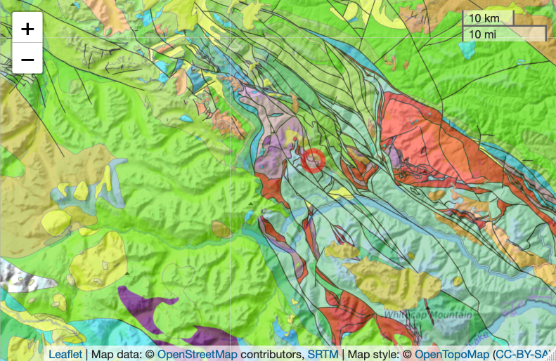
Figure 2. Regional geology showing faults (black lines) and varied lithology. Tour location at red dot. Source: Map created in RStudio by NH using Leaflet package with Macrostrat.org. R code available upon request to NH.
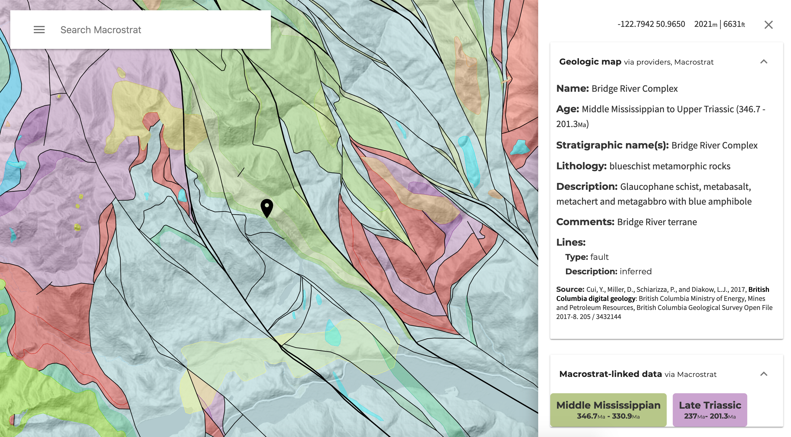
Figure 3. Geological classifications in the tour region. Black marker points to the south ridge at the half-way point of the route, at -122.7942 W, 50.9650 N, leading to alpine meadow in the cirque basin. Lines indicate faults. Colors correspond to different geological formations. Description of the geology for the ridge location at the marker is indicated in the panel on the right. Source: Macrostrat.org
How many other formations can you see that cross the meadow location in the tour (these are color coded in the map in Fig. 3)? Are you curious about these other rock types along the tour and those in the wider region? Find our more by visiting the Macrostrat.org website at this location. Click on the formation to see its lithology, as shown for the formation colored light green, above.
