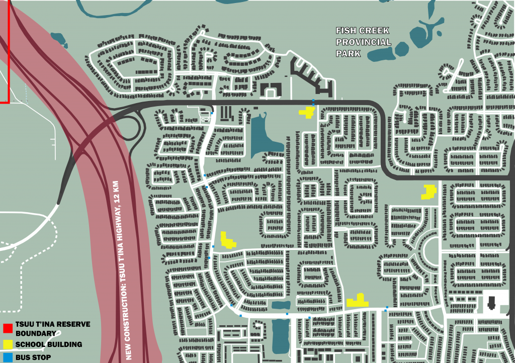
I looked at an intersection that is located adjacent to an elementary school near the house I grew up in. The neighborhood, like many in Calgary, is not very walkable. On weekdays before school, and after students are dismissed, there is a lot of congestion on this specific intersection and it doesn’t seem like the safest situation to have kids running around in every day.

Excluding the highway, the map below shows the approximate area that can be reached within a 15 minute walk of that intersection, which includes four schools located on the perimeter of a loop created by the two larger roads in the neighborhood. This area includes a handful of bus stops, a gas station, a church, and a lot of single family homes. During the morning school rush the two main roads become incredibly congested and it is nearly impossible to leave this area.
This is a mental map of Calgary and its surroundings. Anything directly adjacent to the train tracks can be reached by the LRT line I live near. I grew up in the “Deep Suburbs” in the South West, and don’t really drive on my own, so my knowledge of what exists in this city is limited to what can be reached by transit in an hour (1h 30 max). As a primarily transit commuter, more than half of this city is entirely unfamiliar to me despite living here for my entire life.

