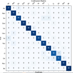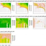
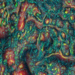
MTP is an image output that allows the viewer to visualize a landscape using various scales of topographic position. By utilizing a local-, meso-, and broad-scale topographic position, prominent features at each scale can be visualized at once (Lindsay et…