In this lab, we explored landscape change in Edmonton, Alberta from 1966 to 1976 using data from the Canadian Land Use Monitoring Program. This data was put into Fragstats, a computer software program designed to compute a variety of landscape metrics. Also required was the creation of a transition matrix in Excel and a report written from a particular professional perspective. I chose to write as an agricultural planning consultant, and hence focussed my analysis on threatened agricultural areas and urban encroachment.
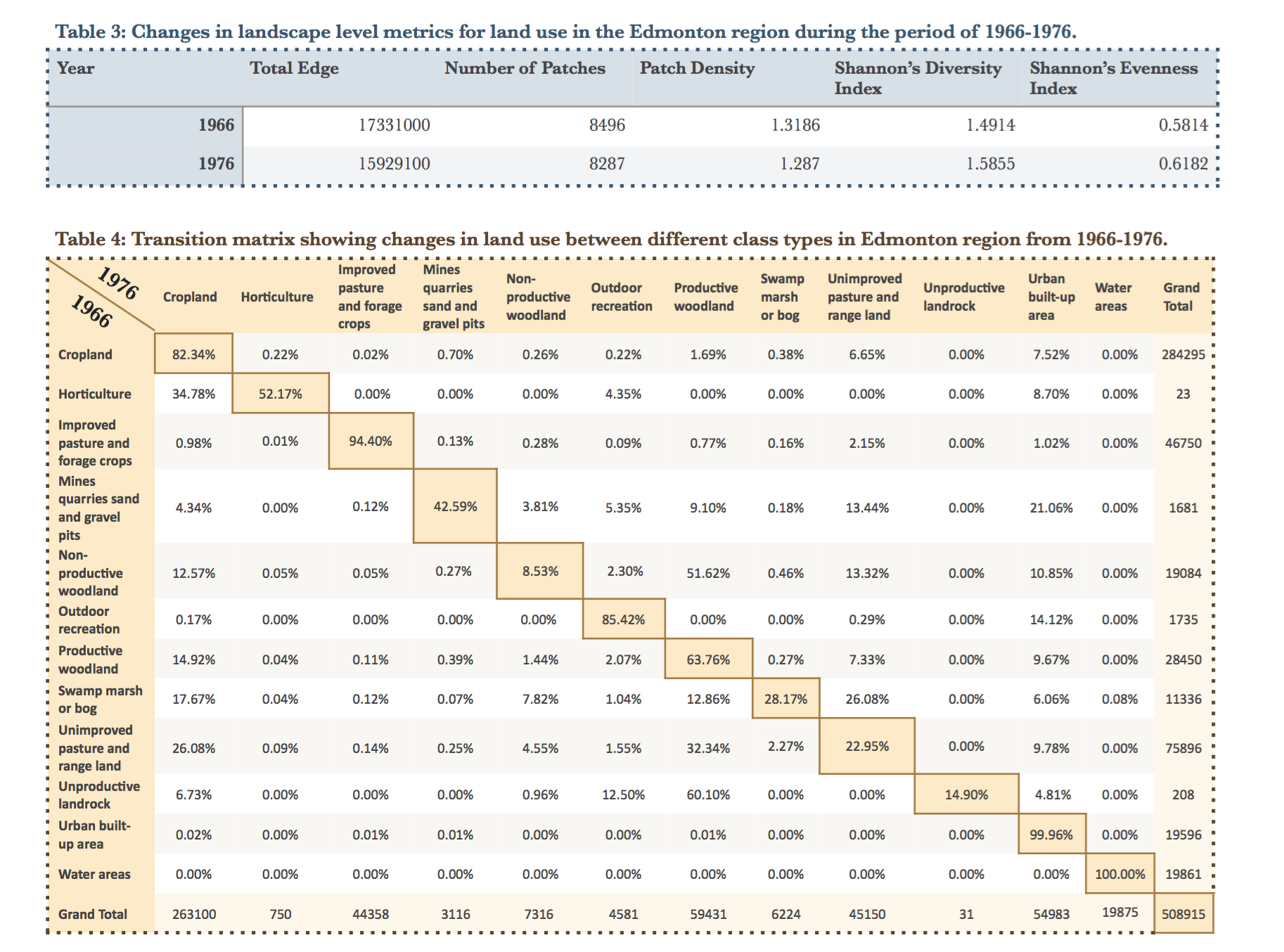
The Fragstats analysis involved several different class and landscape metrics including total area, percentage of landscape, core area, number of patches and patch density.

The results were compiled into a transition matrix that shoes how land uses changed from 1966 to 1976.
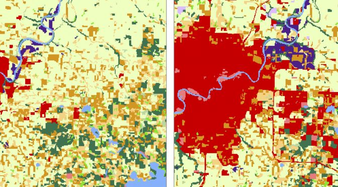
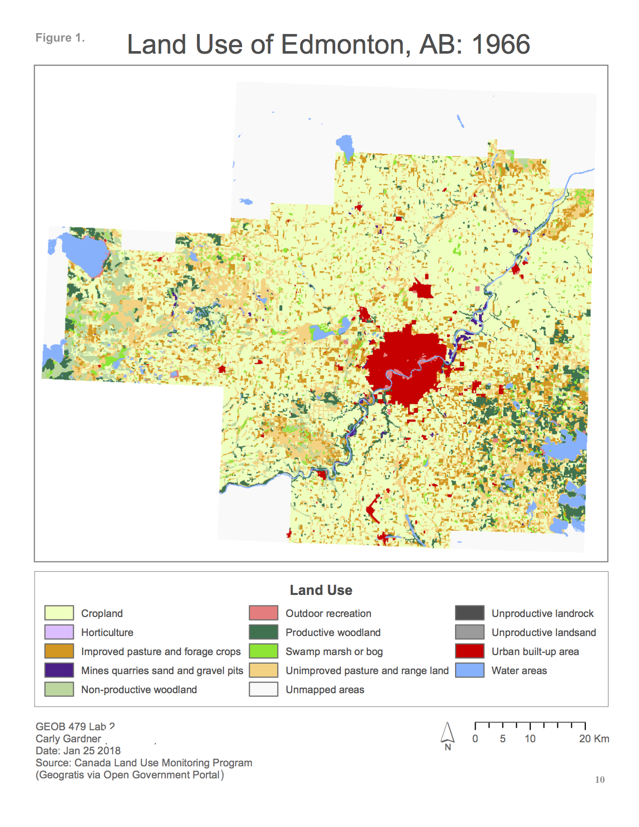
Land use maps were also produced.

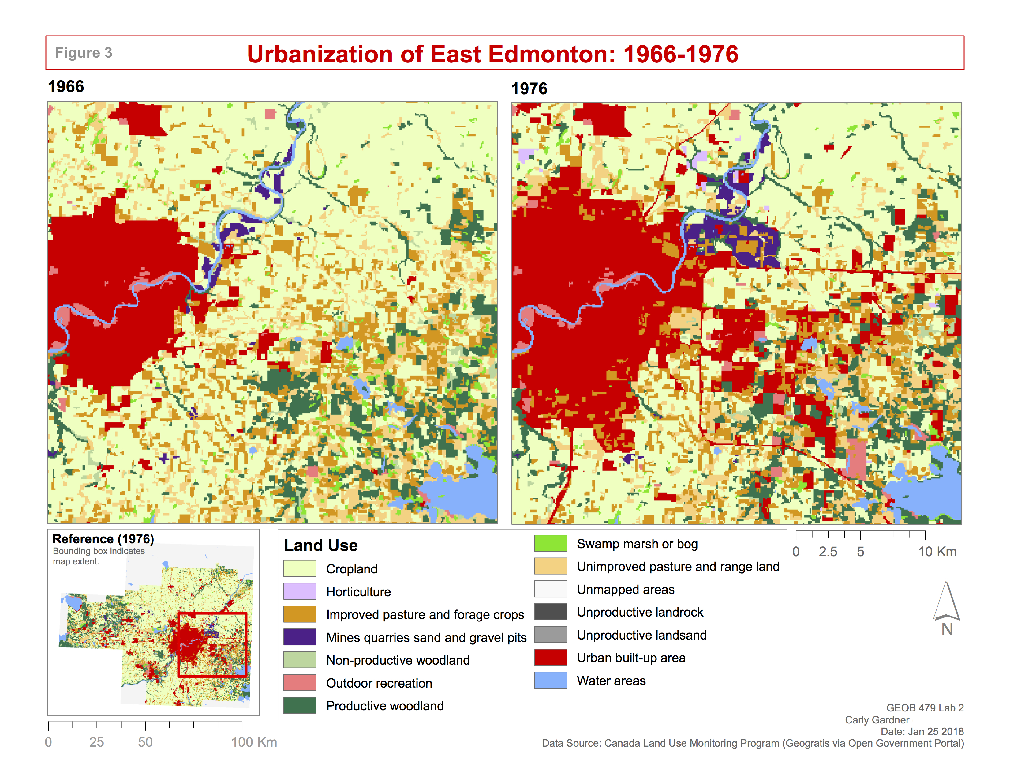 The analysis ultimately revealed that although some areas were converted to cropland (namely, areas previously used for horticulture, unimproved pasture and rangeland), there was a net decline in total cropland area. The biggest threat to cropland was conversion to urban built-up area, which consumed 7.5% of existing cropland. This is equivalent to about 21,379 hectares of agricultural land consumed by urban development. Class metrics also revealed a growing number of cropland patches, despite the total area decreasing. Moreover, cropland core areas became increasingly disjunct. This indicates an increasingly fragmented cropland area, with each patch becoming smaller, narrower, and/or disrupted by land use changes.
To a certain extent, this decrease of cropland area and increasing fragmentation is expected within the boundaries of a major urban centre like Edmonton. The construction of new highways and the development of new neighbourhoods is largely unavoidable for regions experiencing such high rates of population growth. That being said, the limited nature of good agricultural land makes cropland an extremely valuable resource that requires preservation.
As a pretend agricultural planning consultant, I suggested the development of a comprehensive plan that involves key stakeholders of the Edmonton CMA in order to confine urban sprawl and preserve high-quality agricultural areas. This would include the establishment of a legislated urban growth boundary, promotion of densification over sprawl, gathering of inspiration and expertise from existing plans such as British Columbia’s Agricultural Land Reserve, the establishment of rules to prevent land speculation on agricultural reserves, and engagement in stakeholder consultations.