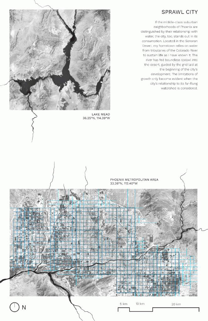
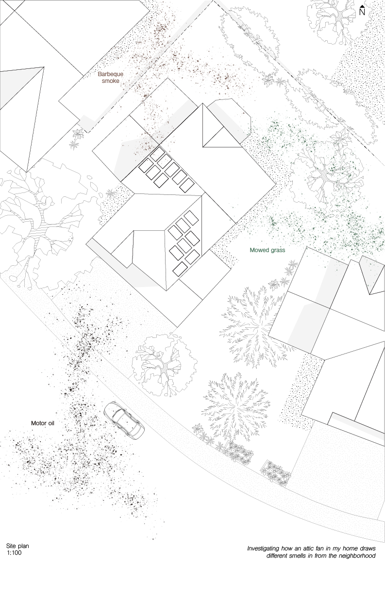
My explorations of home focused on my family’s house in Phoenix, Arizona, USA. Water plays an important part of environmental experiences in the desert city, but is also in short supply, with access increasingly falling along class boundaries. Growing up in a middle-class suburb, I routinely experienced the pleasures and excesses of non-necessary water usage.
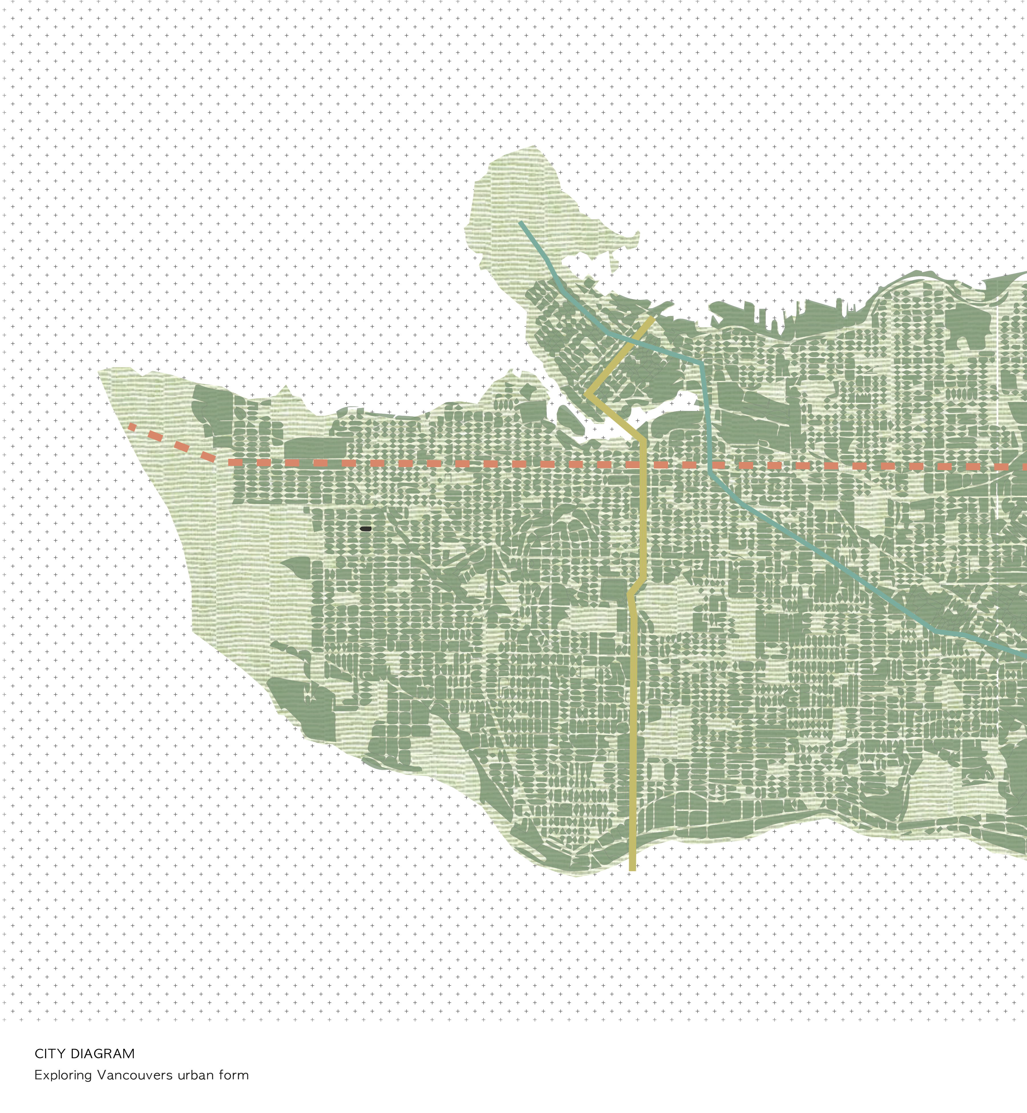
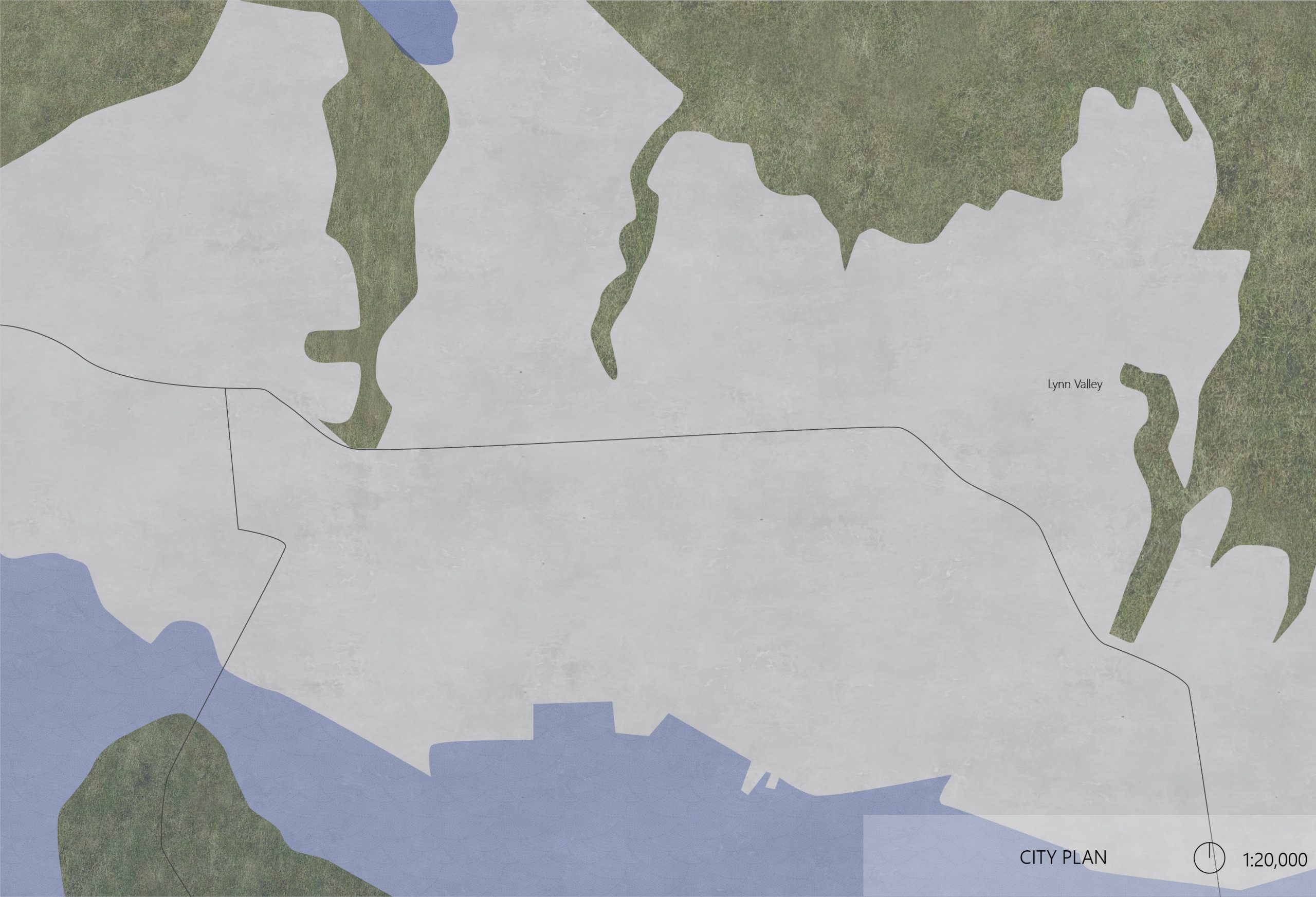
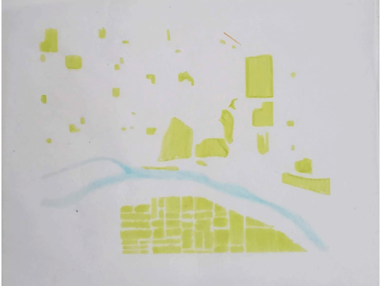
Note: the city diagram should appear as a GIF; troubleshooting to come!
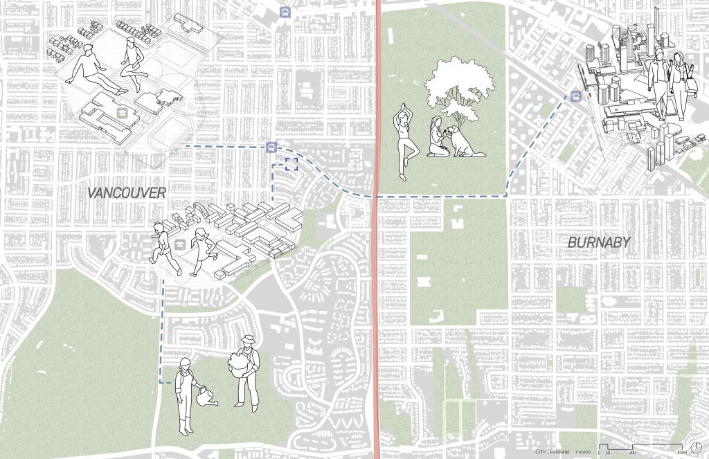
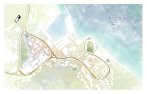
The site is located in residential area, and is encircled by Green space, then beaches, and finally the ocean. The colored lines have showed the routes and various zoning around the site, including residential area, cultural museums (Vancouver Maritime Museum, Museum of Vancouver), green spaces, and beaches. The circular distribution of geographical typology has fulfilled people’s experience when they are walking to the beach. I have searched about the walking experience from home to the shoreline.
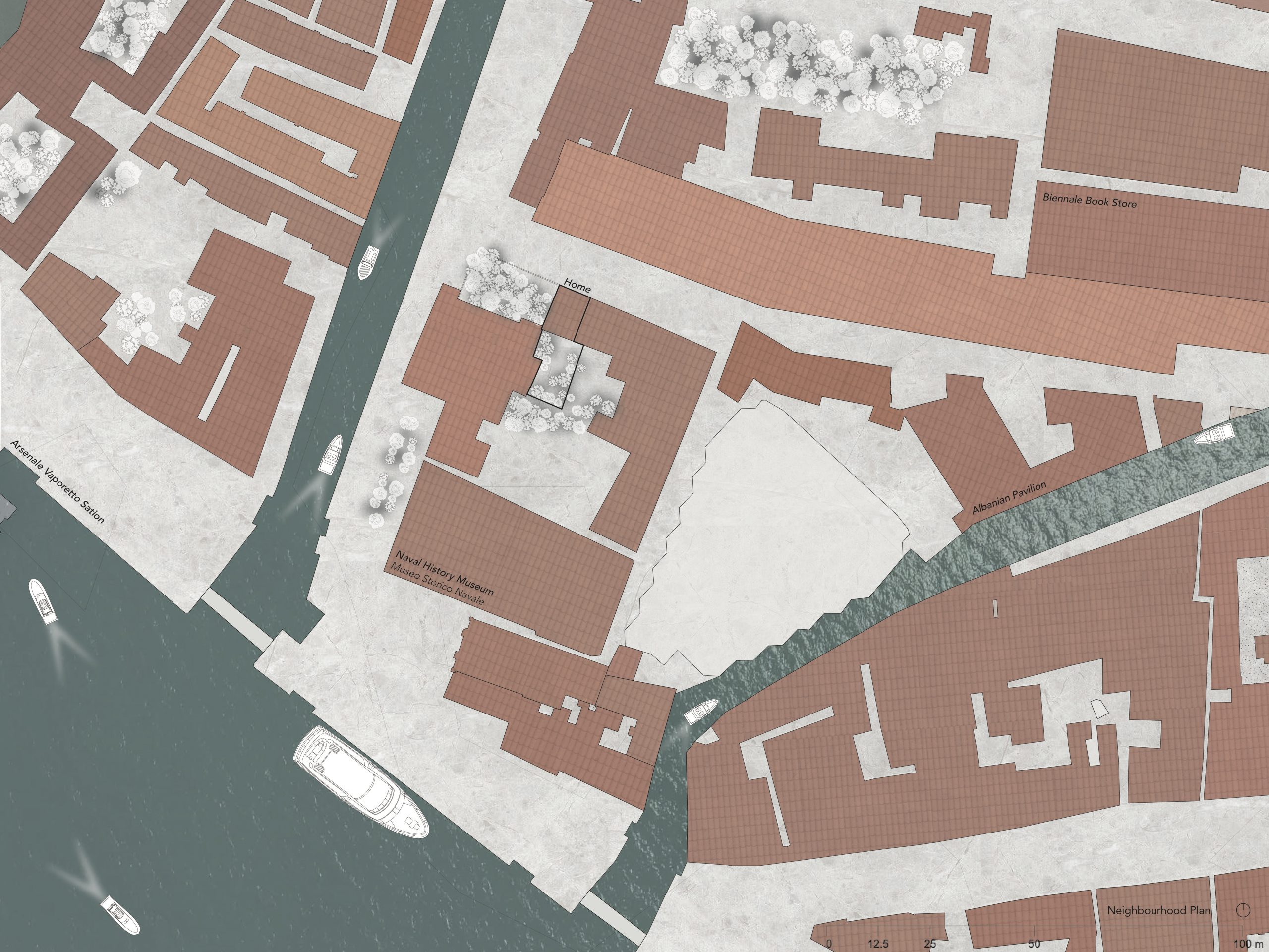
This past summer I worked at the Venice Biennale and lived in a neighbourhood in the south east side of Venice called Castello. While only spending three months there, it is a place I quickly came to call home. The street I lived on— an uncommonly wide residential street— was always packed with people dining and chatting in the restaurant just downstairs, or lining up down the block for performances, dances, and movie screenings put on by the Biennale at the performing arts theatre.
On a neighbourhood scale, the lagoon opens onto the Adriatic Sea, and much more boat traffic is seen— from the vaporetto sea bus transportation, private boats residents use, to the navy boats and yachts docked on the sea wall. The lack of green in the drawings attests to the lack of public green infrastructure in the city. Aside from private courtyard access and apartment building gardens, some of the only large green space parks are on the private grounds of the Venice Biennale Giardini— which for a large portion of the year when the exhibitions are running require a fee to enter.
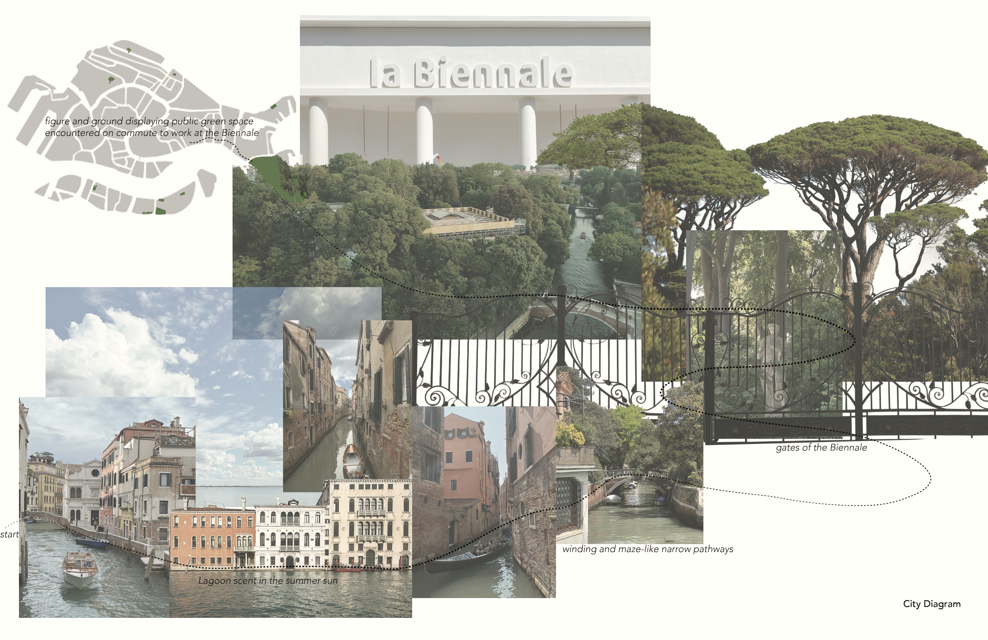
The city diagram explores the experiential qualities in a daily commute— by the water, between narrow buildings along the canals, over bridges to the garden gates. Noting distinct moments and changes in the urban fabric moving towards the Biennale Giardini.
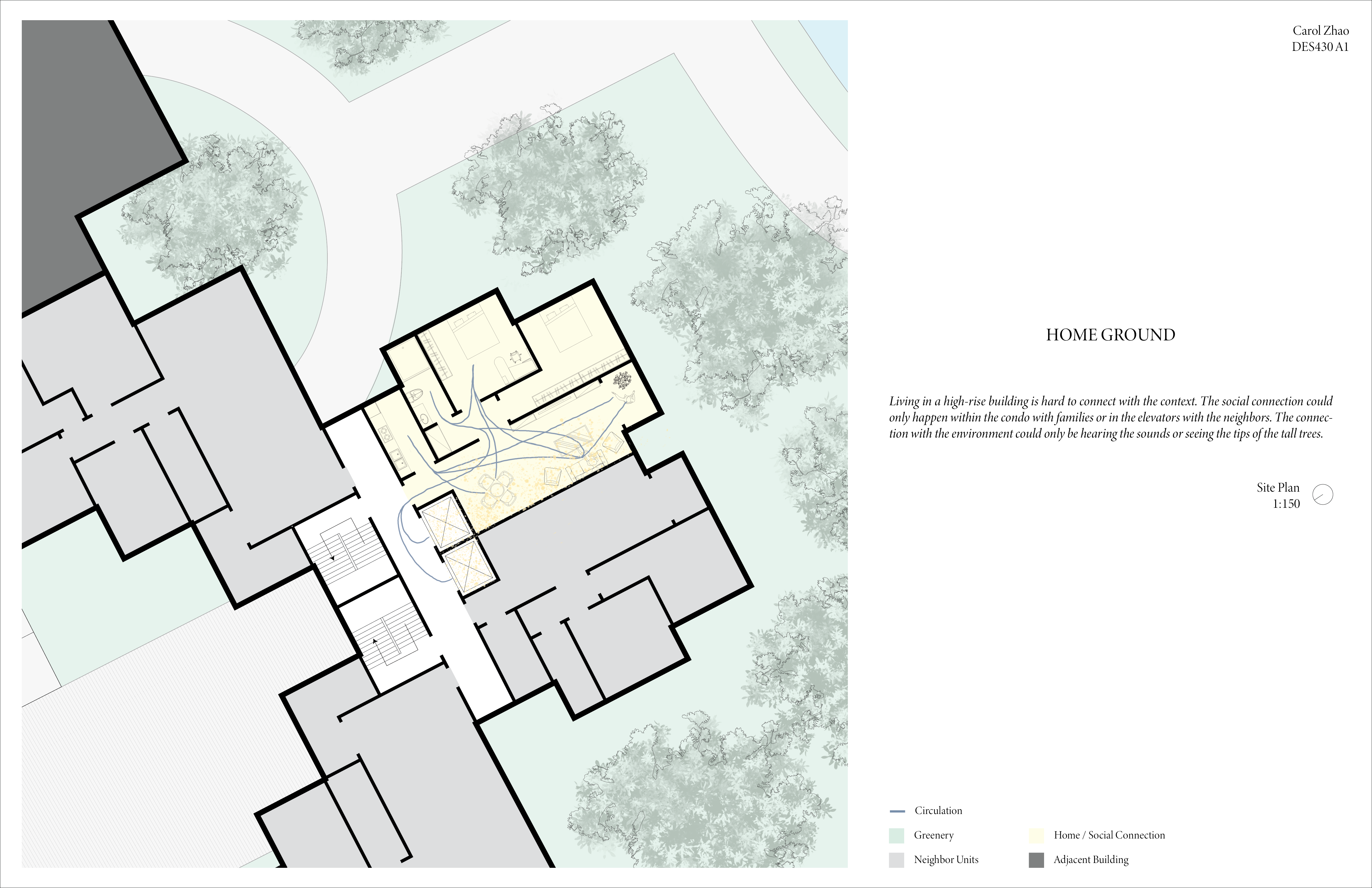
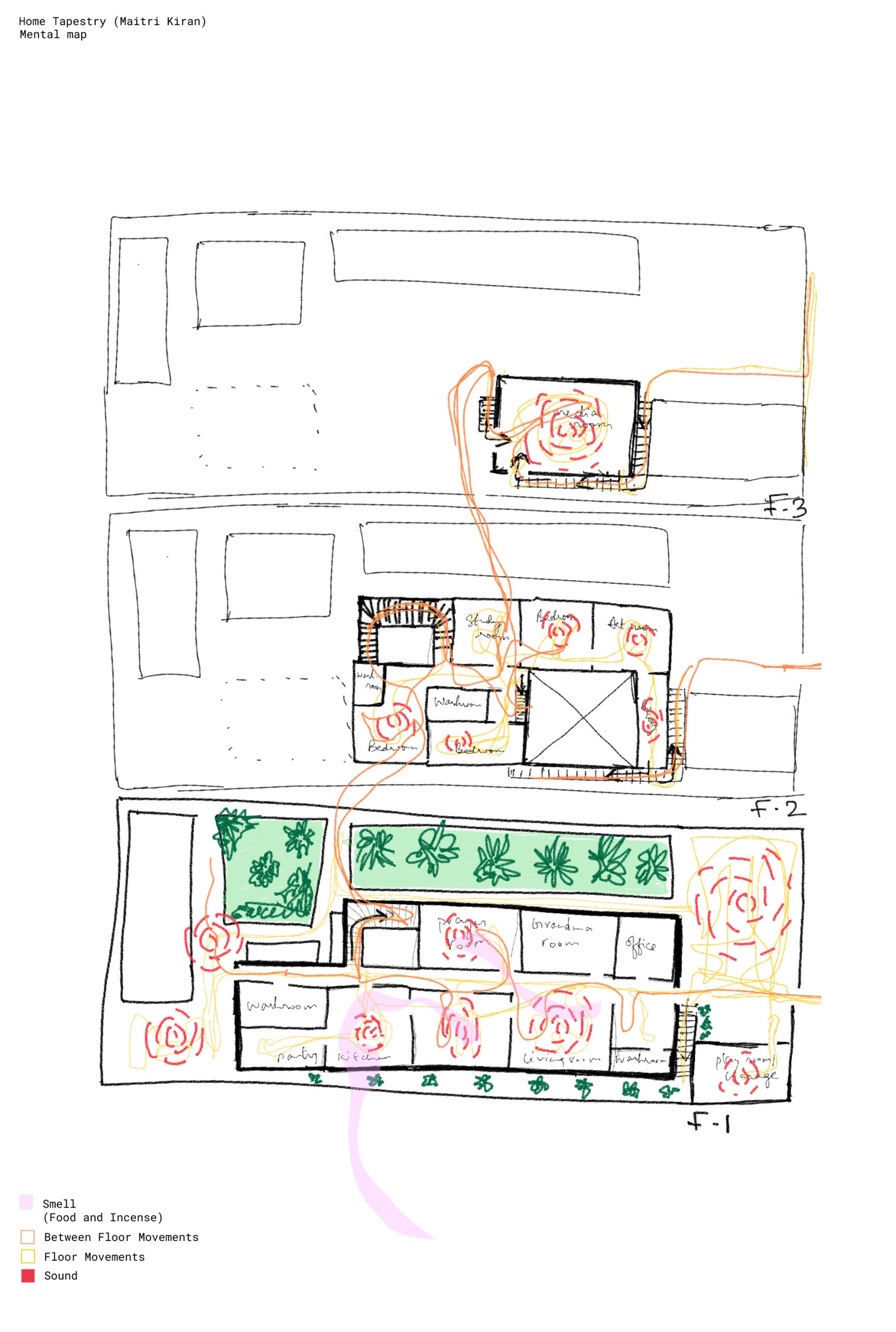
A conceptual mental map of my residence, this visual representation captures the essence of the house without adhering strictly to its precise dimensions. Within this map, the fusion of elements such as movement, aromas, sounds, and the unique utilization of each space converges harmoniously, offering a sensory journey through its interior.
Street Tapestry
This map artfully illustrates the intricate interplay between my residence and its surroundings, primarily the street it’s nestled on. It transcends traditional cartography by seamlessly weaving sensory dimensions into its depiction—capturing not just the visual landscape but also the auditory and olfactory experiences that harmonize within this environment.
Moreover, this dynamic portrayal incorporates the fluidity of movement, with pedestrian and vehicular rhythms elegantly superimposed onto the canvas. Gone are the rigid confines of property lines, as this map transcends conventional boundaries to emphasize the interconnectedness of the entire community. Indeed, it is a map that fosters a profound sense of belonging and shared space—a true testament to its community-centric approach.
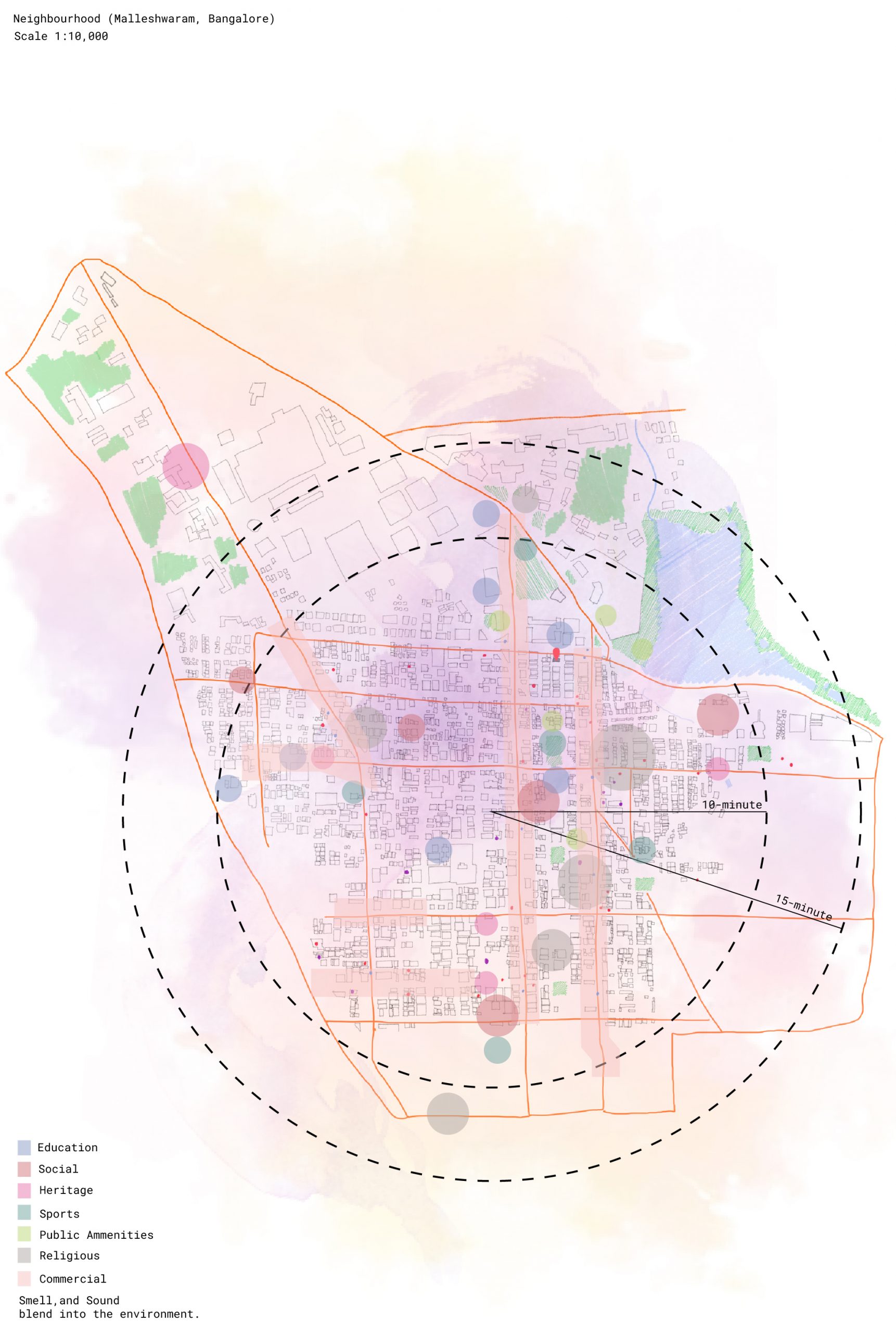
Neighborhood Tapestry
This map unveils the structured urban programming that characterizes the area. Sensory experiences are meticulously superimposed onto the space, yet they seamlessly meld into the environment, making it challenging to isolate any specific sensation at a given moment within a particular locale. As an emblem of interconnectedness, property lines dissolve in this urban landscape, underscoring the city’s role as a cohesive community system.
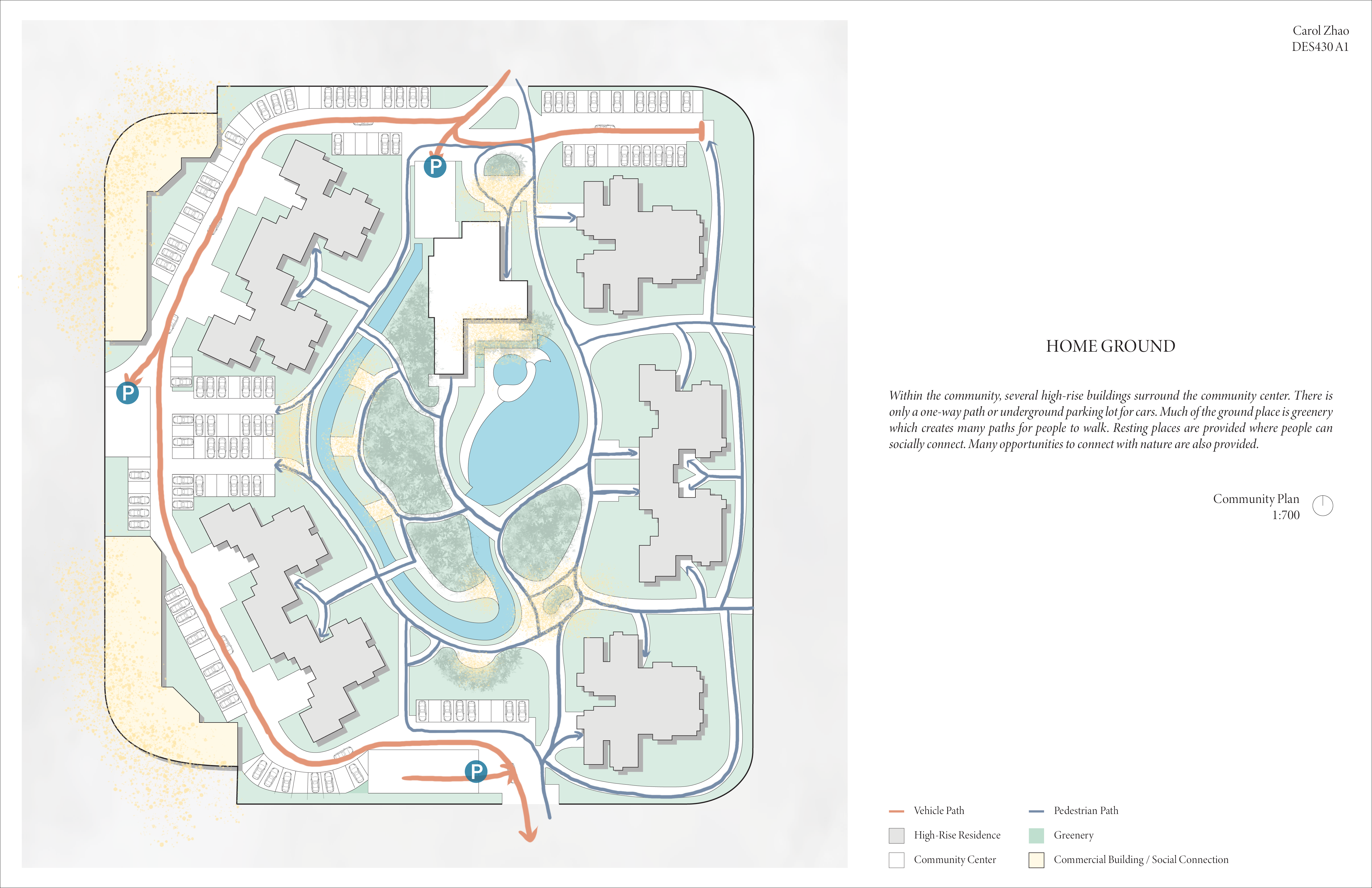
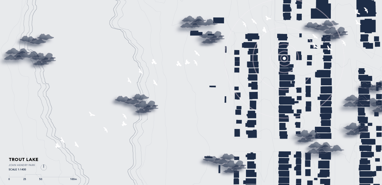
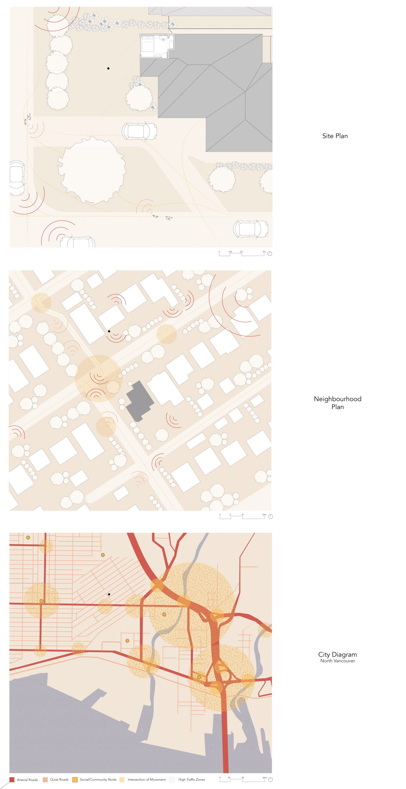
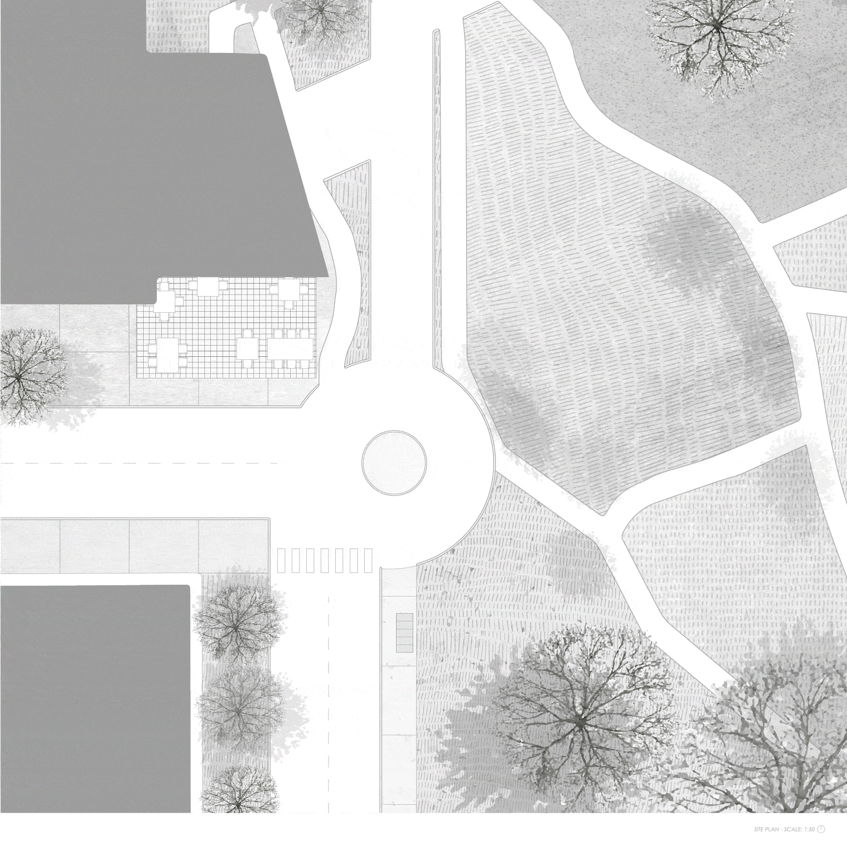
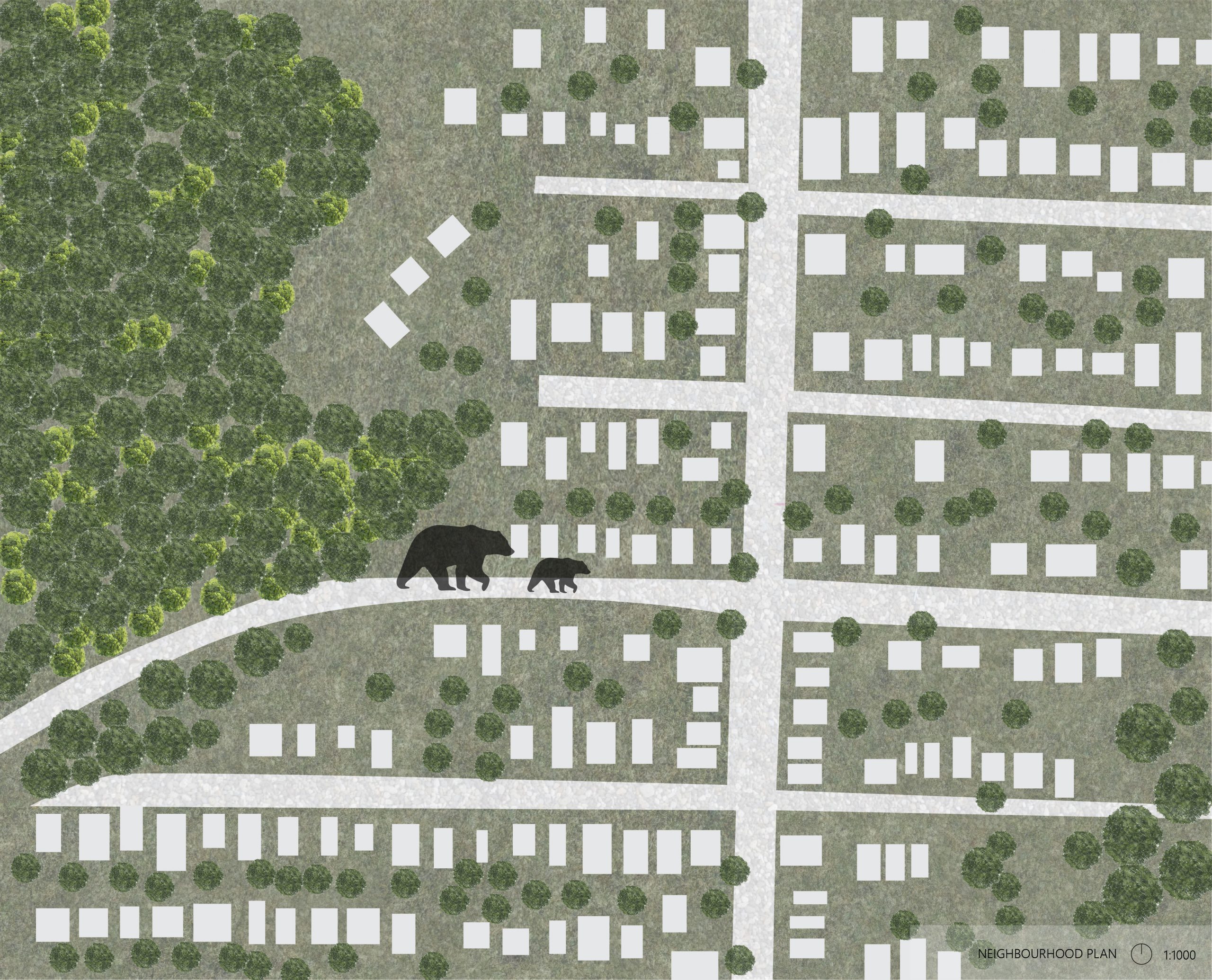
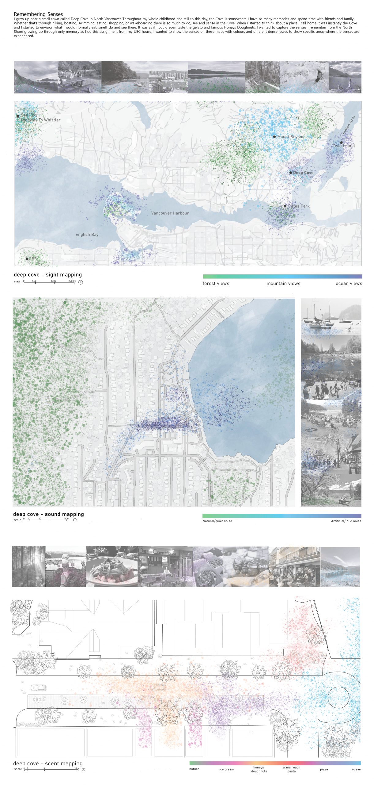
I observed my neighbourhood, Deep Cove, a small seaside village on the far easternmost outskirts of North Vancouver. The region has evolved throughout the years, from a quaint town my parents knew and loved, the community I grew up in and have created lasting memories, to the community it is today, affected by tourism and constant congestion.
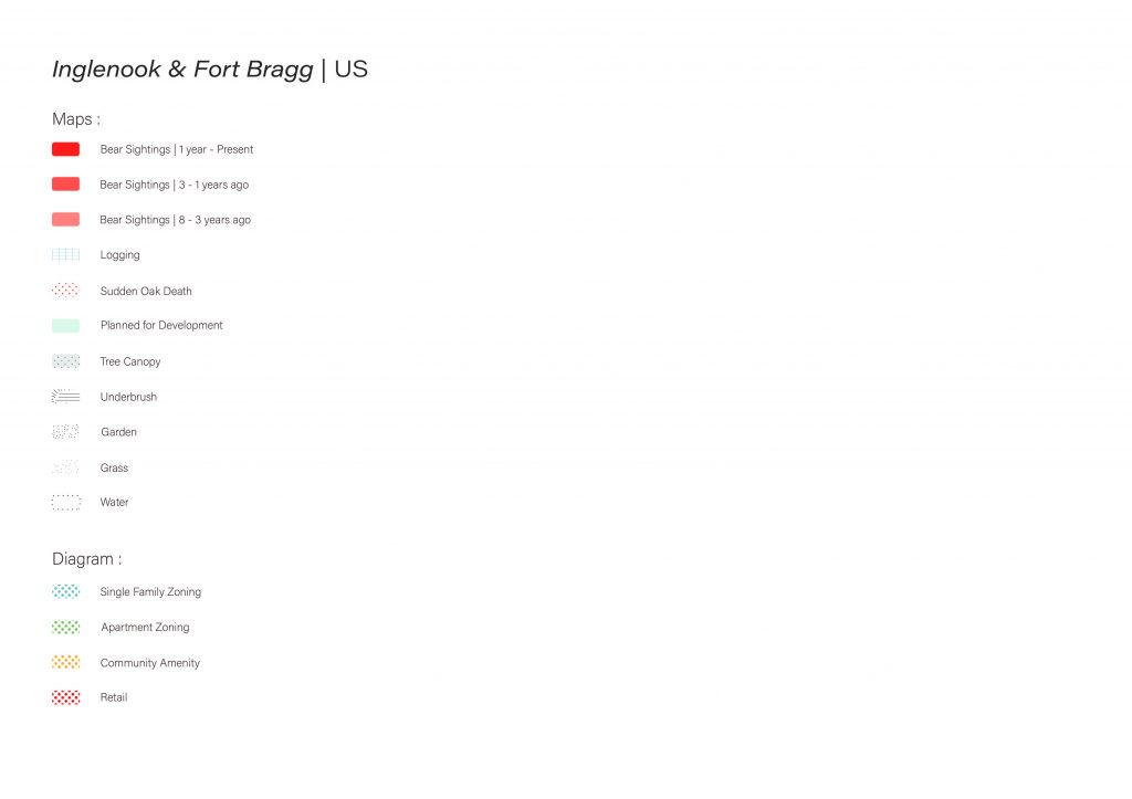
The maps and diagram depict unique attributes of my neighbourhood, specifically nature/animal sounds. It is not uncommon for me to wake up to the sound of a bear (sometimes a woodpecker) in my backyard, with the neighbourhood plan showcasing the distance between the bear’s home and mine.
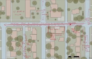
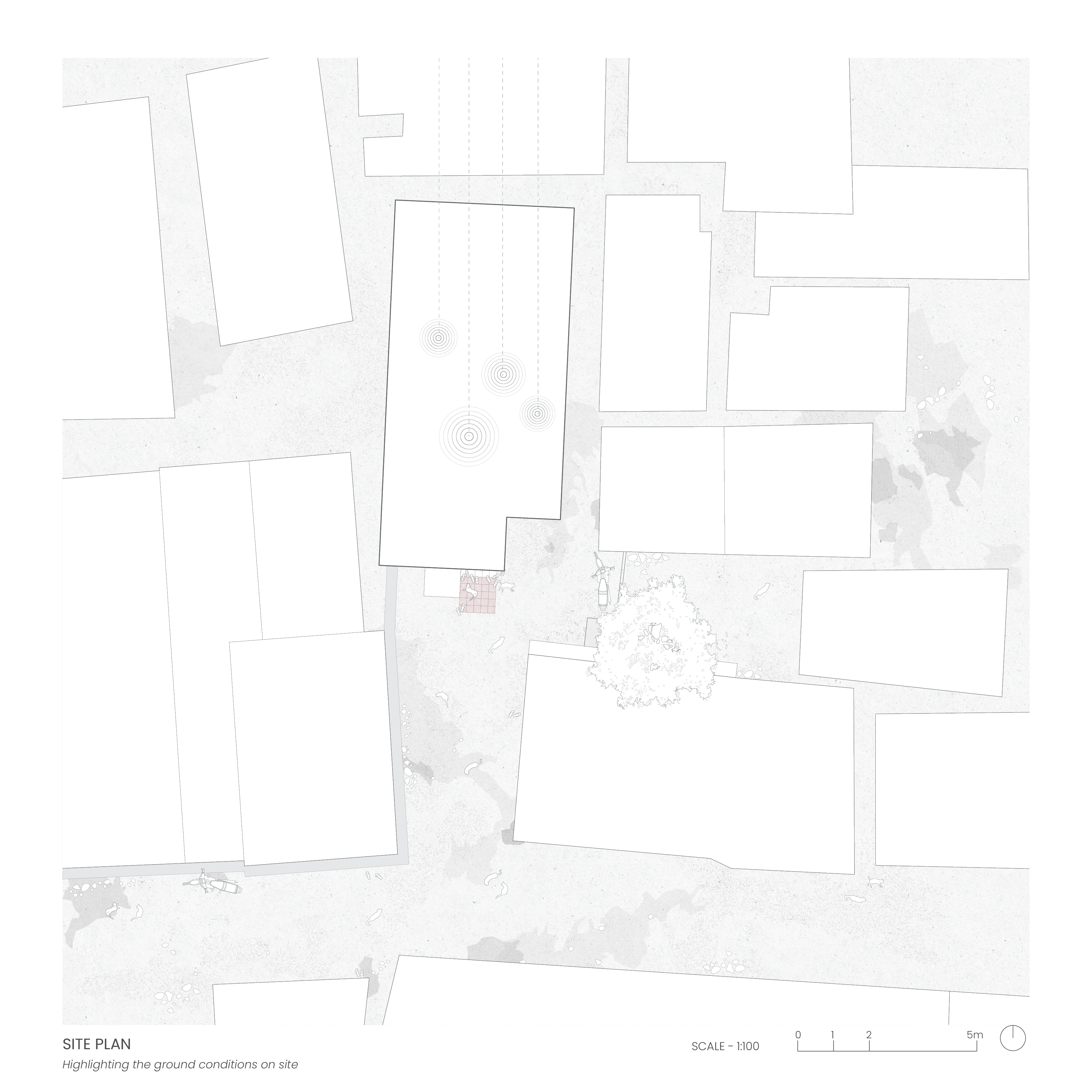
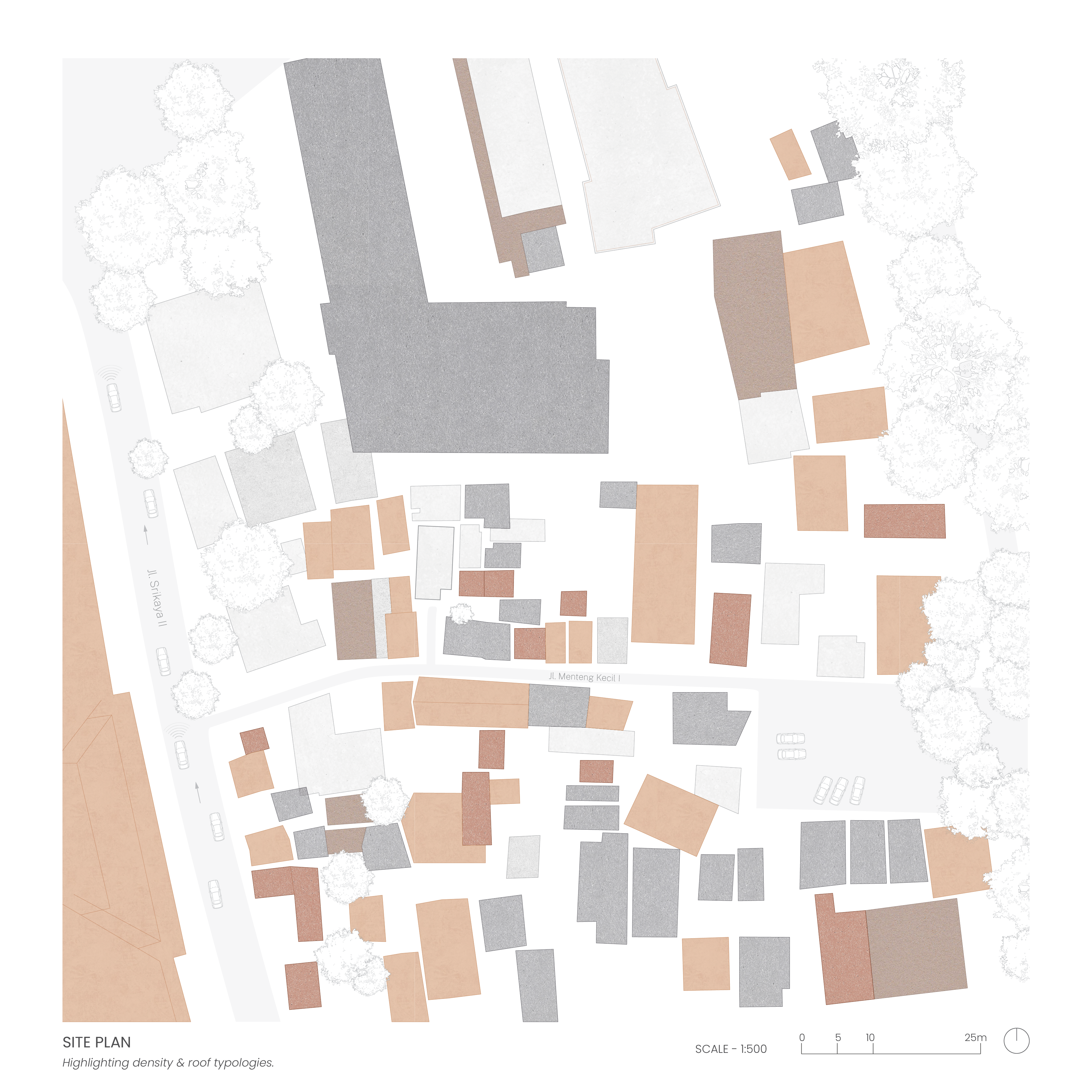
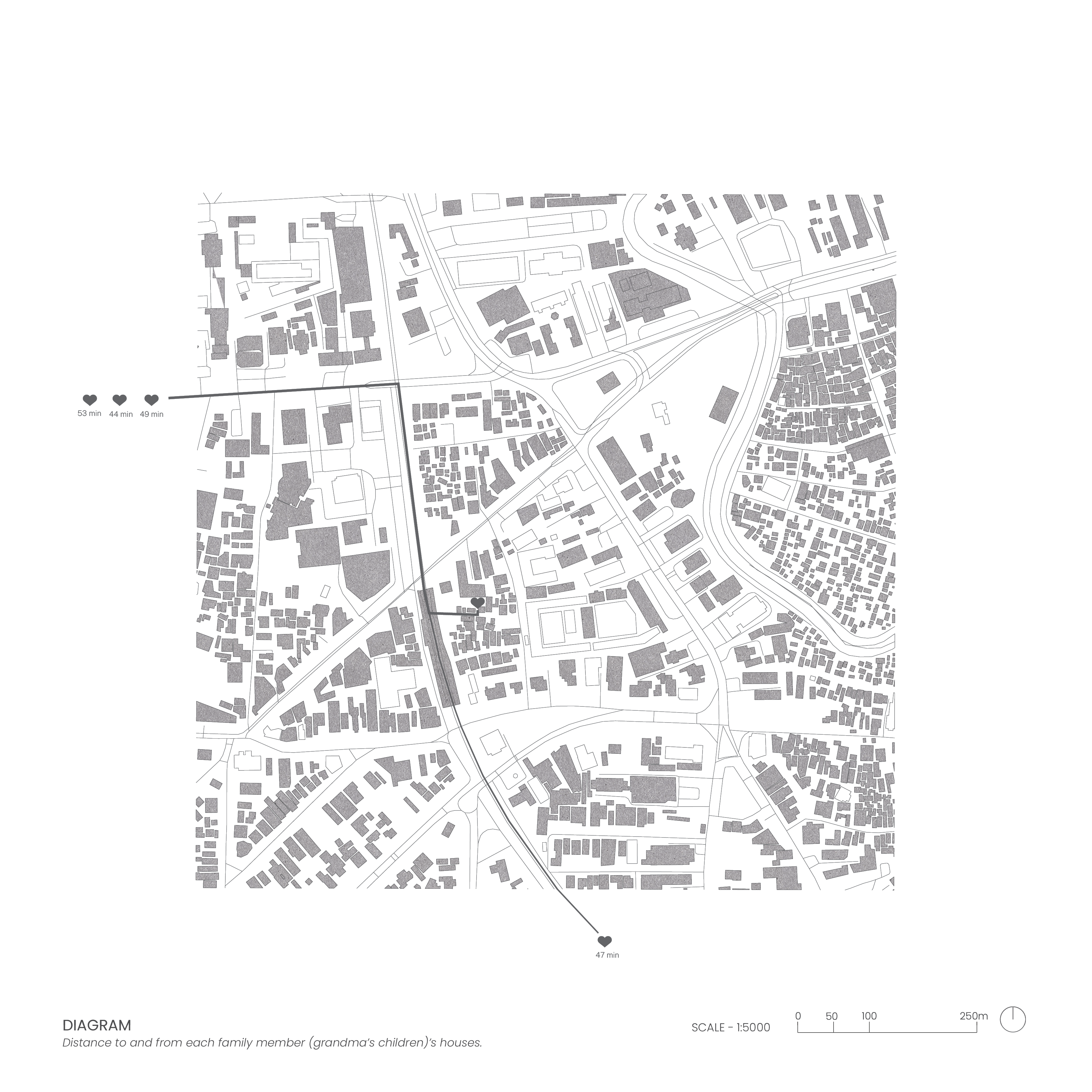
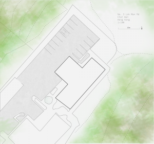
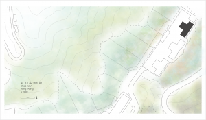
My grandmother’s house is situated in a dense, informal neighborhood in Central Jakarta, Indonesia. Due to the informality of the neighbourhood, it was difficult to gather visual information or references and for such reasons, I had to rely predominantly on my own memory as well as old photographs of the space to produce my drawings. When envisioning the space, the broken concrete and asphalt pathways are what first comes to mind, followed by the stray cats roaming around, and the abundance of sandals outside my grandmother’s house every time we held gatherings. The site plan captures these physical qualities primarily through the ground conditions while the neighbourhood plan highlights its informality, density and roof typologies.
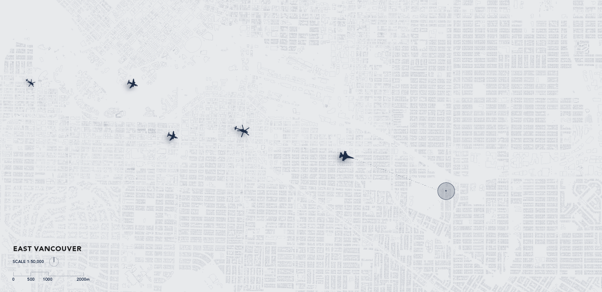
Noise and natural buffers along South East Marine Drive, Vancouver during rush hour.
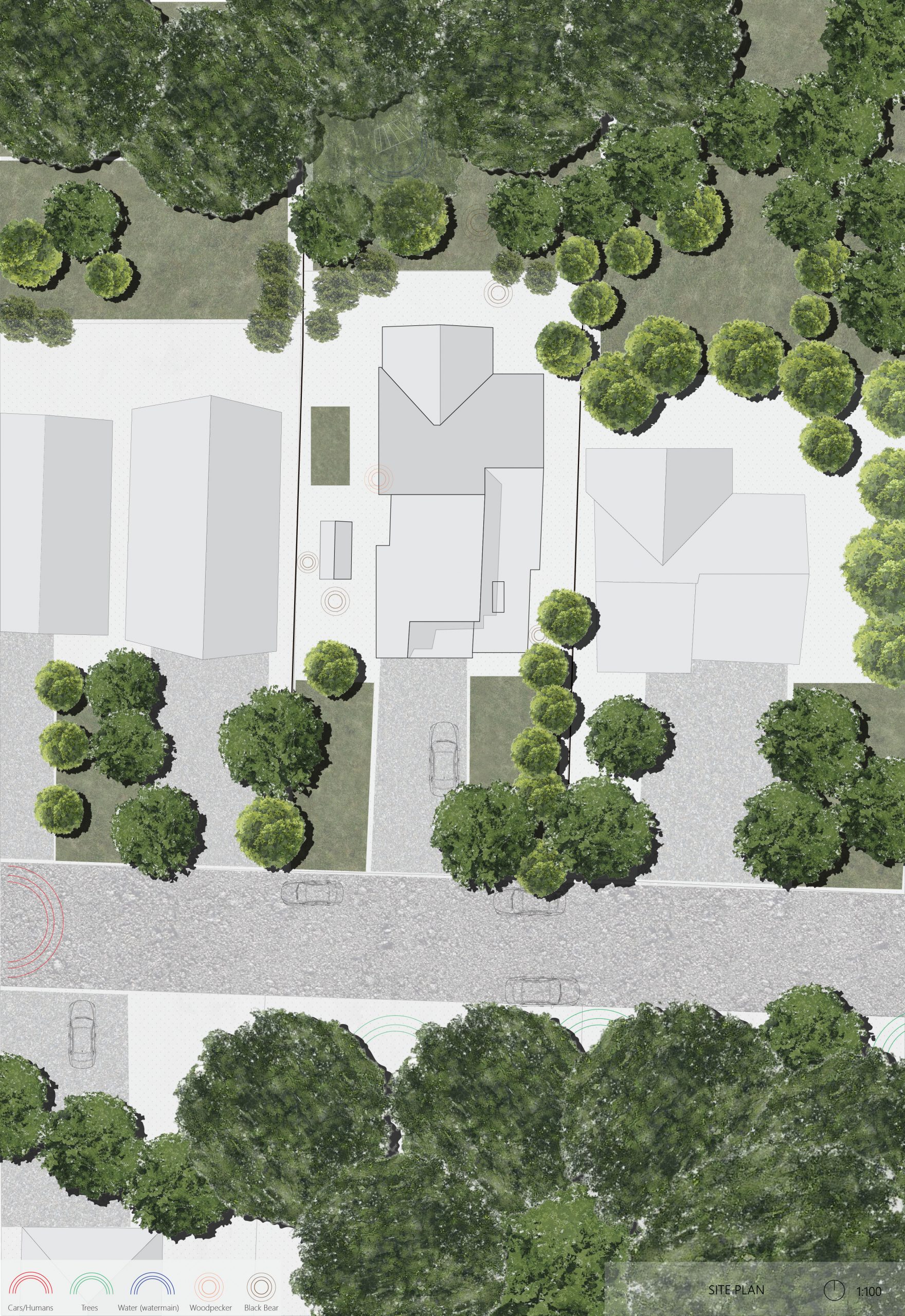
Living along Marine Drive for the past 20 years, I have been use to the constant sounds emitted by vehicles in particular and wanted to map this feeling spatially. Noise is not always liner or physical, but is constantly spread over space in relation to buffers; buildings, hedges. distances etc. The overlapping of different sounds through trace paper resembles how sounds throughout this neighborhood often overlap and become chaotic and how different programs and zones dictate noise intensities and frequency throughout South East Vancouver.
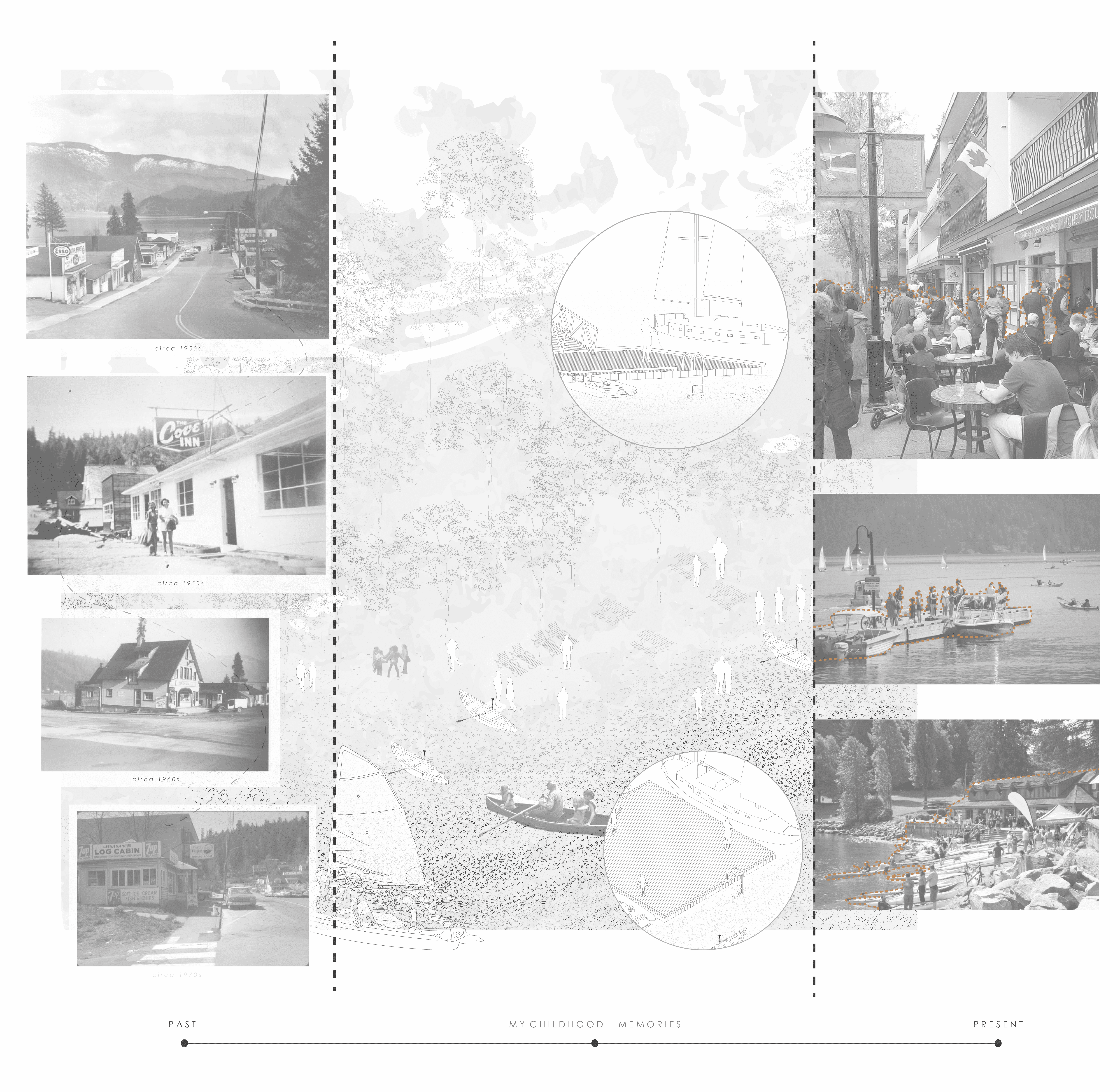
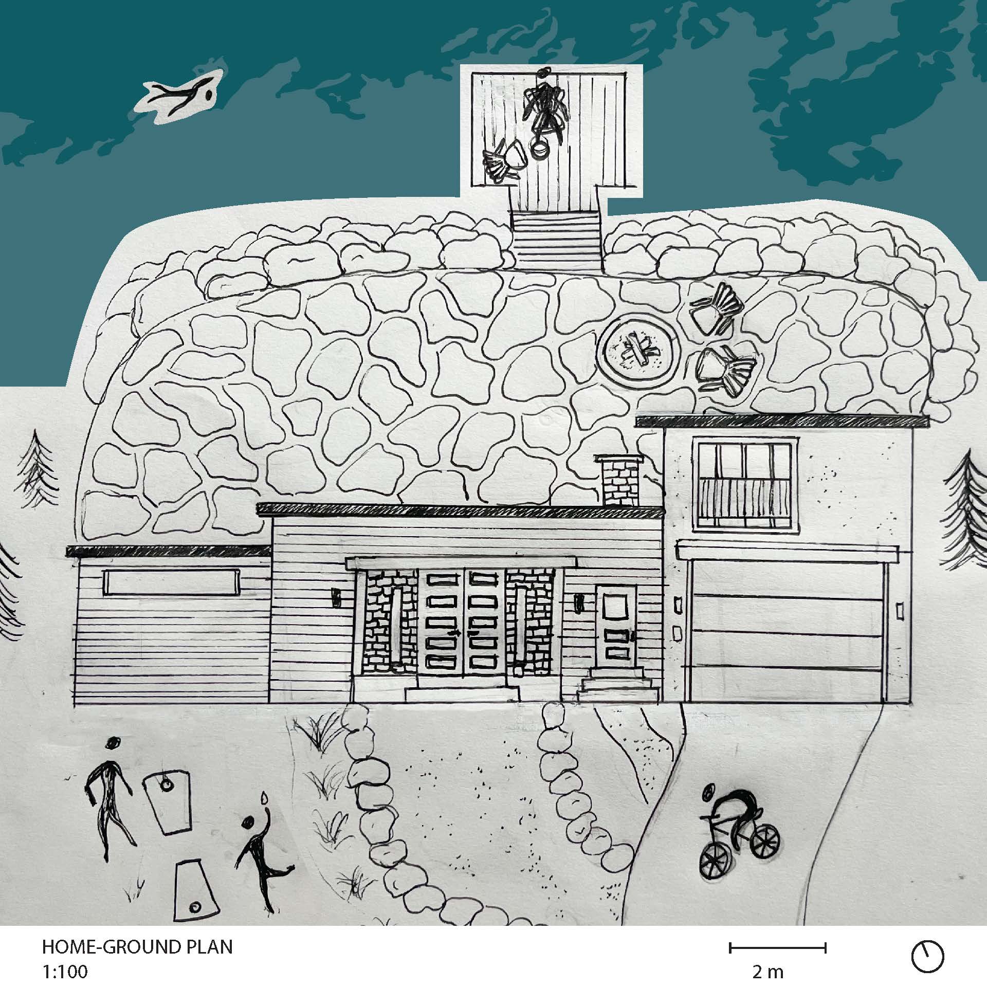
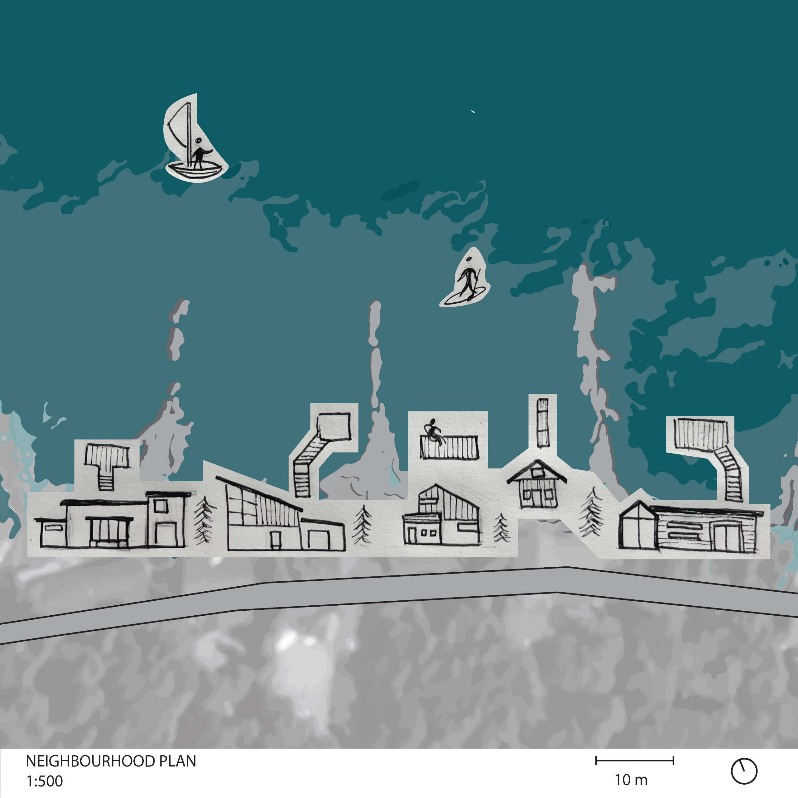
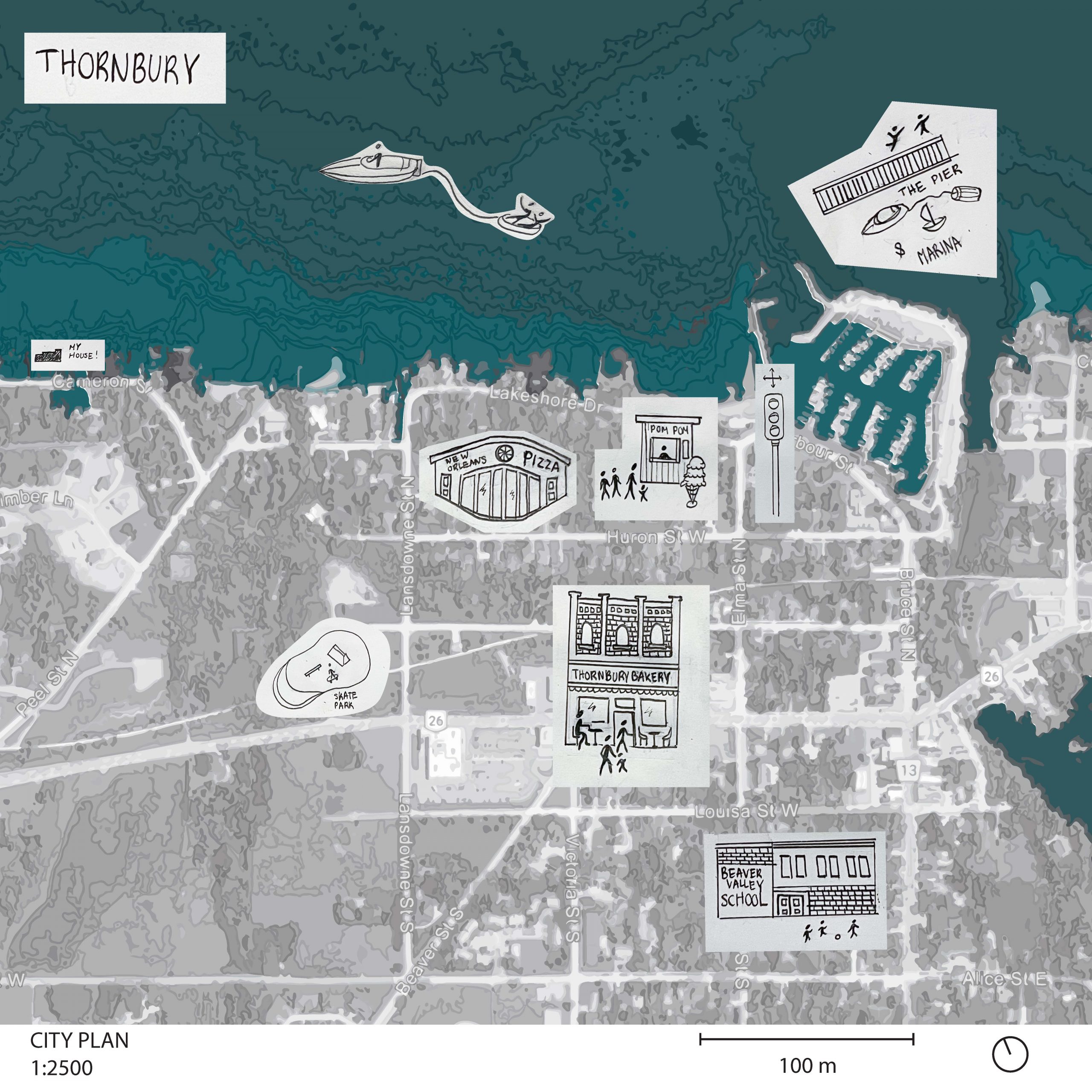
Thornbury is a small town nestled on the southern shores of Georgian Bay. It is an active town and you can always find people swimming, biking and running! There is always a line up for ice-cream or baked goods from the local bakery! The pier and marina is a hotspot with a constant flow of boats and people. I come from a large and very social family, we are very close with all our neighbours and there is always a rotating door of people coming over. The seaside, comforting nature of the town and the vibrancy of the people that live here are a large part of why I consider Thornbury my home-ground.
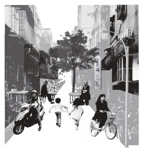
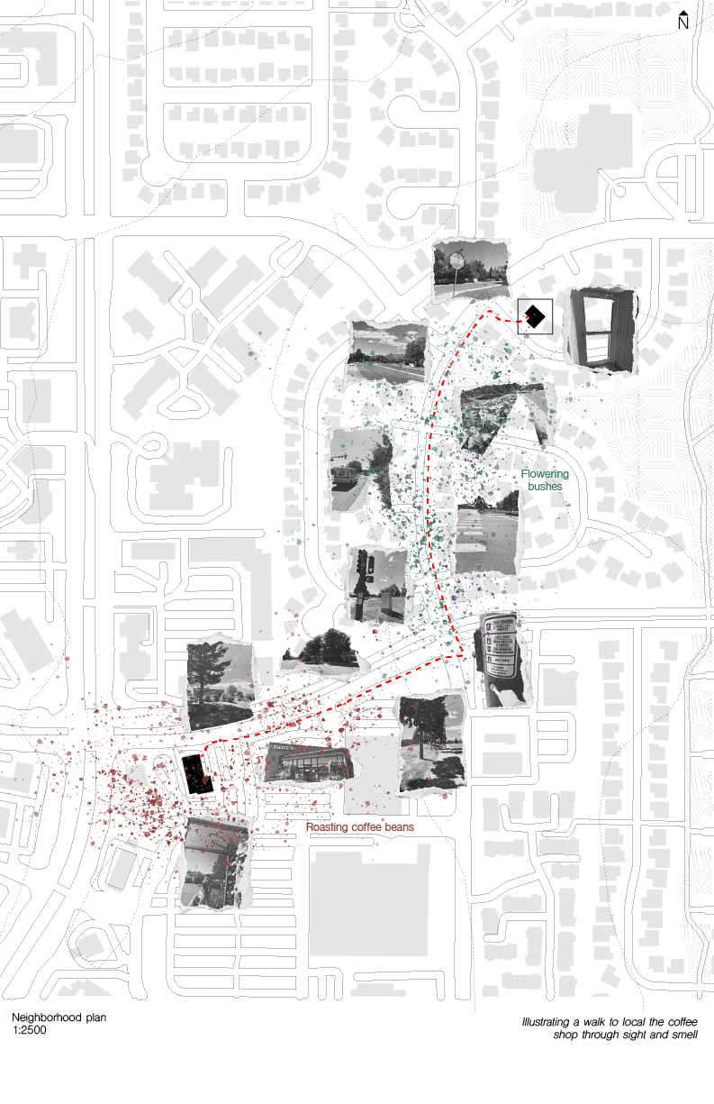
Yongkang Street, nestled within the vibrant tapestry of Taipei’s urban landscape, serves as both the geographical and emotional anchor of my connection to Taiwan.
As I traverse the streets, my journey unfolds along a route that intertwines with my cherished memories. This path weaves through the heart of Yongkang Street, a thoroughfare that has become an indelible part of my life’s narrative.
The collage I’ve composed serves as a harmonious assemblage, fusing together cherished moments into a singular vignette. Within this visual composition, each element coalesces to encapsulate the essence of my most treasured memories,


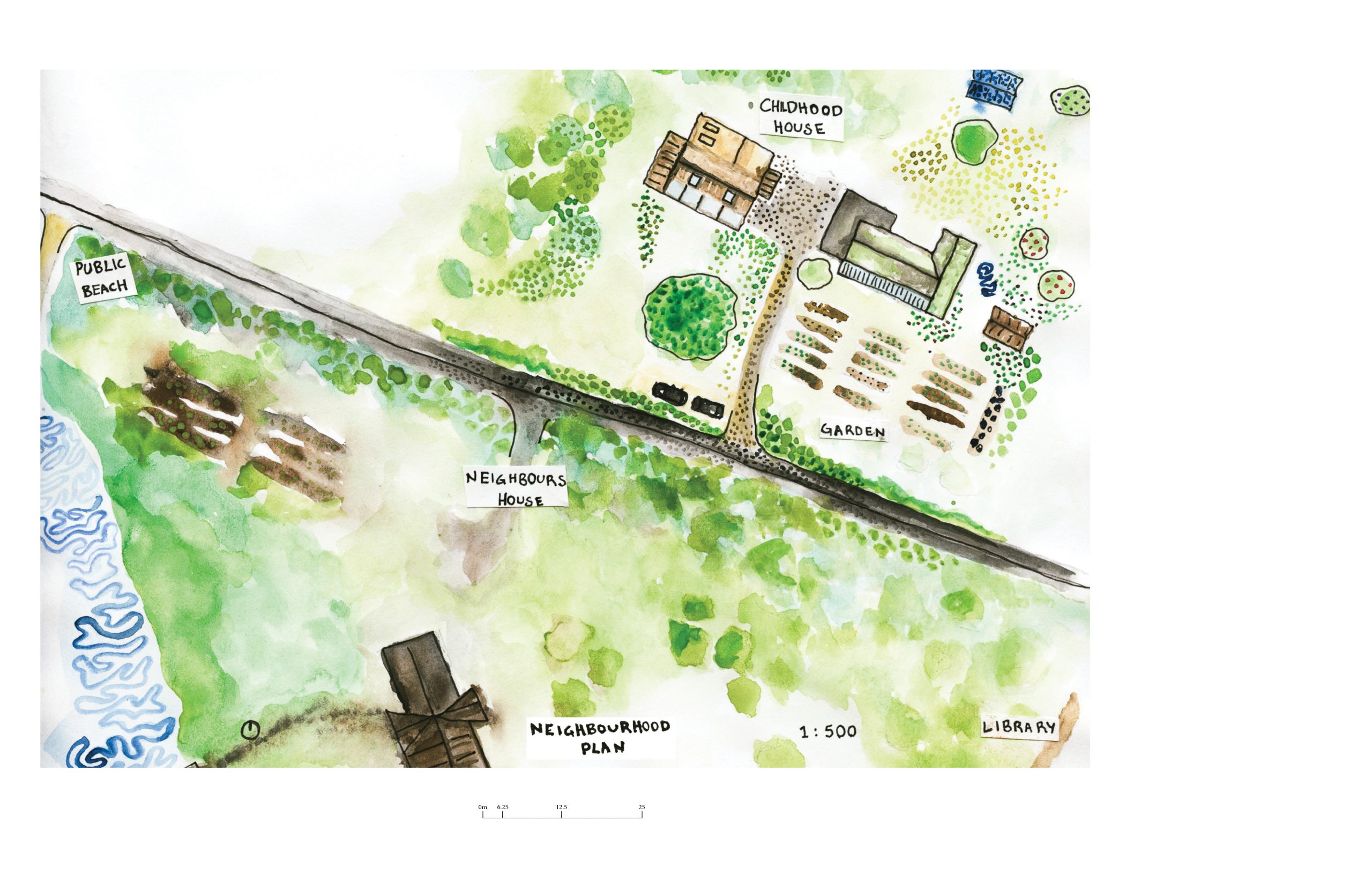
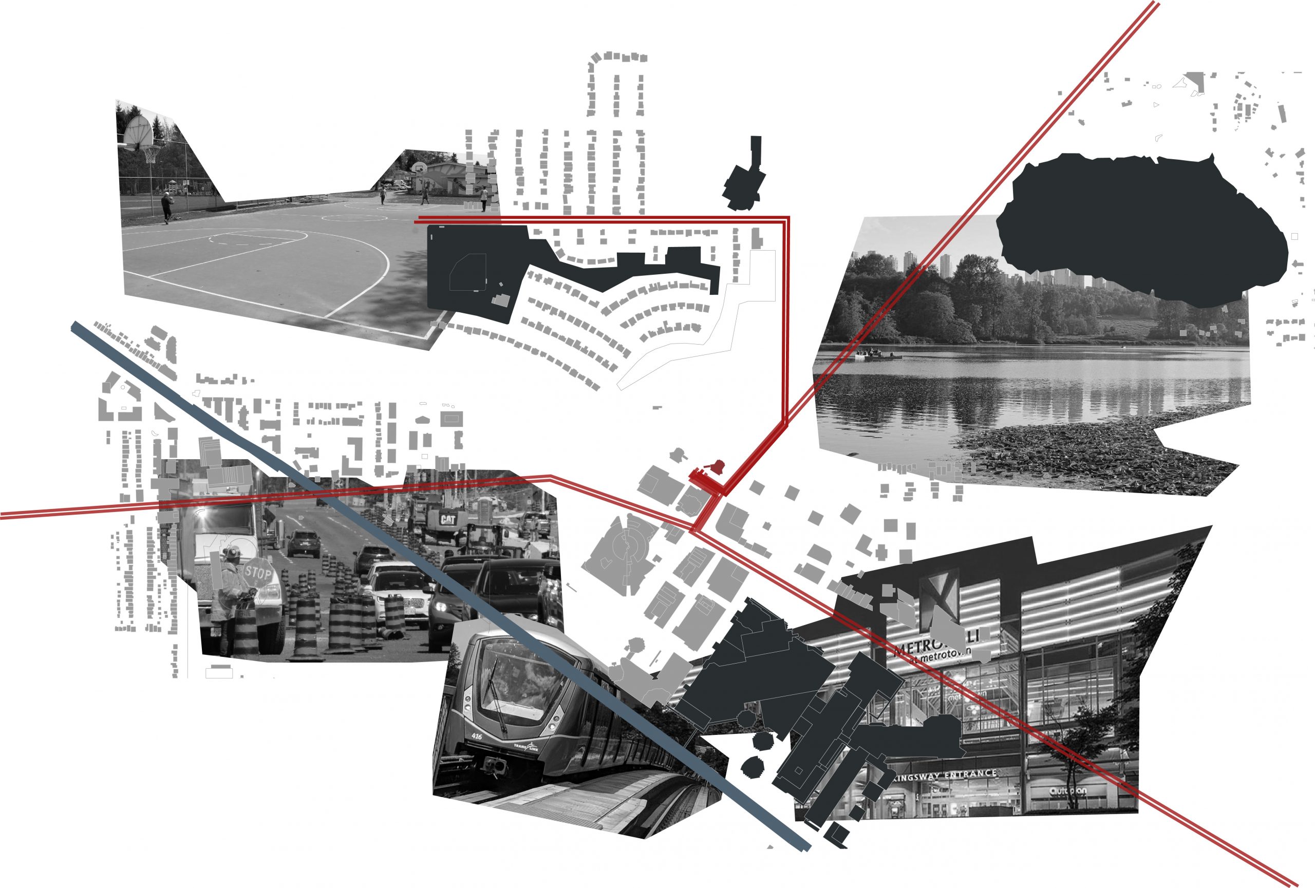
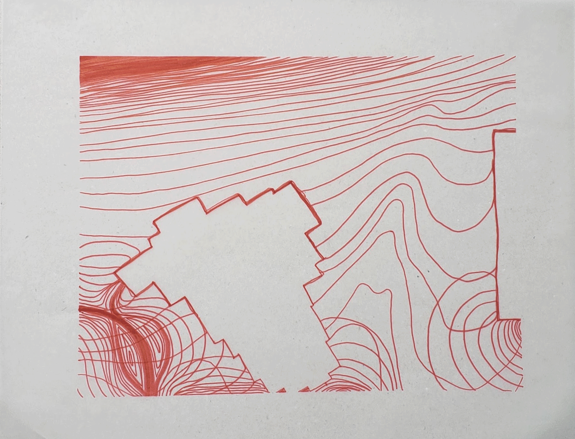
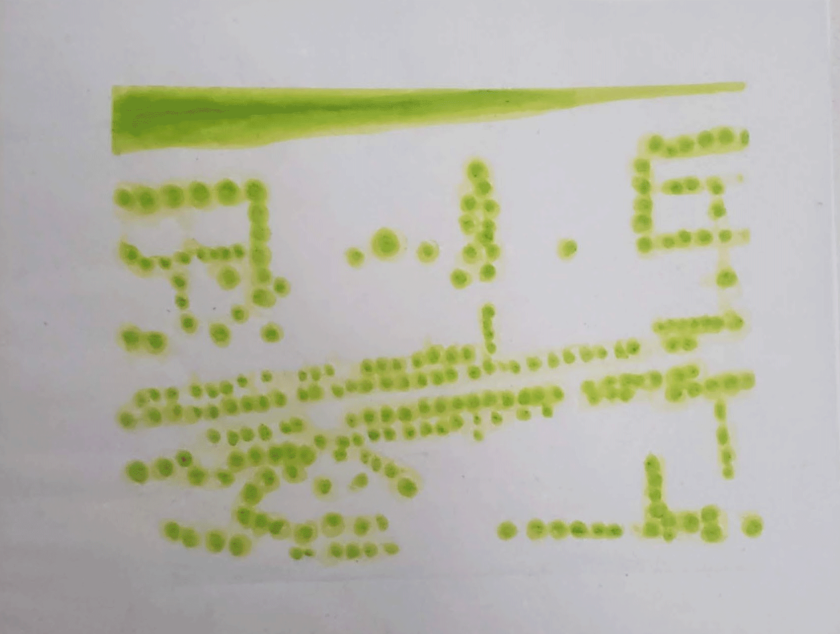
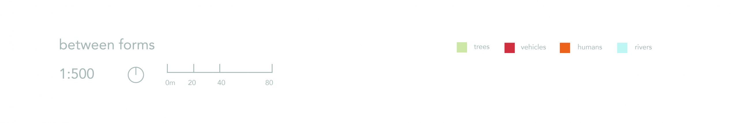
 Neighbourhood Plan 1:500
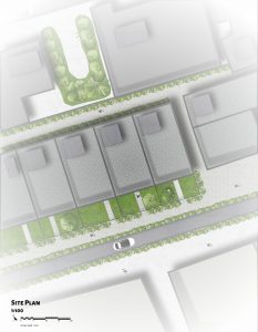
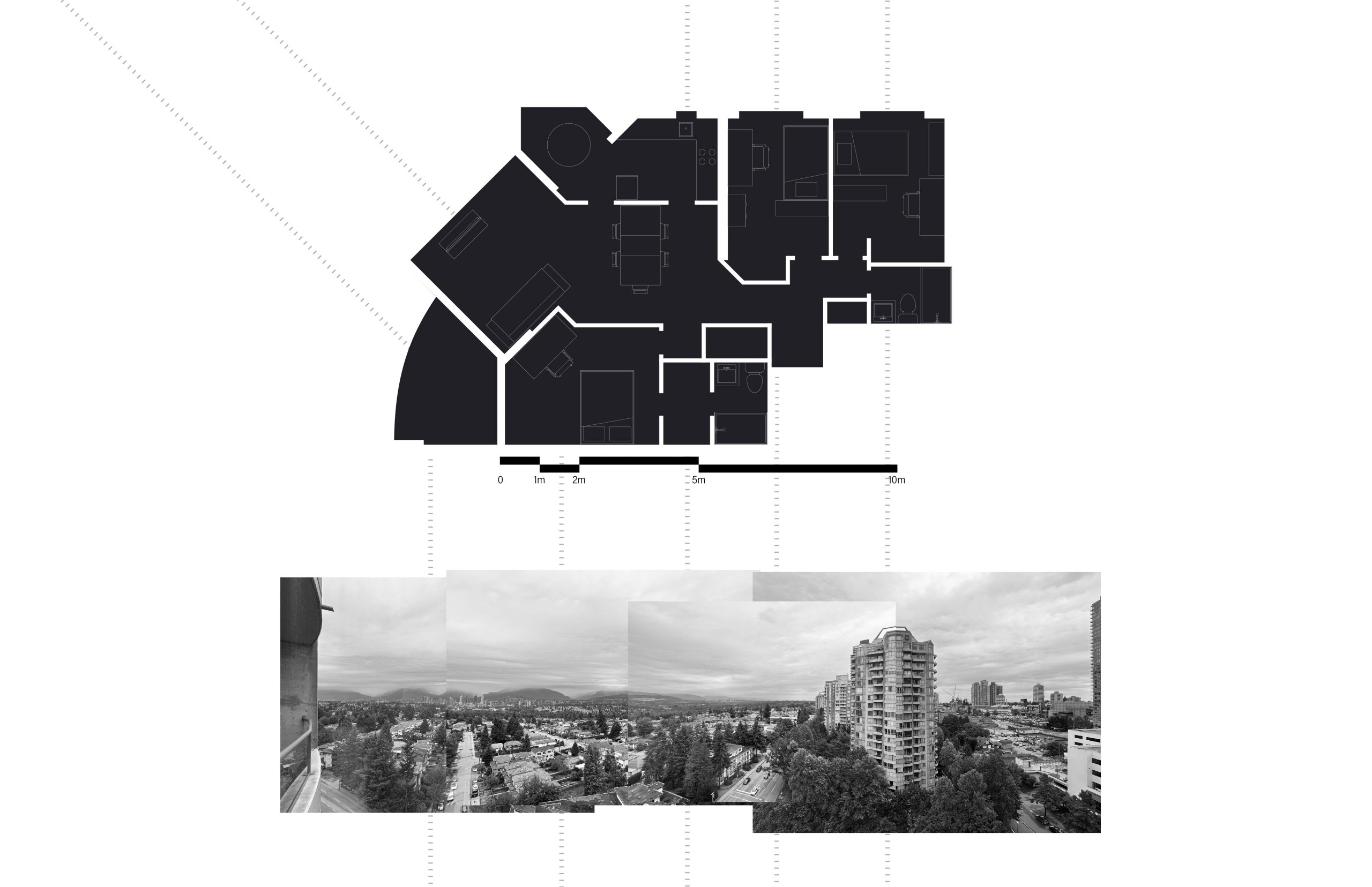
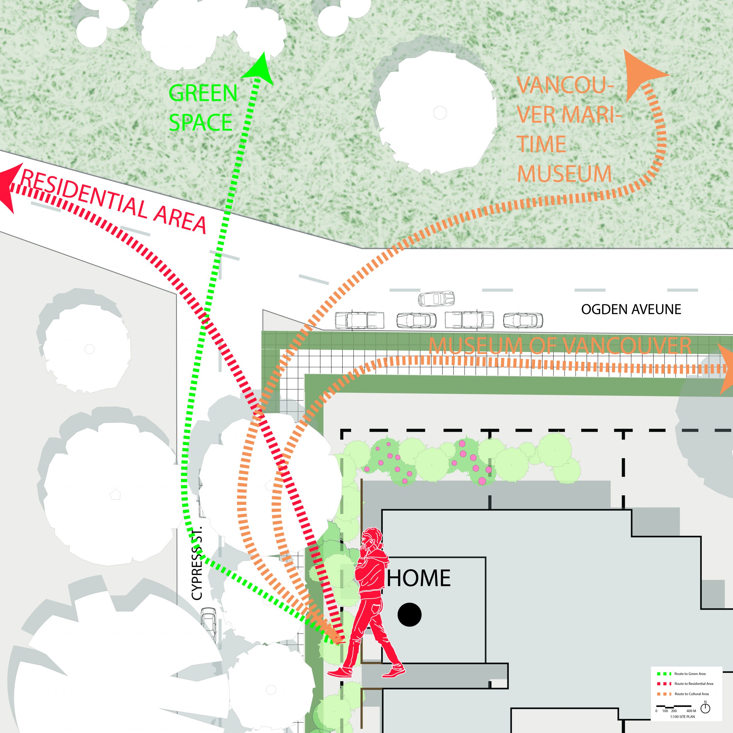 Site Plan 1:100
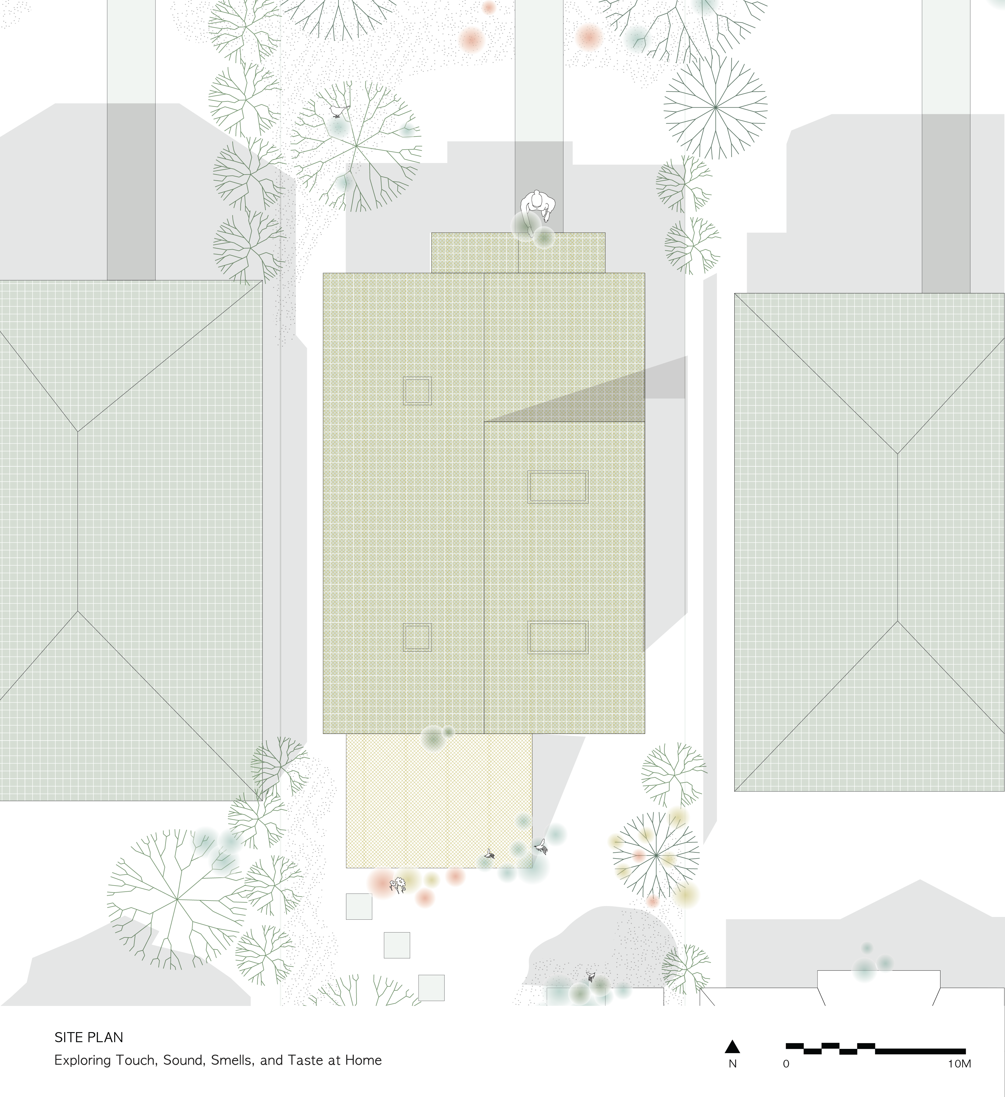
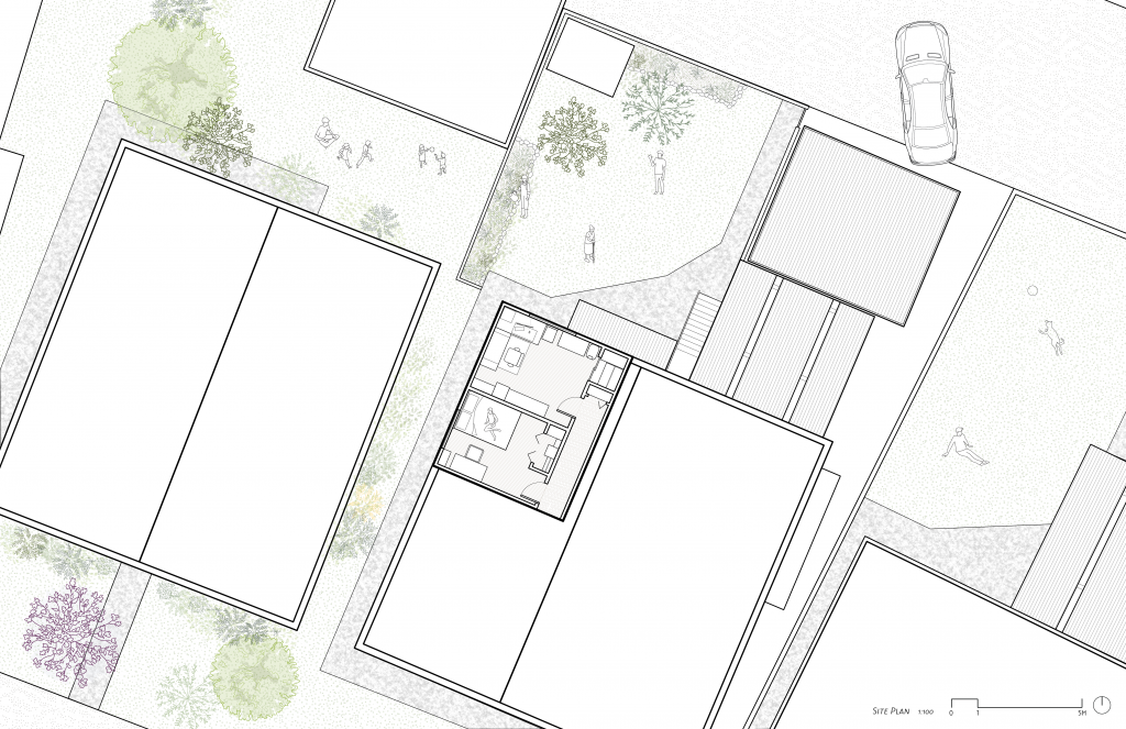


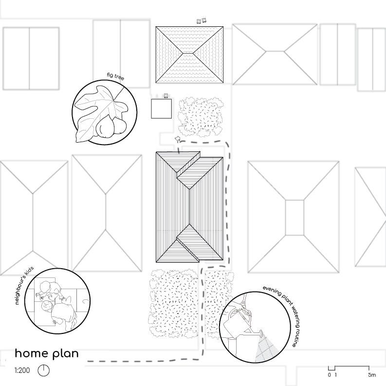


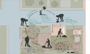 The Chore list – an interactive space of home