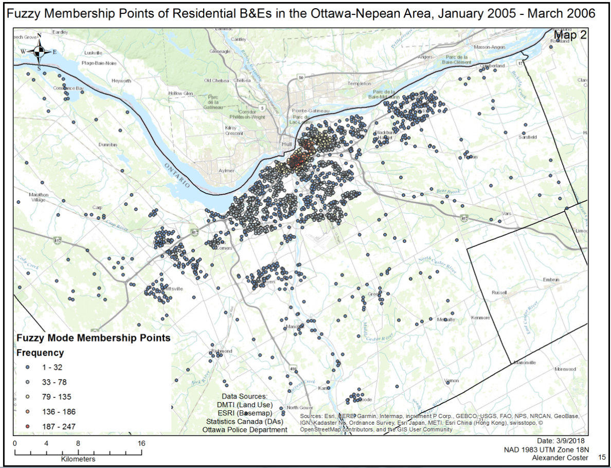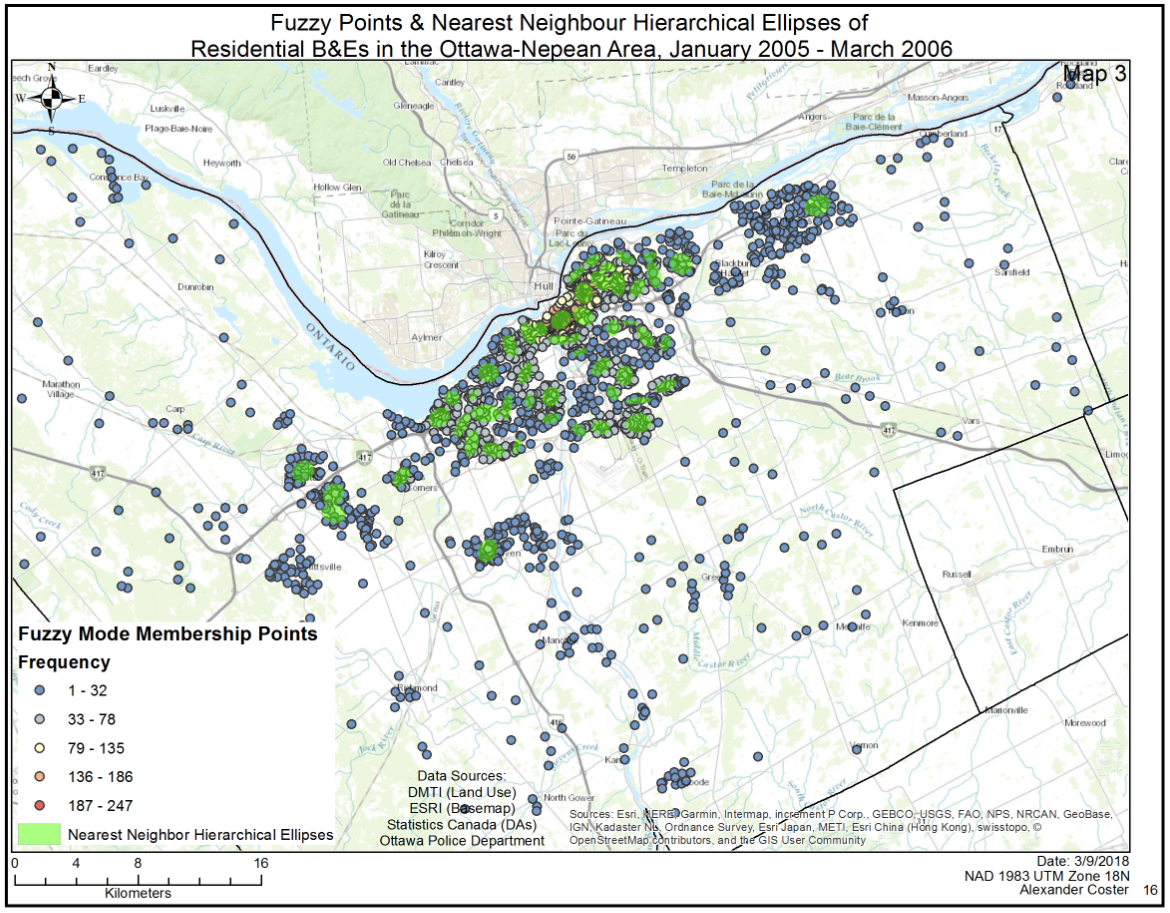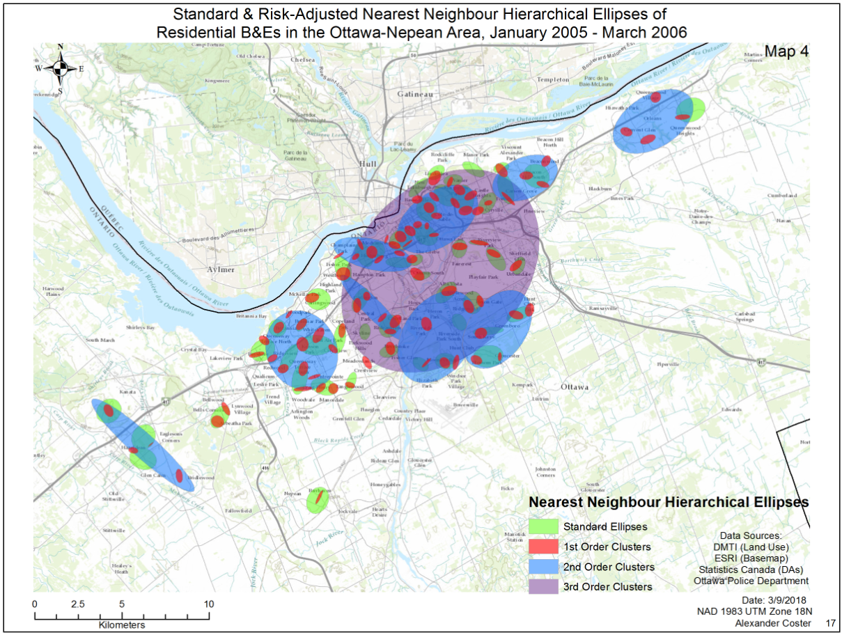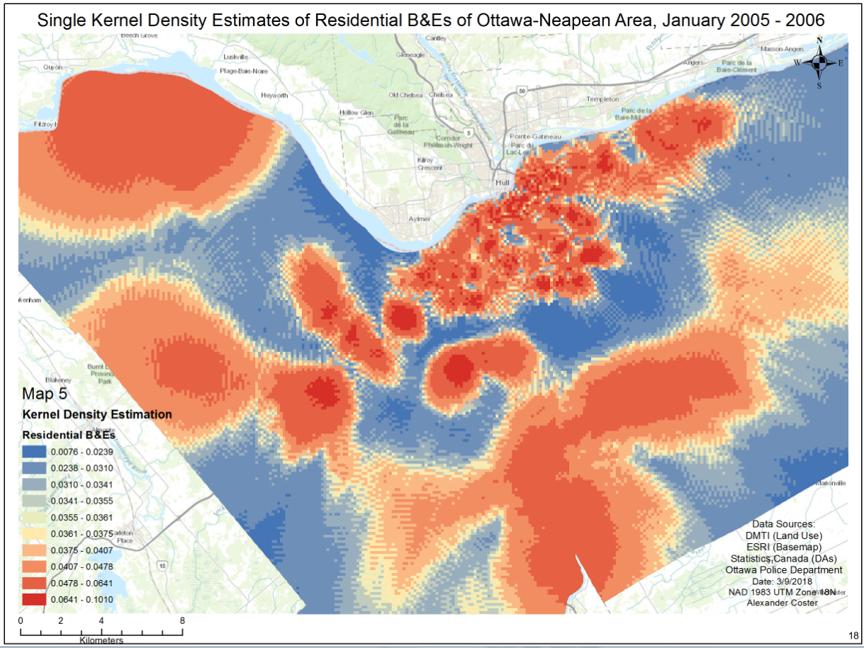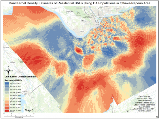
GIS now plays a role in law enforcement agencies around the world. This project focused on the use of the CrimeStat program to analyze the spatial and temporal distribution of various crimes (residential and commercial B&Es, car thefts) between January 2005 and March 2006 to determine if there is any clustering of events. Population densities (above the age of 15) were included to determine if crime placement differs from population values. This type of analysis helps shape first response placement as well as more broad law enforcement initiatives and planning. The analyses concluded that crime events in Ottawa-Nepean are in fact spatial and temporally clustered (not random) and remain independent of population densitie