March 7: This day was dedicated to the GEM presentations of Health Geography.
March 14: Is Crime Related to Geography?
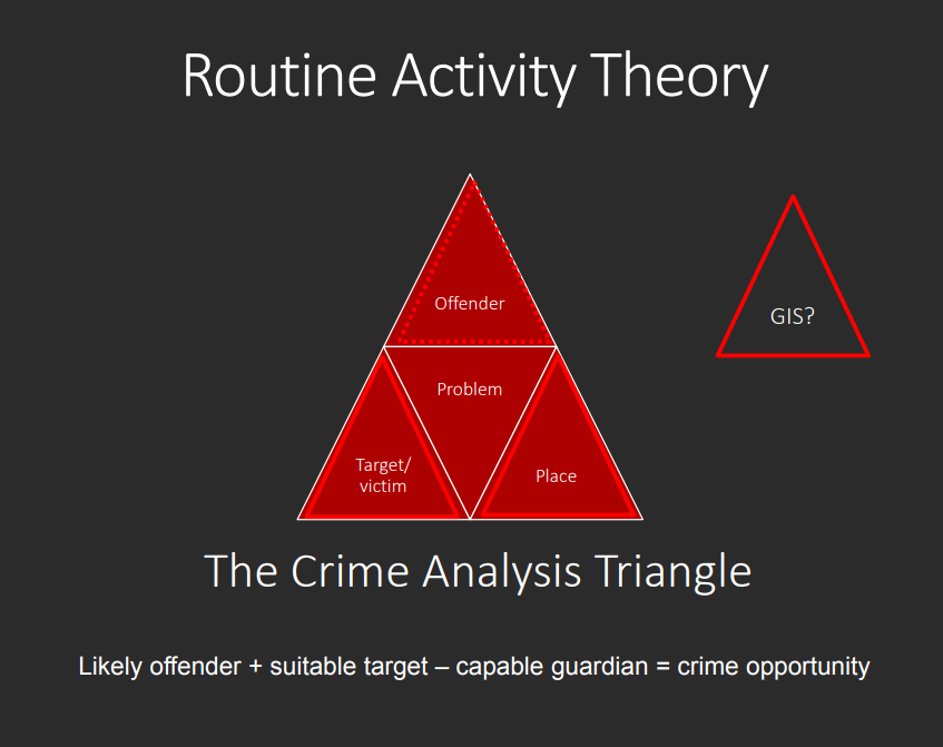
We reviewed the many roles that GIS serves in crime analysis, some of the theories behind crime analysis (Routine Activity Theory, Rational Choice Theory, Criminal Pattern Theory), and how GIS in law enforcement can improve the quality of life and reduce crime. The efforts of Dr. Kim Rossmo in the Robert Pickton trial were discussed, as well as the problems and unforeseen consequences of publishing spatial statistics of crime (ex: maps of where sex offenders live, university crime rates)
Law enforcement understands that since residential and commercial areas are not randomly located, and the routine activities of people are temporally organized, crime magnitudes will be be subject to similar spatial and temporal patterns. Law enforcement can determine areas and times at greater risk of crime events, and can allocate resources accordingly.
March 21: The Use of GIS by Fire Departments
Municipal firefighting departments constantly gather data in order to be better prepared for an emergency, and GIS holds the exceptionally valuable trait of spatially organizing and analyzing this data. GIS can be used to make decisions on the best location of a new fire station and apparatus deployment, pre-incident surveys, fire hydrant maintenance, route planning, and wildfire management.
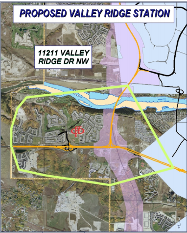
Calgary was used as a study case. The city of Calgary enlisted the help of GIS specialists to perform risk analyses using a wide variety of information like building proximity, road width, hydrant and fire station locations, and water pressure flow maps. This information was integrated into a locational analysis to extract areas best suited to house additional fire stations; they chose a site in the Valley Ridge area.
March 28: This day was dedicated to presentations from the GEM class in Crime Analysis.