
Exploring FRAGSTATS
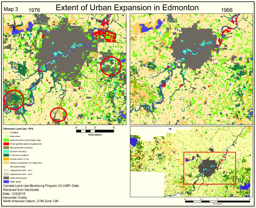
Lab 2 was a substantial undertaking into landscape ecology and the use of FRAGSTAT statistics. Our goal was to describe trends of land conversion that occurred around Edmonton between 1966 and 1976. I chose to explain the trends from the perspective of an urban planner, regarding the city’s expansion pattern as a problematic form of urban sprawl.
We used Canada Land Use Monitoring Program (CLUMP) spatial data, examined the data using FRAGSTATS metrics, created a transition matrix, and presented the data using ArcGIS v10. I found that urban expansion occurred at a relatively high rate compared to population increase, and this expansion usually occurred at the expense of croplands, unproductive woodlands, and open range land. The pattern of urban expansion (explored through the use of metrics Total Area, Number of Patches, and Number of Disjunct Core Areas) suggests that Edmonton’s expansion closely resembles that of uncoordinated, wasteful, inefficient and costly urban sprawl.