Location: Cypress Mtn Viewpoint elevn: 270m. Lat. 49.3508 Long. -123.19
Direct Google URL: This link takes you to a prepared viewpoint.
Hazard type: all
Short Description: This viewpoint offers an overview of the Vancouver area’s geography, relationship to the Fraser river and Georgia strait, and extent of urbanization.
Long Description: People living in the Vancouver area are exposed to a range of natural hazards including floods, landslides, earthquakes, wind storms and others. But people are willing to live close to these hazards either because they are unaware or because they choose to live near streams or have nice views despite the risk. Much of the urbanization of Vancouver occurred without sufficient environmental and geotechnical input into zoning regulations. Although this has rapidly change, the city is still dealiong with a legacy of building and infrastructure built in hazardous areas.
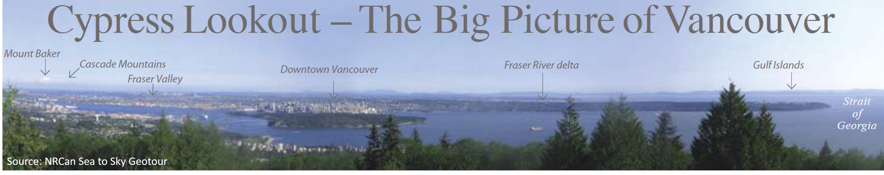
View looking south from the foot of Cypress mt. From the Sea-to-sky GeoTour at http://publications.gc.ca/site/eng/9.692972/publication.html.
media1: Excellent, accessible resource providing a big picture perspective on hazards in regional Vancouver
Some content on this page has been copied, adapted or referenced from Dep’t Geog. UBC’s virtual field trip blog, https://blogs.ubc.ca/fieldtrips/.