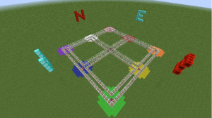
Dynamic visualization software has completely changed how students can view concepts in Science and Math. I explored the WisWeb site and looked at the two graphing applets which I decided to link to a lesson that I do in Minecraft based on the coordinate system. The LfU framework can be seen throughout this lesson as the 3 elements of motivation, construction and reflection are apparent. Students in grade 5 often have a hard time discerning when they will actually use a coordinate system that employs an x, y axis. Minecraft uses not only an x, y axis but employs a z axis which brings the 3rd dimension to the graphing process. Students are placed in the Minecraft environment and are introduced to the x,y, and z axis’s through a virtual orienteering exercise. This incorporates social studies with math in an environment that has no physical limitations. I can also control the environment by freezing students, giving rewards or warping them to a new lesson “Simulations provide the instructor considerably more freedom in designing and applying constraints” (Finkelstein, Perkins, Adams, Kohl, & Podolefsky, 2005). By the end of the 2 day lesson students are quite involved in their environments, have a much better understanding of coordinates and graphing and are keen to start to develop their own coordinate quest platforms. “By presenting concepts at multiple levels using multiple representations and providing students the opportunity for guided exploration with instant feedback” (Stieff & Wilensky, 2003)

Goal: to help students understand the idea of an axis, locating/plotting points on a 2D plane, Relationship between points, introduction of third dimension
Materials: MinecraftEdu, custom coordinates lesson maps (2 maps)
Lesson
- Introduce students to the “Coordinates test area” map where they will be confined to move about on a grid in a confined zone to record 9 seperate coordinates on a seperate piece of paper
- Once a basic understanding of how the x,y,z coordinate system works warp students to “Coordinates quest area” and form students into teams of 2
- Place 20 coordinates on projector and give students 40 minutes to locate as many as they can
- Each coordinate location contains a artifact that they must retrieve and that location must be recorded on their pen and paper coordinate hunt map
- When completed ask students to build their own coordinate quest on their private servers, must be complete with seperate recording map
References
Finkelstein, N.D., Perkins, K.K., Adams, W., Kohl, P., & Podolefsky, N. (2005). When learning about the real world is better done virtually: A study of substituting computer simulations for laboratory equipment. Physics Education Research,1(1), 1-8. Retrieved April 02, 2012, from:http://phet.colorado.edu/web-pages/research.html .
Stieff, M., & Wilensky, U. (2003). Connected chemistry – Incorporating interactive simulations into the chemistry classroom. Journal of Science Education and Technology, 12(3), 285-302.