[Somehow this post got stuck in the drafts folder on the blog dashboard in July 2013 and lingered there for quite some time until I found it again in summer 2016.]
Pardon the very general and somewhat cranky, er, excursion here…

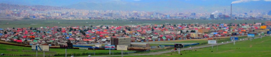
Solar-Powered Pedestrian Map in Ulaanbaatar
Anyone who has visited Mongolia more than once can tell many stories of the massive changes that are happening in the country. Visitors or residents who remain in Ulaanbaatar tell numerous stories about the amazing transformation sthat occur every summer during the construction season. As a recent visitor I might point to the beautification of Ulaanbaatar as a project that began in earnest two or three years ago, but that is obviously being attacked with great energy by Mayor Bat-Uul.
There are now actual sidewalks in the city and plots of greenery that are turning into attractive urban parks. Hosting the ministerial meeting of the Community of Democrarcies in April 2013 obviously lent further impetus to this project as public garbage cans now separate trash from recyclables. Pedestrian crosswalks are not only indicated by road signs, but are occasionally actually observed by pedestrians as well as motorists. Amazing!
Unfortunately, there is still too little research that is capturing these changes in the city or elsewhere. We might think of a highly theoretical engagement with modernity in a Mongolian urban context, but also of the much more detailed documentation of the transformation of the daily life of Mongolians in the city as well as the country. Little of this kind of research is being conducted in an empirical manner by Mongolians as well, and it remains to be seen whether the planned program to support Mongolian Studies abroad will move beyond the traditional philological orientation of Mongolists to focus more on contemporary challenges.
Changing Navigational Tools
Now to more concrete topics…
Overland voyages are certainly an interesting experience in Mongolia. The network of paved roads remains limited and many of the most attractive destinations or many of the necessary trips still involve dirt-roads and off-road travel. Few foreigners take these challenges on on their own.
But, the interaction with drivers and translators around road navigation can often be frustrating. Once you leave the major paved roads there are no road signs. In fact, it sometimes seems as if there is a nation-wide government decree that is better-enforced than many laws that forbids road signs to point to destinations.

Which road to take around Khkukh Nuur? [Khentii, June 2013, photo by Marc Tassé]
For some reasons, there is also a country-wide conspiracy against GPS technology. Oddly for a land that employs fingerprint readers to verify voters’ identity and counts votes through electronic counting machines, GPS devices are shunned. Some claim that maps are unavailable, but even if that is the case (anyone?), knowledge of one’s location would at least allow for decisions about whether to follow the first or the second valley that presents itself as an option en route.
Yet, at the same time, a surprising navigational tool seems to have, er, taken root in the countryside. For some years now, the government has been laying fibreoptic cable to all sum centres in the country to guarantee internect connectivity and mobile phone network access. Typically, this cable is laid at a fairly shallow depth by small backhoes. Whether this construction actually involves more serious mapping efforts or simply follows existing routes, perhaps on the advice of locals, the lengthy mole hill that is created over the cable now shows direct routes between sum centres. If you come across such a mole hill, it will certainly lead you to a sum and ultimately an aimag centre.
It would be nice, of course, if these mole hills were decorated with directional signs, but it is often relatively clear from the rough direction which sum centre the cable might lead to.
As a navigation aide, the cable mole hill appears to be rapidly replacing power lines which previously served as signposts for overland travel to non-locals. Power lines always had the distinct disadvantage that they seem to have been built as the crow flys, or at least with scant regard for the drivability of the route. By contrast, the small backhoes that have been laying fibreoptic cable have preferred flat spaces that lend themselves to driving between sum centres.
If my observation of this use of the cable mole hill is correct, who would have thought that the laying of fibreoptic cable would transform countryside driving not through making information flows possible, but by hinting at a direct route between towns. As more and more Mongolians in the country are relying on cars, such navigational markers may become more and more important. It is unclear whether mole hills will lead to directional signs or will simply erode, in the meantime, trips between sum centres are becoming more direct. Landscapes are still gorgeous and the Autobahn isn’t about to arrive in the countryside, but some of the adventure and enforced relaxation may be waning.
 Follow